Category:Lyddington
Vai alla navigazione
Vai alla ricerca
village in United Kingdom  | |||||
| Carica un file multimediale | |||||
| Istanza di | |||||
|---|---|---|---|---|---|
| Luogo | Rutland, Midlands Orientali, Inghilterra | ||||
| Superficie |
| ||||
 | |||||
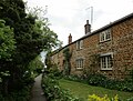
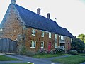
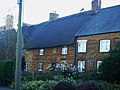
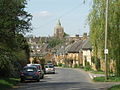
English: Lyddington is a village in the county of Rutland in the East Midlands of England. There are two public houses, The Marquess of Exeter and The Old White Hart.
Voce principale su Wikipedia: Lyddington.

Sottocategorie
Questa categoria contiene le 3 sottocategorie indicate di seguito, su un totale di 3.
L
- St Andrew's Church, Lyddington (27 F)
- Lyddington Bede House (33 F)
W
- Watch Tower, Lyddington (5 F)
File nella categoria "Lyddington"
Questa categoria contiene 200 file, indicati di seguito, su un totale di 207.
(pagina precedente) (pagina successiva)-
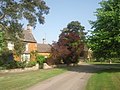
 17C house, Lyddington - geograph.org.uk - 737086.jpg 640 × 437; 86 KB
-
 2 Main Street, Lyddington (geograph 7475617).jpg 1 024 × 768; 154 KB
-
 4 Main Street, Lyddington (geograph 7475614).jpg 1 024 × 768; 196 KB
-
 A seat by Stoke Road - geograph.org.uk - 5921496.jpg 3 776 × 2 520; 4,2 MB
-
 A6003 heading south - geograph.org.uk - 4134976.jpg 640 × 480; 52 KB
-
 A6003 towards Uppingham - geograph.org.uk - 4135493.jpg 640 × 480; 77 KB
-
 Church Lane, Lyddington - geograph.org.uk - 5038186.jpg 480 × 640; 57 KB
-
 Church of St Andrew, Lyddington - geograph.org.uk - 5921373.jpg 3 776 × 2 520; 4,18 MB
-

-
 Cottages above the road, Lyddington (geograph 7469206).jpg 1 024 × 779; 192 KB
-
 Cottages, Main Street, Lyddington (geograph 7475859).jpg 1 024 × 768; 142 KB
-

-
 Cross roads over the A6003 - geograph.org.uk - 3885274.jpg 640 × 480; 432 KB
-
 Decaying tin shed - geograph.org.uk - 3412892.jpg 3 648 × 2 736; 2,81 MB
-

-
 Dutch Barn, Lyddington - geograph.org.uk - 3412894.jpg 3 648 × 2 736; 2,57 MB
-
 Fairchild's Wood - geograph.org.uk - 362417.jpg 640 × 480; 78 KB
-
 Farmland west of Lyddington - geograph.org.uk - 4134974.jpg 640 × 480; 64 KB
-
 Field boundary near Caldecott - geograph.org.uk - 3885753.jpg 582 × 437; 425 KB
-
 Field by London Road - geograph.org.uk - 2903792.jpg 640 × 512; 78 KB
-
 Field by Stoke Road - geograph.org.uk - 2903809.jpg 640 × 467; 67 KB
-
 Fingerpost on Lyddington Green - geograph.org.uk - 4944148.jpg 1 280 × 960; 497 KB
-
 Footpath from Lyddington - geograph.org.uk - 486478.jpg 640 × 480; 71 KB
-
 Footpath over stubble field - geograph.org.uk - 4134980.jpg 640 × 414; 56 KB
-
 Footpath to Lyddington - geograph.org.uk - 823967.jpg 640 × 390; 86 KB
-
 Gate and gas installation - geograph.org.uk - 2903810.jpg 640 × 460; 107 KB
-
 Gate and hedge by London Road - geograph.org.uk - 2903793.jpg 640 × 477; 81 KB
-
 Grazing north of Lyddington - geograph.org.uk - 4135509.jpg 640 × 480; 72 KB
-
 Great Hall cornice - geograph.org.uk - 6228409.jpg 1 024 × 668; 223 KB
-
 House at Lyddington Meadow - geograph.org.uk - 3885843.jpg 640 × 480; 535 KB
-
 In Lyddington village - geograph.org.uk - 5786663.jpg 2 592 × 1 944; 1,58 MB
-
 London Road towards Corby - geograph.org.uk - 2903794.jpg 640 × 468; 72 KB
-
 London Road towards Uppingham - geograph.org.uk - 2903795.jpg 640 × 472; 81 KB
-
 The Marquess of Exeter Hotel, Lyddington - geograph.org.uk - 573608.jpg 640 × 480; 132 KB
-
 Lyddington - cottage off The Green - geograph.org.uk - 4513910.jpg 1 024 × 576; 192 KB
-
 Lyddington - geograph.org.uk - 5038178.jpg 640 × 480; 79 KB
-

-
 Lyddington - the village green - geograph.org.uk - 4513917.jpg 1 024 × 576; 201 KB
-
 Lyddington Bede House - geograph.org.uk - 5038185.jpg 640 × 480; 66 KB
-
 Lyddington Bede House - geograph.org.uk - 5921345.jpg 3 561 × 2 377; 2,22 MB
-
 Lyddington Bede House - geograph.org.uk - 6227958.jpg 1 024 × 683; 256 KB
-
 Lyddington Bede House - geograph.org.uk - 6227961.jpg 1 024 × 683; 255 KB
-
 Lyddington Bede House - geograph.org.uk - 6227964.jpg 1 024 × 683; 288 KB
-
 Lyddington Bede House passage - geograph.org.uk - 6228418.jpg 1 024 × 683; 133 KB
-
 Lyddington Bede House roof - geograph.org.uk - 6228389.jpg 1 024 × 668; 209 KB
-
 Lyddington Bede House, Great Chamber - geograph.org.uk - 6228404.jpg 1 024 × 683; 189 KB
-
 Lyddington Bede House, Rutland - geograph.org.uk - 5245379.jpg 5 184 × 2 920; 4,99 MB
-
 Lyddington buildings (1) (geograph 7128619).jpg 4 320 × 3 240; 3,17 MB
-
 Lyddington buildings (3) (geograph 7129251).jpg 4 320 × 3 240; 3,57 MB
-
 Lyddington church - geograph.org.uk - 5786674.jpg 2 592 × 1 944; 1,24 MB
-
 Lyddington features (5) (geograph 7128596).jpg 3 240 × 4 320; 3,19 MB
-
 Lyddington Green - geograph.org.uk - 4944149.jpg 1 280 × 960; 426 KB
-
 Lyddington Heights - geograph.org.uk - 3885271.jpg 640 × 480; 519 KB
-
 Lyddington houses (10) (geograph 7128621).jpg 4 320 × 3 240; 2,62 MB
-
 Lyddington houses (11) (geograph 7129224).jpg 4 320 × 3 240; 2,48 MB
-
 Lyddington houses (12) (geograph 7129228).jpg 3 167 × 4 223; 2,29 MB
-
 Lyddington houses (16) (geograph 7129254).jpg 4 320 × 3 240; 2,33 MB
-
 Lyddington houses (17) (geograph 7129257).jpg 4 320 × 3 240; 3,1 MB
-
 Lyddington houses (20) (geograph 7129276).jpg 4 320 × 3 240; 2,87 MB
-
 Lyddington houses (21) (geograph 7129279).jpg 4 320 × 3 240; 3,82 MB
-
 Lyddington houses (23) (geograph 7129527).jpg 4 320 × 3 240; 3,25 MB
-
 Lyddington houses (24) (geograph 7129649).jpg 4 035 × 3 025; 2,03 MB
-
 Lyddington houses (26) (geograph 7129677).jpg 4 033 × 3 056; 2,23 MB
-
 Lyddington houses (27) (geograph 7129684).jpg 4 320 × 3 240; 2,88 MB
-
 Lyddington houses (28) (geograph 7130222).jpg 4 320 × 3 240; 2,65 MB
-
 Lyddington houses (29) (geograph 7130223).jpg 4 320 × 3 240; 2,52 MB
-
 Lyddington houses (31) (geograph 7130225).jpg 4 320 × 3 240; 2,58 MB
-
 Lyddington houses (32) (geograph 7130226).jpg 4 320 × 3 240; 1,79 MB
-
 Lyddington houses (33) (geograph 7130227).jpg 4 320 × 3 240; 2,01 MB
-
 Lyddington houses (4) (geograph 7128582).jpg 3 001 × 4 001; 2,55 MB
-
 Lyddington houses (7) (geograph 7128602).jpg 3 971 × 2 977; 2,35 MB
-
 Lyddington houses (geograph 7128573).jpg 3 928 × 2 435; 2,09 MB
-
 Lyddington houses (geograph 7129241).jpg 4 320 × 3 240; 2,8 MB
-
 Lyddington houses (geograph 7129668).jpg 4 320 × 3 240; 2,25 MB
-
 Lyddington houses (geograph 7130224).jpg 4 320 × 3 240; 2,18 MB
-
 Lyddington houses - geograph.org.uk - 5038182.jpg 640 × 480; 87 KB
-
 Lyddington houses - geograph.org.uk - 5038184.jpg 640 × 480; 71 KB
-
 Lyddington houses - geograph.org.uk - 5038191.jpg 640 × 480; 88 KB
-
 Lyddington in October - geograph.org.uk - 4219045.jpg 1 024 × 683; 1,02 MB
-
 Lyddington village - geograph.org.uk - 5038189.jpg 640 × 480; 75 KB
-
 Lyddington, aerial 2017 - geograph.org.uk - 5436360.jpg 640 × 372; 39 KB
-
 Lyddington, almshouses by the church - geograph.org.uk - 3338966.jpg 1 600 × 1 066; 404 KB
-
 Lyddington, former palace garden and watch tower - geograph.org.uk - 4219128.jpg 1 024 × 768; 1,04 MB
-
 Lyddington, house in Church Lane - geograph.org.uk - 3541854.jpg 1 200 × 1 200; 1,65 MB
-
 Lyddington, ironstone walls - geograph.org.uk - 4218307.jpg 811 × 1 024; 1,14 MB
-
 Lyddington, Late c15th watch tower - geograph.org.uk - 5757593.jpg 7 360 × 4 912; 7,79 MB
-
 Lyddington, Main Street - geograph.org.uk - 3540849.jpg 1 024 × 685; 817 KB
-
 Lyddington, Main Street - geograph.org.uk - 4218333.jpg 1 024 × 1 024; 1,09 MB
-
 Lyddington, Main Street and telephone box - geograph.org.uk - 3540831.jpg 860 × 1 024; 1,15 MB
-
 Lyddington, north on Main Street - geograph.org.uk - 3541757.jpg 1 024 × 787; 926 KB
-
 Lyddington, north on Main Street - geograph.org.uk - 4219039.jpg 1 024 × 1 024; 1,31 MB
-
 Lyddington, on the edge of The Green - geograph.org.uk - 4218318.jpg 1 024 × 1 024; 1,29 MB
-
 Lyddington, St. Andrew's Church - geograph.org.uk - 5757591.jpg 6 296 × 4 202; 5,12 MB
-
 Lyddington, St. Andrew's Church, Along the southern aspect - geograph.org.uk - 5757594.jpg 7 174 × 4 787; 7,21 MB
-

-

-

-
 Lyddington, St. Andrew's Church, Medieval wall painting 2 - geograph.org.uk - 5758430.jpg 4 912 × 7 360; 5,93 MB
-

-
 Lyddington, St. Andrew's Church, Nave head stop 1 - geograph.org.uk - 5758420.jpg 6 973 × 4 653; 4,73 MB
-
 Lyddington, St. Andrew's Church, Nave head stop 2 - geograph.org.uk - 5758422.jpg 6 818 × 4 549; 4,29 MB
-
 Lyddington, St. Andrew's Church, Nave head stop 3 - geograph.org.uk - 5758457.jpg 7 174 × 4 787; 5,16 MB
-
 Lyddington, St. Andrew's Church, Nave head stop 4 - geograph.org.uk - 5758474.jpg 7 016 × 4 681; 4,68 MB
-
 Lyddington, St. Andrew's Church, Nave head stop 5 - geograph.org.uk - 5758493.jpg 7 360 × 4 912; 5,7 MB
-
 Lyddington, St. Andrew's Church, Nave head stop 6 - geograph.org.uk - 5758498.jpg 7 360 × 4 912; 5,63 MB
-
 Lyddington, St. Andrew's Church, Nave head stop 7 - geograph.org.uk - 5758503.jpg 6 394 × 4 267; 4,07 MB
-
 Lyddington, St. Andrew's Church, Nave head stops 1 - geograph.org.uk - 5758479.jpg 7 058 × 4 711; 5,08 MB
-
 Lyddington, St. Andrew's Church, Nave head stops 2 - geograph.org.uk - 5758483.jpg 6 634 × 4 427; 3,97 MB
-

-

-
 Lyddington, St. Andrew's Church, Roof corbel 1 - geograph.org.uk - 5758427.jpg 7 174 × 4 787; 5,27 MB
-
 Lyddington, St. Andrew's Church, Roof corbel 2 - geograph.org.uk - 5758486.jpg 7 360 × 4 912; 6,88 MB
-

-
 Lyddington, St. Andrew's Church, Stained glass window - geograph.org.uk - 5758465.jpg 4 785 × 7 171; 7,14 MB
-

-

-

-

-

-
 Lyddington, St. Andrew's Church, The font (date unknown) 1 - geograph.org.uk - 5757600.jpg 4 287 × 6 425; 4,06 MB
-
 Lyddington, St. Andrew's Church, The font (date unknown) 2 - geograph.org.uk - 5757601.jpg 7 094 × 4 735; 5,22 MB
-
 Lyddington, St. Andrew's Church, The nave - geograph.org.uk - 5757603.jpg 7 360 × 4 912; 6,05 MB
-
 Lyddington, St. Andrew's Church, The nave - geograph.org.uk - 5758418.jpg 6 973 × 4 653; 5,27 MB
-
 Lyddington, Stoke Road - geograph.org.uk - 3540854.jpg 1 024 × 723; 817 KB
-
 Lyddington, The Green - geograph.org.uk - 3541752.jpg 1 024 × 686; 859 KB
-
 Lyddington, The Marquess of Exeter - geograph.org.uk - 4219029.jpg 1 024 × 795; 996 KB
-
 Lyddington, the north end of Main Street - geograph.org.uk - 4219004.jpg 1 024 × 683; 932 KB
-
 Lyddington, towards the church - geograph.org.uk - 3541876.jpg 1 200 × 849; 1,15 MB
-
 Lyddington.jpg 640 × 480; 126 KB
-
 Lyndon House, Lyddington - geograph.org.uk - 4944153.jpg 1 280 × 895; 341 KB
-

-
 Main Street reaches the crossroads - geograph.org.uk - 2903788.jpg 640 × 474; 68 KB
-
 Main Street towards Stoke Dry - geograph.org.uk - 2903789.jpg 640 × 473; 69 KB
-
 Main Street, Lyddington - geograph.org.uk - 2451577.jpg 4 000 × 3 000; 3,96 MB
-
 Main Street, Lyddington - geograph.org.uk - 4944155.jpg 1 280 × 960; 448 KB
-
 Main Street, Lyddington, c.1967 - geograph.org.uk - 2265115.jpg 640 × 384; 61 KB
-
 Marquess of Exeter, Lyddington.jpg 941 × 638; 612 KB
-
 Minor road junction - geograph.org.uk - 4135510.jpg 640 × 480; 87 KB
-
 My walking buddies - geograph.org.uk - 3412870.jpg 3 648 × 2 736; 2,79 MB
-
 Notice on gas installation - geograph.org.uk - 2903811.jpg 640 × 632; 99 KB
-

-
 Old gate leading into a field - geograph.org.uk - 2451598.jpg 4 000 × 3 000; 4,43 MB
-
 Old railway line at Lyddington Meadows - geograph.org.uk - 3885838.jpg 608 × 456; 433 KB
-
 Path in Main Street, Lyddington - geograph.org.uk - 2451572.jpg 4 000 × 3 000; 4,32 MB
-
 Road from Lyddington to Bisbrooke - geograph.org.uk - 3885772.jpg 640 × 480; 468 KB
-
 Road junction and grass triangle - geograph.org.uk - 5363964.jpg 3 648 × 2 736; 2,61 MB
-
 Road junction and grass triangle - geograph.org.uk - 5363965.jpg 3 648 × 2 736; 2,25 MB
-
 Roadworks on Main Street, south of Bisbrooke - geograph.org.uk - 5921518.jpg 3 776 × 2 520; 4,03 MB
-
 Rural road towards Bisbrooke - geograph.org.uk - 4135516.jpg 640 × 480; 63 KB
-
 Rural road towards Lyddington - geograph.org.uk - 4134981.jpg 640 × 480; 71 KB
-
 St.Andrew's church - geograph.org.uk - 6228555.jpg 1 024 × 683; 245 KB
-
 St.Andrew's church - geograph.org.uk - 6228589.jpg 1 024 × 683; 268 KB
-
 St.Andrew's church nave - geograph.org.uk - 6228566.jpg 1 024 × 676; 232 KB
-
 St.Andrew's rood screen - geograph.org.uk - 6228576.jpg 1 024 × 683; 240 KB
-
 Stoke Road approaches Lyddington - geograph.org.uk - 2903812.jpg 640 × 478; 86 KB
-
 Stoke Road away from Lyddington - geograph.org.uk - 2903813.jpg 640 × 487; 144 KB
-
 Stoke Road leading to Lyddington - geograph.org.uk - 5921489.jpg 3 776 × 2 520; 4,15 MB
-
 Stoke Road near Lyddington - geograph.org.uk - 2451605.jpg 4 000 × 3 000; 4,17 MB
-
 Stoke Road reaches the crossroads - geograph.org.uk - 2903790.jpg 640 × 469; 72 KB
-
 Stoke Road towards Lyddington - geograph.org.uk - 2903791.jpg 640 × 479; 69 KB
-
 Stoneleigh, Lyddington (geograph 7474996).jpg 1 024 × 768; 197 KB
-
 Stubble field towards Breach Farm - geograph.org.uk - 4135513.jpg 640 × 480; 66 KB
-
 Stubble field west of Lyddington - geograph.org.uk - 4134984.jpg 640 × 455; 65 KB
-
 The Bell House, Lyddington Green - geograph.org.uk - 4944152.jpg 1 280 × 960; 517 KB
-
 The centre of Lyddington - geograph.org.uk - 5038203.jpg 640 × 480; 82 KB
-
 The cross, Lyddington Green - geograph.org.uk - 4944150.jpg 1 280 × 960; 522 KB
-
 The Marquess of Exeter, Lyddington - geograph.org.uk - 5921329.jpg 3 776 × 2 520; 4,05 MB
-
 The Old White Hart, Lyddington - geograph.org.uk - 2232221.jpg 1 600 × 1 067; 1,53 MB
-
 The Rutland Round - geograph.org.uk - 5038162.jpg 640 × 480; 92 KB
-
 The Rutland Round - geograph.org.uk - 5038164.jpg 480 × 640; 106 KB
-
 The Rutland Round - geograph.org.uk - 5038165.jpg 640 × 480; 58 KB
-
 The Rutland Round - geograph.org.uk - 5038166.jpg 640 × 480; 61 KB
-
 The Rutland Round - geograph.org.uk - 5038168.jpg 640 × 480; 92 KB
-
 The Rutland Round - geograph.org.uk - 5038171.jpg 640 × 480; 105 KB
-
 The Rutland Round heading north towards Lyddington - geograph.org.uk - 5921387.jpg 3 776 × 2 520; 3,93 MB
-
 The Rutland Round heading north towards Lyddington - geograph.org.uk - 5921395.jpg 3 776 × 2 520; 3,82 MB
-
 The village green at Lyddington - geograph.org.uk - 2407953.jpg 1 280 × 960; 618 KB
-
 The village green at Lyddington - geograph.org.uk - 2407954.jpg 1 280 × 960; 630 KB
-

-
 Towards Corby - geograph.org.uk - 2903783.jpg 640 × 459; 64 KB
-
 Towards the Uppingham Road - geograph.org.uk - 5038205.jpg 640 × 480; 68 KB
-
 Towards the Uppingham Road - geograph.org.uk - 5038206.jpg 640 × 480; 64 KB
-
 Towards the Uppingham Road - geograph.org.uk - 5038210.jpg 640 × 480; 68 KB
-
 Towards the Uppingham Road - geograph.org.uk - 5038212.jpg 640 × 480; 57 KB
-
 Towards the Uppingham Road - geograph.org.uk - 5038213.jpg 640 × 480; 60 KB
-
 Towards the Uppingham Road - geograph.org.uk - 5038214.jpg 640 × 480; 67 KB
-
 Towards the Uppingham Road - geograph.org.uk - 5038216.jpg 480 × 640; 68 KB
-
 Towards the Uppingham Road - geograph.org.uk - 5038217.jpg 640 × 480; 92 KB
-
 Towards the Uppingham Road - geograph.org.uk - 5038219.jpg 640 × 480; 78 KB
-
 Towards Uppingham - geograph.org.uk - 2903784.jpg 640 × 479; 72 KB
-
 Village green, Lyddington - geograph.org.uk - 3885776.jpg 447 × 596; 492 KB
-
 Village green, Lyddington - geograph.org.uk - 3885782.jpg 616 × 462; 501 KB
-
 Village houses in Lyddington - geograph.org.uk - 2433159.jpg 1 280 × 960; 616 KB
-
 Village Sign and green at Lyddington - geograph.org.uk - 573613.jpg 640 × 480; 154 KB
-
 Wagon Wash, Lyddington - geograph.org.uk - 823975.jpg 640 × 379; 117 KB
-
 Watch Tower, Church lane, Lyddington - geograph.org.uk - 5529708.jpg 5 184 × 3 456; 7,64 MB
-
 Water valve marker - geograph.org.uk - 4944147.jpg 960 × 1 280; 493 KB
-
 Wayside bench, Stoke Road, Lyddington - geograph.org.uk - 3885761.jpg 640 × 480; 503 KB
-
 A6003 to Uppingham - geograph.org.uk - 377896.jpg 640 × 480; 40 KB
-
 Bridleway towards Eyebrook Reservoir - geograph.org.uk - 377910.jpg 640 × 480; 61 KB

.jpg)
.jpg)


.jpg)
.jpg)


_(geograph_7128619).jpg)
_(geograph_7129251).jpg)

_(geograph_7128596).jpg)


_(geograph_7128621).jpg)
_(geograph_7129224).jpg)
_(geograph_7129228).jpg)
_(geograph_7129254).jpg)
_(geograph_7129257).jpg)
_(geograph_7129276).jpg)
_(geograph_7129279).jpg)
_(geograph_7129527).jpg)
_(geograph_7129649).jpg)
_(geograph_7129677).jpg)
_(geograph_7129684).jpg)
_(geograph_7130222).jpg)
_(geograph_7130223).jpg)
_(geograph_7130225).jpg)
_(geograph_7130226).jpg)
_(geograph_7130227).jpg)
_(geograph_7128582).jpg)
_(geograph_7128602).jpg)
.jpg)
.jpg)
.jpg)
.jpg)


_-_geograph.org.uk_-_5758433.jpg)


_1_-_geograph.org.uk_-_5757600.jpg)
_2_-_geograph.org.uk_-_5757601.jpg)


.jpg)


