Category:M2 motorway (England)
Vai alla navigazione
Vai alla ricerca
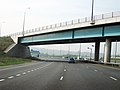
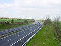
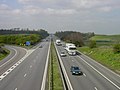
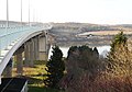
English: The M2 is a motorway in Kent, England. It is 25.7 miles (41.4 km) long and acts as a bypass of the section of the A2 road which runs through the Medway Towns, Sittingbourne and Faversham.
autostrada del Regno Unito     | |||||
| Carica un file multimediale | |||||
| Istanza di | |||||
|---|---|---|---|---|---|
| Luogo | Kent, Sud Est dell'Inghilterra, Inghilterra | ||||
| Sistema di trasporto |
| ||||
| Data di fondazione o creazione |
| ||||
| Lunghezza |
| ||||
| Distinto da | |||||
 | |||||
Sottocategorie
Questa categoria contiene le 2 sottocategorie indicate di seguito, su un totale di 2.
M
- Medway Services (9 F)
- Medway Viaducts (39 F)
File nella categoria "M2 motorway (England)"
Questa categoria contiene 64 file, indicati di seguito, su un totale di 64.
-
 27 miles from everywhere - geograph.org.uk - 650828.jpg 640 × 480; 64 KB
-
 A2 becomes M2 - geograph.org.uk - 1054042.jpg 640 × 481; 59 KB
-
 A2 road, M2 junction, Strood 4915.jpg 4 608 × 3 456; 3,29 MB
-
 A2 road, M2 junction, Strood 4917.jpg 4 608 × 3 456; 3,17 MB
-
 A2 road, M2 junction, Strood 4921.jpg 4 608 × 3 456; 3,11 MB
-
 Approaching Walderslade Woods from M2 - geograph.org.uk - 133912.jpg 640 × 480; 116 KB
-
 Bridge over M2, at junction 1 - geograph.org.uk - 1253043.jpg 640 × 480; 64 KB
-

-
 Eastwards on the M2 - geograph.org.uk - 156585.jpg 640 × 426; 64 KB
-
 End of the M2 - geograph.org.uk - 350564.jpg 640 × 481; 113 KB
-
 Farmbridge over M2 Motorway - geograph.org.uk - 1383116.jpg 640 × 480; 95 KB
-
 Footpath and bridleway beside the M2 - geograph.org.uk - 366395.jpg 640 × 480; 105 KB
-
 Junction 4, M2 Motorway, Kent - geograph.org.uk - 1429664.jpg 640 × 480; 68 KB
-
 Junction 5 of M2 Motorway - geograph.org.uk - 1065666.jpg 640 × 481; 110 KB
-
 Junction 5 on the M2 motorway - geograph.org.uk - 733406.jpg 640 × 467; 92 KB
-
 M2 at Rochester.jpg 2 048 × 1 335; 1,41 MB
-
 M2 between Wrens Road and Stiff Street - geograph.org.uk - 4072.jpg 640 × 480; 56 KB
-
 M2 motorway (Great Britain) map.svg 1 038 × 1 279; 457 KB
-
 M2 motorway - geograph.org.uk - 132816.jpg 640 × 480; 80 KB
-
 M2 Motorway at Junction 2 - geograph.org.uk - 811374.jpg 640 × 480; 64 KB
-
 M2 Motorway begins on Junction 7 - geograph.org.uk - 1383271.jpg 640 × 480; 66 KB
-
 M2 motorway between Stockbury and Hartlip - geograph.org.uk - 122829.jpg 640 × 480; 110 KB
-
 M2 motorway junction 5.jpg 640 × 480; 44 KB
-
 M2 motorway looking towards Rochester, 1 December 2014.jpg 5 152 × 3 864; 7,49 MB
-
 M2 Motorway towards A2 and A299 - geograph.org.uk - 1383121.jpg 640 × 480; 77 KB
-

-
 M2 motorway, 27 October 2014 (1).jpg 480 × 640; 78 KB
-
 M2 motorway, 27 October 2014 (2).jpg 480 × 640; 64 KB
-
 M2 motorway, Bredgar - geograph.org.uk - 133491.jpg 640 × 480; 95 KB
-
 M2 motorway, Bredgar - geograph.org.uk - 133527.jpg 640 × 480; 90 KB
-
 M2 Motorway, Kent - 010613.jpg 640 × 481; 77 KB
-
 M2 past Rochester - geograph.org.uk - 1253005.jpg 640 × 427; 57 KB
-
 M2 past Rochester - geograph.org.uk - 1253021.jpg 640 × 427; 51 KB
-
 M2 past Rochester - geograph.org.uk - 1253044.jpg 640 × 427; 60 KB
-
 M2 underpass - geograph.org.uk - 4994.jpg 640 × 480; 123 KB
-
 M2 viaduct over Mount Lane, Hartlip - geograph.org.uk - 122841.jpg 640 × 464; 119 KB
-
 M2 viaduct over the Medway - geograph.org.uk - 131436.jpg 640 × 450; 85 KB
-
 M2 west from Medway Services - geograph.org.uk - 1166186.jpg 640 × 480; 91 KB
-
 M2, Junction 3, during snow chaos - geograph.org.uk - 1896497.jpg 1 600 × 1 200; 902 KB
-
 M2RailLinkBridgeOverMedway9928.JPG 2 016 × 1 512; 826 KB
-
 MedwayM2BridgeCloud0167.JPG 2 016 × 1 512; 697 KB
-
 MedwayM2BridgeCloud0169.JPG 2 016 × 1 512; 723 KB
-
 MedwayM2OverRochesterChathamKingsnorth9936.JPG 2 016 × 1 512; 813 KB
-
 MedwayViaducts2013.jpg 4 000 × 3 000; 2,94 MB
-
 MerrallM2OverStrood9931.JPG 2 016 × 1 512; 975 KB
-
 Part of the A2-M2 Roundabout - geograph.org.uk - 1543812.jpg 640 × 427; 49 KB
-

-

-
 Roundabout on M2 offramp-onramp - geograph.org.uk - 1053865.jpg 640 × 481; 74 KB
-

-
 Sign to Cobham and Shorne - geograph.org.uk - 1490411.jpg 640 × 427; 59 KB
-
 Signs over M2 - geograph.org.uk - 1253028.jpg 640 × 427; 59 KB
-
 Slip road at M2 Junction 5 - geograph.org.uk - 733418.jpg 640 × 480; 128 KB
-
 Stobart truck on the M2, Strood, 25 April 2007.jpg 492 × 329; 110 KB
-
 UK motorway map - M2.png 790 × 998; 112 KB
-
 UK-Motorway-M2.svg 316 × 141; 9 KB
-
 Under the motorway - geograph.org.uk - 170532.jpg 640 × 480; 75 KB
-
 Westwards on the M2 - geograph.org.uk - 156586.jpg 640 × 426; 69 KB
-
 Wooded Copse - geograph.org.uk - 1385216.jpg 640 × 480; 73 KB
-
 M2 alongside Yelstead Lane - geograph.org.uk - 100403.jpg 640 × 480; 69 KB
-
 M2 Motorway at Night - geograph.org.uk - 327666.jpg 640 × 426; 120 KB
-

-
 M2 near Templepatrick (2) - geograph.org.uk - 255679.jpg 640 × 426; 135 KB
-
 Westwards on the M2 at Copton - geograph.org.uk - 156590.jpg 640 × 426; 71 KB


_map.svg)


.jpg)
.jpg)


_-_geograph.org.uk_-_255679.jpg)
