Category:M56 motorway
Salta a la navigazzion
Và a cercà
road in Cheshire and Greater Manchester, England   _map.svg) | |||||
| Carega su un fail audio / video | |||||
| L'è un(a) | |||||
|---|---|---|---|---|---|
| Part de | |||||
| Sit |
| ||||
| Sistema autostradałe |
| ||||
| Conetesto co | |||||
| Mantegnesto da |
| ||||
| Data de creazzion o de fondazzion |
| ||||
| Longhesa |
| ||||
 | |||||
Sotocategorie
Quella categoria chì la gh'ha doma una sot-categoria, missa chì de sota.
C
- Chester Services (31 F)
Fail in la categoria "M56 motorway"
Quella categoria chì la gh'ha denter 98 i fail riportad chì de sota, su un total de 98.
-
 Approaching bridge over the M56 - geograph.org.uk - 4574149.jpg 640 × 360; 57 KByte
-
 Barnes Hospital from the air (geograph 4032946).jpg 640 × 511; 209 KByte
-
 Bridge carrying Lower Rake Lane - geograph.org.uk - 5116246.jpg 6 000 × 4 000; 6,75 MByte
-
 Capenhurst - M56 - A5117 roundabout - geograph.org.uk - 253869.jpg 640 × 480; 264 KByte
-
 Clearway - geograph.org.uk - 131703.jpg 640 × 426; 59 KByte
-
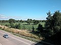 Farmland - geograph.org.uk - 34869.jpg 640 × 480; 155 KByte
-
 Gantry Sign on M56 - geograph.org.uk - 2454074.jpg 3 317 × 2 499; 2,97 MByte
-
 Heading for Manchester Airport - geograph.org.uk - 1134146.jpg 640 × 480; 167 KByte
-
 Inside the Roundabout - geograph.org.uk - 895240.jpg 640 × 480; 107 KByte
-
 Kingsway Interchange 1.png 1 448 × 957; 79 KByte
-
 M56 - geograph.org.uk - 5064350.jpg 5 093 × 3 456; 1,77 MByte
-
 M56 about to pass under Altrincham - geograph.org.uk - 3153251.jpg 640 × 480; 63 KByte
-
 M56 air ambulance at the scene of a crash.jpg 3 648 × 2 736; 2,21 MByte
-
 M56 approaching Hollyhedge Road overbridge - geograph.org.uk - 3154421.jpg 640 × 481; 45 KByte
-
 M56 At Junction 5 - geograph.org.uk - 1134136.jpg 640 × 480; 175 KByte
-
 M56 at Sharston - geograph.org.uk - 3991248.jpg 1 000 × 762; 242 KByte
-
 M56 at Wythenshawe - geograph.org.uk - 1984963.jpg 800 × 533; 78 KByte
-
 M56 at Wythenshawe - geograph.org.uk - 2970884.jpg 3 061 × 2 203; 2,38 MByte
-
 M56 Bridge, Booth Bank - geograph.org.uk - 1337631.jpg 640 × 480; 197 KByte
-
 M56 crash on approach.jpg 3 648 × 2 736; 2,12 MByte
-
 M56 east from Lower Rake Lane bridge - geograph.org.uk - 1239327.jpg 640 × 480; 92 KByte
-
 M56 eastbound slip to Manchester - geograph.org.uk - 4170027.jpg 640 × 480; 64 KByte
-
 M56 Eastwards - geograph.org.uk - 3418122.jpg 640 × 481; 468 KByte
-
 M56 Footbridge, Helsby Marsh - geograph.org.uk - 2154391.jpg 640 × 480; 127 KByte
-
 M56 Footbridge, Woodhouse Park - geograph.org.uk - 2056352.jpg 640 × 480; 230 KByte
-
 M56 from Thornton Green Lane, Thornton le Moors - geograph.org.uk - 1610165.jpg 640 × 480; 47 KByte
-
 M56 Junction 4 - geograph.org.uk - 2056040.jpg 641 × 481; 184 KByte
-
 M56 Junction 5 (Manchester Airport) - geograph.org.uk - 3736096.jpg 640 × 481; 281 KByte
-
 M56 Junction 5, Manchester Airport - geograph.org.uk - 2056357.jpg 640 × 480; 160 KByte
-
 M56 motorway (Great Britain) map.svg 1 038 × 1 279; 457 KByte
-
 M56 Motorway - A5032 overbridge - geograph.org.uk - 2252529.jpg 640 × 480; 50 KByte
-
 M56 Motorway - geograph.org.uk - 1433557.jpg 640 × 480; 71 KByte
-
 M56 Motorway - geograph.org.uk - 35130.jpg 640 × 480; 149 KByte
-
 M56 Motorway - geograph.org.uk - 45604.jpg 640 × 480; 160 KByte
-
 M56 Motorway - Heading South - geograph.org.uk - 1134116.jpg 640 × 480; 142 KByte
-
 M56 Motorway - Rake Lane overbridge - geograph.org.uk - 2252537.jpg 640 × 480; 47 KByte
-

-
 M56 Motorway approaching Smithy Lane footbridge - geograph.org.uk - 2253107.jpg 640 × 480; 46 KByte
-
 M56 motorway at Helsby (1).JPG 4 320 × 3 240; 3,07 MByte
-
 M56 motorway at Helsby (2).JPG 4 000 × 3 000; 2,79 MByte
-
 M56 motorway at Helsby (3).JPG 4 000 × 3 000; 2,79 MByte
-
 M56 motorway at Helsby (4).JPG 4 000 × 3 000; 2,78 MByte
-
 M56 motorway at Helsby (5).JPG 4 000 × 3 000; 2,84 MByte
-
 M56 motorway at Helsby (6).JPG 4 320 × 3 240; 3,8 MByte
-
 M56 Motorway crosses the A41 - geograph.org.uk - 2252528.jpg 640 × 480; 47 KByte
-
 M56 Motorway crossing Helsby Marsh - geograph.org.uk - 2253110.jpg 640 × 480; 55 KByte
-
 M56 motorway from A5117.JPG 4 320 × 3 240; 3,07 MByte
-
 M56 motorway from Wood Lane, Runcorn (1).JPG 4 320 × 3 240; 3,6 MByte
-
 M56 motorway from Wood Lane, Runcorn (2).JPG 4 320 × 3 240; 3,28 MByte
-
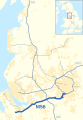 M56 motorway in North West England map.svg 393 × 565; 417 KByte
-
 M56 Motorway near Poplar Hall - geograph.org.uk - 2252534.jpg 640 × 480; 44 KByte
-
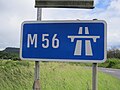 M56 motorway sign, Junction 14.JPG 4 320 × 3 240; 3,26 MByte
-
 M56 motorway viaduct - geograph.org.uk - 1530355.jpg 640 × 426; 84 KByte
-
 M56 Motorway ^ Airport turn-off, Wythenshawe - panoramio.jpg 3 072 × 2 304; 1,8 MByte
-
 M56 Motorway, Looking East - geograph.org.uk - 1337593.jpg 640 × 480; 160 KByte
-
 M56 near Helsby - geograph.org.uk - 2357447.jpg 640 × 481; 36 KByte
-
 M56 Nearing Junction 6 - geograph.org.uk - 1134079.jpg 640 × 480; 172 KByte
-
 M56 Northbound at junction 5 - geograph.org.uk - 3058739.jpg 2 870 × 2 555; 1,9 MByte
-
 M56 passes under Longley Lane - geograph.org.uk - 3153249.jpg 640 × 481; 51 KByte
-
 M56 passes under Whitby Lane - geograph.org.uk - 2762890.jpg 640 × 480; 51 KByte
-
 M56 passes under Whitby Lane, Cheshire.JPG 4 320 × 3 240; 3,04 MByte
-
 M56 Sign Gantry and Bridge At Hollyhedge Road - geograph.org.uk - 2056031.jpg 640 × 480; 156 KByte
-
 M56 Simonsway Bridge - geograph.org.uk - 2056050.jpg 800 × 480; 195 KByte
-
 M56 taken from Chester Rd - panoramio.jpg 2 592 × 1 944; 1,57 MByte
-
 M56 Thorley Lane Bridge, Davenport Green - geograph.org.uk - 2056354.jpg 800 × 480; 195 KByte
-
 M56 Viaduct Runcorn and Frodsham - geograph.org.uk - 747527.jpg 640 × 426; 126 KByte
-
 M56 west from Lower Rake Lane bridge - geograph.org.uk - 1239324.jpg 640 × 480; 100 KByte
-
 M56 westbound - geograph.org.uk - 2574616.jpg 640 × 480; 59 KByte
-
 M56 westbound at Booth Bank - geograph.org.uk - 3883529.jpg 640 × 480; 51 KByte
-
 M56 westbound at Junction 4 - geograph.org.uk - 3154432.jpg 640 × 481; 44 KByte
-
 M56 westbound by Helsby Marsh - geograph.org.uk - 4796025.jpg 640 × 480; 35 KByte
-
 M56 westbound near Helsby - geograph.org.uk - 2357431.jpg 640 × 480; 36 KByte
-
 M56 westbound nears Agden Lane overbridge - geograph.org.uk - 3885000.jpg 640 × 481; 32 KByte
-
 M56, Helsby Lower Rake Lane Bridge - geograph.org.uk - 2154793.jpg 800 × 480; 149 KByte
-
 M56, Helsby Marsh - geograph.org.uk - 2154383.jpg 720 × 480; 152 KByte
-
 M56, Sharston - geograph.org.uk - 2167145.jpg 800 × 600; 270 KByte
-
 M56, Warburton Green - geograph.org.uk - 2056365.jpg 640 × 480; 188 KByte
-
 M56, Woodhouse Park - geograph.org.uk - 2493957.jpg 640 × 427; 141 KByte
-
 M56, Wythenshawe - geograph.org.uk - 2167151.jpg 800 × 600; 292 KByte
-
 M60 to M56 slip road - geograph.org.uk - 3153247.jpg 640 × 480; 75 KByte
-
 M62 on Frodsham Marsh - geograph.org.uk - 1003295.jpg 640 × 426; 73 KByte
-
 Metrolink bridge crosses the M56 motorway, Manchester.jpg 4 608 × 3 456; 2,83 MByte
-
 On the Chester to Runcorn service (16).JPG 4 320 × 3 240; 3,02 MByte
-
 Snow Bridge - geograph.org.uk - 131697.jpg 640 × 426; 39 KByte
-
 The M56 at Junction 10 - geograph.org.uk - 1725531.jpg 2 816 × 2 112; 1,04 MByte
-

-
 The M56 in the direction of Manchester - geograph.org.uk - 3367802.jpg 640 × 480; 67 KByte
-
 The underworld - geograph.org.uk - 801457.jpg 640 × 480; 78 KByte
-
 Traffic Jam on M56 - geograph.org.uk - 1073664.jpg 640 × 612; 118 KByte
-
 Traffic sign gantry on M56 - Hale Barns - geograph.org.uk - 3738802.jpg 4 000 × 3 000; 6,09 MByte
-

-
 UK-Motorway-M56.svg 384 × 141; 10 KByte
-
 View from Helsby Hill - geograph.org.uk - 250843.jpg 640 × 480; 244 KByte
-
 M56 - geograph.org.uk - 8871.jpg 640 × 480; 93 KByte
-
 M56 between Broomedge and High Legh - geograph.org.uk - 75033.jpg 640 × 480; 89 KByte
-
 M56 near Frodsham - geograph.org.uk - 8870.jpg 640 × 480; 101 KByte
-
 M56 Westbound - geograph.org.uk - 49125.jpg 640 × 480; 75 KByte
-
 Motorway Intersection - geograph.org.uk - 52127.jpg 640 × 480; 88 KByte

.jpg)


_-_geograph.org.uk_-_3736096.jpg)


.JPG)
.JPG)
.JPG)
.JPG)
.JPG)
.JPG)


.JPG)
.JPG)


.JPG)


