Category:M65 motorway
Salta a la navigazzion
Và a cercà
road in Lancashire, England   _map.svg) | |||||
| Carega su un fail audio / video | |||||
| L'è un(a) | |||||
|---|---|---|---|---|---|
| Sit | Lancashire, Nord Ovest dell'Inghilterra, Inghiltèra | ||||
| Sistema autostradałe |
| ||||
| Conetesto co | |||||
| Mantegnesto da |
| ||||
| Data de creazzion o de fondazzion |
| ||||
| Longhesa |
| ||||
 | |||||
English: The M65 is a motorway in Lancashire, England. It runs from just south of Preston through the major junction of the M6 and M61 motorways, east past Darwen, Blackburn, Accrington, Burnley, Nelson and ends at Colne. (→M65 motorway)
Svenska: M65 är en motorväg i Storbritannien som går mellan Preston och Colne via Blackburn, Accrington och Burnley. Vid Preston ansluter denna motorväg till motorvägarna M6 och M61. (→M65 (Storbritannien))
| Services: | |
|---|---|
| Connections: | |
| Coordinates: | |
Sotocategorie
Quella categoria chì la gh'ha doma una sot-categoria, missa chì de sota.
B
Fail in la categoria "M65 motorway"
Quella categoria chì la gh'ha denter 47 i fail riportad chì de sota, su un total de 47.
-
-
 Junction 10, M65 Motorway, Burnley - geograph.org.uk - 6129396.jpg 800 × 600; 92 KByte
-
 Clifton Colliery north.jpg 4 005 × 3 003; 4,18 MByte
-
 Clitheroe Road, Brierfield - geograph.org.uk - 694167.jpg 640 × 480; 191 KByte
-
 Dunkenhalgh Aqueduct - geograph.org.uk - 958747.jpg 640 × 480; 82 KByte
-
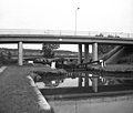
 Footbridge over M65 - geograph.org.uk - 1596454.jpg 640 × 480; 60 KByte
-
 Footbridge over the M65 - geograph.org.uk - 1187522.jpg 480 × 640; 85 KByte
-
 Guide, Blackburn - geograph.org.uk - 35856.jpg 640 × 480; 52 KByte
-
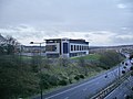 Holiday Inn Express - geograph.org.uk - 1058541.jpg 640 × 480; 167 KByte
-
 Holme Road - geograph.org.uk - 1113381.jpg 480 × 640; 99 KByte
-
 Junction 9 M65, Hapton - geograph.org.uk - 1443584.jpg 640 × 480; 55 KByte
-
 Leeds and Liverpool aquaduct M65.jpg 4 008 × 3 006; 1,99 MByte
-
 Leeds and Liverpool Canal - geograph.org.uk - 1080153.jpg 640 × 480; 73 KByte
-
 M65 - geograph.org.uk - 1058473.jpg 640 × 480; 162 KByte
-
 M65 - geograph.org.uk - 158854.jpg 640 × 480; 78 KByte
-
 M65 - geograph.org.uk - 1650381.jpg 640 × 480; 68 KByte
-
 M65 - geograph.org.uk - 1650382.jpg 640 × 480; 58 KByte
-
 M65 - geograph.org.uk - 768998.jpg 640 × 480; 165 KByte
-
 M65 - geograph.org.uk - 990736.jpg 640 × 480; 237 KByte
-
 M65 between Jn7 and Jn8 - geograph.org.uk - 65210.jpg 640 × 479; 115 KByte
-
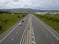
 M65 crossing Stanworth Valley - geograph.org.uk - 399503.jpg 640 × 372; 343 KByte
-
 M65 from the Burnley Way.jpg 4 008 × 3 006; 5,34 MByte
-
 M65 Junction 4 Approach - geograph.org.uk - 1394601.jpg 640 × 480; 60 KByte
-
 M65 Junction 5 - geograph.org.uk - 1187545.jpg 640 × 359; 65 KByte
-
 M65 motorway (Great Britain) map.svg 1 038 × 1 279; 457 KByte
-
 M65 motorway in North West England map.svg 393 × 565; 418 KByte
-
 M65 View - geograph.org.uk - 1369759.jpg 640 × 480; 57 KByte
-
 Motorway Bridge - geograph.org.uk - 260742.jpg 640 × 480; 71 KByte
-
 Motorway Viaducts near Burnley - geograph.org.uk - 4205.jpg 600 × 381; 33 KByte
-
 Oswaldtwistle - DSC03883.JPG 3 648 × 2 736; 3,56 MByte
-
 Oswaldtwistle - DSC03884.JPG 3 648 × 2 736; 3,57 MByte
-
 Oswaldtwistle - DSC03885.JPG 3 648 × 2 736; 3,56 MByte
-
 Oswaldtwistle - DSC03886.JPG 3 648 × 2 736; 3,56 MByte
-
 Pendle Way crossing the M65 (geograph 4086454).jpg 4 320 × 3 240; 3,38 MByte
-
 UK-Motorway-M65.svg 384 × 141; 10 KByte
-
 Under the M65 - geograph.org.uk - 1394618.jpg 640 × 480; 72 KByte
-
 Underneath the M65 - geograph.org.uk - 484160.jpg 640 × 426; 305 KByte
-
 An uneasy ride - geograph.org.uk - 484164.jpg 640 × 386; 262 KByte
-
 Brimmicroft Bridge - geograph.org.uk - 484155.jpg 640 × 426; 273 KByte
-
 Brimmicroft footbridge - geograph.org.uk - 539612.jpg 640 × 417; 345 KByte
-
 Guide Junction 5 M65 Looking Towards Preston - geograph.org.uk - 475940.jpg 640 × 480; 77 KByte
-
 Helter skelter - geograph.org.uk - 695656.jpg 640 × 480; 102 KByte
-
 M65 - geograph.org.uk - 674714.jpg 640 × 480; 70 KByte
-
 M65 between junctions 5 and 6 - geograph.org.uk - 378284.jpg 640 × 439; 335 KByte
-
 M65 Junction 6 - geograph.org.uk - 425350.jpg 640 × 370; 229 KByte
-
 New M65 bridge at Davyfield, Roman Road, Eccleshill - geograph.org.uk - 12537.jpg 640 × 425; 118 KByte
-
 Whittlefield Aqueduct - geograph.org.uk - 4200.jpg 600 × 367; 37 KByte


.jpg)


