Category:M67 motorway
Salta a la navigazzion
Và a cercà
motorway in Greater Manchester, England    | |||||
| Carega su un fail audio / video | |||||
| L'è un(a) | |||||
|---|---|---|---|---|---|
| Sit | Grande Manchester, Nord Ovest dell'Inghilterra, Inghiltèra | ||||
| Sistema autostradałe |
| ||||
| Mantegnesto da |
| ||||
| Data de creazzion o de fondazzion |
| ||||
| Longhesa |
| ||||
 | |||||
| Connections: | |
|---|---|
| Coordinates: | |
Sotocategorie
Quella categoria chì la gh'ha doma una sot-categoria, missa chì de sota.
B
Fail in la categoria "M67 motorway"
Quella categoria chì la gh'ha denter 119 i fail riportad chì de sota, su un total de 119.
-
 ABC WAX - geograph.org.uk - 4336194.jpg 1 000 × 849; 641 KByte
-
 Along the M67 - geograph.org.uk - 2207001.jpg 640 × 592; 80 KByte
-
 Approaching J3 M67 - Hyde - geograph.org.uk - 1969888.jpg 3 264 × 2 448; 1,29 MByte
-
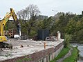 Automasters Demolished - geograph.org.uk - 1013870.jpg 640 × 480; 130 KByte
-
 Bridge over M67 - geograph.org.uk - 2702336.jpg 1 280 × 960; 975 KByte
-
 Bridge over M67 - Hyde - geograph.org.uk - 1969868.jpg 3 264 × 2 448; 1,34 MByte
-
 Canal and Motorway - geograph.org.uk - 1117790.jpg 640 × 480; 116 KByte
-
 Christ Church alongside the M67 - geograph.org.uk - 1703182.jpg 640 × 507; 174 KByte
-
 Cobwebs under the M67 - geograph.org.uk - 4355022.jpg 1 000 × 1 000; 743 KByte
-
 Crossing the M67 - geograph.org.uk - 1121727.jpg 640 × 480; 112 KByte
-
 Cyclists under the M67 - geograph.org.uk - 2288977.jpg 640 × 480; 122 KByte
-
 Denton Intersection M67-M60 - geograph.org.uk - 898329.jpg 640 × 480; 51 KByte
-
 Ducks on the Peak Forest Canal - geograph.org.uk - 1274637.jpg 640 × 559; 158 KByte
-
 Eastbound Exit, M67 Junction 3 - geograph.org.uk - 1637568.jpg 640 × 480; 108 KByte
-
 Eastbound M67 - geograph.org.uk - 1036521.jpg 640 × 480; 124 KByte
-
 Eastbound M67 - geograph.org.uk - 1637579.jpg 640 × 480; 97 KByte
-
 Eastbound M67 - geograph.org.uk - 2702361.jpg 1 280 × 960; 991 KByte
-
 Eastern Footbridge - geograph.org.uk - 1006010.jpg 640 × 480; 110 KByte
-
 Eastern Footbridge - geograph.org.uk - 2207007.jpg 640 × 541; 92 KByte
-
 Empty Motorway - Denton - geograph.org.uk - 1992407.jpg 4 224 × 3 168; 5,53 MByte
-
 End of Motorway - geograph.org.uk - 37840.jpg 640 × 480; 169 KByte
-
 End of the M67 - geograph.org.uk - 1907900.jpg 640 × 437; 119 KByte
-
 Footbridge Across the M67 at Hyde - geograph.org.uk - 2698355.jpg 1 280 × 960; 654 KByte
-
 Footbridge over the motorway - geograph.org.uk - 1842908.jpg 3 872 × 2 415; 1,86 MByte
-
 Footbridge to Spiral Ramp - geograph.org.uk - 1546538.jpg 640 × 497; 146 KByte
-
 Footbridge Underview - geograph.org.uk - 1474587.jpg 640 × 459; 109 KByte
-
 Footpath under the M67 - geograph.org.uk - 2138257.jpg 640 × 480; 124 KByte
-
 Gantry over the M67 - geograph.org.uk - 2882020.jpg 4 000 × 3 000; 3,74 MByte
-
 Godley Bridlepath - geograph.org.uk - 1036533.jpg 640 × 480; 119 KByte
-
 Lane under the M67 Motorway - geograph.org.uk - 3385438.jpg 640 × 480; 144 KByte
-
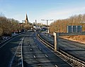
 M67 - geograph.org.uk - 2719865.jpg 640 × 480; 122 KByte
-
 M67 - geograph.org.uk - 2719868.jpg 640 × 480; 131 KByte
-
 M67 - geograph.org.uk - 4134172.jpg 2 670 × 2 449; 1,59 MByte
-
 M67 - geograph.org.uk - 4134182.jpg 3 702 × 2 592; 1,66 MByte
-
 M67 - geograph.org.uk - 4134692.jpg 3 858 × 2 572; 1,55 MByte
-
 M67 and site of ABC Wax - geograph.org.uk - 5056541.jpg 1 000 × 704; 582 KByte
-
 M67 at Denton - geograph.org.uk - 1096055.jpg 640 × 480; 135 KByte
-
 M67 at Denton - geograph.org.uk - 1438334.jpg 640 × 438; 97 KByte
-
 M67 at Denton - geograph.org.uk - 4272298.jpg 1 000 × 750; 715 KByte
-
 M67 at Denton - geograph.org.uk - 4558882.jpg 1 000 × 750; 581 KByte
-
 M67 at Hyde - geograph.org.uk - 2444936.jpg 640 × 480; 127 KByte
-
 M67 at Junction 3 - geograph.org.uk - 2698358.jpg 1 280 × 960; 571 KByte
-
 M67 Eastbound - geograph.org.uk - 4740425.jpg 1 000 × 750; 721 KByte
-
 M67 Eastbound - geograph.org.uk - 4841717.jpg 1 000 × 750; 524 KByte
-
 M67 Eastbound - geograph.org.uk - 5673067.jpg 1 280 × 960; 781 KByte
-
 M67 eastbound at Junction 3 - geograph.org.uk - 3820559.jpg 640 × 482; 46 KByte
-
 M67 Embankment - geograph.org.uk - 3240432.jpg 640 × 461; 217 KByte
-
 M67 end at M60 junction - geograph.org.uk - 3043253.jpg 640 × 480; 55 KByte
-
 M67 exit slip at Godley - geograph.org.uk - 3043248.jpg 640 × 480; 70 KByte
-
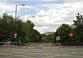
 M67 exit slip at Junction 2 - geograph.org.uk - 3043249.jpg 640 × 480; 55 KByte
-
 M67 Junction 1 - geograph.org.uk - 1095919.jpg 640 × 436; 105 KByte
-
 M67 junction 1 - geograph.org.uk - 4688963.jpg 1 000 × 750; 490 KByte
-
 M67 junction 1 - geograph.org.uk - 4952794.jpg 1 000 × 750; 635 KByte
-
 M67 Junction 1A - geograph.org.uk - 5727161.jpg 1 280 × 960; 843 KByte
-
 M67 Junction 2 - geograph.org.uk - 2698049.jpg 1 280 × 960; 607 KByte
-
 M67 Junction 2 - geograph.org.uk - 4148717.jpg 1 000 × 890; 769 KByte
-
 M67 Junction 2 - geograph.org.uk - 786350.jpg 640 × 480; 103 KByte
-
 M67 Junction 3 - geograph.org.uk - 4307063.jpg 1 000 × 968; 595 KByte
-
 M67 Junction 3 - geograph.org.uk - 4333868.jpg 1 000 × 732; 517 KByte
-
 M67 Junction 3 - geograph.org.uk - 4855498.jpg 1 000 × 750; 560 KByte
-
 M67 Junction 3 - geograph.org.uk - 828667.jpg 640 × 481; 109 KByte
-
 M67 Junction 3 Eastbound - geograph.org.uk - 3424186.jpg 1 600 × 1 041; 368 KByte
-
 M67 Junction 3 exit sliproad - geograph.org.uk - 4358080.jpg 1 000 × 1 000; 742 KByte
-
 M67 Motorway - Denton - geograph.org.uk - 1969897.jpg 3 264 × 2 448; 1,33 MByte
-
 M67 Motorway - geograph.org.uk - 1006004.jpg 640 × 480; 122 KByte
-
 M67 Motorway - geograph.org.uk - 1006230.jpg 640 × 480; 105 KByte
-
 M67 Motorway - geograph.org.uk - 1012679.jpg 640 × 454; 115 KByte
-
 M67 motorway - geograph.org.uk - 3240463.jpg 640 × 445; 115 KByte
-
 M67 motorway - geograph.org.uk - 5558641.jpg 1 280 × 960; 917 KByte
-
 M67 Motorway - Mottram - geograph.org.uk - 1969863.jpg 3 264 × 2 448; 1,31 MByte
-
 M67 Motorway From Hyde - geograph.org.uk - 2702356.jpg 1 280 × 960; 753 KByte
-
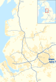 M67 motorway in North West England map.svg 393 × 565; 417 KByte
-
 M67 motorway traffic jam - geograph.org.uk - 3415782.jpg 1 024 × 504; 95 KByte
-
 M67 motorway, Hyde - geograph.org.uk - 1943317.jpg 640 × 480; 80 KByte
-
 M67 near Godley - geograph.org.uk - 5475323.jpg 1 280 × 862; 840 KByte
-
 M67 off slip road - geograph.org.uk - 1943321.jpg 640 × 449; 97 KByte
-
 M67 passes under Edward Street bridge - geograph.org.uk - 3043251.jpg 640 × 479; 53 KByte
-
 M67 tameside.jpg 2 056 × 2 682; 577 KByte
-
 M67 to A57 junction from the air.jpg 5 184 × 3 456; 10,66 MByte
-
 M67 towards Hyde - geograph.org.uk - 1036515.jpg 640 × 487; 110 KByte
-
 M67 Towards Hyde - geograph.org.uk - 2702348.jpg 1 280 × 960; 835 KByte
-
 M67 towards Manchester - geograph.org.uk - 2357177.jpg 640 × 448; 147 KByte
-
 M67 Towards Mottram - geograph.org.uk - 2702342.jpg 1 280 × 960; 697 KByte
-
 M67 viewed from train near Godley - geograph.org.uk - 2477766.jpg 1 600 × 1 198; 324 KByte
-
 M67 Westbound - geograph.org.uk - 4841778.jpg 1 000 × 809; 526 KByte
-
 M67 westbound - geograph.org.uk - 5111708.jpg 1 000 × 750; 598 KByte
-
 M67 Westbound - geograph.org.uk - 5672963.jpg 1 280 × 960; 973 KByte
-
 M67 Westbound - geograph.org.uk - 6059331.jpg 1 280 × 960; 950 KByte
-
 M67 westbound at Godley - geograph.org.uk - 3043245.jpg 640 × 479; 70 KByte
-
 M67 westbound near Longlands - geograph.org.uk - 3043244.jpg 640 × 481; 65 KByte
-
 M67, Denton - geograph.org.uk - 2440642.jpg 2 560 × 1 920; 1,96 MByte
-
 M67, Denton - geograph.org.uk - 3372791.jpg 640 × 480; 73 KByte
-
 Manchester Road North - geograph.org.uk - 784697.jpg 638 × 480; 98 KByte
-
 May blossom - geograph.org.uk - 829364.jpg 640 × 481; 133 KByte
-

-
 Motorway Bridge M67 - geograph.org.uk - 2886995.jpg 2 649 × 3 595; 5,37 MByte
-
 Nose to Tail on the M67 - geograph.org.uk - 1552731.jpg 640 × 480; 115 KByte
-
 Oldham Street - geograph.org.uk - 2137694.jpg 640 × 480; 112 KByte
-
 Peak Forest Canal - geograph.org.uk - 1117802.jpg 640 × 480; 117 KByte
-
 Railway bridge over M67 - geograph.org.uk - 1969875.jpg 3 264 × 2 448; 1,33 MByte
-
 Slip road to M67 - geograph.org.uk - 2959006.jpg 640 × 480; 185 KByte
-
 Slip road@ Junction 3, M67 - geograph.org.uk - 2719872.jpg 640 × 480; 148 KByte
-
 Sliproad from M67 - geograph.org.uk - 1438431.jpg 640 × 456; 148 KByte
-
 Sliproad to M67 - geograph.org.uk - 1008815.jpg 1 000 × 751; 564 KByte
-
 Sliproad to M67 - geograph.org.uk - 1438350.jpg 640 × 482; 142 KByte
-
 Standing Traffic - geograph.org.uk - 998438.jpg 640 × 491; 118 KByte
-
 Two Miles to the M60 - geograph.org.uk - 1117796.jpg 640 × 522; 140 KByte
-
 UK motorway map - M67.png 250 × 200; 28 KByte
-
 UK-Motorway-M67.svg 384 × 141; 13 KByte
-
 Under the M67 - geograph.org.uk - 2138267.jpg 640 × 480; 119 KByte
-
 Under the M67 - geograph.org.uk - 998418.jpg 640 × 480; 175 KByte
-
 Under the M67 - geograph.org.uk - 998442.jpg 640 × 480; 107 KByte
-
 Underside of the M67 - geograph.org.uk - 1117758.jpg 640 × 480; 131 KByte
-
 View across the motorway - geograph.org.uk - 4744850.jpg 1 000 × 750; 530 KByte
-
 View along the M67 - geograph.org.uk - 2198214.jpg 640 × 462; 109 KByte
-
 West along the M67 - geograph.org.uk - 2207016.jpg 640 × 610; 68 KByte
-
 Westbound M67 - geograph.org.uk - 1433476.jpg 640 × 444; 120 KByte
-
 Western footbridge - geograph.org.uk - 3692563.jpg 1 000 × 750; 238 KByte
-
 ABC Wax - geograph.org.uk - 1011132.jpg 640 × 481; 107 KByte


