Category:M80 motorway
Salta a la navigazzion
Và a cercà
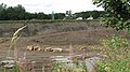
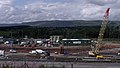
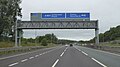
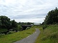
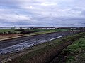
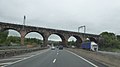
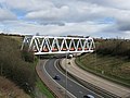
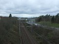
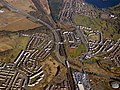
The M80 motorway runs between Glasgow and Stirling; most of it has been upgraded from the A80, but sections remain.
road in Scotland   _map.svg) | |||||
| Carega su un fail audio / video | |||||
| L'è un(a) | |||||
|---|---|---|---|---|---|
| Sit | |||||
| Sistema autostradałe |
| ||||
| Data de creazzion o de fondazzion |
| ||||
| Longhesa |
| ||||
| Diferent de | |||||
 | |||||
Sotocategorie
Quella categoria chì la gh'ha 6 sot-categorie chì de sota, su un numer complessiv de 6.
A
- Arria (sculpture) (6 F)
C
- Crowwood roundabout (2 F)
N
- North Road Bridge (6 F)
R
- Red Burn Viaduct, Castlecary (14 F)
S
- Stepps bypass bridge (2 F)
- Stirling Services (10 F)
Fail in la categoria "M80 motorway"
Quella categoria chì la gh'ha denter 45 i fail riportad chì de sota, su un total de 45.
-
 A80 - geograph.org.uk - 1465120.jpg 640 × 480; 83 KByte
-
 A80 - geograph.org.uk - 1465132.jpg 640 × 480; 80 KByte
-
 A80 at Castlecary - geograph.org.uk - 1747802.jpg 968 × 648; 115 KByte
-
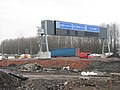
 A80 Upgrade Works - geograph.org.uk - 1470765.jpg 640 × 480; 92 KByte
-
 A80 upgrading - geograph.org.uk - 1579152.jpg 640 × 480; 55 KByte
-
 Balornock from the air (geograph 5716315).jpg 640 × 480; 235 KByte
-
 Barbeth Moss and the new Motorway - geograph.org.uk - 1622171.jpg 640 × 480; 100 KByte
-
 Birds Eye View of the M80 (geograph 4415566).jpg 640 × 489; 92 KByte
-
 Bridge 13, Forth and Clyde Canal - geograph.org.uk - 1006152.jpg 640 × 480; 64 KByte
-
 Bridge under the M80 - geograph.org.uk - 1122920.jpg 640 × 480; 112 KByte
-
 Building the M80 - geograph.org.uk - 1460345.jpg 640 × 359; 74 KByte
-
 Christmas Eve traffic on A80 - geograph.org.uk - 1637897.jpg 640 × 480; 59 KByte
-
 Contractor's Compound - geograph.org.uk - 1497968.jpg 640 × 362; 61 KByte
-
 Earthworks at Westfield - geograph.org.uk - 1498025.jpg 640 × 480; 128 KByte
-
 Gantry over M80 by Dalshannon - geograph.org.uk - 5959700.jpg 1 024 × 576; 92 KByte
-
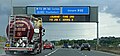 Gantry sign on the M80 motorway - geograph.org.uk - 5485404.jpg 640 × 301; 101 KByte
-
 Gantry sign on the M80 motorway - geograph.org.uk - 5485417.jpg 640 × 480; 122 KByte
-
 Glasgow City , The M80 Motorway - geograph.org.uk - 5015867.jpg 6 000 × 4 000; 6,26 MByte
-
 Glasgow City - The M80 Motorway (geograph 5015871).jpg 6 000 × 4 000; 6,96 MByte
-
 M8 North of Alexandra Park - geograph.org.uk - 1241430.jpg 640 × 480; 60 KByte
-
 M80 construction - geograph.org.uk - 2296742.jpg 640 × 480; 189 KByte
-
 M80 construction - geograph.org.uk - 2296750.jpg 640 × 480; 228 KByte
-
 M80 Junction 4 - geograph.org.uk - 2683043.jpg 640 × 480; 140 KByte
-
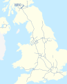 M80 motorway (Great Britain) map.svg 1 038 × 1 279; 457 KByte
-
 M80 Upgrade at Mollinsburn - geograph.org.uk - 1497949.jpg 640 × 480; 76 KByte
-
 M80, Junction 2 - geograph.org.uk - 128080.jpg 640 × 434; 78 KByte
-
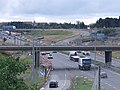
 M80-M73 Junction - geograph.org.uk - 4032145.jpg 640 × 480; 208 KByte
-
 Molinsburn motorway junction from the air (geograph 5308137).jpg 480 × 640; 147 KByte
-
 New bridge over Luggie Water - geograph.org.uk - 1622186.jpg 640 × 480; 95 KByte
-
-
 New Line of Road - geograph.org.uk - 1497982.jpg 640 × 480; 68 KByte
-
 New M80 Motorway under construction - geograph.org.uk - 1622181.jpg 640 × 480; 69 KByte
-
 New Mollinsburn Interchange - geograph.org.uk - 1622194.jpg 640 × 480; 105 KByte
-
 North Lanarkshire , The M80 Motorway - geograph.org.uk - 5015855.jpg 6 000 × 4 000; 5,23 MByte
-
 Overhead sign Gantry, M80-M73 Junction - geograph.org.uk - 4032163.jpg 640 × 480; 228 KByte
-
 Provan gas works from the air (geograph 5716347).jpg 640 × 480; 214 KByte
-
 Railway bridge crossing M80 - geograph.org.uk - 5959622.jpg 1 024 × 768; 135 KByte
-
 Railway bridge over the M80 at Castlecary (geograph 5960111).jpg 1 024 × 576; 81 KByte
-
 Railway Bridge over the M80 Motorway - geograph.org.uk - 1225138.jpg 640 × 480; 71 KByte
-
 Railway towards Glasgow (geograph 5336764).jpg 640 × 480; 54 KByte
-
 The M80 motorway - geograph.org.uk - 3562205.jpg 640 × 394; 118 KByte
-
 The M80 motorway from the air (geograph 5716335).jpg 640 × 480; 237 KByte
-
 Under the M80 (geograph 6419696).jpg 1 600 × 1 067; 216 KByte
-
 Under the M80, Denny - geograph.org.uk - 1129035.jpg 640 × 480; 110 KByte
-
 Warning signs for Junctions 4A and 5 M80 east - geograph.org.uk - 2957703.jpg 640 × 455; 66 KByte


.jpg)

.jpg)


.jpg)


.jpg)


.jpg)

.jpg)
.jpg)

.jpg)
.jpg)

