Category:Mablethorpe and Sutton
Aller à la navigation
Aller à la recherche
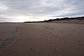
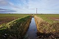
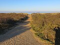
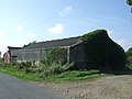
English: Mablethorpe and Sutton is a civil parish and town in East Lindsey, Lincolnshire, England. It is on the North Sea coast and includes Mablethorpe, Trusthorpe, Sutton-on-Sea and Sandilands along with the inland village of Thorpe. According to the 2001 census it had a population of 11,780.
localité britannique du comté anglais de Lincolnshire | |||||
| Téléverser des médias | |||||
| Nature de l’élément | |||||
|---|---|---|---|---|---|
| Lieu | East Lindsey, Lincolnshire, Midlands de l'Est, Angleterre | ||||
| Population |
| ||||
| site officiel | |||||
 | |||||
Sous-catégories
Cette catégorie comprend 4 sous-catégories, dont les 4 ci-dessous.
M
S
T
Média dans la catégorie « Mablethorpe and Sutton »
Cette catégorie comprend 420 fichiers, dont les 200 ci-dessous.
(page précédente) (page suivante)-
 'Peace Man' in this beach hut - geograph.org.uk - 3940871.jpg 4 288 × 3 216 ; 374 kio
-
 10 a.m. until 't'ree'^ - geograph.org.uk - 2813535.jpg 2 472 × 3 296 ; 1,89 Mio
-
 1st Green at Sandilands Golf Club - geograph.org.uk - 5743822.jpg 1 600 × 1 200 ; 428 kio
-
 A bracing beach walk - geograph.org.uk - 3700049.jpg 640 × 480 ; 41 kio
-
 A colourful road junction - geograph.org.uk - 3174766.jpg 4 000 × 3 000 ; 4,17 Mio
-
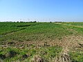
 A field in Lincolnshire - geograph.org.uk - 6646829.jpg 6 252 × 4 164 ; 3,74 Mio
-
 A land drain - geograph.org.uk - 6645259.jpg 6 252 × 4 164 ; 3,13 Mio
-
 A life on the ocean waves - geograph.org.uk - 2103523.jpg 3 296 × 2 472 ; 1,87 Mio
-
 A path leading to Poplar Farm - geograph.org.uk - 2899758.jpg 800 × 600 ; 117 kio
-
 A pole with a name - geograph.org.uk - 6645242.jpg 4 163 × 6 251 ; 3,76 Mio
-
 A road in Lincolnshire - geograph.org.uk - 6645226.jpg 6 252 × 4 164 ; 3,42 Mio
-
 A romantic view of a holiday park - geograph.org.uk - 3767096.jpg 640 × 427 ; 82 kio
-
 A step down to the beach - geograph.org.uk - 2102150.jpg 3 296 × 2 472 ; 1,93 Mio
-
 A winter's walk along the prom^ - geograph.org.uk - 2230592.jpg 3 296 × 2 472 ; 3,82 Mio
-
 A1031 heading south - geograph.org.uk - 4680993.jpg 640 × 480 ; 73 kio
-
 A1031 looking north - geograph.org.uk - 3668449.jpg 640 × 481 ; 81 kio
-
 A1111 road outside Sutton on Sea - geograph.org.uk - 3940838.jpg 1 024 × 768 ; 160 kio
-
 A52 Huttoft Road - geograph.org.uk - 3538952.jpg 2 256 × 1 504 ; 1,83 Mio
-
 A52 Station Road - geograph.org.uk - 3668395.jpg 640 × 480 ; 69 kio
-
 Access from Hutton Bank to the promenade - geograph.org.uk - 3465908.jpg 640 × 452 ; 328 kio
-
 Access ramp to the beach - geograph.org.uk - 3465884.jpg 640 × 427 ; 265 kio
-
 Acre Gap Flood Storage Scheme - geograph.org.uk - 4450591.jpg 640 × 480 ; 68 kio
-
 Alford Road (A1104) - geograph.org.uk - 3524382.jpg 640 × 480 ; 86 kio
-
 Alford Road (A1111) - geograph.org.uk - 4681023.jpg 640 × 480 ; 42 kio
-
 Alford Road (A1111) - geograph.org.uk - 4681027.jpg 640 × 480 ; 74 kio
-
 Alford Road A1111 towards Sutton on Sea - geograph.org.uk - 3940828.jpg 1 024 × 768 ; 110 kio
-
 Approaching The Cross - geograph.org.uk - 1219818.jpg 640 × 480 ; 59 kio
-
 Arch in Marigold Cottage garden - geograph.org.uk - 4597951.jpg 640 × 480 ; 123 kio
-
 Aubrey Parker Way, Trusthorpe - geograph.org.uk - 6339891.jpg 5 456 × 3 632 ; 3,72 Mio
-
 Autumn colours in the dunes - geograph.org.uk - 3667294.jpg 640 × 427 ; 94 kio
-

-
 Bathing Beauties - geograph.org.uk - 2401803.jpg 640 × 480 ; 83 kio
-
 Beach at North End - geograph.org.uk - 5752220.jpg 1 600 × 1 200 ; 340 kio
-
 Beach at Trusthorpe - geograph.org.uk - 6339859.jpg 5 456 × 3 632 ; 2,81 Mio
-
 Beach essentials - geograph.org.uk - 2561461.jpg 640 × 427 ; 143 kio
-
 Beach Hut - geograph.org.uk - 2401824.jpg 640 × 480 ; 98 kio
-
 Beach huts - geograph.org.uk - 2401736.jpg 640 × 480 ; 103 kio
-
 Beach Huts - geograph.org.uk - 2401822.jpg 640 × 480 ; 68 kio
-
 Beach huts - geograph.org.uk - 2435009.jpg 640 × 389 ; 58 kio
-
 Beach Huts - geograph.org.uk - 3177277.jpg 640 × 480 ; 79 kio
-
 Beach huts above coast road - geograph.org.uk - 6212882.jpg 1 024 × 683 ; 161 kio
-
 Beach huts and colonnade - geograph.org.uk - 2434893.jpg 460 × 640 ; 96 kio
-
 Beach huts at Sandilands - geograph.org.uk - 6212663.jpg 1 024 × 683 ; 149 kio
-
 Beach huts on the promenade at Sandilands - geograph.org.uk - 6212871.jpg 1 024 × 683 ; 125 kio
-
 Beach huts on the promenade at Sandilands - geograph.org.uk - 6212874.jpg 1 024 × 683 ; 122 kio
-
 Beach huts SP26 and 28 - geograph.org.uk - 3182320.jpg 640 × 397 ; 44 kio
-
 Beach, Mablethorpe - geograph.org.uk - 6338847.jpg 5 456 × 3 632 ; 2,6 Mio
-
 Beach, Mablethorpe - geograph.org.uk - 6338867.jpg 5 456 × 3 632 ; 2,34 Mio
-
 Beach, Mablethorpe - geograph.org.uk - 6338872.jpg 5 456 × 3 632 ; 3,04 Mio
-
 Beach, North End, Mablethorpe - geograph.org.uk - 6338833.jpg 5 456 × 3 632 ; 3,18 Mio
-
 Beach, North End, Mablethorpe - geograph.org.uk - 6338835.jpg 5 456 × 3 632 ; 2,28 Mio
-
 Beach, North End, Mablethorpe - geograph.org.uk - 6338840.jpg 5 456 × 3 632 ; 2,54 Mio
-
 Beach, North End, Mablethorpe - geograph.org.uk - 6338841.jpg 5 456 × 3 632 ; 2,31 Mio
-
 Behind the sea wall - geograph.org.uk - 3280816.jpg 1 024 × 768 ; 133 kio
-
 Bend in the Thorpe Hannah Drain - geograph.org.uk - 3948502.jpg 640 × 427 ; 74 kio
-
 Bend on Huttoft Road (A52) - geograph.org.uk - 4681088.jpg 640 × 480 ; 59 kio
-
 Boy Grift Drain - geograph.org.uk - 3975556.jpg 640 × 480 ; 64 kio
-
 Boy Grift Drain - geograph.org.uk - 4656935.jpg 640 × 480 ; 75 kio
-
 Boy Grift Pumping Station - geograph.org.uk - 3257240.jpg 2 256 × 1 504 ; 895 kio
-
 Boygrift Outfall lagoon - geograph.org.uk - 5743835.jpg 1 600 × 1 200 ; 442 kio
-
 Brick Kiln - geograph.org.uk - 2561632.jpg 640 × 427 ; 106 kio
-
 Brick Kiln, Sutton Ings - geograph.org.uk - 4547832.jpg 640 × 427 ; 98 kio
-
 Brickyard Lane - geograph.org.uk - 4681017.jpg 640 × 480 ; 56 kio
-
 Brickyard Lane - geograph.org.uk - 4681020.jpg 640 × 480 ; 63 kio
-
 Bridge Farm on Mile Lane - geograph.org.uk - 3948431.jpg 640 × 427 ; 66 kio
-
 Bridge over the Thorpe Hannah Drain - geograph.org.uk - 3948497.jpg 640 × 427 ; 82 kio
-
 Brown sea is land - geograph.org.uk - 6092747.jpg 4 608 × 3 456 ; 2,49 Mio
-
 Bungalow on Kent Avenue - geograph.org.uk - 4404735.jpg 640 × 480 ; 35 kio
-
 Bus stop by the sea path - geograph.org.uk - 3767072.jpg 640 × 427 ; 68 kio
-
 Camping and caravan site, Meers Bank - geograph.org.uk - 4404742.jpg 640 × 480 ; 59 kio
-
 Car Wash on Alford Road - geograph.org.uk - 3668447.jpg 640 × 480 ; 58 kio
-
 Caravan Park at Trusthorpe - geograph.org.uk - 6339865.jpg 5 456 × 3 632 ; 3,11 Mio
-
 Caravan park beside fishing pond - geograph.org.uk - 4656926.jpg 640 × 480 ; 67 kio
-
 Caravans, Golden Sands Holiday Park - geograph.org.uk - 4404862.jpg 640 × 480 ; 70 kio
-
 Clouds and fields - geograph.org.uk - 6646837.jpg 6 252 × 4 164 ; 3,06 Mio
-
 Come on^ Keep up^ - geograph.org.uk - 2469221.jpg 1 024 × 768 ; 101 kio
-
 Construction work at a farm by the A1111 - geograph.org.uk - 4547921.jpg 640 × 427 ; 49 kio
-
 Corner turret, Station Road-High Street - geograph.org.uk - 3280786.jpg 768 × 1 024 ; 114 kio
-
 Country Meadow Caravan ^ Camping Park - geograph.org.uk - 2899772.jpg 800 × 600 ; 126 kio
-
 Course of disused railway - geograph.org.uk - 4681078.jpg 640 × 480 ; 63 kio
-
 Cows at Poplar Farm - geograph.org.uk - 3174866.jpg 4 000 × 3 000 ; 4,21 Mio
-
 Crabtree Lane - geograph.org.uk - 2467995.jpg 1 024 × 768 ; 136 kio
-
 Crabtree Lane - geograph.org.uk - 3976075.jpg 640 × 480 ; 58 kio
-
 Crabtree Lane - geograph.org.uk - 4681034.jpg 640 × 480 ; 62 kio
-
 Crabtree Lane - geograph.org.uk - 4681036.jpg 640 × 480 ; 58 kio
-
 Crabtree Lane - geograph.org.uk - 4681066.jpg 640 × 480 ; 72 kio
-
 Crabtree Lane - geograph.org.uk - 4681071.jpg 640 × 475 ; 95 kio
-
 Crabtree Lane - geograph.org.uk - 4681082.jpg 640 × 480 ; 56 kio
-

-
 Crookbank carpark, path to the sea - geograph.org.uk - 4637433.jpg 640 × 427 ; 73 kio
-
 Crop field and wind turbines, The Grange - geograph.org.uk - 3524367.jpg 640 × 480 ; 64 kio
-
 Crop field off Stain Lane - geograph.org.uk - 4680984.jpg 640 × 480 ; 74 kio
-
 Crop Fields off Crabtree Lane - geograph.org.uk - 3061317.jpg 2 256 × 1 504 ; 913 kio
-
 Deserted paddling pool - geograph.org.uk - 4450352.jpg 640 × 480 ; 64 kio
-
 Deserted village of Stain, aerial 2018 - geograph.org.uk - 5779644.jpg 800 × 533 ; 68 kio
-
 Detail of brick kiln, Lakeside Springs, Sutton on Sea - geograph.org.uk - 6128134.jpg 683 × 1 024 ; 256 kio
-
 Drain and stubble field near The Grange - geograph.org.uk - 4656922.jpg 640 × 480 ; 78 kio
-
 Drain and Track off Ings Road - geograph.org.uk - 3757982.jpg 2 256 × 1 504 ; 2,06 Mio
-
 Drain from North Road - geograph.org.uk - 6340364.jpg 5 456 × 3 632 ; 4,16 Mio
-
 Drain from North Road - geograph.org.uk - 6340366.jpg 5 456 × 3 632 ; 4,97 Mio
-
 Drain junction near Main Street - geograph.org.uk - 3256299.jpg 2 256 × 1 504 ; 1,21 Mio
-
 Drain off Ings Road - geograph.org.uk - 3757998.jpg 3 000 × 2 000 ; 4,39 Mio
-
 Drain off Main Street - geograph.org.uk - 3256297.jpg 1 504 × 2 256 ; 1,13 Mio
-
 Drain off Mile Lane - geograph.org.uk - 4681000.jpg 640 × 480 ; 101 kio
-
 Drainage dyke and old bridge - geograph.org.uk - 3174891.jpg 4 000 × 3 000 ; 4,06 Mio
-
 Dry drain and fields - geograph.org.uk - 4656929.jpg 640 × 480 ; 92 kio
-
 Dune lagoon - geograph.org.uk - 3667312.jpg 640 × 427 ; 66 kio
-
 Dune lagoon - geograph.org.uk - 3667367.jpg 640 × 427 ; 85 kio
-

-
 Dunes and Grass - geograph.org.uk - 3177151.jpg 640 × 480 ; 77 kio
-
 Dunes by the beach - geograph.org.uk - 2946096.jpg 1 500 × 991 ; 111 kio
-
 Dunes footpath to the beach and the sea at Mablethorpe - geograph.org.uk - 6080871.jpg 4 000 × 3 000 ; 3,56 Mio
-
 Dunes track to the beach and sea at Mablethorpe North End - geograph.org.uk - 6080874.jpg 4 000 × 3 000 ; 3,51 Mio
-
 Dyke beside Ings Lane - geograph.org.uk - 2285031.jpg 3 296 × 2 472 ; 1,96 Mio
-
 Early morning tractor on the beach - geograph.org.uk - 4560759.jpg 480 × 640 ; 45 kio
-
 Edge of the Caravan Park - geograph.org.uk - 5743668.jpg 1 600 × 1 200 ; 505 kio
-
 Elder Farm - geograph.org.uk - 4656911.jpg 640 × 480 ; 89 kio
-
 Elder Farm on North Road - geograph.org.uk - 6340367.jpg 5 456 × 3 632 ; 4,34 Mio
-
 Entrance to caravan park - geograph.org.uk - 4681067.jpg 640 × 480 ; 79 kio
-
 Entrance to Golden Sands Holiday Park - geograph.org.uk - 3256278.jpg 2 256 × 1 504 ; 1,09 Mio
-
 Entrance to Golden Sands Holiday Park - geograph.org.uk - 4404857.jpg 640 × 480 ; 55 kio
-
 Entrance to Grange Leisure Park - geograph.org.uk - 2517719.jpg 1 280 × 960 ; 415 kio
-
 Evacuation route marker - geograph.org.uk - 6645234.jpg 6 252 × 4 164 ; 4,58 Mio
-

-
 Farm building, Bridge Farm - geograph.org.uk - 4656908.jpg 640 × 480 ; 63 kio
-
 Farm buildings on Crabtree Lane - geograph.org.uk - 4681035.jpg 640 × 480 ; 62 kio
-
 Farm buildings on Mile Lane - geograph.org.uk - 4680995.jpg 640 × 480 ; 49 kio
-
 Farm machinery - geograph.org.uk - 3976058.jpg 640 × 480 ; 80 kio
-
 Farm track and windfarm - geograph.org.uk - 3063962.jpg 1 024 × 768 ; 183 kio
-
 Farm track from A1111 - geograph.org.uk - 3940834.jpg 1 024 × 786 ; 250 kio
-
 Farm track off Ings Lane - geograph.org.uk - 2467987.jpg 1 024 × 768 ; 197 kio
-
 Farm track off stain Lane - geograph.org.uk - 2519293.jpg 1 194 × 648 ; 483 kio
-
 Farm track off Stain Lane - geograph.org.uk - 4680986.jpg 640 × 480 ; 57 kio
-
 Farmland near Meers Bridge - geograph.org.uk - 4404730.jpg 640 × 480 ; 69 kio
-
 Farmland off Golf Road - geograph.org.uk - 5744889.jpg 1 600 × 1 201 ; 570 kio
-
 Fields and drains off Crabtree Lane - geograph.org.uk - 4656938.jpg 640 × 480 ; 67 kio
-
 Fields and Skies - geograph.org.uk - 6646834.jpg 6 252 × 4 164 ; 3,48 Mio
-
 Fields looking towards Mile Lane - geograph.org.uk - 5743655.jpg 1 600 × 1 200 ; 748 kio
-
 Fields off Mile Lane - geograph.org.uk - 3256268.jpg 2 256 × 1 504 ; 1,59 Mio
-

-
 Fishing lake off Alford Road (A1111) - geograph.org.uk - 4681025.jpg 640 × 480 ; 87 kio
-
 Flat farmland and hedgerow - geograph.org.uk - 4681028.jpg 640 × 480 ; 75 kio
-
 Flat farmland and wind turbines - geograph.org.uk - 4681002.jpg 640 × 465 ; 29 kio
-
 Flat farmland off Brickyard Lane - geograph.org.uk - 4681019.jpg 640 × 480 ; 83 kio
-
 Flat farmland off Mile Lane - geograph.org.uk - 4680997.jpg 640 × 480 ; 95 kio
-
 Flat farmland off the A1031 - geograph.org.uk - 4680994.jpg 640 × 480 ; 72 kio
-
 Flat field off North Road - geograph.org.uk - 4656915.jpg 640 × 480 ; 77 kio
-
 Flat field, Sutton Ings - geograph.org.uk - 4681030.jpg 640 × 480 ; 101 kio
-
 Flooded ridge and furrow - geograph.org.uk - 3279825.jpg 640 × 427 ; 60 kio
-
 Flying horse in Sutton on Sea - geograph.org.uk - 3280791.jpg 768 × 1 024 ; 124 kio
-
 Footbridge and Footpath off Meers Bank - geograph.org.uk - 3063908.jpg 1 024 × 768 ; 188 kio
-
 Footbridge next to North Road - geograph.org.uk - 3174884.jpg 4 000 × 3 000 ; 4 Mio
-
 Footbridge on North Road - geograph.org.uk - 6340371.jpg 5 456 × 3 632 ; 3,87 Mio
-
 Footbridge over drain and new houses - geograph.org.uk - 3757965.jpg 2 256 × 1 504 ; 2,2 Mio
-
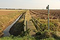 Footbridge over Meers Bank drain - geograph.org.uk - 4179061.jpg 1 024 × 683 ; 280 kio
-
 Footpath across the field - geograph.org.uk - 3975569.jpg 480 × 640 ; 55 kio
-
 Footpath behind the sea wall - geograph.org.uk - 2468121.jpg 1 024 × 768 ; 175 kio
-
 Footpath crossing - geograph.org.uk - 3975583.jpg 640 × 480 ; 66 kio
-
 Footpath to Alford Road - geograph.org.uk - 3062664.jpg 1 024 × 768 ; 166 kio
-
 Footpath to Sandilands - geograph.org.uk - 3976062.jpg 640 × 480 ; 70 kio
-
 Footpath to the A1031 - geograph.org.uk - 3723684.jpg 640 × 427 ; 94 kio
-
 Former level crossing - geograph.org.uk - 3976071.jpg 640 × 480 ; 50 kio
-
 Former Radio Station, Trusthorpe - geograph.org.uk - 6339894.jpg 5 456 × 3 632 ; 6,41 Mio
-
 From where one surveys the vegetables - geograph.org.uk - 4598160.jpg 480 × 640 ; 115 kio
-
 Frozen puddle South Promenade - geograph.org.uk - 4338521.jpg 480 × 640 ; 58 kio
-
 Gale force from the German Sea - geograph.org.uk - 3697327.jpg 640 × 480 ; 41 kio
-

-
 Garden of Remembrance Mablethorpe Cemetery - geograph.org.uk - 6339937.jpg 5 456 × 3 632 ; 4,47 Mio
-
 Gas bottles blocking a culvert - geograph.org.uk - 6340385.jpg 5 456 × 3 632 ; 5,7 Mio
-
 Golden Sands Caravan Park - geograph.org.uk - 2507977.jpg 640 × 480 ; 85 kio
-
 Golf course and Clubhouse - geograph.org.uk - 3465774.jpg 640 × 428 ; 320 kio
-
 Golf Course Promenade - geograph.org.uk - 3976433.jpg 640 × 480 ; 43 kio
-
 Grange Farm and Wind Farm - geograph.org.uk - 1219794.jpg 640 × 480 ; 45 kio
-
 Grange ^ Links Hotel - geograph.org.uk - 2561674.jpg 640 × 427 ; 72 kio
-
 Grass and Dunes - geograph.org.uk - 3177164.jpg 640 × 480 ; 97 kio
-
 Gray day at the seaside - geograph.org.uk - 2137137.jpg 1 600 × 1 061 ; 115 kio
-
 Grazing off Alford Road (A1111) - geograph.org.uk - 4656928.jpg 640 × 480 ; 83 kio
-
 Greenfield Caravan Park - geograph.org.uk - 2401640.jpg 640 × 480 ; 125 kio
-
 Greenfield Farm - geograph.org.uk - 4404724.jpg 640 × 480 ; 59 kio
-
 Heading for Trusthorpe from Sutton on Sea - geograph.org.uk - 1497811.jpg 640 × 480 ; 65 kio
-
 Heading south on Mile Lane - geograph.org.uk - 4681007.jpg 640 × 480 ; 54 kio
-

-

-
 Holivans Caravan Site - geograph.org.uk - 5744852.jpg 1 600 × 1 200 ; 541 kio
-
 Horses for Hire - geograph.org.uk - 3168090.jpg 640 × 427 ; 79 kio
-
 House and farm track off Kent Avenue - geograph.org.uk - 3767116.jpg 640 × 427 ; 76 kio
-
 House at Kirkstead Holiday Park - geograph.org.uk - 6340361.jpg 5 456 × 3 632 ; 4,2 Mio
-
 House on Crabtree Lane - geograph.org.uk - 4681083.jpg 640 × 480 ; 95 kio
-
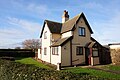
 House on Meers Bank, North End - geograph.org.uk - 4404747.jpg 640 × 480 ; 48 kio
-
 Houses on Alford Road (A1111) - geograph.org.uk - 4681024.jpg 640 × 480 ; 67 kio
-

-
 Huttoft Road (A52) - geograph.org.uk - 4681086.jpg 640 × 480 ; 67 kio
-
 Ings footpath - geograph.org.uk - 2561648.jpg 640 × 427 ; 78 kio
-
 Ings lane and Ings Lane Farm - geograph.org.uk - 3759602.jpg 2 256 × 1 504 ; 1,62 Mio
-
 Ings Lane Farm - geograph.org.uk - 4681032.jpg 640 × 480 ; 64 kio
-
 Ings Road - geograph.org.uk - 4681029.jpg 640 × 480 ; 66 kio
-
 Ings Road - geograph.org.uk - 4681031.jpg 640 × 480 ; 60 kio
-
 Interesting signage for the Garden Cafe - geograph.org.uk - 4451351.jpg 480 × 640 ; 89 kio
-
 Just made it - geograph.org.uk - 1142983.jpg 640 × 480 ; 56 kio
-
 Kent Avenue, from Meers Bridge - geograph.org.uk - 3767119.jpg 640 × 427 ; 65 kio


_-_geograph.org.uk_-_3524382.jpg)
_-_geograph.org.uk_-_4681023.jpg)
_-_geograph.org.uk_-_4681027.jpg)


_-_geograph.org.uk_-_4681088.jpg)


_-_geograph.org.uk_-_4681025.jpg)


_-_geograph.org.uk_-_4656928.jpg)


_-_geograph.org.uk_-_4681024.jpg)

_-_geograph.org.uk_-_4681086.jpg)


