Category:Maghull
Vai alla navigazione
Vai alla ricerca
town and civil parish in the Metropolitan Borough of Sefton, in Merseyside, England  | |||||
| Carica un file multimediale | |||||
| Istanza di | |||||
|---|---|---|---|---|---|
| Luogo | Sefton, Merseyside, Nord Ovest dell'Inghilterra, Inghilterra | ||||
| Considerato essere uguale a | Maghull (pagina Wikimedia duplicata, parrocchia civile dell'Inghilterra) | ||||
| sito web ufficiale | |||||
 | |||||
Sottocategorie
Questa categoria contiene le 14 sottocategorie indicate di seguito, su un totale di 14.
A
- Ashworth Hospital (2 F)
C
L
M
- Maghull railway station (40 F)
O
P
- Park Lane bridge, Maghull (2 F)
S
- School Lane bridge, Maghull (6 F)
- Schools in Maghull (4 F)
- Shops in Maghull (21 F)
- Streets in Maghull (14 F)
File nella categoria "Maghull"
Questa categoria contiene 200 file, indicati di seguito, su un totale di 262.
(pagina precedente) (pagina successiva)-
 A field at Moss Nook farm - geograph.org.uk - 3068667.jpg 2 866 × 1 996; 1,8 MB
-
 A footbridge over Maghull Brook - geograph.org.uk - 4980561.jpg 4 390 × 2 300; 7,95 MB
-
 A junction on the Trans Pennine Trail - geograph.org.uk - 4980554.jpg 3 968 × 2 801; 6,1 MB
-
 A lane closure on the M58 - geograph.org.uk - 3047277.jpg 4 592 × 3 056; 5,71 MB
-
 A lane through the Park in Maghull - geograph.org.uk - 3068024.jpg 2 304 × 3 072; 4,64 MB
-
 A mast near Melling, Liverpool - geograph.org.uk - 3068760.jpg 2 304 × 3 072; 2,3 MB
-
 Ancient Chapel of Maghull - geograph.org.uk - 3960518.jpg 4 000 × 3 000; 4,54 MB
-

-
 Approaching The Methodist Swing Bridge - geograph.org.uk - 4611182.jpg 2 556 × 1 914; 2,39 MB
-
 Ashworth Farm Maghull.jpg 1 200 × 1 600; 283 KB
-
 Ashworth Farm March 2012.jpg 1 200 × 1 143; 232 KB
-
 Ashworth farm.JPG 3 066 × 2 296; 2,69 MB
-
 B5422 Sefton Lane - geograph.org.uk - 3418217.jpg 640 × 480; 46 KB
-
 Bell's Lane, Lydiate, at night - geograph.org.uk - 5243115.jpg 683 × 1 024; 109 KB
-
 Bench mark and bolt on Red Lion Bridge, Maghull - geograph.org.uk - 5512762.jpg 1 024 × 769; 242 KB
-
 Boat passing through swing bridge No.15 - geograph.org.uk - 4191909.jpg 1 000 × 750; 758 KB
-

-

-
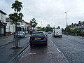
 Boyer Avenue, Maghull - geograph.org.uk - 5582820.jpg 1 024 × 802; 188 KB
-
 Bradley's Farm - geograph.org.uk - 3332143.jpg 3 065 × 1 812; 1,27 MB
-
 Bradley's Farm - geograph.org.uk - 6138483.jpg 800 × 499; 82 KB
-
 Bradley's Farm, Moss Side, Maghull - geograph.org.uk - 3921919.jpg 1 024 × 681; 159 KB
-
 Bradley's Farm, Moss Side, Maghull - geograph.org.uk - 3934462.jpg 1 024 × 681; 103 KB
-
 Bridge across Maghull Brook - geograph.org.uk - 5262245.jpg 1 000 × 750; 180 KB
-
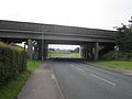
 Bridge over the M58 - geograph.org.uk - 3332147.jpg 3 769 × 2 226; 1,57 MB
-
 Bridge Road Footbridge - geograph.org.uk - 4611212.jpg 2 560 × 1 920; 2,51 MB
-
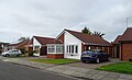 Bungalows on Milton Way, Maghull - geograph.org.uk - 6136740.jpg 800 × 487; 71 KB
-

-
 Bus stop on School Lane - geograph.org.uk - 6138489.jpg 800 × 600; 110 KB
-
 Bus stop on the B5422 - geograph.org.uk - 6136737.jpg 800 × 600; 87 KB
-
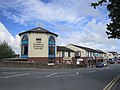
 Cheshire Lines health club, Maghull.jpg 4 320 × 3 240; 3,49 MB
-
 Cloudy skies above Melling - geograph.org.uk - 3068865.jpg 3 068 × 2 298; 2,09 MB
-
 Coach ^ Horses public house, Maghull - geograph.org.uk - 4272373.jpg 1 600 × 1 200; 428 KB
-
 Damfield Road, Maghull and a bench mark - geograph.org.uk - 5508780.jpg 1 024 × 768; 277 KB
-
 Deyes High School.jpg 2 560 × 1 536; 1,46 MB
-
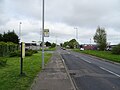
 Deyes Lane, Maghull - geograph.org.uk - 6138499.jpg 800 × 600; 79 KB
-
 Dodds Lane - geograph.org.uk - 4121707.jpg 3 903 × 2 281; 6,8 MB
-
 Dover Road shops, Maghull - geograph.org.uk - 4772192.jpg 1 024 × 682; 151 KB
-
 Duxbury Close, Maghull - geograph.org.uk - 3508533.jpg 640 × 480; 66 KB
-
 Eastway, Maghull - geograph.org.uk - 2540833.jpg 800 × 534; 154 KB
-
 Elizabeth II postbox on Deyes Lane, Maghull - geograph.org.uk - 6138347.jpg 3 888 × 5 184; 4,32 MB
-
 Elizabeth II postbox on Liverpool Road North, Maghull - geograph.org.uk - 6139582.jpg 2 952 × 5 177; 3,41 MB
-
 Entrance to Magull Manor apartments - geograph.org.uk - 4074497.jpg 640 × 452; 108 KB
-
 Entrance to recreational area off Melling Lane - geograph.org.uk - 2161653.jpg 1 600 × 1 198; 515 KB
-
 Escape to the country - geograph.org.uk - 90343.jpg 640 × 426; 157 KB
-
 Farm bridge over the M58 - geograph.org.uk - 3151854.jpg 640 × 480; 47 KB
-
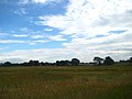
 Farmland near Bradley's Farm - geograph.org.uk - 6138486.jpg 800 × 600; 102 KB
-
 Field at Melling Lane, Maghull.JPG 4 320 × 3 240; 3,75 MB
-
 Fields alongside the motorway - geograph.org.uk - 3068660.jpg 2 898 × 2 050; 2,08 MB
-
 Fields at the north end of Sefton Meadows - geograph.org.uk - 4597403.jpg 1 024 × 681; 123 KB
-

-
 Fields in Melling - geograph.org.uk - 3068845.jpg 3 068 × 2 298; 2,42 MB
-
 Fields near Melling - geograph.org.uk - 3068776.jpg 3 070 × 2 300; 2,36 MB
-
 Flat farmland near Guest Farm - geograph.org.uk - 6138476.jpg 800 × 600; 103 KB
-
 Flush Bracket - geograph.org.uk - 3863685.jpg 1 000 × 750; 292 KB
-

-
 Footpath from Millbank Lane to Old Lane, Maghull - geograph.org.uk - 5425090.jpg 1 600 × 1 200; 1,02 MB
-
 Footpath from Park Lane to Millbank Lane. Maghull - geograph.org.uk - 5425081.jpg 1 600 × 1 200; 1,15 MB
-
 Footpath from Park Lane to Millbank Lane. Maghull - geograph.org.uk - 5425083.jpg 1 600 × 1 200; 924 KB
-
 Footpath within Parkhaven Trust grounds - geograph.org.uk - 3420956.jpg 768 × 1 024; 452 KB
-
 Footpath within Parkhaven Trust grounds - geograph.org.uk - 3420974.jpg 768 × 1 024; 519 KB
-
 Former telephone exchange, Maghull.jpg 4 608 × 3 456; 3,6 MB
-
 Foxhouse Lane - geograph.org.uk - 3048029.jpg 4 528 × 2 986; 7,65 MB
-

-
 Giddygate Lane - geograph.org.uk - 6138480.jpg 800 × 600; 154 KB
-
 Golden Field - geograph.org.uk - 2171465.jpg 3 073 × 1 694; 4,65 MB
-
 Green Lane, Maghull - geograph.org.uk - 2540843.jpg 800 × 534; 246 KB
-
 Green Lane, Maghull - geograph.org.uk - 2540851.jpg 800 × 534; 200 KB
-
 Greenhouses - Moss Side - geograph.org.uk - 3310522.jpg 3 535 × 1 718; 2,43 MB
-
 Hedgeline ^ Housing - Park Lane, Maghull - geograph.org.uk - 3310539.jpg 4 608 × 3 072; 4,53 MB
-
 High Pasture.JPG 2 560 × 1 920; 416 KB
-
 High Pastures Surgery - geograph.org.uk - 6136835.jpg 800 × 518; 70 KB
-

-
 Houses on Hesketh Drive - geograph.org.uk - 6138495.jpg 800 × 486; 68 KB
-
 Houses on Hillcrest, Maghull - geograph.org.uk - 6139570.jpg 800 × 513; 69 KB
-

-

-

-

-
 Jubilee Wood at Sefton Meadows - geograph.org.uk - 1411390.jpg 640 × 426; 79 KB
-
 Junction between Dodds and Moss Lane with Northway Primary School.JPG 3 872 × 2 592; 4,24 MB
-
 Junction of Hall Lane and Northway, Maghull - geograph.org.uk - 3710907.jpg 1 024 × 681; 182 KB
-
 Kennet Prison - geograph.org.uk - 3310530.jpg 4 608 × 3 072; 4,51 MB
-
 Kensington House, Maghull.jpg 4 320 × 3 240; 3,36 MB
-

-
 Leatherbarrows Lane - geograph.org.uk - 3068689.jpg 3 072 × 2 304; 3,1 MB
-
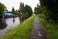
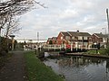
 Leeds and Liverpool Canal - geograph.org.uk - 6136831.jpg 800 × 600; 99 KB
-
 Leeds ^ Liverpool Canal - geograph.org.uk - 6184128.jpg 1 600 × 1 065; 534 KB
-
 Leeds ^ Liverpool Canal - geograph.org.uk - 6184132.jpg 1 600 × 1 065; 598 KB
-
 Leeds ^ Liverpool Canal - geograph.org.uk - 6184135.jpg 1 600 × 1 065; 663 KB
-
 Leeds ^ Liverpool Canal - geograph.org.uk - 6184138.jpg 1 600 × 1 065; 492 KB
-
 Leeds ^ Liverpool Canal - geograph.org.uk - 6184142.jpg 1 600 × 1 065; 587 KB
-
 Leeds ^ Liverpool Canal - geograph.org.uk - 6184210.jpg 1 600 × 1 065; 662 KB
-
 Leeds ^ Liverpool Canal - geograph.org.uk - 6184213.jpg 1 600 × 1 065; 603 KB
-
 Leeds ^ Liverpool Canal - geograph.org.uk - 6184216.jpg 1 600 × 1 065; 745 KB
-
 Leeds ^ Liverpool Canal - geograph.org.uk - 6184219.jpg 1 600 × 1 065; 678 KB
-
 Leeds ^ Liverpool Canal - geograph.org.uk - 6184223.jpg 1 600 × 1 065; 498 KB
-
 Leeds ^ Liverpool Canal - geograph.org.uk - 6184226.jpg 1 600 × 1 065; 602 KB
-
 Leeds ^ Liverpool Canal - geograph.org.uk - 6184229.jpg 1 600 × 1 065; 548 KB
-
 Leeds ^ Liverpool Canal - geograph.org.uk - 6184232.jpg 1 600 × 1 065; 609 KB
-
 Leeds ^ Liverpool Canal - geograph.org.uk - 6184234.jpg 1 600 × 1 065; 568 KB
-
 Leeds ^ Liverpool Canal - geograph.org.uk - 6184236.jpg 1 600 × 1 065; 696 KB
-
 Leeds ^ Liverpool Canal - geograph.org.uk - 6184238.jpg 1 600 × 1 065; 687 KB
-
 Leeds ^ Liverpool Canal - geograph.org.uk - 6184239.jpg 1 600 × 1 065; 644 KB
-
 Leeds ^ Liverpool Canal - geograph.org.uk - 6184255.jpg 1 600 × 1 065; 566 KB
-
 Leeds ^ Liverpool Canal - geograph.org.uk - 6184258.jpg 1 600 × 1 065; 604 KB
-
 Leeds ^ Liverpool Canal - geograph.org.uk - 6184259.jpg 1 600 × 1 065; 558 KB
-
 Leeds ^ Liverpool Canal - geograph.org.uk - 6184264.jpg 1 600 × 1 065; 433 KB
-
 Leeds ^ Liverpool Canal - geograph.org.uk - 6185262.jpg 1 600 × 1 065; 658 KB
-
 Leeds ^ Liverpool Canal - geograph.org.uk - 6185264.jpg 1 600 × 1 065; 779 KB
-
 Leeds ^ Liverpool Canal - geograph.org.uk - 6185266.jpg 1 600 × 1 065; 498 KB
-
 Leeds ^ Liverpool Canal - geograph.org.uk - 6185268.jpg 1 600 × 1 065; 527 KB
-
 Leeds ^ Liverpool Canal - geograph.org.uk - 6185270.jpg 1 600 × 1 065; 530 KB
-
 Leeds ^ Liverpool Canal - geograph.org.uk - 6185307.jpg 1 600 × 1 065; 554 KB
-
 Leeds ^ Liverpool Canal - geograph.org.uk - 6185311.jpg 1 600 × 1 065; 358 KB
-

-
 Level crossing on station Road, Maghull - geograph.org.uk - 6143978.jpg 800 × 600; 107 KB
-

-
 Liverpool Road North, Maghull (geograph 6136833).jpg 800 × 600; 88 KB
-
 Liverpool Road North, Maghull (geograph 6139584).jpg 5 184 × 3 888; 5,85 MB
-

-
 Liverpool Road south looking north - geograph.org.uk - 2454830.jpg 640 × 480; 71 KB
-
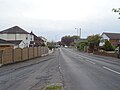
 Liverpool Road South, Maghull - geograph.org.uk - 6136739.jpg 800 × 600; 90 KB
-
 M58 at Maghull - geograph.org.uk - 3332150.jpg 2 476 × 1 558; 701 KB
-
 M58 at Melling - geograph.org.uk - 3332153.jpg 3 983 × 2 400; 2,07 MB
-

-
 M58 motorway - Moss Nook Lane bridge - geograph.org.uk - 2886281.jpg 639 × 453; 104 KB
-

-

-

-
 M58 near Melling - geograph.org.uk - 3068756.jpg 2 304 × 3 072; 2,54 MB
-
 Maghull Baptist Church - geograph.org.uk - 4113450.jpg 4 192 × 2 790; 7,59 MB
-
 Maghull Brook.JPG 1 920 × 2 560; 974 KB
-
 Maghull Business Centre.jpg 4 320 × 3 240; 2,87 MB
-
 Maghull Cricket Club pavilion - geograph.org.uk - 3420987.jpg 1 024 × 768; 375 KB
-
 Maghull FC - geograph.org.uk - 491925.jpg 640 × 426; 64 KB
-
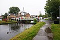
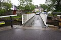
 Maghull Hall Swing Bridge - geograph.org.uk - 4272382.jpg 1 600 × 1 200; 450 KB
-
 Maghull Hall Swing Bridge - geograph.org.uk - 4611195.jpg 2 447 × 1 373; 1,45 MB
-
 Maghull Hall Swing Bridge No 12 - geograph.org.uk - 5159177.jpg 800 × 569; 106 KB
-
 Maghull Methodist Church - geograph.org.uk - 4272376.jpg 1 600 × 1 200; 421 KB
-
 Maghull Methodist Church - geograph.org.uk - 6136841.jpg 800 × 510; 73 KB
-
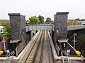
 Maghull North railway station, Merseyside - geograph.org.uk - 5843108.jpg 1 600 × 1 200; 447 KB
-
 Maghull North railway station, Merseyside - geograph.org.uk - 5843112.jpg 1 600 × 1 200; 489 KB
-
 Maghull North railway station, Merseyside - geograph.org.uk - 6006368.jpg 1 600 × 1 200; 420 KB
-
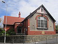 Maghull Parish Hall.jpg 4 320 × 3 240; 3,34 MB
-
 Maghull Park - geograph.org.uk - 3068042.jpg 3 072 × 2 304; 3,26 MB
-
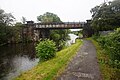
 Maghull Railway Bridge No 11a - geograph.org.uk - 5158937.jpg 800 × 523; 140 KB
-
 Maghull Railway Station - geograph.org.uk - 6143981.jpg 800 × 600; 121 KB
-
 Maghull sign (1).jpg 4 320 × 3 240; 3,7 MB
-
 Maghull sign, Melling Lane.JPG 3 240 × 4 320; 5,38 MB
-
 Maghull Square - Maghull in Bloom 2.JPG 1 944 × 2 896; 1,31 MB
-
 Maghull Square - Maghull in Bloom 3.JPG 2 896 × 1 944; 1,33 MB
-
 Maghull Square - Maghull in Bloom 4.JPG 1 944 × 2 896; 930 KB
-
 Maghull Square - Maghull in Bloom 5.JPG 2 896 × 1 944; 1,32 MB
-
 Maghull Square - Maghull in Bloom.JPG 1 944 × 2 896; 1,24 MB
-
 Maukin Farm, Green Lane, Maghull - geograph.org.uk - 2540847.jpg 800 × 534; 189 KB
-
 Meadows leisure complex, Maghull - geograph.org.uk - 3580031.jpg 1 024 × 614; 93 KB
-
 Melling Lane, Maghull (1).JPG 4 320 × 3 240; 2,92 MB
-
 Melling Lane, Maghull (2).JPG 4 320 × 3 240; 4,74 MB
-
 Melling Lane, Maghull (3).JPG 4 320 × 3 240; 4,44 MB
-
 Methodist Swing Bridge No 15 - geograph.org.uk - 5159213.jpg 800 × 540; 124 KB
-
 Methodist Swing Bridge, Maghull - geograph.org.uk - 4272378.jpg 1 600 × 1 200; 605 KB
-

-

-
 Millbank Lane, Maghull - geograph.org.uk - 3921918.jpg 1 024 × 682; 240 KB
-
 Millbank Lane, Maghull - geograph.org.uk - 5425087.jpg 1 600 × 1 200; 950 KB
-
 Milton Way, Maghull - geograph.org.uk - 6136742.jpg 800 × 600; 117 KB
-

-
 Moss Lane joins Deyes Lane in Maghull - geograph.org.uk - 2154977.jpg 1 600 × 1 198; 596 KB
-
 Moss Lane-Deyes Lane junction - geograph.org.uk - 2454908.jpg 640 × 480; 68 KB
-
 Moss Nook Farm fields - geograph.org.uk - 3068868.jpg 2 906 × 2 064; 2,37 MB
-
 Northway Bridge No 12A - geograph.org.uk - 5159185.jpg 800 × 521; 123 KB
-
 Northway Primary School.JPG 3 872 × 2 592; 4,14 MB
-

-
 Old glasshouses, Moss Side, Maghull - geograph.org.uk - 3921920.jpg 1 024 × 681; 142 KB
-
 Old Racecourse Road, Maghull - geograph.org.uk - 1411362.jpg 640 × 426; 90 KB
-
 Optoplast manufacturing, Maghull.jpg 4 320 × 3 240; 2,99 MB
-
 Ordnance Survey Flush Bracket G2493 - geograph.org.uk - 3960538.jpg 4 000 × 3 000; 4,54 MB
-
 Ordnance Survey Flush Bracket G2494 - geograph.org.uk - 3960555.jpg 4 000 × 3 000; 2,76 MB
-
 Outfall on the River Alt - geograph.org.uk - 6066221.jpg 1 600 × 1 200; 440 KB
-
 Park lane-School lane junction - geograph.org.uk - 2454901.jpg 640 × 480; 76 KB
-
 Parkhaven - geograph.org.uk - 94973.jpg 640 × 481; 121 KB
-
 Playpark in Maghull - geograph.org.uk - 3068744.jpg 2 274 × 1 811; 2,01 MB
-
 Potato fields. - geograph.org.uk - 532809.jpg 640 × 481; 110 KB
-
 Poverty lane joins Leatherbarrow's Lane in Maghull - geograph.org.uk - 2161643.jpg 1 600 × 1 198; 427 KB
-
 Pumping station at Sefton Meadows - geograph.org.uk - 4597457.jpg 1 024 × 576; 174 KB
-
 Pylons alongside Trans Pennine Trail - geograph.org.uk - 4074495.jpg 1 000 × 1 008; 150 KB
-
 Rafael Sabatini - geograph.org.uk - 96337.jpg 640 × 480; 135 KB
-
 Railway bridge 11a at Maghull - geograph.org.uk - 4272385.jpg 1 600 × 1 200; 500 KB
-
 Red Lion Bridge - geograph.org.uk - 3605242.jpg 1 024 × 745; 228 KB
-
 Red Lion Bridge No 13 in Maghull - geograph.org.uk - 5159188.jpg 800 × 567; 109 KB
-
 River Alt at Sefton - geograph.org.uk - 1411376.jpg 640 × 426; 72 KB
-
 River Alt at Sefton Meadows - geograph.org.uk - 4597434.jpg 1 024 × 576; 150 KB
-
 Road resurfacing, Westway, Maghull - geograph.org.uk - 4134556.jpg 1 024 × 681; 137 KB
-
 Roads between Melling and Maghull - geograph.org.uk - 3068737.jpg 2 970 × 2 160; 2,24 MB
-
 Roadside ^ Fields - Park Lane - Maghull - geograph.org.uk - 3310534.jpg 3 072 × 4 608; 4,47 MB
-
 Roundabout, School Lane, Moss Side - geograph.org.uk - 2663314.jpg 640 × 480; 50 KB
-
 Secluded footpath - geograph.org.uk - 3068833.jpg 2 304 × 3 072; 4,1 MB
-
 Security Fence - Ashworth Hospital - geograph.org.uk - 3310519.jpg 4 384 × 3 044; 6 MB
-
 Sefton Meadows Tip - geograph.org.uk - 2292672.jpg 800 × 541; 127 KB


_on_sunflower,_Maghull_-_geograph.org.uk_-_3645463.jpg)


.jpg)
.jpg)


.jpg)


.JPG)
.JPG)
.JPG)


