Category:Mainstone
Aller à la navigation
Aller à la recherche
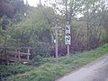
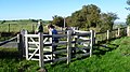
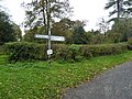
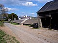
English: Mainstone is a small village and parish in Shropshire, England, near the border with Powys, Wales. It lies in the Clun Forest, a large remote and very rural area which is semi-forested and rather hilly.
village britannique  | |||||
| Téléverser des médias | |||||
| Nature de l’élément | |||||
|---|---|---|---|---|---|
| Lieu | Shropshire, Midlands de l'Ouest, Angleterre | ||||
 | |||||
Sous-catégories
Cette catégorie comprend seulement la sous-catégorie ci-dessous.
C
- St John the Baptist, Churchtown (13 F)
Média dans la catégorie « Mainstone »
Cette catégorie comprend 300 fichiers, dont les 200 ci-dessous.
(page précédente) (page suivante)-
 "The Larches" - geograph.org.uk - 1934785.jpg 640 × 480 ; 99 kio
-
 A beet crop by the Kerry Ridgeway - geograph.org.uk - 5897109.jpg 6 000 × 4 000 ; 4,81 Mio
-
 A defined section of Offa's Dyke on Edenhope Hill - geograph.org.uk - 5609049.jpg 5 184 × 2 920 ; 4,88 Mio
-

-
 A meeting of the ways - geograph.org.uk - 2065714.jpg 640 × 480 ; 119 kio
-
 A view from Eaton Coppice - geograph.org.uk - 823584.jpg 640 × 480 ; 90 kio
-
 Above Churchtown Woods - geograph.org.uk - 823593.jpg 640 × 480 ; 67 kio
-
 Above Mainstone - geograph.org.uk - 1595688.jpg 640 × 426 ; 181 kio
-
 Across the valley to Reilth arm - geograph.org.uk - 680258.jpg 640 × 480 ; 80 kio
-
 Approaching Cefn Einion - geograph.org.uk - 2964094.jpg 640 × 480 ; 138 kio
-
 At the end of the day - geograph.org.uk - 709547.jpg 638 × 431 ; 47 kio
-
 Badger Face Welsh Mountain Sheep - geograph.org.uk - 3303858.jpg 1 600 × 1 200 ; 1,72 Mio
-
 Barn at Vron Farm - geograph.org.uk - 3727531.jpg 800 × 451 ; 177 kio
-
 Beech trees on Knuck Bank - geograph.org.uk - 2965456.jpg 640 × 480 ; 92 kio
-
 Bend in the lane - geograph.org.uk - 6115394.jpg 640 × 480 ; 92 kio
-
 Bridleway junction, Kerry Ridgeway - geograph.org.uk - 2066687.jpg 3 072 × 2 304 ; 2,17 Mio
-
 Bridleway leaving the Kerry Ridgeway - geograph.org.uk - 5896136.jpg 6 000 × 4 000 ; 6,91 Mio
-
 Bridleway to Nut Wood - geograph.org.uk - 5899807.jpg 6 000 × 4 000 ; 7,72 Mio
-
 Bryn Dadlu - geograph.org.uk - 3276242.jpg 640 × 360 ; 208 kio
-
 Bullet point typo, it's Two Crosses. - geograph.org.uk - 1190450.jpg 640 × 470 ; 54 kio
-
 Caer Din - geograph.org.uk - 1935349.jpg 640 × 480 ; 57 kio
-
 Cattle feeder on the Kerry Ridgeway - geograph.org.uk - 2065702.jpg 3 072 × 2 304 ; 2,34 Mio
-
 Cefn Einion - geograph.org.uk - 3728799.jpg 800 × 451 ; 194 kio
-
 Churchtown Hill - geograph.org.uk - 1590270.jpg 427 × 640 ; 194 kio
-
 Churchtown Hill - geograph.org.uk - 2073931.jpg 3 072 × 2 304 ; 2,68 Mio
-
 Churchtown Woods - geograph.org.uk - 825200.jpg 480 × 640 ; 148 kio
-
 Clearing Nut Wood - geograph.org.uk - 834206.jpg 640 × 480 ; 98 kio
-
 Converted chapel at Cefn Einion - geograph.org.uk - 6114378.jpg 640 × 480 ; 78 kio
-
 Converted chapel in Mainstone - geograph.org.uk - 5940380.jpg 640 × 480 ; 81 kio
-
 Converted chapel near Cefn Einion - geograph.org.uk - 2964109.jpg 640 × 480 ; 116 kio
-
 Converted chapel, Cefn Einion - geograph.org.uk - 3728801.jpg 640 × 480 ; 123 kio
-
 Cottage near the lane junction - geograph.org.uk - 5235483.jpg 640 × 480 ; 45 kio
-
 Country road east of Cefn Einion - geograph.org.uk - 2075632.jpg 640 × 480 ; 100 kio
-
 Crossroad near Cefn Einion - geograph.org.uk - 6114383.jpg 640 × 480 ; 66 kio
-
 Cwm Ffrydd - geograph.org.uk - 1595703.jpg 640 × 427 ; 239 kio
-
 Cwm Ffrydd - geograph.org.uk - 1595708.jpg 640 × 427 ; 203 kio
-
 Cwm Ffrydd - geograph.org.uk - 2073946.jpg 640 × 480 ; 97 kio
-
 Cyffordd o lwybrau - Junction of paths - geograph.org.uk - 4522444.jpg 640 × 452 ; 84 kio
-
 Dead end, dead shot^ - geograph.org.uk - 1190436.jpg 640 × 497 ; 71 kio
-
 Descending Churchtown Hill - geograph.org.uk - 5881127.jpg 4 000 × 3 000 ; 3,87 Mio
-
 Disused quarry and house at Cefn Einion - geograph.org.uk - 6114380.jpg 640 × 480 ; 115 kio
-
 Drainage below Kerry Ridgeway - geograph.org.uk - 5897081.jpg 6 000 × 4 000 ; 7,81 Mio
-
 Drive to Reilth House - geograph.org.uk - 3727549.jpg 800 × 600 ; 245 kio
-
 Driveway to Middle Knuck Farm - geograph.org.uk - 6236421.jpg 1 024 × 768 ; 676 kio
-
 Edenhope Hill - geograph.org.uk - 4522474.jpg 640 × 450 ; 57 kio
-
 Edenhope Hill - geograph.org.uk - 5881100.jpg 4 000 × 3 000 ; 3,63 Mio
-
 Fallen tree - geograph.org.uk - 1190542.jpg 640 × 438 ; 126 kio
-

-
 Farm buildings - geograph.org.uk - 2965481.jpg 640 × 480 ; 85 kio
-
 Farm track to Middle Woodbatch Cottage Farm - geograph.org.uk - 679538.jpg 640 × 480 ; 70 kio
-
 Field above Hopton Bank - geograph.org.uk - 5897136.jpg 6 000 × 4 000 ; 7,13 Mio
-
 Field above Hopton Bank - geograph.org.uk - 5897166.jpg 6 000 × 4 000 ; 5,41 Mio
-
 Field above Pantglas - geograph.org.uk - 5897159.jpg 6 000 × 4 000 ; 6,78 Mio
-
 Field edge footpath near Mainstone - geograph.org.uk - 6294656.jpg 640 × 480 ; 63 kio
-
 Field entrance by the Kerry Ridgeway - geograph.org.uk - 5899790.jpg 6 000 × 4 000 ; 7,59 Mio
-
 Field of beet below Caer Din - geograph.org.uk - 5899833.jpg 6 000 × 4 000 ; 6,62 Mio
-
 Fields above Pantglas - geograph.org.uk - 5899107.jpg 6 000 × 4 000 ; 7,06 Mio
-
 Fields near Pantglas - geograph.org.uk - 5899181.jpg 6 000 × 4 000 ; 7,79 Mio
-

-
 Footbridge over the River Unk - geograph.org.uk - 6333221.jpg 6 000 × 4 000 ; 3,48 Mio
-
 Footpath sign at top of Churchtown Hill - geograph.org.uk - 5881122.jpg 4 000 × 3 000 ; 3,54 Mio
-
 Gate on ODP where the Kerry Ridgeway crosses too - geograph.org.uk - 4371110.jpg 640 × 360 ; 101 kio
-
 Gate on Offa's Dyke Path - geograph.org.uk - 4157059.jpg 640 × 360 ; 106 kio
-

-
 Grassland at Reilth Top - geograph.org.uk - 3727539.jpg 800 × 451 ; 189 kio
-
 Grazing land near Mainstone - geograph.org.uk - 680547.jpg 640 × 480 ; 81 kio
-
 Heathland beside the Kerry Ridgeway - geograph.org.uk - 6143310.jpg 640 × 480 ; 68 kio
-
 Hergan - geograph.org.uk - 322206.jpg 600 × 450 ; 58 kio
-
 High lane - geograph.org.uk - 6115318.jpg 640 × 480 ; 78 kio
-
 Horseshoe Coppice Pond - geograph.org.uk - 685473.jpg 640 × 480 ; 97 kio
-
 Impressive Parasol Mushroom 1 - geograph.org.uk - 2064028.jpg 2 304 × 3 072 ; 2,07 Mio
-
 Impressive parasol mushroom 2 - geograph.org.uk - 2064031.jpg 480 × 640 ; 127 kio
-

-

-
 Kerry Ridgeway - geograph.org.uk - 2064019.jpg 3 072 × 2 304 ; 2,83 Mio
-
 Kerry Ridgeway - geograph.org.uk - 2065744.jpg 3 072 × 2 304 ; 2,38 Mio
-
 Kerry Ridgeway at Pantglas - geograph.org.uk - 2065737.jpg 640 × 480 ; 105 kio
-
 Kerry Ridgeway near Dog and Duck Cottage - geograph.org.uk - 2064065.jpg 640 × 480 ; 93 kio
-
 Lane above Dog and Duck Cottage - geograph.org.uk - 5899819.jpg 6 000 × 4 000 ; 4,8 Mio
-
 Lane and phone-box at Dog and Duck Cottage - geograph.org.uk - 680268.jpg 640 × 480 ; 104 kio
-
 Lane between Cefn Einion and Mainstone - geograph.org.uk - 6114391.jpg 640 × 480 ; 103 kio
-
 Lane junction at Dog and Duck Cottage - geograph.org.uk - 680269.jpg 640 × 480 ; 108 kio
-
 Lane junction at Pantglas - geograph.org.uk - 706837.jpg 640 × 480 ; 82 kio
-
 Lane north from Bishop's Moat - geograph.org.uk - 679559.jpg 640 × 492 ; 95 kio
-
 Lane on Round Bank - geograph.org.uk - 5881108.jpg 4 000 × 3 000 ; 3,26 Mio
-
 Lane through woodland - geograph.org.uk - 2965488.jpg 640 × 480 ; 137 kio
-
 Lanes meeting near Bishop's Moat - geograph.org.uk - 5899894.jpg 6 000 × 4 000 ; 4,6 Mio
-
 Lichen - geograph.org.uk - 688217.jpg 480 × 640 ; 118 kio
-
 Little weir - geograph.org.uk - 1311033.jpg 640 × 480 ; 195 kio
-
 Lone lamb asleep in a field - geograph.org.uk - 6114396.jpg 640 × 480 ; 102 kio
-
 Looking east - geograph.org.uk - 706833.jpg 640 × 480 ; 100 kio
-
 Lower Short Ditch turbary nature reserve - geograph.org.uk - 6073200.jpg 1 024 × 768 ; 170 kio
-
 Lower Shortditch Turbary Nature Reserve - geograph.org.uk - 5896128.jpg 6 000 × 4 000 ; 5,43 Mio
-
 Mainstone chapel - geograph.org.uk - 680259.jpg 640 × 480 ; 94 kio
-
 March frost - geograph.org.uk - 1190560.jpg 640 × 429 ; 110 kio
-
 Motte and Bailey at Bishop's Moat - geograph.org.uk - 679550.jpg 640 × 480 ; 89 kio
-
 Neglected phone box on the Kerry Ridgeway - geograph.org.uk - 6073096.jpg 1 024 × 768 ; 209 kio
-
 New hedge line - geograph.org.uk - 1190248.jpg 640 × 428 ; 115 kio
-
 New stile on Offa's Dyke path, E of Cwm Farm ^ N of Hergan - geograph.org.uk - 5609044.jpg 5 184 × 2 920 ; 5,87 Mio
-
 Offa's Dike - geograph.org.uk - 5880323.jpg 4 000 × 3 000 ; 4,64 Mio
-
 Offa's Dike - geograph.org.uk - 5880326.jpg 4 000 × 3 000 ; 4,63 Mio
-
 Offa's Dike path - geograph.org.uk - 5880312.jpg 4 000 × 3 000 ; 4,9 Mio
-
 Offa's Dyke - geograph.org.uk - 1020641.jpg 640 × 480 ; 83 kio
-
 Offa's Dyke - geograph.org.uk - 5899283.jpg 6 000 × 4 000 ; 7,52 Mio
-
 Offa's Dyke above the Unk valley - geograph.org.uk - 5758871.jpg 683 × 1 024 ; 133 kio
-
 Offa's Dyke below Hergan - geograph.org.uk - 6347368.jpg 6 000 × 4 000 ; 3,04 Mio
-
 Offa's Dyke beside Nut Wood - geograph.org.uk - 6332647.jpg 6 000 × 4 000 ; 2,94 Mio
-
 Offa's Dyke north of Churchtown - geograph.org.uk - 6073224.jpg 1 024 × 768 ; 241 kio
-
 Offa's Dyke north of Churchtown - geograph.org.uk - 6333225.jpg 6 000 × 4 000 ; 3,06 Mio
-
 Offa's Dyke Path - geograph.org.uk - 2065708.jpg 3 072 × 2 304 ; 2,44 Mio
-
 Offa's Dyke Path - geograph.org.uk - 6332657.jpg 6 000 × 3 478 ; 2,44 Mio
-
 Offa's Dyke Path approaching Middle Knuck - geograph.org.uk - 6339144.jpg 6 000 × 4 000 ; 3,45 Mio
-
 Offa's Dyke Path approaching Nut Wood - geograph.org.uk - 6332641.jpg 6 000 × 4 000 ; 3,08 Mio
-
 Offa's Dyke Path at Crows Nest - geograph.org.uk - 1934799.jpg 480 × 640 ; 106 kio
-
 Offa's Dyke Path at Hergan - geograph.org.uk - 1595441.jpg 640 × 427 ; 192 kio
-
 Offa's Dyke Path crosses the lane - geograph.org.uk - 4368541.jpg 640 × 360 ; 47 kio
-
 Offa's Dyke Path leading north from Churchtown - geograph.org.uk - 834158.jpg 640 × 480 ; 125 kio
-
 Offa's Dyke Path near Crows Nest - geograph.org.uk - 1934803.jpg 640 × 480 ; 132 kio
-
 Offa's Dyke Path north of Churchtown - geograph.org.uk - 6333222.jpg 6 000 × 4 000 ; 2,93 Mio
-
 Offa's Dyke Path south of Middle Knuck - geograph.org.uk - 6347362.jpg 6 000 × 4 000 ; 4,02 Mio
-
 Offa's Dyke, Path, and Shropshire Way - geograph.org.uk - 825159.jpg 640 × 480 ; 53 kio
-
 Old and new signs at Churchtown - geograph.org.uk - 1595699.jpg 640 × 426 ; 227 kio
-
 Old corrugated barn beside ODP - geograph.org.uk - 4157066.jpg 640 × 360 ; 62 kio
-
 Old methodist chapel - geograph.org.uk - 421596.jpg 600 × 450 ; 131 kio
-
 Old relics in the field bottom - geograph.org.uk - 6115427.jpg 640 × 480 ; 140 kio
-
 Old roadsign on road crossed by Offa's Dyke path - geograph.org.uk - 390053.jpg 640 × 480 ; 108 kio
-
 Old shed in the field - geograph.org.uk - 6115382.jpg 640 × 480 ; 121 kio
-
 Old Toll House, Mainstone - geograph.org.uk - 6115104.jpg 729 × 800 ; 151 kio
-
 On ODP below Nut Wood - geograph.org.uk - 4371085.jpg 640 × 360 ; 74 kio
-
 On ODP beside Nut Wood - geograph.org.uk - 4371097.jpg 640 × 360 ; 61 kio
-
 On ODP near Nut Wood - geograph.org.uk - 4368567.jpg 640 × 360 ; 62 kio
-
 On Offa's Dyke Path - geograph.org.uk - 4157070.jpg 640 × 360 ; 48 kio
-
 On Offa's Dyke Path - geograph.org.uk - 4368525.jpg 640 × 360 ; 69 kio
-
 On Offa's Dyke Path - geograph.org.uk - 5940409.jpg 640 × 480 ; 74 kio
-
 On Offa's Dyke Path - geograph.org.uk - 6294673.jpg 640 × 436 ; 56 kio
-
 On Offa's Dyke Path above Nut Wood - geograph.org.uk - 4368563.jpg 640 × 360 ; 53 kio
-

-
 On Offa's Dyke Path at Eaton's Coppice - geograph.org.uk - 4157057.jpg 640 × 360 ; 94 kio
-
 On Offa's Dyke Path in August - geograph.org.uk - 4157051.jpg 640 × 360 ; 114 kio
-
 On Offa's Dyke Path in early spring - geograph.org.uk - 4368529.jpg 640 × 360 ; 60 kio
-
 On Offa's Dyke Path near Mainstone - geograph.org.uk - 4157071.jpg 640 × 360 ; 85 kio
-
 On Offa's Dyke, south-west of Hergan - geograph.org.uk - 339009.jpg 640 × 480 ; 160 kio
-
 On part of Offa's Dyke Path - geograph.org.uk - 6294675.jpg 640 × 480 ; 56 kio
-
 On part of the Kerry Ridgeway - Ffordd Las Ceri - geograph.org.uk - 6143217.jpg 640 × 480 ; 104 kio
-
 On part of the Kerry Ridgeway - Ffordd Las Ceri - geograph.org.uk - 6143231.jpg 640 × 480 ; 112 kio
-

-

-

-

-

-

-
 On part of the Shropshire Way in Spring - geograph.org.uk - 6114787.jpg 640 × 480 ; 52 kio
-
 On Reilith Top - geograph.org.uk - 3276231.jpg 640 × 480 ; 305 kio
-
 On the Kerry Ridgeway - geograph.org.uk - 2064043.jpg 640 × 480 ; 114 kio
-
 On the Kerry Ridgeway - geograph.org.uk - 2065756.jpg 3 072 × 2 304 ; 2,88 Mio
-
 On the Kerry Ridgeway in April - geograph.org.uk - 6131662.jpg 640 × 480 ; 83 kio
-
 On the lovely Kerry Ridgeway at Pantglas farm - geograph.org.uk - 6142907.jpg 640 × 480 ; 125 kio
-

-
 One man and his dog on the Kerry Ridgeway - geograph.org.uk - 1935351.jpg 640 × 480 ; 108 kio
-
 Part of Cefn Einion - geograph.org.uk - 2964098.jpg 640 × 480 ; 105 kio
-
 Part of Mainstone - geograph.org.uk - 5940375.jpg 640 × 480 ; 67 kio
-
 Part of Offa's Dyke - geograph.org.uk - 2965473.jpg 640 × 480 ; 94 kio
-
 Part of the Shropshire Way - geograph.org.uk - 6114910.jpg 640 × 480 ; 111 kio
-
 Part of the Shropshire Way near Reilth farm - geograph.org.uk - 6114504.jpg 640 × 480 ; 78 kio
-
 Path crossing, Churchtown - geograph.org.uk - 5475814.jpg 480 × 640 ; 86 kio
-
 Pens on the Kerry Ridgeway - geograph.org.uk - 2066646.jpg 640 × 480 ; 99 kio
-
 Phone box at Dog and Duck Cottage - geograph.org.uk - 1934832.jpg 640 × 480 ; 118 kio
-
 Plough soil beside the Kerry Ridgeway - geograph.org.uk - 6143290.jpg 640 × 480 ; 72 kio
-
 Pond beside ODP - geograph.org.uk - 4371105.jpg 640 × 360 ; 68 kio
-
 Pond beside the Kerry Ridgeway - geograph.org.uk - 6143241.jpg 640 × 480 ; 78 kio
-
 Pond Edenhope Hill - geograph.org.uk - 5881095.jpg 4 000 × 3 000 ; 3,2 Mio
-
 Pond near Pantglas - geograph.org.uk - 2065726.jpg 3 072 × 2 304 ; 2,13 Mio
-
 Puddle across the lane - geograph.org.uk - 6115422.jpg 640 × 480 ; 123 kio
-
 Reilth Road - geograph.org.uk - 3727546.jpg 800 × 451 ; 204 kio
-
 Reilth Top - geograph.org.uk - 3276225.jpg 640 × 480 ; 344 kio
-
 Reilth Top - geograph.org.uk - 688225.jpg 640 × 480 ; 87 kio
-
 Reservoir above Pantglas - geograph.org.uk - 5899117.jpg 5 725 × 3 816 ; 2,4 Mio
-
 Road above Cwm Moch - geograph.org.uk - 2073865.jpg 640 × 480 ; 109 kio
-
 Road junction by Dog and Duck Cottage - geograph.org.uk - 2064059.jpg 640 × 480 ; 117 kio
-
 Road junction on the Kerry Ridgeway - geograph.org.uk - 5235413.jpg 640 × 480 ; 43 kio
-
 Road junction south of Mainstone - geograph.org.uk - 2075624.jpg 640 × 480 ; 93 kio
-
 Road signs between Mainstone and Cefn Einion - geograph.org.uk - 5940309.jpg 640 × 480 ; 126 kio
-
 Roadsigns between Mainstone and Cefn Einion - geograph.org.uk - 6114403.jpg 640 × 480 ; 111 kio
-
 Rolling hills above the Unk valley - geograph.org.uk - 5899828.jpg 6 000 × 4 000 ; 4,46 Mio
-
 Round barrow beside the Kerry Ridgeway - geograph.org.uk - 6143259.jpg 640 × 480 ; 77 kio
-
 Ruined caravan beside the Kerry Ridgeway - geograph.org.uk - 6143306.jpg 640 × 480 ; 136 kio
-
 Shadwell Hall - geograph.org.uk - 396275.jpg 600 × 450 ; 52 kio
-
 Shadwell Hall Farm - geograph.org.uk - 421589.jpg 600 × 450 ; 71 kio
-
 Sheep above Pantglas - geograph.org.uk - 5899135.jpg 6 000 × 4 000 ; 6,12 Mio
-
 Sheep and cattle on Bryn Dadlu - geograph.org.uk - 5899854.jpg 6 000 × 4 000 ; 6,92 Mio
-
 Sheep and lorry - geograph.org.uk - 3276219.jpg 640 × 480 ; 289 kio
-
 Sheep at Cefn Einion - geograph.org.uk - 2075627.jpg 640 × 480 ; 104 kio
-
 Sheep at Two Crosses - geograph.org.uk - 2073890.jpg 640 × 480 ; 91 kio
-
 Sheep by the Kerry Ridgeway - geograph.org.uk - 5899849.jpg 6 000 × 4 000 ; 7,73 Mio
-
 Sheep in field - geograph.org.uk - 683293.jpg 640 × 480 ; 103 kio
-
 Sheep pasture - geograph.org.uk - 2965447.jpg 640 × 480 ; 98 kio
-
 Sheep pastures below Reilth farm - geograph.org.uk - 6114399.jpg 640 × 480 ; 102 kio
-
 Sheep pastures beside the Kerry Ridgeway - geograph.org.uk - 6131647.jpg 640 × 480 ; 103 kio
-
 Sheep rack on the Kerry Ridgeway - geograph.org.uk - 2065719.jpg 640 × 480 ; 94 kio
-


