Category:Manby
Vai alla navigazione
Vai alla ricerca
English: Media related to the village and civil parish of Manby, East Lindsey, Lincolnshire, England
village in the United Kingdom  | |||||
| Carica un file multimediale | |||||
| Istanza di | |||||
|---|---|---|---|---|---|
| Luogo | East Lindsey, Lincolnshire, Midlands Orientali, Inghilterra | ||||
 | |||||
Sottocategorie
Questa categoria contiene le 3 sottocategorie indicate di seguito, su un totale di 3.
File nella categoria "Manby"
Questa categoria contiene 87 file, indicati di seguito, su un totale di 87.
-
 A sign for Grimoldby and Manby - geograph.org.uk - 3728949.jpg 1 024 × 681; 294 KB
-
 B1200 road past The Lancaster Inn - geograph.org.uk - 1960624.jpg 640 × 480; 61 KB
-
 B1200 through Saltfleetby St. Peter, aerial 2015 - geograph.org.uk - 4346420.jpg 796 × 1 024; 126 KB
-

-
-
 Carlton Road at its junction with Church Lane in Manby - geograph.org.uk - 6080967.jpg 3 854 × 2 891; 2,65 MB
-
 Cattle pens at Manby, aerial 2018 - geograph.org.uk - 5682496.jpg 533 × 800; 81 KB
-
 Causeway Bridge Farm - geograph.org.uk - 3278308.jpg 640 × 427; 44 KB
-
 Causeway Bridge, Manby, aerial 2016 - geograph.org.uk - 4881240.jpg 640 × 427; 51 KB
-
 Church Lane, Manby, aerial 2014 - geograph.org.uk - 3967277.jpg 640 × 469; 47 KB
-
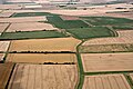
 Crop field beside drain - geograph.org.uk - 4407156.jpg 640 × 480; 70 KB
-

-
 Cropmark, Grimoldby Ings, aerial 2019 - geograph.org.uk - 6233287.jpg 1 024 × 683; 169 KB
-
 Drain beside Manby Middlegate (B1200). - geograph.org.uk - 4407157.jpg 640 × 480; 103 KB
-
-

-
 Farmland beside drain, Manby - geograph.org.uk - 4407171.jpg 640 × 480; 66 KB
-
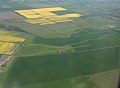
 Fenland east of Manby - geograph.org.uk - 2981587.jpg 640 × 427; 40 KB
-
-
 Field off Church Lane - geograph.org.uk - 3687004.jpg 2 256 × 1 504; 1,76 MB
-

-

-

-
 Flowers of wasteland - geograph.org.uk - 3537867.jpg 427 × 640; 58 KB
-
 Former Manby airfield, aerial 2017 - geograph.org.uk - 5594465.jpg 800 × 533; 72 KB
-
 Former RAF Manby - geograph.org.uk - 2981563.jpg 640 × 427; 70 KB
-
 Former RAF Manby - geograph.org.uk - 429091.jpg 640 × 480; 88 KB
-
 Former RAF Manby - geograph.org.uk - 429107.jpg 640 × 480; 101 KB
-
 Former RAF Manby and ELDC offices - geograph.org.uk - 3132550.jpg 427 × 640; 89 KB
-

-
 Gibson Hall, the old Station HQ at RAF Manby - geograph.org.uk - 6251435.jpg 4 608 × 3 072; 2,81 MB
-
 Hedge-lined lane between Manby and Causeway Bridge - geograph.org.uk - 6080979.jpg 4 000 × 3 000; 3,22 MB
-
 Lane at Eastfield Farm - geograph.org.uk - 6080983.jpg 3 870 × 2 903; 1,72 MB
-

-

-
 Looking across Manby showground - geograph.org.uk - 1942423.jpg 640 × 480; 58 KB
-
 Looking towards Manby showground - geograph.org.uk - 1942408.jpg 640 × 480; 59 KB
-
 Obstacle at Manby Off Road Park - panoramio.jpg 3 888 × 2 592; 3,2 MB
-
 Manby airfield - geograph.org.uk - 3142173.jpg 640 × 427; 51 KB
-
 Manby Airfield and Hidden Hangars - geograph.org.uk - 3625370.jpg 1 024 × 768; 234 KB
-
 Manby Controltower - geograph.org.uk - 3621729.jpg 1 024 × 768; 146 KB
-
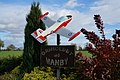
 Manby crossroads and village signs - geograph.org.uk - 1939278.jpg 640 × 480; 55 KB
-
 Manby disused airfield - geograph.org.uk - 3537829.jpg 640 × 427; 74 KB
-

-
 Manby House Hotel - geograph.org.uk - 4102999.jpg 3 264 × 1 836; 3,52 MB
-
 Manby Middlegate (B1200) - geograph.org.uk - 4407168.jpg 640 × 480; 53 KB
-
 Manby Middlegate (B1200) - geograph.org.uk - 4407173.jpg 640 × 480; 67 KB
-
 Manby Middlegate (B1200) - geograph.org.uk - 4407199.jpg 640 × 480; 69 KB
-
 Manby Middlegate (B1200) - geograph.org.uk - 4407207.jpg 640 × 480; 80 KB
-
 Manby showground and airstrip - geograph.org.uk - 3068693.jpg 640 × 427; 59 KB
-
 Manby Station Commanders with a picture of Guy Gibson, - geograph.org.uk - 6251439.jpg 2 400 × 2 020; 714 KB
-
 Manby washes - geograph.org.uk - 2981573.jpg 640 × 427; 55 KB
-

-
 Manby Washes, aerial 2015 - geograph.org.uk - 4440355.jpg 640 × 427; 57 KB
-

-
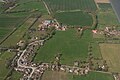
 Manby, aerial 2017 - geograph.org.uk - 5594481.jpg 800 × 533; 96 KB
-

-
 New housing at Manby, aerial 2018 - geograph.org.uk - 5682505.jpg 800 × 458; 63 KB
-
 New Year's Day in Manby - geograph.org.uk - 3278260.jpg 640 × 427; 140 KB
-
 No more poplars, B1200 towards Manby - geograph.org.uk - 3836214.jpg 640 × 427; 57 KB
-

-

-
 Permissive footpath - 'Rachel's Way' - at Manby - geograph.org.uk - 6080973.jpg 4 000 × 3 000; 4,53 MB
-
 Reflections on the weather - geograph.org.uk - 3278294.jpg 640 × 427; 134 KB
-

-
 Road at Eastfield Farm - geograph.org.uk - 3041989.jpg 2 256 × 1 504; 943 KB
-

-
 Tall chimneys - geograph.org.uk - 3278251.jpg 640 × 427; 104 KB
-
 Tall Chimneys - geograph.org.uk - 3278325.jpg 640 × 427; 107 KB
-
 Tank at entrance to Manby Showground - geograph.org.uk - 2515422.jpg 1 280 × 960; 267 KB
-
 The Former Plough - geograph.org.uk - 6206911.jpg 1 024 × 576; 132 KB
-
 The road to Causeway Bridge Farm - geograph.org.uk - 3278285.jpg 640 × 427; 113 KB
-
 The road to Causeway Bridge Farm - geograph.org.uk - 3278319.jpg 640 × 427; 48 KB
-
 The water tower at ex RAF Manby - geograph.org.uk - 6251430.jpg 4 608 × 3 072; 5,38 MB
-
 Track at the Manby Land Rover Show - panoramio.jpg 3 888 × 2 592; 1,57 MB
-
 Unnamed road to Manby - geograph.org.uk - 3041992.jpg 2 256 × 1 504; 966 KB
-
 Vampire road Manby - geograph.org.uk - 4071274.jpg 1 024 × 768; 132 KB
-
 View across RAF Manby airfield - geograph.org.uk - 6251427.jpg 3 132 × 1 228; 1,1 MB
-
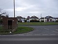
 Village signposts Grimoldby and Manby - geograph.org.uk - 1804138.jpg 1 600 × 1 200; 638 KB
-

-

-

-
 Causeway Bridge Farm - geograph.org.uk - 465247.jpg 640 × 480; 68 KB
-
 Farm track to Eastfield Farm - geograph.org.uk - 626019.jpg 640 × 480; 65 KB
-
 Field of oilseed rape - geograph.org.uk - 464628.jpg 640 × 480; 77 KB
-
 Flooding at Dowsey Fen - geograph.org.uk - 481909.jpg 640 × 427; 122 KB
-
 Howdales - geograph.org.uk - 432031.jpg 640 × 427; 65 KB


_-_geograph.org.uk_-_4407188.jpg)


_-_geograph.org.uk_-_4407205.jpg)

._-_geograph.org.uk_-_4407157.jpg)


_-_geograph.org.uk_-_4407168.jpg)
_-_geograph.org.uk_-_4407173.jpg)
_-_geograph.org.uk_-_4407199.jpg)
_-_geograph.org.uk_-_4407207.jpg)


