Category:Mansfield, Nottinghamshire
Vai alla navigazione
Vai alla ricerca
cittadina della contea inglese del Nottinghamshire  | |||||
| Carica un file multimediale | |||||
| Istanza di | |||||
|---|---|---|---|---|---|
| Luogo |
| ||||
| Popolazione |
| ||||
| Distinto da | |||||
| sito web ufficiale | |||||
 | |||||
English: Mansfield is a large town in Nottinghamshire, England.
Sottocategorie
Questa categoria contiene le 15 sottocategorie indicate di seguito, su un totale di 15.
B
C
D
- Drury Dam Viaduct (16 F)
M
N
R
S
- A Spire for Mansfield (7 F)
T
- Titchfield Park, Mansfield (26 F)
V
File nella categoria "Mansfield, Nottinghamshire"
Questa categoria contiene 200 file, indicati di seguito, su un totale di 200.
-
 17 and 19, Church Street, Mansfield, Nottinghamshire (1).jpg 3 024 × 4 032; 2,18 MB
-
 17 and 19, Church Street, Mansfield, Nottinghamshire (4).jpg 3 024 × 4 032; 2,27 MB
-
 39, West Gate, Mansfield (Cafe Silver, Recruitment Agent).jpg 2 977 × 4 054; 2,17 MB
-
 Berry Hill Water Tower - geograph.org.uk - 12947.jpg 494 × 640; 76 KB
-
 Billingsley in Mansfield.jpg 1 877 × 1 554; 619 KB
-
 BillingsleyMansfield1799 1802.jpg 1 764 × 1 615; 584 KB
-
 Boundary stone and forest track near Rainworth - geograph.org.uk - 2696093.jpg 2 048 × 1 536; 932 KB
-
 Boundary stone in forest near Rainworth - geograph.org.uk - 2696069.jpg 1 536 × 2 048; 911 KB
-
 Boundary Wall And Gate Piers At Old Grammar School.jpg 2 154 × 2 167; 915 KB
-
 Boundary Wall And Gate Piers To Number 2 Boundary Wall And Gate Piers To Number 80 (1).jpg 4 048 × 3 036; 6,34 MB
-
 Boundary Wall And Gate Piers To Number 2 Boundary Wall And Gate Piers To Number 80 (2).jpg 4 048 × 3 036; 5,71 MB
-
 Bowmans Transport - NX65 HGE.jpg 4 032 × 3 024; 1,35 MB
-
 Bowmans Transport - SF65 ZTD.jpg 4 032 × 3 024; 1,21 MB
-
 Bus Stop (St Lawrence Church), Skerry Hill, Mansfield 2.jpg 4 048 × 3 036; 3,39 MB
-
 Bus stop, High Street, Mansfield Woodhouse.jpg 1 998 × 2 674; 810 KB
-
 Buttercross Market, Mansfield .jpg 1 241 × 2 392; 891 KB
-
 Cattle Market weather vane - geograph.org.uk - 1769094.jpg 1 024 × 683; 76 KB
-
 Cemetery Chapel At Mansfield Cemetery, Nottingham Road, Mansfield, Notts (11).jpg 3 024 × 4 032; 2,21 MB
-
 Cemetery Chapel At Mansfield Cemetery, Nottingham Road, Mansfield, Notts (14).jpg 2 868 × 4 036; 2,8 MB
-
 Cemetery Chapel At Mansfield Cemetery, Nottingham Road, Mansfield, Notts (3).jpg 3 024 × 4 032; 3,29 MB
-
 Communication mast - geograph.org.uk - 535867.jpg 640 × 480; 63 KB
-
 Drury Dam Viaduct, Quarry Lane, Mansfield (12).jpg 3 036 × 4 048; 6,08 MB
-
 Entry to subway - geograph.org.uk - 1768854.jpg 1 024 × 683; 260 KB
-
 Field Mill House, Grade II Listed Building (6).jpg 2 160 × 3 840; 3,22 MB
-
 Field Mill House, Grade II Listed Building (7).jpg 3 840 × 2 160; 3,12 MB
-
 Field Mill House, Grade II Listed Building (8).jpg 2 160 × 3 840; 3,87 MB
-
 Field Mill House, Grade II Listed Building (9).jpg 3 840 × 2 160; 3,27 MB
-
 Footbridge to Shops - geograph.org.uk - 14759.jpg 640 × 502; 86 KB
-
 Footpath, Normanshill Wood - geograph.org.uk - 1413942.jpg 427 × 640; 79 KB
-
 Forest Clearing, Strawberry Hill - geograph.org.uk - 1061067.jpg 640 × 480; 100 KB
-
 Forest Town Arena (Formerly Miner's Welfare Club), Forest Town, Mansfield, Notts (1).jpg 3 840 × 2 160; 2,64 MB
-
 Forest Town Arena (Formerly Miner's Welfare Club), Forest Town, Mansfield, Notts (2).jpg 3 840 × 2 160; 2,89 MB
-
 Garages To North East Of Teversal Manor, Buttery Lane, Teversal, Mansfield (2).jpg 4 048 × 3 036; 2,45 MB
-
 Garages To North East Of Teversal Manor, Buttery Lane, Teversal, Mansfield (3).jpg 4 048 × 3 036; 2,51 MB
-
 Garages To North East Of Teversal Manor, Buttery Lane, Teversal, Mansfield (4).jpg 4 048 × 3 036; 3,9 MB
-
 Garages To North East Of Teversal Manor, Buttery Lane, Teversal, Mansfield (5).jpg 3 338 × 2 501; 1,17 MB
-
 Gate at Olde Mansfield Center Cemetery.jpg 3 936 × 2 952; 2,78 MB
-
 Hamilton Hill - geograph.org.uk - 12237.jpg 640 × 358; 58 KB
-
 Holden Street, Mansfield - geograph.org.uk - 1202139.jpg 640 × 424; 62 KB
-
 HolmesHerbert.gif 320 × 240; 58 KB
-
 Industria, Leeming Street, Mansfield (4).jpg 2 578 × 4 053; 1,85 MB
-
 Inlet into river Maun - geograph.org.uk - 459443.jpg 640 × 480; 184 KB
-
 Intake Farm School, Armstrong Road, Ladybrook Lane, Mansfield (1).jpg 3 927 × 3 006; 3,84 MB
-
 Intake Farm School, Armstrong Road, Ladybrook Lane, Mansfield (2).jpg 4 048 × 3 036; 4,6 MB
-
 Intake Farm School, Armstrong Road, Ladybrook Lane, Mansfield (3).jpg 4 048 × 3 036; 4,68 MB
-
 Intake Farm School, Armstrong Road, Ladybrook Lane, Mansfield (4).jpg 4 048 × 3 036; 5,21 MB
-
 Intake Farm School, Armstrong Road, Ladybrook Lane, Mansfield (6).jpg 4 048 × 3 036; 4,77 MB
-
 Intake Farm School, Armstrong Road, Ladybrook Lane, Mansfield (7).jpg 4 048 × 3 036; 4,96 MB
-
 Intake Farm School, Armstrong Road, Ladybrook Lane, Mansfield (8).jpg 4 048 × 3 036; 6,03 MB
-
 K6 Telephone Kiosk, High Street, Mansfield Woodhouse (Close up).jpg 2 160 × 3 840; 2,85 MB
-
 K6 Telephone Kiosk, High Street, Mansfield Woodhouse.jpg 3 036 × 4 048; 4,81 MB
-
 Lakeside Club, Pleasley.jpg 4 048 × 3 036; 3,37 MB
-
 Lammas Leisure Centre (1).jpg 4 048 × 3 036; 3,73 MB
-
 Lammas Leisure Centre (2).jpg 4 048 × 3 036; 4,09 MB
-
 Lammas Leisure Centre (3).jpg 4 048 × 3 036; 3,8 MB
-
 Lammas Leisure Centre (4).jpg 3 840 × 2 160; 2,6 MB
-
 Lammas Leisure Centre (5).jpg 3 840 × 2 160; 2,32 MB
-
 Lammas Leisure Centre (6).jpg 4 048 × 3 036; 3,39 MB
-
 Lammas Leisure Centre (7).jpg 4 048 × 3 036; 3,64 MB
-
 Mansfield (35507138232).jpg 4 000 × 3 000; 3,26 MB
-
 Mansfield (35545877791).jpg 4 000 × 3 000; 2,09 MB
-
 Mansfield (35676092455).jpg 4 000 × 3 000; 2,06 MB
-
 Mansfield - Approaching Station - geograph.org.uk - 1103233.jpg 640 × 480; 87 KB
-
-
 Mansfield - Handley Arcade - geograph.org.uk - 1201719.jpg 640 × 480; 97 KB
-

-
 Mansfield - Maun Valley Trail - geograph.org.uk - 1163620.jpg 640 × 431; 57 KB
-
 Mansfield - Midworth Street - geograph.org.uk - 1227541.jpg 640 × 480; 86 KB
-

-

-
 Mansfield - sundial on Westgate - geograph.org.uk - 1227531.jpg 480 × 640; 72 KB
-
-
 Mansfield - The Court House - geograph.org.uk - 1227558.jpg 640 × 480; 71 KB
-
 Mansfield - Whiteleys Mill - geograph.org.uk - 1163638.jpg 640 × 470; 72 KB
-
 Mansfield 103.2 local radio studio.jpg 2 496 × 1 853; 982 KB
-
 Mansfield Buttercross.jpg 3 408 × 2 978; 1,96 MB
-
 Mansfield By-pass - geograph.org.uk - 57496.jpg 640 × 480; 92 KB
-
 Mansfield Community Arts Centre Bus Stop, Leeming Street, Mansfield.jpg 3 216 × 2 965; 1,88 MB
-
 Mansfield Job Centre Plus - geograph.org.uk - 1769243.jpg 683 × 1 024; 266 KB
-
 Mansfield marketplace in 2004.jpg 640 × 480; 78 KB
-
 Mansfield Transmitter - geograph.org.uk - 787978.jpg 640 × 480; 34 KB
-

-
-
 Mansfieldprotest.jpg 7 584 × 2 291; 10,55 MB
-

-
 Mayoregg.jpg 720 × 960; 63 KB
-
 Municipal Borough of Mansfield, Nottinghamshire (1970).svg 455 × 745; 64 KB
-
 N C C Mansfield Bus Station (1).jpg 3 979 × 3 034; 1,54 MB
-
 N C C Mansfield Bus Station (2).jpg 3 852 × 3 019; 1,48 MB
-
 N C C Mansfield Bus Station (3).jpg 3 278 × 3 186; 1,63 MB
-
 New Road Through Countryside - geograph.org.uk - 11695.jpg 640 × 480; 55 KB
-
 Norwood Lodge, Newbound Lane, Norwood, Mansfield (1).jpg 4 048 × 3 036; 4,91 MB
-
 Norwood Lodge, Newbound Lane, Norwood, Mansfield (2).jpg 4 048 × 3 036; 4,23 MB
-
 Norwood Lodge, Newbound Lane, Norwood, Mansfield (3).jpg 4 048 × 3 036; 3,94 MB
-
 Norwood Lodge, Newbound Lane, Norwood, Mansfield (4).jpg 4 048 × 3 036; 5,94 MB
-
 Nottingham-Derby-Mansfield-Alfreton-Belper-Heage-Crich-BUA-2011.jpg 952 × 952; 988 KB
-
 Number 35 And Attached Boundary Wall, Grade II listed building, Pleasley, Mansfield (1).jpg 4 048 × 3 036; 4,15 MB
-
 Number 35 And Attached Boundary Wall, Grade II listed building, Pleasley, Mansfield (2).jpg 4 048 × 3 036; 5,34 MB
-
 Number 35 And Attached Boundary Wall, Grade II listed building, Pleasley, Mansfield (3).jpg 4 048 × 3 036; 5,13 MB
-
 Number 35 And Attached Boundary Wall, Grade II listed building, Pleasley, Mansfield (4).jpg 4 048 × 3 036; 3,96 MB
-
 Number 35 And Attached Boundary Wall, Grade II listed building, Pleasley, Mansfield (5).jpg 4 048 × 3 036; 5,25 MB
-
 Old Newark Road - geograph.org.uk - 62947.jpg 640 × 480; 134 KB
-
 Ordnance Survey One-Inch Sheet 112 Nottingham, Published 1947.jpg 10 875 × 12 765; 15,9 MB
-
 Ordnance Survey One-Inch Sheet 112 Nottingham, Published 1960.jpg 8 289 × 9 973; 11,75 MB
-
 Ordnance Survey One-Inch Sheet 112 Nottingham, Published 1968.jpg 8 327 × 9 898; 11,61 MB
-
 Ordnance Survey One-Inch Sheet 46 The Dukeries, Published 1928.jpg 11 842 × 8 836; 41,92 MB
-
 Pleasley - old school - geograph.org.uk - 1525715.jpg 640 × 480; 91 KB
-
 Pleasley Bridge, Grade II listed building, Pleasley, Mansfield.jpg 4 048 × 3 036; 5 MB
-
 Pleasley dam and old mill building.jpg 800 × 531; 110 KB
-
-
 Pleasley Hill House, Grade II listed building, Pleasley, Mansfield (1).jpg 3 036 × 4 048; 2,77 MB
-
 Pleasley Hill House, Grade II listed building, Pleasley, Mansfield (2).jpg 3 036 × 4 048; 4,79 MB
-
 Pleasley Miners Welfare.jpg 4 048 × 3 036; 3,33 MB
-
 Pole on Water Lane - geograph.org.uk - 788039.jpg 640 × 480; 39 KB
-

-

-

-

-

-
 Railway crossing on bridleway - geograph.org.uk - 856953.jpg 640 × 426; 153 KB
-
 Ratcher Hill Quarry, Mansfield - geograph.org.uk - 1060941.jpg 640 × 477; 112 KB
-
 Rebecca Addlington Swiming Pool (1).jpg 3 500 × 1 535; 651 KB
-
 Rebecca Addlington Swiming Pool (2).jpg 2 081 × 1 343; 459 KB
-
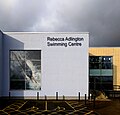
 Rebecca Adlington Swimming Centre (2).jpg 3 174 × 3 068; 1,75 MB
-
 Rebecca Adlington Swimming Centre (3).jpg 3 718 × 2 931; 2,11 MB
-
 Rebecca Adlington Swimming Centre (4).jpg 2 868 × 3 664; 2,57 MB
-
 Rebecca Adlington Swimming Centre (5).jpg 3 187 × 3 075; 1,51 MB
-
 Rebecca Adlington Swimming Centre (6).jpg 3 837 × 2 117; 1,17 MB
-
 Rebecca Adlington Swimming Centre (7).jpg 2 082 × 3 791; 818 KB
-
 Rebecca Adlington Swimming Centre, Mansfield (1).jpg 3 130 × 3 008; 1,59 MB
-
 Richardleese.jpg 2 365 × 3 000; 908 KB
-
 River Maun at Kings Mill - geograph.org.uk - 856924.jpg 640 × 426; 133 KB
-
 Robin Hood Line, Mansfield - geograph.org.uk - 483327.jpg 640 × 480; 112 KB
-
 School House Cottage And Adjoining Manor Room, Buttery Lane, Teversal, Mansfield (10).jpg 4 048 × 3 036; 1,97 MB
-
 School House Cottage And Adjoining Manor Room, Buttery Lane, Teversal, Mansfield (13).jpg 4 048 × 3 036; 5,57 MB
-

-
 School House Cottage And Adjoining Manor Room, Buttery Lane, Teversal, Mansfield (15).jpg 4 013 × 2 927; 3,33 MB
-
 School House Cottage And Adjoining Manor Room, Buttery Lane, Teversal, Mansfield (16).jpg 3 970 × 3 008; 3,79 MB
-
 School House Cottage And Adjoining Manor Room, Buttery Lane, Teversal, Mansfield (17).jpg 4 048 × 3 036; 5,82 MB
-

-
 School House Cottage And Adjoining Manor Room, Buttery Lane, Teversal, Mansfield (19).jpg 4 048 × 3 036; 5,72 MB
-

-
 School House Cottage And Adjoining Manor Room, Buttery Lane, Teversal, Mansfield (8).jpg 4 048 × 3 036; 4,75 MB
-
 Sherwood Miners Welfare, Birding Street, Mansfield (1).jpg 2 314 × 4 142; 1,73 MB
-
 Sherwood Miners Welfare, Birding Street, Mansfield (2).jpg 3 495 × 2 971; 2,26 MB
-
 Space for a brewery - geograph.org.uk - 1769214.jpg 1 024 × 683; 202 KB
-
 Stanton's Mill And Adjoining Outbuildings, Bath Lane, Mansfield (2).jpg 4 048 × 3 036; 2,57 MB
-
 Stinting Lane heading SW - geograph.org.uk - 459450.jpg 640 × 480; 169 KB
-
 Stoneleigh, Crowhill Drive, Mansfield (Gate Pillars).jpg 3 731 × 3 039; 3,97 MB
-
 Strawberry Hill Heath - geograph.org.uk - 539848.jpg 640 × 480; 145 KB
-
 Table Top Tree - geograph.org.uk - 533613.jpg 640 × 480; 136 KB
-
 The Early Doors in Mansfield - geograph.org.uk - 1248311.jpg 640 × 427; 66 KB
-
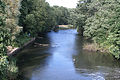
 The River Maun. - geograph.org.uk - 494499.jpg 640 × 480; 180 KB
-
 The station of the Transmitter - geograph.org.uk - 804303.jpg 640 × 480; 56 KB
-
 Thompson's Grave - geograph.org.uk - 22017.jpg 640 × 480; 86 KB
-
 Steve Ward.jpg 3 264 × 2 448; 1,41 MB
-
 Water Lane - geograph.org.uk - 804341.jpg 640 × 480; 51 KB
-
 Water Meadows (3).jpg 3 036 × 4 048; 5,16 MB
-
 Water Meadows (4).jpg 4 048 × 3 036; 3,82 MB
-
 Water Meadows (5).jpg 4 048 × 3 036; 3,74 MB
-
 Water Meadows, Mansfield (1).jpg 4 048 × 3 036; 3,24 MB
-
 Water Tower, Berry Hill, Mansfield - geograph.org.uk - 36650.jpg 640 × 418; 89 KB
-
 West Nottinghamshire College - geograph.org.uk - 16330.jpg 640 × 480; 89 KB
-
 Westfield Folkhouse, Manasfield (2).jpg 3 840 × 2 160; 3,45 MB
-
 Westfield Folkhouse, Manasfield (3).jpg 3 840 × 2 160; 3,71 MB
-
 Westfield Folkhouse, Manasfield (4).jpg 3 840 × 2 160; 2,62 MB
-
 Westfield Folkhouse, Manasfield (5).jpg 3 840 × 2 160; 2,11 MB
-
 Westfield Folkhouse, Manasfield (6).jpg 3 840 × 2 160; 2,44 MB
-

-
 Westgate House, 1 and 1a West Gate, Mansfield (1).jpg 2 639 × 4 043; 1,88 MB
-
 Bessie Sheppard's Stone - geograph.org.uk - 533627.jpg 640 × 480; 87 KB
-
 Bird Stone - geograph.org.uk - 19096.jpg 640 × 480; 141 KB
-
 Caves Information Centre, Mansfield - geograph.org.uk - 467578.jpg 480 × 640; 141 KB
-
 Children's Play area - geograph.org.uk - 62956.jpg 640 × 480; 110 KB
-
 Church Street, Mansfield - geograph.org.uk - 535888.jpg 480 × 640; 74 KB
-
 Deserted skate park - geograph.org.uk - 477692.jpg 640 × 480; 154 KB
-
 Disused quarry off Littlewood Lane - geograph.org.uk - 468420.jpg 640 × 480; 163 KB
-
 Entrance to Ransom Wood Business Park - geograph.org.uk - 62964.jpg 640 × 480; 148 KB
-
 Forest Road Recreation Ground - geograph.org.uk - 22015.jpg 640 × 480; 73 KB
-
 Forest Stone - geograph.org.uk - 1414037.jpg 640 × 427; 53 KB
-
 High Heels, Mansfield - geograph.org.uk - 535903.jpg 480 × 640; 76 KB
-
 Looking towards Shirebrook Wood - geograph.org.uk - 279787.jpg 640 × 480; 102 KB
-
 NE from Northfield Avenue - geograph.org.uk - 468629.jpg 640 × 480; 150 KB
-
-
 Normanshill Wood, Pine Trees - geograph.org.uk - 11305.jpg 480 × 640; 118 KB
-
 Normanshill Wood, Pine Trees - geograph.org.uk - 11306.jpg 480 × 640; 103 KB
-
 Old colliery site, Warsop - geograph.org.uk - 14438.jpg 640 × 425; 68 KB
-
 On the bridge looking north - geograph.org.uk - 437946.jpg 640 × 480; 135 KB
-
 Parliament Oak - geograph.org.uk - 45271.jpg 425 × 640; 152 KB
-
 Pylon on farmland - geograph.org.uk - 550952.jpg 640 × 480; 72 KB
-
 Railway bridge next to works - geograph.org.uk - 468637.jpg 640 × 480; 158 KB
-

-
 Reclaimed land near Sookholme - geograph.org.uk - 279798.jpg 640 × 480; 95 KB
-
 River Maun - geograph.org.uk - 494534.jpg 640 × 480; 198 KB
-
 River Maun, near Snake Hill - geograph.org.uk - 494518.jpg 640 × 480; 190 KB
-
 Sherwood Observatory - geograph.org.uk - 59137.jpg 640 × 480; 107 KB
-
 Stone built building, Carr Bank Park - geograph.org.uk - 483323.jpg 480 × 640; 185 KB
-
 Track to Sookholme - geograph.org.uk - 279766.jpg 446 × 640; 165 KB
-
 Two Oaks Farm - geograph.org.uk - 59135.jpg 640 × 480; 85 KB
-
 Warsop Main Colliery pit tip - geograph.org.uk - 14436.jpg 640 × 425; 84 KB
.jpg)
.jpg)
.jpg)


.jpg)
.jpg)
,_Skerry_Hill,_Mansfield_2.jpg)


.jpg)
.jpg)
.jpg)

.jpg)

.jpg)
.jpg)
.jpg)
.jpg)


,_Forest_Town,_Mansfield,_Notts_(1).jpg)
,_Forest_Town,_Mansfield,_Notts_(2).jpg)
.jpg)
.jpg)
.jpg)
.jpg)


.jpg)

.jpg)
.jpg)
.jpg)
.jpg)
.jpg)
.jpg)
.jpg)
.jpg)


.jpg)
.jpg)
.jpg)
.jpg)
.jpg)
.jpg)
.jpg)
.jpg)
.jpg)
.jpg)


.jpg)

.svg)
.jpg)
.jpg)
.jpg)

.jpg)
.jpg)
.jpg)
.jpg)

.jpg)
.jpg)
.jpg)
.jpg)
.jpg)


.jpg)
.jpg)
.jpg)


.jpg)
.jpg)
.jpg)
.jpg)
.jpg)


.jpg)
.jpg)
.jpg)
.jpg)
.jpg)
.jpg)
.jpg)
.jpg)
.jpg)


.jpg)
.jpg)
.jpg)
.jpg)
.jpg)
.jpg)
.jpg)
.jpg)
.jpg)
.jpg)
.jpg)
.jpg)

.jpg)

.jpg)


.jpg)
.jpg)
.jpg)
.jpg)


.jpg)
.jpg)
.jpg)
.jpg)
.jpg)
.jpg)
.jpg)


