Category:Manton, Wiltshire
Aller à la navigation
Aller à la recherche
village britannique du Wiltshire  | |||||
| Téléverser des médias | |||||
| Nature de l’élément | |||||
|---|---|---|---|---|---|
| Lieu | Marlborough, Wiltshire, Angleterre du Sud-Ouest, Angleterre | ||||
 | |||||
English: Manton is a small village in Wiltshire on the outskirts of Marlborough just off the A4 Bath Road.
Média dans la catégorie « Manton, Wiltshire »
Cette catégorie comprend 30 fichiers, dont les 30 ci-dessous.
-
 Clatford Bottom - geograph.org.uk - 278328.jpg 640 × 480 ; 142 kio
-
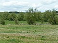 Kennet valley near Manton - geograph.org.uk - 1315893.jpg 640 × 480 ; 178 kio
-
 Manton - geograph.org.uk - 1315919.jpg 640 × 480 ; 182 kio
-
 Road into Manton from the west - geograph.org.uk - 1315898.jpg 640 × 480 ; 177 kio
-
 Sheep near Manton - geograph.org.uk - 1318945.jpg 640 × 480 ; 174 kio
-
 The Oddfellows Arms, Manton - geograph.org.uk - 104371.jpg 640 × 481 ; 39 kio
-
 Arable farmland above Marlborough - geograph.org.uk - 278237.jpg 640 × 480 ; 128 kio
-
 Barton Down, north of Marlborough - geograph.org.uk - 44038.jpg 640 × 427 ; 44 kio
-

-
 Clatford Bottom - geograph.org.uk - 278313.jpg 640 × 480 ; 112 kio
-
 Clatford Bottom - geograph.org.uk - 278317.jpg 640 × 480 ; 124 kio
-
 Clatford Bottom - geograph.org.uk - 278331.jpg 640 × 480 ; 127 kio
-
 Clatford Bottom - geograph.org.uk - 278349.jpg 640 × 480 ; 111 kio
-
 Copse above Manton - geograph.org.uk - 278253.jpg 640 × 480 ; 101 kio
-
 Farmland near Clench Common - geograph.org.uk - 416606.jpg 640 × 480 ; 175 kio
-
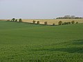
 Farmland near Marlborough - geograph.org.uk - 411077.jpg 640 × 480 ; 164 kio
-
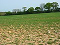
 Farmland, Manton - geograph.org.uk - 278294.jpg 640 × 480 ; 140 kio
-
 Farmland, Manton - geograph.org.uk - 278306.jpg 640 × 480 ; 128 kio
-
 Farmland, Marlborough - geograph.org.uk - 408733.jpg 640 × 480 ; 106 kio
-
 Farmland, Marlborough - geograph.org.uk - 408736.jpg 640 × 480 ; 132 kio
-
 Farmland, Wernham Farm - geograph.org.uk - 416617.jpg 640 × 480 ; 174 kio
-
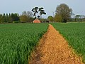 Footpath through wheat, Clench Common - geograph.org.uk - 419342.jpg 640 × 480 ; 149 kio
-
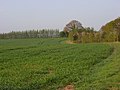
 Kennet Valley, west of Manton - geograph.org.uk - 123152.jpg 640 × 481 ; 46 kio
-
 Path through West Woods near Marlborough - geograph.org.uk - 409295.jpg 640 × 480 ; 182 kio
-
 Sheep above Marlborough - geograph.org.uk - 278243.jpg 640 × 480 ; 134 kio
-
 Sign at entrance to West Woods, near Marlborough - geograph.org.uk - 409378.jpg 640 × 480 ; 166 kio
-
 Stubble above Marlborough - geograph.org.uk - 278229.jpg 640 × 480 ; 119 kio
-
 Wansdyke, West Woods, near Marlborough (2) - geograph.org.uk - 409337.jpg 640 × 480 ; 220 kio
-
 Wansdyke, West Woods, near Marlborough (3) - geograph.org.uk - 409354.jpg 640 × 480 ; 206 kio
-
 Wansdyke, West Woods, near Marlborough - geograph.org.uk - 409328.jpg 640 × 480 ; 210 kio


_-_geograph.org.uk_-_409337.jpg)
_-_geograph.org.uk_-_409354.jpg)
