Category:Map legends
Vai alla navigazione
Vai alla ricerca
tabella che indica in che modo leggere e comprendere un'illustrazione | |||||
| Carica un file multimediale | |||||
| Sottoclasse di |
| ||||
|---|---|---|---|---|---|
| Parte di | |||||
| Consiste di | |||||
| Distinto da | |||||
| Considerato essere uguale a | didascalia | ||||
| |||||
- (it) Legenda
- (de) Legende (Karte)
- (en) Caption
- (nl) Legenda
- (pl) Legenda map
- (sv) Bildtext
See also:
Sottocategorie
Questa categoria contiene le 11 sottocategorie indicate di seguito, su un totale di 11.
File nella categoria "Map legends"
Questa categoria contiene 36 file, indicati di seguito, su un totale di 36.
-
 Guang Yutu 1558 Vol 1 Pg 01 Legend.jpg 4 375 × 4 579; 4,42 MB
-
 A Tiszavölgy viszabályozási átnézeti térképe... Valyi Béla ... - btv1b53198405s (2 of 2).jpg 3 328 × 5 141; 2,35 MB
-
-
 Andree, Richard. Volkerkarte von Russland. 1881 C.jpg 1 382 × 676; 189 KB
-
-
 Capture legende cyclabilite.png 190 × 231; 6 KB
-

-
 Conventional signs for Swiss National Maps.pdf 647 × 1 120, 12 pagine; 830 KB
-
 Ecozone-Biocountry-Palearctic-legend-da.svg 172 × 419; 5 KB
-
 Ethnographic map of the Kars Oblast (1902)-map legend-1.png 757 × 686; 433 KB
-
 Ethnographic map of the Tiflis Governorate (1902)-map legend-1.jpg 928 × 1 211; 179 KB
-
 Ethnographic map of the Tiflis Governorate (1902)-map legend-2.jpg 1 105 × 392; 73 KB
-
 European location legend ro.png 503 × 316; 44 KB
-
-
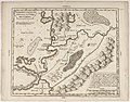
 Graeciae Pars Meridionalis sive Peloponnesus 02.jpg 4 668 × 3 850; 3,92 MB
-
 IsraelCVFRlegend.jpg 1 340 × 2 762; 124 KB
-
-
 Language key - Мапа української мови 1871 (cropped).jpg 1 194 × 896; 988 KB
-
 Legenda 2022 Russian invasion of Ukraine.jpg 1 920 × 2 167; 706 KB
-
 Legende cyclabilite.png 550 × 682; 28 KB
-
 LegendExample.jpg 476 × 186; 24 KB
-
 Litologiaeuskaraz.png 389 × 463; 105 KB
-
 O-kort grøft og å.png 179 × 126; 14 KB
-
 Ordnance Survey Characteristic Sheet for the Engraved Six-Inch Maps of Great Britain - 1897.png 4 788 × 7 198; 30,37 MB
-
 Přehledná národopisná mapa Ukrajiny - Legend.jpg 833 × 1 141; 125 KB
-
 Riproduzione 4.pdf 781 × 1 304; 2,1 MB
-
 Semiconductor legend.png 509 × 116; 7 KB
-
 Senator-Kraft-Straße in Wunstorf, Straßenschild mit Legendentafel.jpg 3 928 × 1 767; 928 KB
-
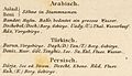
 Stein, Christ. Gottfr. Dan.West-Asien. 1865 P.jpg 787 × 221; 29 KB
-
 Stein, Christ. Gottfr. Dan.West-Asien. 1865 Q.jpg 918 × 531; 65 KB
-
 Stieler, Adolf. Das Mittellandische Meer Und Nord-Afrika. 1875 XA.jpg 622 × 739; 126 KB
-
 T0001759 1.jpg 3 229 × 1 399; 888 KB
-
 Templat Peta-id.svg 1 100 × 1 500; 274 KB
-
 UoH Mar24 Rebrand New Map Logo.jpg 4 176 × 2 784; 3,44 MB
-
 UoH Mar24 Rebrand Revinyled Map Legend.jpg 4 176 × 2 784; 3,5 MB
-
 Зеница 20190810 165114.jpg 1 836 × 3 264; 2,23 MB

.jpg)


.jpg)

-map_legend-1.png)
-map_legend-1.jpg)


.jpg)


-map_legend-2.jpg)