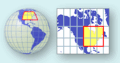
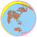
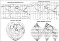
Category:Map projections
Pereiti į navigaciją
Jump to search

English: This map-projection-related category exists in the following hierarchy:
- Category:Map projections
- Category:Maps by projection
- Category:EXAMPLE projection – media related to the EXAMPLE projection other than maps
- Category:Maps with EXAMPLE projection (“Category:EXAMPLE projections”) – maps made using the EXAMPLE projection
- See also Category:Images of map projections on the theory of mapping
- See also Category:Maps by projection for maps assorted by type of mapping
- See also Category:Geographic coordinate system
See also category: Projective geometry.
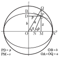
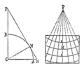
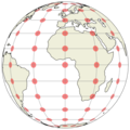
representation of the surface of a sphere or ellipsoid onto a plane map | |||||
| Įkelti mediją | |||||
| Poklasis |
| ||||
|---|---|---|---|---|---|
| |||||
Subkategorijos
Rodomos 9 subkategorijos (iš viso yra 9 subkategorijos).
Daugialypės terpės rinkmenos kategorijoje „Map projections“
Šioje kategorijoje yra viena rinkmena.
-

-

-
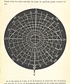
 101 of 'Lehrbuch der Landkartenprojektionen' (11306943394).jpg 992 × 1 190; 155 KiB
-

-

-

-

-

-
-

-

-

-
-
-
-
 205infinitesimal elements on sphere and plane(6).svg 402 × 120; 18 KiB
-
 295 of 'Eclectic Physical Geography' (11201337104).jpg 1 315 × 2 066; 852 KiB
-

-

-

-

-
 A second plate of geography containing the projection of maps (12325996485).jpg 2 500 × 1 977; 1,71 MiB
-
 Adams Doubly-Periodic with Tissot's Indicatrices of Distortion.svg 1 600 × 1 600; 574 KiB
-
-
 Annals of the New York Academy of Sciences (1879-) (18226862830).jpg 2 056 × 1 724; 923 KiB
-
 Australia american polygonic cfr.png 2 833 × 2 891; 108 KiB
-
 Blank Kazakhstan Map.png 3 000 × 1 700; 375 KiB
-
 Blank Kyrgyzstan Map.png 3 200 × 1 600; 326 KiB
-
 Blank Mongolia Map.png 3 000 × 1 500; 313 KiB
-
 Blank Tajikistan Map.png 3 000 × 2 300; 338 KiB
-
 Blank Turkmenistan Map.png 3 000 × 2 000; 295 KiB
-
 Blank Uzbekistan Map.png 3 000 × 2 000; 301 KiB
-
 Blome Geography 1686 Cornell CUL PJM 1013 01.jpg 4 534 × 7 215; 5,32 MiB
-
 Brockhaus and Efron Encyclopedic Dictionary b28 639-0.jpg 3 097 × 2 456; 1,23 MiB
-
 Cahill-conformal-butterfly-20w-hypso-extended.jpg 571 × 331; 108 KiB
-
 Compared differentials ds.png 1 199 × 594; 14 KiB
-
 Comparison of cartography surface development.svg 512 × 384; 60 KiB
-
 Comparison of Mercator projections.svg 512 × 455; 55 KiB
-
 Conformal map projection from globe to octahedron.png 2 304 × 998; 1,22 MiB
-
 Cross sections of earth show radius of the circles of latitude.png 377 × 854; 10 KiB
-
 Cross sections of earth show radius of the circles of latitude.svg 440 × 900; 1 KiB
-
 Cumbria II Projection.png 800 × 800; 838 KiB
-
 Cumbria projection.png 2 058 × 1 036; 2,05 MiB
-
 CylProj infinitesimals2.svg 495 × 142; 44 KiB
-
 DCS-Maps-World.svg 512 × 260; 809 KiB
-
 Desarrollo balón.png 450 × 450; 49 KiB
-
 Diagram to Aid Construction of Cahill-Keyes Projection.jpg 492 × 529; 129 KiB
-
 Diaspora map.svg 512 × 280; 283 KiB
-

-
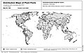 Distribution map S. tangolias.jpg 1 116 × 707; 173 KiB
-
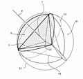
 Earth cube map development.svg 512 × 512; 50 KiB
-
 EB1911 - Map Projections- area 1.jpg 47 × 52; 2 KiB
-
 EB1911 - Map Projections- area 2.jpg 50 × 27; 2 KiB
-
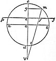
 EB1911 - Map Projections- Fig. 1.jpg 173 × 172; 14 KiB
-
 EB1911 - Map Projections- Fig. 10.jpg 193 × 210; 15 KiB
-
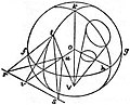
 EB1911 - Map Projections- Fig. 11.jpg 481 × 476; 162 KiB
-

-
 EB1911 - Map Projections- Fig. 13.jpg 260 × 195; 24 KiB
-

-
 EB1911 - Map Projections- Fig. 15.jpg 159 × 204; 14 KiB
-

-
 EB1911 - Map Projections- Fig. 17.jpg 148 × 177; 14 KiB
-
 EB1911 - Map Projections- Fig. 18.jpg 138 × 115; 10 KiB
-
 EB1911 - Map Projections- Fig. 19.—Sinusoidal Equal-area Projection.jpg 306 × 318; 56 KiB
-
 EB1911 - Map Projections- Fig. 2.jpg 481 × 175; 26 KiB
-
 EB1911 - Map Projections- Fig. 20.jpg 157 × 246; 14 KiB
-
 EB1911 - Map Projections- Fig. 21.jpg 201 × 200; 11 KiB
-
 EB1911 - Map Projections- Fig. 22.jpg 221 × 324; 65 KiB
-
 EB1911 - Map Projections- Fig. 23.jpg 163 × 157; 13 KiB
-
 EB1911 - Map Projections- Fig. 24.jpg 156 × 172; 11 KiB
-

-
 EB1911 - Map Projections- Fig. 26.—Globular Projection.jpg 476 × 452; 139 KiB
-

-
 EB1911 - Map Projections- Fig. 3.jpg 163 × 162; 21 KiB
-
 EB1911 - Map Projections- Fig. 4.jpg 173 × 170; 16 KiB
-
 EB1911 - Map Projections- Fig. 5.jpg 173 × 165; 18 KiB
-
 EB1911 - Map Projections- Fig. 6.—Orthographic Projection.jpg 297 × 293; 52 KiB
-
 EB1911 - Map Projections- Fig. 7.jpg 156 × 173; 13 KiB
-
 EB1911 - Map Projections- Fig. 8.jpg 238 × 193; 27 KiB
-
 EB1911 - Map Projections- Fig. 9.jpg 194 × 242; 20 KiB
-
 Eckert-1 map projection.jpg 4 000 × 2 000; 2,1 MiB
-
 Ee910f.gif 910 × 419; 60 KiB
-
 Ellipsoid reduced angle definition.svg 330 × 321; 78 KiB
-
 Ellipsoid revolution oblate aac.svg 327 × 204; 24 KiB
-
 Ellipsoid revolution prolate aac.svg 328 × 372; 26 KiB
-
 Ellipsoid revolution prolate and oblate aac.svg 328 × 596; 49 KiB
-
 Flag Map of Russian Federal Oblast & Republic & Autonomous Okrugs.png 4 000 × 2 216; 2,21 MiB
-
 Geographic coordinates on map.svg 450 × 250; 11 KiB
-
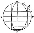
 Geography. Projections of the sphere, and common terrestrial globe (13407299923).jpg 1 566 × 2 000; 1,35 MiB
-
 Gujarat in 10th century.jpg 640 × 800; 274 KiB
-
 Gujarat in 12th century.jpg 640 × 640; 277 KiB
-
 Guyou with Tissot's Indicatrices of Distortion.svg 1 600 × 800; 583 KiB
-
 Hammer Retroazimuthal with Tissot's Indicatrices of Distortion.svg 1 600 × 1 600; 605 KiB
-
 Hasslerovo zobrazení.gif 701 × 542; 26 KiB
-
 Hobo-Dyer with Tissot's Indicatrices of Distortion.svg 1 600 × 809; 510 KiB
-

-
 Kaardiprojektsiooni klassid.gif 417 × 218; 22 KiB
-
 KUGSPI-9 Loxodrome.gif 200 × 200; 59 KiB
-
 Křovákovo zobrazení.png 754 × 954; 54 KiB
-
 Layout of Ptolemys 1st Projection.png 2 107 × 1 214; 1 016 KiB
-
 Lee Conformal Projection SW.jpg 2 376 × 2 058; 677 KiB
-
 Lee Tetrahedral (triangular) with Tissot's Indicatrices of Distortion.svg 1 600 × 1 386; 586 KiB
-
 Leonardo-Octant-projection.JPG 800 × 681; 275 KiB
-
 Lossodromia carte nautiche.png 959 × 425; 373 KiB
-
 Map of the Waldseemüller globe in nearly rectangular projection 2.jpg 3 458 × 2 058; 3,74 MiB
-
 Map of the Waldseemüller globe in nearly rectangular projection.jpg 3 458 × 2 058; 4,2 MiB
-
 Map projections (1912) (14760419026).jpg 1 416 × 2 830; 485 KiB
-
Map projections and distortions.webm 5 min 4 s, 1 920 × 1 080; 12,34 MiB
-
 Map Region Morocco.jpg 1 156 × 1 166; 359 KiB
-
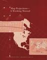 MapProjections AWorkingManual.pdf 1 291 × 1 668, 397 puslapiai; 21,43 MiB
-
 MapProjectionsUsedByUSGS.pdf 833 × 1 350, 330 puslapių; 6,43 MiB
-
 Mathematical cartography logo.svg 485 × 390; 3 KiB
-
 Meridian convergence and spehrical excess.png 615 × 598; 13 KiB
-
 Meridian convergence and spehrical excess.svg 769 × 747; 66 KiB
-
 Meyers b10 s0457 b1.png 322 × 158; 9 KiB
-
 Meyers b10 s0457 b2.png 156 × 353; 14 KiB
-
 Meyers b10 s0457 b3.png 233 × 247; 12 KiB
-
 Meyers b10 s0458 b1.png 147 × 145; 3 KiB
-
 Meyers b10 s0458 b2.png 120 × 115; 3 KiB
-
 Meyers b10 s0458 b3.png 221 × 179; 8 KiB
-
 Meyers b10 s0458 b4.png 362 × 142; 11 KiB
-
 Meyers b10 s0459 b1.png 120 × 145; 3 KiB
-
 Morocco map (orthographic projection).png 1 920 × 1 920; 880 KiB
-
 National Atlas Projection.gif 260 × 136; 13 KiB
-
 Netzentwuerfe.png 797 × 2 161; 242 KiB
-
 Newsmap - Maps are not true for all purposes.jpg 3 000 × 2 234; 498 KiB
-
 Ortogonaalne ja tsentraalne (gnomooniline) projitseerimisviis.gif 500 × 131; 6 KiB
-
 Ortograafiline ekvatoriaalprojektsioon moondeellipsitega.png 503 × 503; 96 KiB
-
 Ortograafiline kaldprojektsioon moondeellipsitega.png 503 × 503; 152 KiB
-
 Ortograafiline polaarprojektsioon moondeellipsitega.png 503 × 503; 159 KiB
-
 Paralelos e Meridianos.jpg 531 × 319; 49 KiB
-
 Philbrick-sinu-mollweide-uninterrupted.jpg 1 008 × 542; 215 KiB
-
 Planisfeer - vertekening Orion.jpg 767 × 500; 652 KiB
-
 Polykonické zobrazení.gif 564 × 370; 28 KiB
-
 Position of map axis.png 681 × 651; 12 KiB
-
 Probh.png 704 × 196; 203 KiB
-
 Projection (PSF).png 2 475 × 1 863; 1,97 MiB
-
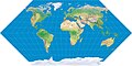
 Projection AuthaGraph.png 2 280 × 990; 2,99 MiB
-
 Proyecciones portulanos.png 720 × 400; 96 KiB
-
 Ptolemaic projections.png 2 112 × 2 418; 1,93 MiB
-
 Layout of Ptolemys 2nd Projection.png 2 107 × 1 221; 961 KiB
-
 Qiuxinzhengzhoufangweitouying.png 600 × 600; 41 KiB
-
 Rhumbs and great circles on Mercator.svg 300 × 214; 96 KiB
-
 Scottish geographical magazine (1885) (14596594870).jpg 1 826 × 1 786; 678 KiB
-
 Scottish geographical magazine (1885) (14596788867).jpg 2 116 × 1 352; 326 KiB
-
 Scottish geographical magazine (1885) (14780943154).jpg 1 962 × 2 906; 523 KiB
-
 Sima Anandapur 20240130 010627 Maps.jpg 719 × 923; 463 KiB
-
 Sima Anandapur https---maps.app.goo.gl-qndkYNgzw6XqhzTz5.jpg 719 × 912; 431 KiB
-
 Small circle.png 150 × 139; 27 KiB
-
 Small circle.svg 150 × 139; 9 KiB
-
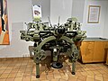 Statens Kartverk Hønefoss (kartmuseet) - WILD A8 stereautograf, innkjøpt 1971 av Kartverket.jpg 4 032 × 3 024; 3,27 MiB
-
 Stereograafiline ja perspektiivne projektsioon.gif 500 × 141; 8 KiB
-
 Stereograafiline projektsioon erinevates aspektides.png 558 × 777; 168 KiB
-
 Stereograafiline projektsioon polaar.png 862 × 859; 697 KiB
-
 Taipei centered azimuthal equidistant projection.gif 4 000 × 4 000; 2,35 MiB
-

-

-
 Tobler Hyperelliptical with Tissot's Indicatrices of Distortion.svg 1 600 × 800; 598 KiB
-
 Two-point Equidistant with Tissot's Indicatrices of Distortion.svg 1 600 × 1 545; 616 KiB
-
 Térképvetületek.jpg 966 × 682; 128 KiB
-
Unfolding the Earth.ogv 1 min 18 s, 480 × 360; 4,57 MiB
-
 Vetületek.jpg 1 755 × 2 268; 160 KiB
-
 Visionscarto-bertin1953.svg 700 × 475; 716 KiB
-
 Waterman projection (Pacific centered).jpg 3 000 × 2 029; 1,87 MiB
-
 Webster's home, school and office dictionary (1916) (14591237757).jpg 3 136 × 2 380; 1,9 MiB
-
 Yukon EPSG 3410.svg 512 × 117; 399 KiB
-
 Zobrazovací rovnice.jpg 309 × 98; 19 KiB
-
 Česká republika, Křovák.png 3 110 × 1 791; 40 KiB
-
 特許図版 図4.jpg 669 × 630; 41 KiB
-
 特許図版 図5.jpg 669 × 661; 26 KiB
-
 特許図版 図14.jpg 747 × 669; 135 KiB
.jpg)
.jpg)
.jpg)
.jpg)
.jpg)
.jpg)
%27_(11245672816).jpg)
.jpg)
.jpg)
.jpg)
.jpg)
.jpg)
.jpg)
.jpg)
%27_(11235461505).jpg)
.jpg)
.jpg)
.jpg)
.jpg)
.jpg)
.jpg)


_(18226862830).jpg)


_periegesis_(sic),_-_Dionysii_mundi_descriptio_Stephano_interprete_Fleuron_T145303-1.png)


.jpg)


_with_Tissot%27s_Indicatrices_of_Distortion.svg)


_(14760419026).jpg)


.png)


.png)


_(14596594870).jpg)
_(14596788867).jpg)
_(14780943154).jpg)


_-_WILD_A8_stereautograf,_innkj%C3%B8pt_1971_av_Kartverket.jpg)


.jpg)
_(14591237757).jpg)


.svg)
_projitseerimisviis.gif)