Category:Mappae mundi
Aller à la navigation
Aller à la recherche
carte du monde médiévale | |||||
| Téléverser des médias | |||||
| Nature de l’élément | |||||
|---|---|---|---|---|---|
| Sous-classe de | |||||
| |||||
Medieval European maps of the world.
Sous-catégories
Cette catégorie comprend 27 sous-catégories, dont les 27 ci-dessous.
B
- Borgia map (4 F)
C
- Catalan round mapamundi (15 F)
- Catalan-Estense World Map (8 F)
- Cosmas Indicopleustes (28 F)
- Cotton Mappa Mundi (9 F)
E
- Ebstorf world map (11 F)
F
G
- Genoese map (7 F)
H
- Hereford Mappa Mundi (1 P, 37 F)
L
M
- Map of Juan de la Cosa (37 F)
- Mappa mundi d'Albi (3 F)
- Mappa mundi of Andrea Bianco (11 F)
P
- Psalter world map London (14 F)
R
- Ravenna Cosmography (5 F)
- Rudimentum novitiorum (7 F)
T
- The Sawley Map (5 F)
V
- Vinland Map (7 F)
W
- Walsperger map (6 F)
- World map of Pietro Vesconte (17 F)
Pages dans la catégorie « Mappae mundi »
Cette catégorie comprend seulement la page ci-dessous.
Média dans la catégorie « Mappae mundi »
Cette catégorie comprend 59 fichiers, dont les 59 ci-dessous.
-
 1250 Arnamagnaeanisches Institut Reykjavik occidente europeo.jpg 878 × 615 ; 52 kio
-
 1250 Arnamagnaeanisches Institut Reykjavik.jpg 2 301 × 1 772 ; 624 kio
-
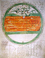
 A map of the world - Latin Psalter (13th-15th C), f.9 - BL Add MS 28681.jpg 1 202 × 1 574 ; 996 kio
-
 1420 Sallust de Geneve.jpg 1 139 × 1 118 ; 170 kio
-
 1420 Salustio de Ginebra Peninsula Iberica.jpg 995 × 640 ; 62 kio
-

-

-

-
 T.V.(1857) - (2) MAPA DEL MUNDO CONOCIDO DE LOS ANTIGUOS.jpg 4 215 × 3 135 ; 5,85 Mio
-
 216 of 'Le Continent austral. Hypothèses et découvertes' (11127566875).jpg 935 × 906 ; 146 kio
-
 217 of 'Le Continent austral. Hypothèses et découvertes' (11128364005).jpg 1 005 × 1 001 ; 164 kio
-
 218 of 'Le Continent austral. Hypothèses et découvertes' (11302342224).jpg 1 275 × 992 ; 152 kio
-
-
 41 of 'Le Continent austral. Hypothèses et découvertes' (11129178023).jpg 1 022 × 1 021 ; 162 kio
-

-
 45 of 'Le Continent austral. Hypothèses et découvertes' (11302329793).jpg 1 132 × 1 138 ; 208 kio
-
 A junk or jong in the Arabian Sea, from Catalan Atlas.jpg 811 × 857 ; 418 kio
-
 Atlas of Battista Agnese WDL7336.pdf 2 737 × 3 750, 17 pages ; 3,33 Mio
-
 Battistero Padova Creazione.jpg 2 100 × 2 124 ; 2,6 Mio
-
 BNF 7478 Latin mappa mundi.jpg 4 442 × 4 826 ; 2,95 Mio
-
 Bodleian Libraries, Mandorla Mappa Mundi.jpg 1 000 × 675 ; 170 kio
-
 Bodleian Libraries, Mappa Mundi.jpg 1 000 × 675 ; 124 kio
-
 Bodleian Libraries, Peter Apian, an armillary sphere and a zonal Mappa Mundi.jpg 1 000 × 675 ; 185 kio
-
 CamposantoPisa Cosmographia detalle mapamundi.jpg 2 448 × 3 264 ; 1,18 Mio
-
 Carta generale del mondo conoscito dagli antichi.jpg 2 898 × 1 890 ; 3,76 Mio
-
 Carte du monde connu.jpg 1 778 × 2 676 ; 1,23 Mio
-
 Caserta-reggia-fresco.jpg 1 552 × 1 026 ; 892 kio
-
 ClippedToWorldMap Zekeriya-Kazvinî Acaib-ül-Mahlûkat 1553.jpg 321 × 320 ; 59 kio
-
 Compendium of Cosmography WDL7337.pdf 3 177 × 3 750, 27 pages ; 4,89 Mio
-
 Explication de la mappemonde. - Phisique, politique & mathématique; (IA explicationdelam00deni).pdf 1 254 × 2 018, 42 pages ; 5,75 Mio
-
-
 Fragmento de mapamundi (Atlas Miller).jpg 4 112 × 3 088 ; 7,44 Mio
-
 Galiza no mapa-mundi do Liber Floridus de Lambert of Saint-Omer (c. 1120).jpg 318 × 267 ; 139 kio
-
 Giovanni di Paolo Terra Cieli.jpg 2 498 × 2 552 ; 3,26 Mio
-
 Ibn al Wardi's atlas.jpg 1 000 × 665 ; 429 kio
-
 Ibn Howqal World map.jpg 460 × 473 ; 189 kio
-
 Ibn Wardi mappa mundi.jpeg 720 × 569 ; 88 kio
-
 Imago Mundi de Honorius of Autum (editado por Henry of Mainz) 1190.PNG 1 270 × 1 859 ; 5,28 Mio
-
 Jong (Javanese junk), Java island, and other Indonesian islands in Catalan atlas.jpg 1 345 × 845 ; 714 kio
-
 Liber Floridus 1120 Peuples p42.png 504 × 596 ; 608 kio
-
 Macrobius, mappa mundi.jpg 528 × 544 ; 40 kio
-
 Map of Leardo (Galizia).png 1 920 × 938 ; 5,3 Mio
-
 Mapa-mundi do Liber Floridus de Lambert of Saint-Omer (c. 1120).jpg 1 722 × 1 298 ; 3,35 Mio
-
 Mapa-múndi islandês (séc. XIII).jpg 7 287 × 5 419 ; 9,44 Mio
-
 Mappa Mundi 2 from Bede, De natura rerum.jpg 1 285 × 1 330 ; 634 kio
-
 Mappa Mundi from Bede, De natura rerum.jpg 675 × 1 000 ; 230 kio
-
 Mappamundi WDL6763.png 7 117 × 8 819 ; 71,2 Mio
-
 Mappemonde Fleury.jpg 1 976 × 2 528 ; 1 021 kio
-
 Michelangelo Caetani, Overview of the Divine Comedy, 1855 Cornell CUL PJM 1071 01.jpg 4 748 × 6 391 ; 5,64 Mio
-
 MillerAtlas - Feuille 1 r° Hémisphère portugais.jpg 14 240 × 10 144 ; 74,63 Mio
-
 Planisfero terre emerse 1459 - Sala Creazione di Palazzo Besta - Teglio.jpg 1 090 × 637 ; 308 kio
-
 Ravenna mappa mundi, c.650.jpg 2 926 × 3 130 ; 3,12 Mio
-
 Stanza della Segnatura - Globo celeste.png 2 098 × 1 828 ; 7,55 Mio
-
 The mid 15th-century Catalan centered on Jerusalem.jpg 700 × 700 ; 190 kio
-
 The voyage of the Vega round Asia and Europe (Page 513) BHL11186067.jpg 2 044 × 3 248 ; 676 kio
-
 World map intermediate between T-O and mappa mundi.jpg 3 473 × 3 696 ; 4,17 Mio
-
 World map ranulf higden.jpg 1 923 × 2 610 ; 3,96 Mio
-
 Zeitzer Weltkarte.jpg 8 536 × 9 200 ; 24,79 Mio
-
 Zodiac by Battista Agnese.jpg 600 × 605 ; 221 kio


,_f.9_-_BL_Add_MS_28681.jpg)


_vol._1%27_(11093365125).jpg)
_vol._1%27_(11245111556).jpg)
%27_(11134189723).jpg)
_-_(2)_MAPA_DEL_MUNDO_CONOCIDO_DE_LOS_ANTIGUOS.jpg)
.jpg)
.jpg)
.jpg)
.jpg)
.jpg)
.jpg)
.jpg)


.jpg)
.jpg)


_1190.PNG)
,_Java_island,_and_other_Indonesian_islands_in_Catalan_atlas.jpg)


.png)
.jpg)
.jpg)


_BHL11186067.jpg)


