Category:Mappae mundi
Pereiti į navigaciją
Jump to search
medieval European map of the world | |||||
| Įkelti mediją | |||||
| Tai yra | |||||
|---|---|---|---|---|---|
| Poklasis | |||||
| |||||
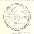
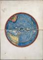
Medieval European maps of the world.
Subkategorijos
Rodomos 27 subkategorijos (iš viso yra 27 subkategorijos).
B
- Borgia map (11 F)
C
- Catalan round mapamundi (15 F)
- Catalan-Estense World Map (8 F)
- Cosmas Indicopleustes (28 F)
- Cotton Mappa Mundi (9 F)
E
- Ebstorf world map (11 F)
F
- Fake Vinland Maps (7 F)
G
- Genoese map (7 F)
H
- Hereford Mappa Mundi (1 P, 37 F)
L
M
- Map of Juan de la Cosa (38 F)
- Mappa mundi d'Albi (3 F)
- Mappa mundi of Andrea Bianco (11 F)
P
- Psalter world map London (14 F)
R
- Ravenna Cosmography (5 F)
- Rudimentum novitiorum (7 F)
T
- The Sawley Map (5 F)
W
- Walsperger map (6 F)
- World map of Pietro Vesconte (17 F)
Puslapiai kategorijoje „Mappae mundi“
Šioje kategorijoje yra vienas puslapis.
Daugialypės terpės rinkmenos kategorijoje „Mappae mundi“
Rodomi 59 šios kategorijos rinkmenos (iš viso kategorijoje yra 59 rinkmenos).
-
 1250 Arnamagnaeanisches Institut Reykjavik occidente europeo.jpg 878 × 615; 52 KiB
-
 1250 Arnamagnaeanisches Institut Reykjavik.jpg 2 301 × 1 772; 624 KiB
-
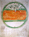
 A map of the world - Latin Psalter (13th-15th C), f.9 - BL Add MS 28681.jpg 1 202 × 1 574; 996 KiB
-
 1420 Sallust de Geneve.jpg 1 139 × 1 118; 170 KiB
-
 1420 Salustio de Ginebra Peninsula Iberica.jpg 995 × 640; 62 KiB
-

-

-

-
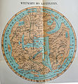
 T.V.(1857) - (2) MAPA DEL MUNDO CONOCIDO DE LOS ANTIGUOS.jpg 4 215 × 3 135; 5,85 MiB
-
 216 of 'Le Continent austral. Hypothèses et découvertes' (11127566875).jpg 935 × 906; 146 KiB
-
 217 of 'Le Continent austral. Hypothèses et découvertes' (11128364005).jpg 1 005 × 1 001; 164 KiB
-
 218 of 'Le Continent austral. Hypothèses et découvertes' (11302342224).jpg 1 275 × 992; 152 KiB
-
-
 41 of 'Le Continent austral. Hypothèses et découvertes' (11129178023).jpg 1 022 × 1 021; 162 KiB
-

-
 45 of 'Le Continent austral. Hypothèses et découvertes' (11302329793).jpg 1 132 × 1 138; 208 KiB
-
 A junk or jong in the Arabian Sea, from Catalan Atlas.jpg 811 × 857; 418 KiB
-
 Atlas of Battista Agnese WDL7336.pdf 2 737 × 3 750, 17 puslapių; 3,33 MiB
-
 Battistero Padova Creazione.jpg 2 100 × 2 124; 2,6 MiB
-
 BNF 7478 Latin mappa mundi.jpg 4 442 × 4 826; 2,95 MiB
-
 Bodleian Libraries, Mandorla Mappa Mundi.jpg 1 000 × 675; 170 KiB
-
 Bodleian Libraries, Mappa Mundi.jpg 1 000 × 675; 124 KiB
-
 Bodleian Libraries, Peter Apian, an armillary sphere and a zonal Mappa Mundi.jpg 1 000 × 675; 185 KiB
-
 CamposantoPisa Cosmographia detalle mapamundi.jpg 2 448 × 3 264; 1,18 MiB
-
 Carta generale del mondo conoscito dagli antichi.jpg 2 898 × 1 890; 3,76 MiB
-
 Carte du monde connu.jpg 1 778 × 2 676; 1,23 MiB
-
 Caserta-reggia-fresco.jpg 1 552 × 1 026; 892 KiB
-
 ClippedToWorldMap Zekeriya-Kazvinî Acaib-ül-Mahlûkat 1553.jpg 321 × 320; 59 KiB
-
 Compendium of Cosmography WDL7337.pdf 3 177 × 3 750, 27 puslapiai; 4,89 MiB
-
 Explication de la mappemonde. - Phisique, politique & mathématique; (IA explicationdelam00deni).pdf 1 254 × 2 018, 42 puslapiai; 5,75 MiB
-
-
 Fragmento de mapamundi (Atlas Miller).jpg 4 112 × 3 088; 7,44 MiB
-
-
 Giovanni di Paolo Terra Cieli.jpg 2 498 × 2 552; 3,26 MiB
-
 Ibn al Wardi's atlas.jpg 1 000 × 665; 429 KiB
-
 Ibn Howqal World map.jpg 460 × 473; 189 KiB
-
 Ibn Wardi mappa mundi.jpeg 720 × 569; 88 KiB
-
 Imago Mundi de Honorius of Autum (editado por Henry of Mainz) 1190.PNG 1 270 × 1 859; 5,28 MiB
-
 Jong (Javanese junk), Java island, and other Indonesian islands in Catalan atlas.jpg 1 345 × 845; 714 KiB
-
 Liber Floridus 1120 Peuples p42.png 504 × 596; 608 KiB
-
 Macrobius, mappa mundi.jpg 528 × 544; 40 KiB
-
 Map of Leardo (Galizia).png 1 920 × 938; 5,3 MiB
-
 Mapa-mundi do Liber Floridus de Lambert of Saint-Omer (c. 1120).jpg 1 722 × 1 298; 3,35 MiB
-
 Mapa-múndi islandês (séc. XIII).jpg 7 287 × 5 419; 9,44 MiB
-
 Mappa Mundi 2 from Bede, De natura rerum.jpg 1 285 × 1 330; 634 KiB
-
 Mappa Mundi from Bede, De natura rerum.jpg 675 × 1 000; 230 KiB
-
 Mappamundi WDL6763.png 7 117 × 8 819; 71,2 MiB
-
 Mappemonde Fleury.jpg 1 976 × 2 528; 1 021 KiB
-
 Michelangelo Caetani, Overview of the Divine Comedy, 1855 Cornell CUL PJM 1071 01.jpg 4 748 × 6 391; 5,64 MiB
-
 MillerAtlas - Feuille 1 r° Hémisphère portugais.jpg 14 240 × 10 144; 74,63 MiB
-
 Planisfero terre emerse 1459 - Sala Creazione di Palazzo Besta - Teglio.jpg 1 090 × 637; 308 KiB
-
 Ravenna mappa mundi, c.650.jpg 2 926 × 3 130; 3,12 MiB
-
 Stanza della Segnatura - Globo celeste.png 2 098 × 1 828; 7,55 MiB
-
 The mid 15th-century Catalan centered on Jerusalem.jpg 700 × 700; 190 KiB
-
 The voyage of the Vega round Asia and Europe (Page 513) BHL11186067.jpg 2 044 × 3 248; 676 KiB
-
 World map intermediate between T-O and mappa mundi.jpg 3 473 × 3 696; 4,17 MiB
-
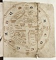
 World map ranulf higden.jpg 1 923 × 2 610; 3,96 MiB
-
 Zeitzer Weltkarte.jpg 8 536 × 9 200; 24,79 MiB
-
 Zodiac by Battista Agnese.jpg 600 × 605; 221 KiB


,_f.9_-_BL_Add_MS_28681.jpg)


_vol._1%27_(11093365125).jpg)
_vol._1%27_(11245111556).jpg)
%27_(11134189723).jpg)
_-_(2)_MAPA_DEL_MUNDO_CONOCIDO_DE_LOS_ANTIGUOS.jpg)
.jpg)
.jpg)
.jpg)
.jpg)
.jpg)
.jpg)
.jpg)


.jpg)
.jpg)


_1190.PNG)
,_Java_island,_and_other_Indonesian_islands_in_Catalan_atlas.jpg)


.png)
.jpg)
.jpg)


_BHL11186067.jpg)


