Category:Maps of Europe under Nazi occupation
Vai alla navigazione
Vai alla ricerca
territorio europeo occupato dalle forze militari dell'Asse  | |||||
| Carica un file multimediale | |||||
| Istanza di |
| ||||
|---|---|---|---|---|---|
| Data di inizio |
| ||||
| Data di fine |
| ||||
| |||||
Sottocategorie
Questa categoria contiene un'unica sottocategoria, indicata di seguito.
C
- Maps of Czechoslovakia (1939) (28 F)
File nella categoria "Maps of Europe under Nazi occupation"
Questa categoria contiene 23 file, indicati di seguito, su un totale di 23.
-
 2svitovavijnamapa.jpg 1 090 × 1 000; 659 KB
-
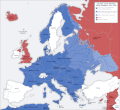
 Europa bajo la Alemania nazi.png 1 088 × 998; 261 KB
-
 Europe under Nazi domination zh hans.png 1 088 × 998; 241 KB
-
 Europe under Nazi domination zh hant.png 1 088 × 998; 237 KB
-
 Europe under Nazi domination-el.png 1 088 × 998; 182 KB
-
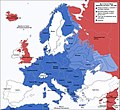
 Europe under Nazi domination.png 1 088 × 998; 187 KB
-
 Europe, 1942.svg 519 × 488; 617 KB
-
 Flag Map Of Germany Nazi (Version1).svg 512 × 518; 107 KB
-
 Flag Map Of Germany Nazi (Version2).svg 512 × 511; 76 KB
-
 Flag Map Of Third Reich Occupied Europe.png 1 930 × 2 002; 431 KB
-
 Occupational Zones of Nazi Germany (Zoomed Wikipedia Map).png 1 425 × 625; 47 KB
-
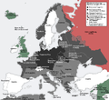
 Second world war europe 1941-1942 map de.png 1 090 × 1 000; 161 KB
-
 Second world war europe 1941-1942 map it.gif 1 090 × 1 000; 108 KB
-
 Sweden locator map 1942.svg 450 × 456; 481 KB
-
 Victorious Nazi Germany.png 737 × 546; 185 KB
-
 World War II in Europe, 1942 (Korean).svg 519 × 488; 671 KB
-
 World War II in Europe, 1942 (no labels).svg 519 × 488; 620 KB
-
 World War II in Europe, 1942-es.svg 519 × 488; 1,68 MB
-
 World War II in Europe, 1942-pt.svg 519 × 488; 676 KB
-
 World War II in Europe, 1942-vi.svg 519 × 488; 676 KB
-
 World War II in Europe, 1942-zh.svg 519 × 488; 665 KB
-
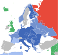
 World War II in Europe, 1942.svg 519 × 488; 674 KB
-
 WWII Occupied Europe Blank Map.png 1 088 × 998; 200 KB


.svg)
.svg)

.png)


.svg)
.svg)


