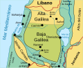
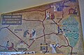
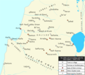
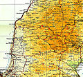
Category:Maps of Galilee
Zur Navigation springen
Zur Suche springen
Wikimedia-Kategorie | |||||
| Medium hochladen | |||||
| Ist ein(e) | |||||
|---|---|---|---|---|---|
| Kategorie kombiniert die Themen | |||||
| Galiläa | |||||
Gebiet im Norden Israel  Галилея, ок. 50 года | |||||
| Ist ein(e) | |||||
| Ist Teil von | |||||
| Ort | Nordbezirk, Israel | ||||
| Besteht aus | |||||
| Schlüsselereignis |
| ||||
| Höchster Punkt | |||||
 | |||||
Unterkategorien
Es werden 3 von insgesamt 3 Unterkategorien in dieser Kategorie angezeigt:
In Klammern die Anzahl der enthaltenen Kategorien (K), Seiten (S), Dateien (D)
A
M
O
Medien in der Kategorie „Maps of Galilee“
Folgende 48 Dateien sind in dieser Kategorie, von 48 insgesamt.
-
 7villages.svg 900 × 600; 144 KB
-
 Betzet Map.png 2.900 × 686; 90 KB
-
 C+B-Galilee-Map.JPG 1.131 × 1.600; 718 KB
-
 Cana Where.png 4.549 × 2.049; 26,71 MB
-
 DeganiaRegion.png 1.048 × 1.034; 82 KB
-
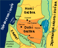 Dolní Galilea.svg 600 × 493; 32 KB
-
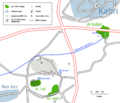
 Falls map 21.jpeg 1.595 × 1.220; 531 KB
-
 Falls Map 21det.jpeg 2.408 × 3.446; 1,4 MB
-
 Gader-hatzafon2.svg 1.200 × 1.100; 173 KB
-
 Galilee he.svg 600 × 493; 37 KB
-
 Galilee-AR.svg 1.353 × 1.412; 1,7 MB
-
 Galilee-He.svg 1.353 × 1.412; 1,69 MB
-
 GalileeAR.png 775 × 624; 117 KB
-
 GalileeAR.svg 783 × 640; 237 KB
-
 Galiläa Karte.png 2.493 × 2.048; 968 KB
-
 Hazor-map.jpg 4.233 × 3.565; 7,57 MB
-
 Horní Galilea.svg 600 × 493; 30 KB
-
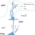 HulaHebrew (cropped).png 489 × 489; 59 KB
-
 HulaHebrew.png 489 × 810; 88 KB
-
 HulaHebrew.svg 534 × 855; 124 KB
-
 Israel map-B85.png 497 × 332; 21 KB
-
 Israel-1er-juin-1948-detail-galilee.png 450 × 293; 101 KB
-
 Jezreel Valley 2.jpg 1.575 × 1.102; 785 KB
-
 Jizre'elské údolí.svg 550 × 551; 26 KB
-
 Lower Galilee Cana marks.jpg 2.508 × 1.680; 3,78 MB
-
 Lower Galilee map-es.svg 600 × 493; 233 KB
-
 Lower Galilee map.svg 2.493 × 2.048; 595 KB
-
 Map of galilee en.png 1.015 × 837; 82 KB
-
 Map of galilee mo.png 1.015 × 837; 78 KB
-
 Map of Galilee.svg 512 × 512; 18 KB
-
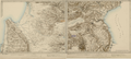
 Nazareth Karte von Galiläa.JPG 4.530 × 2.984; 5,74 MB
-
 Northern Palestine under the Zaydans.png 1.226 × 1.084; 203 KB
-
 Operation Hiram.jpg 1.315 × 1.223; 2,76 MB
-

-

-
 Ghadschar.png 759 × 591; 286 KB
-
 SNS Galilée.png 958 × 819; 278 KB
-
 TelKabriRegion.png 1.002 × 862; 58 KB
-
 TiberiasRegion1870s.jpg 1.299 × 934; 436 KB
-
 Tochnit hamizpim 2.jpg 3.000 × 2.766; 715 KB
-
 Israel outline northwest.png 520 × 320; 41 KB
-
 Western galilee.png 610 × 738; 103 KB
-
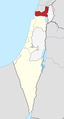
 Israel outline northern Acre.png 520 × 320; 16 KB
-
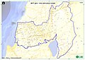
 WV Lower Galilee region in Israel.png 613 × 1.140; 84 KB
-
 WV Upper Galilee region in Israel.png 613 × 1.140; 82 KB
-
 Yiftah.GIF 357 × 195; 7 KB
-
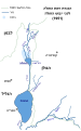
 מרום הגליל.jpg 1.269 × 898; 154 KB
-
 רכבת העמק.jpg 1.653 × 1.181; 189 KB


.png)


_(14586885740).jpg)
_(14770454371).jpg)


