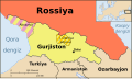
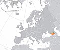
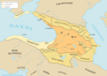
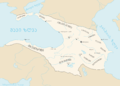
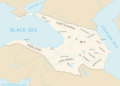
Category:Maps of Georgia
Irez a navigado
Irez a serchilo
Landoj de Eŭropo: Albania · Andora · Armenia‡ · Azerbaijan‡ · Austria · Belgia · Bielorusia · Bosnia e Herzegovina · Bulgaria · Chekia · Dania · Estonia · Finlando · Francia‡ · Germania · Grekia · Hispania‡ · Hungaria · Republiko di Irlando · Islando · Italia · Kazakstan‡ · Gruzia‡ · Chipro‡ · Kroatia · Latvia · Liechtenstein · Lituania · Luxemburgia · Malta · Moldova · Monako · Montenegro · Nederlando‡ · Republiko Norda-Macedonia · Norvegia · Polonia · Portugal‡ · Rumania · Rusia‡ · San-Marino · Serbia · Slovakia · Slovenia · Suedia · Suisia · Turkia‡ · Ukraina · Unionita Rejio · Vatikano
Specifa statuso: Akrotiri and Dhekelia‡ · Faero · Guernsey · Jersey · Gibraltar · Man-Insulo · Svalbard – Limigita rekono: Abkhazia‡ · Gagauzia · Kosovo · Sud-Osetia‡ · Transdnistria · Turkiana republiko di nordala Chipro‡ · UN Buffer Zone in Cyprus‡
‡: parte en Eŭropo
Specifa statuso: Akrotiri and Dhekelia‡ · Faero · Guernsey · Jersey · Gibraltar · Man-Insulo · Svalbard – Limigita rekono: Abkhazia‡ · Gagauzia · Kosovo · Sud-Osetia‡ · Transdnistria · Turkiana republiko di nordala Chipro‡ · UN Buffer Zone in Cyprus‡
‡: parte en Eŭropo
kategorio en Vikimedio | |||||
| Sendez 'media' | |||||
| Esas | |||||
|---|---|---|---|---|---|
| Kategorio kombinas temojn | |||||
 | |||||
Subkategorii
Ica kategorio havas la sequanta 34 subkategorii, ek 34.
*
A
B
C
D
E
F
G
H
L
- Linguistic maps of Georgia (14 D)
M
- Maps of Georgia by decade (empty)
- Military maps of Georgia (6 D)
O
- OpenStreetMap maps of Georgia (19 D)
P
- Physical maps of Georgia (4 D)
R
S
T
Artikli en la kategorio "Maps of Georgia"
La sequanta 2 pagini es en ica kategorio, ek 2.
"Media" en kategorio "Maps of Georgia"
La sequanta 130 arkivi es en ica kategorio, ek 130.
-
 20220121 DM Overview2021 repatriation v2.pdf 1 754 × 1 239; 757 KB
-
 3Ge2020.jpg 1 920 × 1 080; 419 KB
-
 Administrative Map of Georgia.jpg 2 336 × 1 274; 656 KB
-
 Areas Map of Georgia ibericus.jpg 1 920 × 1 020; 1,42 MB
-
 Areas Map of Georgia lafertei.jpg 1 920 × 1 134; 1,47 MB
-
 Areas Map of Georgia Martviliensis.jpg 1 920 × 1 116; 1,48 MB
-
 Areas Map of Georgia mellyi.jpg 1 920 × 1 020; 1,42 MB
-
 Areas Map of Georgia prunierianus.jpg 1 920 × 1 020; 1,42 MB
-
 Areas Map of Georgia schaudoirianus.jpg 1 920 × 1 020; 1,41 MB
-
 Areas Map of Georgia szekelyi.jpg 1 920 × 1 020; 1,42 MB
-
 Areas Map of Georgia titarenkoi correct.jpg 1 920 × 1 116; 687 KB
-
 Areas Map of Georgia titarenkoi.jpg 1 920 × 1 116; 1,48 MB
-
 Argonauts Georgia 1988.jpg 744 × 750; 57 KB
-
 Armenianhighlandorg.png 700 × 472; 138 KB
-
 Avnevi.png 480 × 360; 7 KB
-

-
 Bolinisinin xəritəsi.jpg 877 × 737; 393 KB
-
 Cat123456.png 560 × 300; 19 KB
-
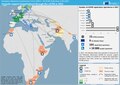
 Caucasus envsec baseb.png 1 439 × 1 027; 706 KB
-
 Caucasus regions map svenska.svg 2 006 × 1 618; 271 KB
-
 Circassia in 1750.png 800 × 533; 138 KB
-
 Colored Map of Georgia (Country).png 5 427 × 4 112; 873 KB
-
 Coverage map of Magticom 2020.jpg 3 716 × 1 964; 4,4 MB
-
 Duchy of Aragvi.svg 723 × 1 565; 544 KB
-
 ECDM 20150615 World.pdf 1 625 × 1 125; 802 KB
-
 ECHO Caucasus Central Asia Editable A4 Landscape.pdf 1 754 × 1 239; 576 KB
-
 ECHO Caucasus Central Asia Editable A4 Landscape.png 1 123 × 794; 541 KB
-
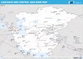
 ECHO Southern Caucasus BaseMap A4 Landscape.png 3 509 × 2 481; 394 KB
-
 Europe Georgia.svg 2 045 × 1 720; 2,69 MB
-
 Europe location GEO3.png 810 × 769; 66 KB
-
 Europe-Georgia.svg 2 045 × 1 720; 2,7 MB
-
 Evex hospital map.jpg 1 716 × 1 084; 191 KB
-
 FLII Georgia.png 1 707 × 868; 970 KB
-
 Ge 1000.png 681 × 600; 70 KB
-
 Ge 1010.png 725 × 600; 76 KB
-
 Ge 700.png 813 × 600; 79 KB
-
 Ge 800.png 782 × 600; 78 KB
-
 Ge 900.png 777 × 600; 78 KB
-
 Ge iberia.png 320 × 220; 14 KB
-
 General map of Georgia and Armenia.jpg 3 508 × 2 571; 1,35 MB
-
 Georgia administrative map-fr.svg 707 × 385; 1,14 MB
-
 Georgia (Colchis Iberia) (cropshd).png 315 × 160; 108 KB
-
 Georgia (country) Black Sea basin, West Georgia, Colchis.png 1 714 × 912; 229 KB
-
 Georgia - DPLA - 7cda5902fc88d1915ca9497ae7d168a5.jpg 2 560 × 3 280; 4,24 MB
-
 Georgia - DPLA - b56dc6446d53c9717a8f9dc6bcc6e9c0.jpg 2 556 × 3 272; 6,75 MB
-
 Georgia administrative map-ru.svg 707 × 385; 1,08 MB
-
 Georgia as wine producing country.jpg 1 135 × 749; 181 KB
-
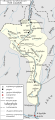
 Georgia Base Map.png 1 097 × 695; 298 KB
-
 Georgia before August 2008 (ka).svg 1 715 × 913; 1,63 MB
-
 Georgia before August 2008.svg 1 715 × 913; 249 KB
-
 Georgia Blank Map (de facto borders).png 4 096 × 2 063; 590 KB
-
 Georgia disputed w1 countrymap.svg 1 000 × 1 000; 15 KB
-
 Georgia GHI Solar-resource-map GlobalSolarAtlas World-Bank-Esmap-Solargis.png 1 842 × 1 479; 1,43 MB
-
 Georgia high detail map.png 2 529 × 1 872; 340 KB
-
 Georgia in 1762.svg 1 024 × 738; 1,35 MB
-
 Georgia map in a Rustaveli Av underpass, Tbiiisi.jpg 4 032 × 3 024; 2,42 MB
-
 Georgia post 961x.png 750 × 1 044; 492 KB
-
 Georgia protected areas 2.jpg 2 560 × 1 359; 3,63 MB
-

-
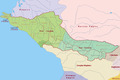
 Georgia regions map.png 800 × 543; 105 KB
-
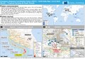
 Georgia — Location Map (2013) - GEO - UNOCHA (Turkish).png 1 027 × 1 024; 244 KB
-
 Georgia, Ossetia, Russia and Abkhazia (bn).svg 676 × 400; 118 KB
-
 Georgia, Ossetia, Russia and Abkhazia (uz).svg 676 × 400; 619 KB
-
 Georgia-Chechnya.jpg 1 426 × 1 199; 356 KB
-
 Georgian empire with tributaries.png 1 976 × 1 419; 413 KB
-
 Georgian empire-ka.png 1 974 × 1 418; 426 KB
-
 Georgian empire.png 1 974 × 1 418; 420 KB
-
 Georgian hierarchy.png 1 169 × 1 399; 282 KB
-
 Georgian kingdoms map.png 312 × 192; 7 KB
-
 Georgian regions by GDP per capita in 2022 (GEL).png 1 200 × 722; 64 KB
-
 Georgian regions by HDI 2021.png 1 136 × 722; 50 KB
-
 Georgian Sub-groups Satellite Map.jpg 1 427 × 798; 779 KB
-
 GeorgianKingdomDuchyOfJavakheti.png 1 907 × 1 228; 254 KB
-
 Gruzia.png 810 × 769; 67 KB
-
 Gruzie.png 810 × 769; 69 KB
-
 Gürcistan Azerileri Ve Oranları.png 6 360 × 3 002; 451 KB
-
 Imereti kingdom map 1737.jpg 1 888 × 4 382; 3,21 MB
-
 Imereti kingdom map 1738.jpg 3 173 × 9 543; 13,32 MB
-
 IranAndNeighbours.png 538 × 316; 11 KB
-
 Kartli in XVI-XVIIIth c..png 4 000 × 5 080; 2,15 MB
-
 Kingdom of Georgia after dissolution as a unified state, 1490 AD-es.svg 985 × 650; 1,23 MB
-
 Kingdom of Georgia after dissolution as a unified state, 1490 AD.he.svg 923 × 609; 1,13 MB
-
 Kingdom of Georgians (Tao-Klarjeti), X c.jpg 1 882 × 2 379; 1,92 MB
-
 Language families of Caucasus (Armenian).png 2 376 × 1 649; 375 KB
-
 Language families of Caucasus-ka.svg 563 × 390; 475 KB
-
 Language families of Caucasus.svg 563 × 390; 475 KB
-
 Laz and georgian people.jpg 2 587 × 1 854; 1,82 MB
-
 Lazika arm.png 298 × 174; 4 KB
-
 Laziska arm.png 298 × 174; 4 KB
-
 Lazistan Haritası - Map of Lazistan.tif 5 262 × 3 366, 2 pagini; 10,78 MB
-
 Location of Georgian in Europe.png 1 218 × 1 024; 230 KB
-
 LocationGeorgia.svg 1 000 × 500; 2,76 MB
-
 M1.jpg 960 × 678; 113 KB
-
 Machakhela map 1900.jpg 9 101 × 5 743; 48,42 MB
-
 Map of adjara.jpg 6 500 × 4 263; 2,43 MB
-
 Map of the Georgian regions by HDI in 2021.webp 1 072 × 570; 278 KB
-
 Map-of-Georgia-Color.png 800 × 663; 39 KB
-
 Meskheti Map - მესხეთის რუკა - სამცხე-საათაბაგო.jpg 4 352 × 2 979; 4,27 MB
-
 Meskheti map of VIII-X centuries (en).svg 800 × 534; 1,59 MB
-
 Meskheti map of VIII-X centuries (ka).svg 800 × 534; 1,36 MB
-
 Military Administrative division of the Kingdom of Kartli..png 4 000 × 5 080; 2,16 MB
-
 Miniature Georgia.jpg 1 600 × 1 200; 774 KB
-
 PAT - Georgia.gif 975 × 860; 337 KB
-
 Physica Georgiae tabula.png 800 × 426; 526 KB
-
 Plan of old Mtskheta.jpg 1 988 × 1 608; 313 KB
-
 Regional representation.png 1 658 × 988; 1,4 MB
-
 Saapako.png 1 742 × 1 080; 4,92 MB
-
 SamegreloHistorical.png 998 × 533; 68 KB
-
 SCMPD Precincts.jpg 4 224 × 3 264; 2,23 MB
-
 Segonda Guèrra d'Ossetia (2008).png 881 × 502; 170 KB
-
 Sokhumi castle - Imereti kingdom map 1738.jpg 871 × 711; 320 KB
-
 Soviet claims to Turkey in 1945-1953-az.png 1 176 × 980; 115 KB
-
 SOĞANLIQ KƏNDİ XƏRİTƏDƏ.jpg 800 × 1 047; 411 KB
-
 Spruner von Merz, Karl; Menke, Th..jpg 1 280 × 753; 474 KB
-
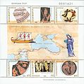
 Stamps of Georgia, 2003-24.jpg 326 × 240; 62 KB
-
 Territorial claims of the Georgian SSR against Turkey, 1946.png 2 967 × 2 500; 842 KB
-
 Un-georgia.png 3 033 × 2 244; 1,44 MB
-
 VAUGONDY GEORGIA MAP.jpg 800 × 519; 219 KB
-
 Vinregioner-georgia-svenska.jpg 1 030 × 693; 84 KB
-
 Watershed divides in Georgia.png 1 280 × 811; 1,39 MB
-
 Zugdidi City Map.jpg 7 874 × 7 480; 4,79 MB
-
 Епархии Грузинской православной церкви.png 1 281 × 878; 56 KB
-
 Историко-географические провинции Грузии..png 2 000 × 1 382; 324 KB
-
 Карта Тбилиси 1834.jpg 994 × 963; 627 KB
-
 Կողքիս Kolkhida arm.png 566 × 599; 44 KB
-
 Վրաստանի վարչական մարզեր.png 1 280 × 681; 229 KB
-
 Քարթվելալեզու պետությունների քարտեզ (hy).svg 790 × 550; 3,81 MB
-
 گرجستان.png 250 × 250; 43 KB
-
 ქ. ზუგდიდი, ზუგდიდის მუნიციპალიტეტი.jpg 1 276 × 1 192; 875 KB
-
 ქალაქი ზუგდიდი, ზუგდიდის მუნიციპალიტეტი.jpg 1 276 × 1 192; 877 KB


_(19742931354).jpg)


.png)


_(cropshd).png)
_Black_Sea_basin,_West_Georgia,_Colchis.png)


.svg)


_-_GEO_-_UNOCHA_(Turkish).png)
.svg)
.svg)


.png)


,_X_c.jpg)
.png)


.svg)
.svg)


.png)


.svg)


.png)