Category:Maps of Livonia
Zur Navigation springen
Zur Suche springen
Wikimedia-Kategorie | |||||
| Medium hochladen | |||||
| Ist ein(e) | |||||
|---|---|---|---|---|---|
| Kategorie kombiniert die Themen | |||||
| Livland | |||||
historische Landschaft im Baltikum  | |||||
| Ist ein(e) | |||||
| Ist Teil von | |||||
 | |||||
Unterkategorien
Diese Kategorie enthält folgende Unterkategorie:
In Klammern die Anzahl der enthaltenen Kategorien (K), Seiten (S), Dateien (D)
O
Medien in der Kategorie „Maps of Livonia“
Folgende 37 Dateien sind in dieser Kategorie, von 37 insgesamt.
-
 Rzeczpospolita2nar.png 3.507 × 2.480; 1,08 MB
-
 1662 Samogetia is Lithuania.jpg 2.908 × 1.772; 1,85 MB
-
 17ct map with current borders of Belarus.jpg 3.968 × 3.363; 4,43 MB
-
 Ancient Estonian counties.png 1.281 × 878; 88 KB
-
 Ancient Estonian counties.svg 1.281 × 878; 221 KB
-
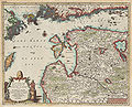
 Blaeu 1645 - Livonia vulgo Lyefland.jpg 3.616 × 3.044; 1,13 MB
-
 Bm04066abm.jpg 640 × 589; 126 KB
-
 Bm04067abm.jpg 640 × 440; 115 KB
-
 Bm05042am.jpg 299 × 480; 57 KB
-
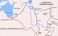
 Campaigns of Stefan Batory (1578-82).png 963 × 603; 112 KB
-
 Carte de la Livonie ou Lifland.jpg 2.198 × 1.985; 5,88 MB
-
 Carte historique de la Lettonie vue à Sigulda.jpg 3.454 × 2.489; 10,24 MB
-
 Cum privilegio.jpg 3.810 × 2.950; 5,66 MB
-
 Der Verrückte des Zaren - Handlungsorte in der Kohlschen Karte von 1841.jpg 2.913 × 2.074; 3,34 MB
-
 Die Hertzogthümer Curland und Liefland.jpg 1.957 × 1.361; 4,24 MB
-
 Ducatuum Livoniae et Curlandiae Nova Tabula, 1705.jpg 4.089 × 3.400; 4,27 MB
-
 FileRzeczpospolita2narkor.png 1.957 × 1.539; 532 KB
-
 Jersika.jpg 655 × 335; 74 KB
-
 Kampania Stefana Batorego (1578-82).png 963 × 603; 122 KB
-
 La Livonie avec les frontieres de Courlande et de Finlande.jpg 2.928 × 2.377; 3,42 MB
-
 Liflyandskaya gubernia.png 916 × 768; 41 KB
-
 Livland 15jh.png 1.000 × 900; 2,23 MB
-
 Livland1560-85.gif 1.890 × 1.370; 183 KB
-
 Livland1585-1710.gif 1.890 × 1.370; 168 KB
-
 Livonia Islande.jpg 945 × 710; 1,05 MB
-
 Livonia Pomerania.jpg 1.093 × 764; 666 KB
-
 Livonia sive Liefland.jpg 2.038 × 1.581; 4,83 MB
-
 LIVONIA vulgo Lyefland-Joan Blaeu, 1662.jpg 3.968 × 3.094; 4,27 MB
-
 Livoniae descriptio.jpg 1.044 × 817; 1,34 MB
-
 Livonian Livs 1250.JPG 3.072 × 4.608; 8,41 MB
-
 Livonian war (1558-60) map.png 657 × 355; 61 KB
-
 Livonie, Curlande et Samogitie.jpg 1.608 × 1.407; 3,03 MB
-
 Livoniæ et Curlandiæ Tabula.jpg 3.224 × 2.728; 4,24 MB
-
 Livonskaya war.gif 650 × 944; 71 KB
-
 Nova totius Livoniæ accurata descriptio.jpg 4.188 × 3.209; 8,16 MB
-
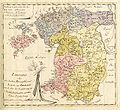
 Russland, Polen und Livland bis ins 17. Jahrhundert (1886) (14596926569).jpg 2.264 × 1.768; 1.010 KB
-
 Siege of Wolmar, 1601.png 4.313 × 5.537; 27,9 MB


.png)


.png)


_map.png)


_(14596926569).jpg)
