Category:Maps of Washington (state)
跳转到导航
跳转到搜索
美国州份:亚拉巴马州 · 亞利桑那州 · 伊利诺伊州 · 佛罗里达州 · 佛蒙特州 · 俄亥俄州 · 俄克拉荷馬州 · 俄勒冈州 · 內布拉斯加州 · 内华达州 · 加利福尼亚州 · 北卡罗来纳州 · 北达科他州 · 华盛顿州 · 南卡罗来纳州 · 南达科他州 · 印第安纳州 · 喬治亞州 · 堪薩斯州 · 夏威夷州 · 威斯康辛州 · 宾夕法尼亚州 · 密歇根州 · 密蘇里州 · 密西西比州 · 康乃狄克州 · 弗吉尼亚州 · 德克萨斯州 · 怀俄明州 · 新墨西哥州 · 新泽西州 · 新罕布什尔州 · 明尼蘇達州 · 爱荷华州 · 爱达荷州 · 特拉华州 · 猶他州 · 田纳西州 · 科羅拉多州 · 纽约州 · 缅因州 · 羅德島州 · 肯塔基州 · 蒙大拿州 · 西維吉尼亞州 · 路易斯安那州 · 阿拉斯加州 · 阿肯色州 · 马里兰州 · 麻薩諸塞州 – 華盛頓哥倫比亞特區
島嶼地區:北马里亚纳群岛 · 波多黎各 · 美屬維爾京群島 · 美屬薩摩亞 · 關島 – 美国本土外小岛屿:中途島 · 威克島 · 帕邁拉環礁 · 納弗沙島 · 约翰斯顿环礁 · 豪蘭島 · 貝克島 · 賈維斯島 · 金曼礁
島嶼地區:北马里亚纳群岛 · 波多黎各 · 美屬維爾京群島 · 美屬薩摩亞 · 關島 – 美国本土外小岛屿:中途島 · 威克島 · 帕邁拉環礁 · 納弗沙島 · 约翰斯顿环礁 · 豪蘭島 · 貝克島 · 賈維斯島 · 金曼礁
维基媒体分类 | |||||
| 上传媒体 | |||||
| 隶属于 | |||||
|---|---|---|---|---|---|
| 分類結合話題 | |||||
| 华盛顿州 | |||||
美国西北部的州 someja satełitar in setenbre    | |||||
| 读音 (音频文件) | |||||
| 隶属于 | |||||
| 所属实体 | |||||
| 名称由来 | |||||
| 位置 | |||||
| 相接水体 | |||||
| 行政中心 | |||||
| 立法机构 | |||||
| 行政机构 | |||||
| 最高司法机关 | |||||
| 政府首脑 |
| ||||
| 成立或建立時間 |
| ||||
| 最高点 | |||||
| 人口 |
| ||||
| 面积 |
| ||||
| 海拔 |
| ||||
| 取代對象 | |||||
| 相異於 | |||||
| 最高温度记录 |
| ||||
| 最低温度记录 |
| ||||
| 官方网站 | |||||
 | |||||

子分类
本分类有以下39个子分类,共有39个子分类。
*
A
B
- Blank maps of Washington (5 F)
C
E
F
G
H
- Maps of Haro Strait (5 F)
L
M
- Maps of Puget Sound (43 F)
- Mount Baker hazard maps (3 F)
O
P
T
V
W
分类“Maps of Washington (state)”中的媒体文件
以下133个文件属于本分类,共133个文件。
-
 1915 map of Lamoine.jpg 1,800 × 1,650;1.6 MB
-
 2022 Adopted Legislative District 15.pdf 1,275 × 1,650;2.45 MB
-
 2022 Legislative District 15.png 412 × 527;161 KB
-
 Admiralty Chart No 2940 Cape Disappointment to Cape Flattery, Published 1948.jpg 11,296 × 20,801;68.99 MB
-
 AmtrakCascadesDiner.JPG 2,448 × 3,264;1.97 MB
-
 Anderson Steamboat Company 1916 route map.png 1,224 × 1,432;2.52 MB
-
 BPA Cross-Cascade Corridors.png 1,282 × 822;541 KB
-
 Chehalis.png 1,592 × 1,143;3.22 MB
-
 Cherry Point WA map.png 1,328 × 880;685 KB
-
 West Coast of North America satellite orthographic.jpg 384 × 1,000;91 KB
-
 West Coast of North America satellite orthographic.png 383 × 1,000;467 KB
-
 Columbia dams map.png 1,205 × 1,207;414 KB
-
 Columbia Gorge AVA map.JPG 705 × 468;125 KB
-
 Columbia Valley AVA Wash map.JPG 705 × 468;128 KB
-
 Colville Reservation map outline.png 632 × 462;466 KB
-
 Copalis Rock Reservation EO 704 illustration.jpg 1,849 × 1,780;433 KB
-
 Cowlitz.png 1,497 × 1,045;2.63 MB
-
 Divisions of the Court of Appeals of the State of Washington.png 794 × 519;183 KB
-
 Easternwashington TransparentBack.PNG 221 × 136;4 KB
-
 Easternwashington.PNG 221 × 136;3 KB
-
 Ecclesiastical Province of Seattle map.png 528 × 292;17 KB
-
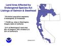 Esa-land-area-10-10.pdf 1,500 × 1,125;136 KB
-

-
 First four Legislative Districts or Counties of Oregon.png 1,779 × 1,189;94 KB
-
 Flattery Rocks Reservation EO 703 illustration.jpg 1,874 × 1,766;448 KB
-
 Fort Vancouver National Historic Site map 2002.12.png 499 × 467;19 KB
-
 Gulf Islands map.png 770 × 669;288 KB
-
 Hanford Reach National Monument.png 830 × 877;282 KB
-
 Hare map-main.png 2,729 × 2,446;2.14 MB
-
 Horse Heaven Hills AVA map.JPG 705 × 468;126 KB
-
 Idaho & Washington Northern map 1910.jpg 474 × 908;72 KB
-
 Image OlympicPeninsulaMap.jpg 258 × 202;19 KB
-
 Indian Tribes in Washington State.jpg 750 × 561;134 KB
-

-
 Issaquah Police Headquarters.png 575 × 425;31 KB
-
 Juan de Fuca transmission project map color.png 841 × 544;155 KB
-
 Juan de Fuca transmission project map.png 716 × 465;108 KB
-
 Juniper Dunes Wilderness (13626587835).jpg 4,200 × 5,700;6.68 MB
-
 Kettle-River-Range NASA-MODIS 11Aug2001.jpg 1,586 × 984;874 KB
-
 Kootenay & Kootenai River map.png 794 × 683;129 KB
-
 Lake Steilacoom Map.png 1,113 × 1,260;1.29 MB
-
 Lake Washington region.png 400 × 347;42 KB
-
 LakeCrescentContour.png 7,200 × 3,600;1.65 MB
-
 Landijs laatste ijstijd rond Seattle.jpg 719 × 790;152 KB
-
 Landijs laatste ijstijd rond Seattle2.jpg 719 × 790;239 KB
-
 Lemei Rock in the Indian Heaven Wilderness Visitor Map.png 1,372 × 1,604;1.65 MB
-
 Lewis and Pierce County, WA map.png 920 × 598;174 KB
-
 Locmap-Haro-Boundary additional labels.png 384 × 309;61 KB
-
 Locmap-Haro-Boundary without border.png 384 × 309;73 KB
-
 Locmap-RosarioStrait with border.png 345 × 309;53 KB
-
 Locmap-RosarioStrait without border.png 345 × 309;49 KB
-
 Lushootseed area.png 2,095 × 2,159;958 KB
-
 Manufacturing opportunities in the state of Washington (1918) (14779801361).jpg 1,888 × 1,338;588 KB
-
 Manufacturing opportunities in the state of Washington (1918) (14779809461).jpg 1,936 × 1,304;618 KB
-
 Manufacturing opportunities in the state of Washington (1918) (14780588584).jpg 1,824 × 1,324;585 KB
-
 Manufacturing opportunities in the state of Washington (1918) (14802804773).jpg 1,928 × 1,320;629 KB
-
 Map missoula floods.gif 668 × 481;24 KB
-

-
 Map of Ebey's Landing National Historical Reserve.jpg 2,031 × 1,684;1.02 MB
-
 Map of licensed Washington breweries 2014.png 872 × 605;256 KB
-
 Map of Lyre River.png 707 × 326;283 KB
-

-

-

-
 Marcus (1942) Washington 1-125000 topographic quadrangles.jpg 2,000 × 2,418;1.02 MB
-
 Mount Rainier National Park map.pdf 3,260 × 2,531;739 KB
-
 Mount Rainier vicinity map.png 697 × 646;115 KB
-
 Mount-rainier-lahar-lavaflow-pyroclasticflow-hazardmap.jpg 520 × 672;83 KB
-
 Mountains to Sound Greenway, Washington, US.jpg 1,000 × 640;608 KB
-
 Mt. Saint Helens post-eruption hydrology alterations.jpg 1,453 × 892;547 KB
-
 Newport WA map 1908.jpg 1,229 × 1,195;186 KB
-
 Nooksack.png 1,814 × 1,196;4.17 MB
-
 Northern State Hospital dairy farm map.png 567 × 896;59 KB
-
 PacificNW volcanics1.png 455 × 700;28 KB
-
 Pend Oreille River Map.png 899 × 727;123 KB
-
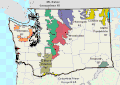
 Physiographic provinces of Washington state (26640804830).jpg 2,200 × 1,700;2.36 MB
-
 PigWar-boundaries.png 1,058 × 855;637 KB
-
 Puget lobe of the Cordilleran ice sheet.jpg 1,952 × 2,200;3.97 MB
-
 Puget Sound Basin.gif 982 × 1,264;199 KB
-
 Rattlesnake Hills AVA map.JPG 705 × 468;126 KB
-
 Red Mountain AVA map.JPG 705 × 468;125 KB
-
 Republic Mine Map and Cross Section, Washington.jpg 1,277 × 728;117 KB
-
 Salmon River Idaho Map.png 879 × 695;119 KB
-
 San Juan Islands map without border.png 784 × 861;541 KB
-
 San Juan Islands map.png 784 × 861;504 KB
-
 SanJuanIslands-labelled-focusShaw.jpg 462 × 326;53 KB
-
 SEA map.png 405 × 554;82 KB
-
 Seattle City Light power system map, 1985 (25160240962).jpg 1,200 × 833;288 KB
-
 Seattle Golf Club Map.jpg 7,170 × 5,910;1.63 MB
-
 Secretary Salazar Anacortes 01 (6926301847).jpg 4,368 × 2,912;5.09 MB
-
 Skagit River power sources map, circa 1967.jpg 3,300 × 2,550;349 KB
-
 SPD Squadron Camps 11-1918 (22028019312).jpg 2,408 × 2,960;5.52 MB
-
 State of Washington, Core Distribution of Bull Trout (cropped).jpg 1,960 × 1,318;361 KB
-
 The Rocks AVA map.JPG 705 × 468;227 KB
-
 Un-Cruise Adventures - Legacy of Discovery (itinerary map).jpg 2,250 × 1,459;1.99 MB
-
 Uw-archives map columbia the dalles 1887.jpg 640 × 480;63 KB
-
 Vancouver National Historic Reserve ownership map 2003.jpg 1,146 × 711;429 KB
-
 Vancouver Tornado - RTX loop.gif 600 × 550;228 KB
-
 Vancouver-island-relief.jpg 866 × 673;154 KB
-
 Vidbejo-Vaŝingtonio.jpg 1,330 × 648;157 KB
-
 WA - Washington State Patriol Districts.gif 208 × 140;5 KB
-
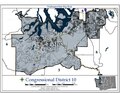 WA CD 10-2013.pdf 1,650 × 1,275;2.43 MB
-
 WA I-1639 sheriff's statements by county.png 1,760 × 1,412;1.02 MB
-
 Wahluke Slope AVA map.JPG 705 × 468;125 KB
-
 Walla Walla AVA map.JPG 705 × 468;126 KB
-
 Washington 90.jpg 1,466 × 948;458 KB
-
 Washington administrative blank map.png 1,031 × 675;742 KB
-
 Washington Congressional District Details Map.png 3,600 × 5,625;4.59 MB
-
 Washington Congressional District Map.png 5,625 × 3,600;3.46 MB
-
 Washington County Trend 2020.svg 744 × 497;375 KB
-
 Washington National Forest Map.gif 499 × 353;25 KB
-
 Washington PSNS.jpg 240 × 183;73 KB
-
 Washington ref 2001.jpg 812 × 513;237 KB
-
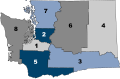
 Washington regions map (ru).png 3,007 × 1,743;898 KB
-
 Washington regions map.png 3,008 × 1,743;909 KB
-
 Washington State Legislative Districts after.jpg 1,600 × 1,200;512 KB
-
 Washington State Patrol (district map).svg 512 × 333;286 KB
-
 Washington state, 1st legislative district map (2002-12).pdf 1,275 × 1,650;570 KB
-
 Washington state, 1st legislative district map (2002-12).png 1,683 × 1,275;2.09 MB
-
-
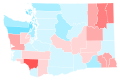
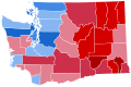 Washington US House Election Results By County 2022.svg 810 × 535;61 KB
-
 Washington wind resource map 50m 800-fr.jpg 1,100 × 850;287 KB
-
 Washington wind resource map 50m 800.jpg 1,100 × 850;972 KB
-
 Washington-NED-USGS-2.jpg 500 × 354;220 KB
-
 Washington. Irrigation by drainage basins. 1939 - btv1b53189470g.jpg 9,176 × 5,530;4.65 MB
-
 Washington. Location of irrigated Land. 1949 - btv1b53200421j.jpg 9,709 × 5,700;6.91 MB
-
 Wenatcheerivermap.jpg 338 × 410;110 KB
-
 Whatcomtrail2bwskagit.jpg 640 × 480;144 KB
-
 Willamette meridians.png 261 × 291;138 KB
-
 Wpdms shdrlfi020l champoeg oregon.jpg 300 × 200;32 KB
-
 Yacolt Burn Map.jpg 2,000 × 1,308;402 KB
-
 Yakima Indian Reservation map.png 1,486 × 1,038;335 KB
-
 Yakima Valley AVA.JPG 705 × 468;126 KB


_(19953260223).jpg)


.jpg)


_(14779801361).jpg)
_(14779809461).jpg)
_(14780588584).jpg)
_(14802804773).jpg)


.jpg)
_Washington_1-125000_topographic_quadrangles.jpg)


.jpg)


.jpg)

.jpg)

.jpg)
.jpg)

.jpg)


.png)


.svg)
.png)


