Category:Maps of fictional places or locations
Pereiti į navigaciją
Jump to search
Deutsch: Karten oder Pläne von fiktiven oder erdachten Städten, Orten, Landschaften, etc.
English: Maps that are fictitious or too incorrect. Maps with {{Fictitious map}} are automatically included in this category. For SVG-maps use {{Fictitious map|1=SVG}}.
visual representation of an imaginary or fictional geography or concept  | |||||
| Įkelti mediją | |||||
| Tai yra | |||||
|---|---|---|---|---|---|
| Poklasis | |||||
| Teminiu požiūriu nurodo |
| ||||
| Skiriasi nuo | |||||
| |||||
Subkategorijos
Rodomos 22 subkategorijos (iš viso yra 22 subkategorijos).
*
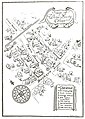
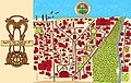
- Maps of fictional cities (18 F)
A
F
- Maps of Fullmetal Alchemist (6 F)
G
M
- Maps of Attack on Titan (14 F)
O
- Maps of One Piece (22 F)
P
- Maps of Prahy (2 F)
S
T
V
W
Daugialypės terpės rinkmenos kategorijoje „Maps of fictional places or locations“
Rodoma 117 šios kategorijos rinkmenų (iš viso kategorijoje yra 117 rinkmenų).
-
 236 of 'The Memoirs of Sherlock Holmes' (11304353756).jpg 1 405 × 760; 148 KiB
-
 7b9395852723.jpg 1 775 × 1 085; 250 KiB
-
 Adventure 20Oct1924--the dead-line--map.png 667 × 532; 97 KiB
-
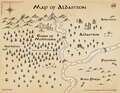 Aldastron Map.pdf 1 650 × 1 275; 5,63 MiB
-
 Alternate map of Albrechtice Uyezd with APP Hyptek.jpg 2 299 × 3 120; 1,62 MiB
-
 Atvatabar.jpg 270 × 216; 17 KiB
-
 Aynestïl2.jpg 640 × 480; 22 KiB
-
 Backrooms Map.jpg 4 032 × 3 024; 3,82 MiB
-
 BI-Book AgilieBICityMap justDistricts colour.png 1 709 × 1 617; 699 KiB
-
 Blank World Banner.png 4 092 × 1 187; 2,23 MiB
-
-
 Chalyltopo.svg 2 951 × 2 307; 3,27 MiB
-
 Chinese map of The Twelve Kingdoms series.png 1 200 × 1 024; 820 KiB
-
 Crimson skies map.png 1 536 × 1 038; 424 KiB
-
 Dissolved United States map as predicted by Igor Panarin.svg 959 × 593; 331 KiB
-
 Eisenbahn auf Lummerland nach Augsburger Puppenkiste.png 462 × 427; 18 KiB
-
 Express Occidentalis.png 1 080 × 2 145; 116 KiB
-
 Fadh1.jpg 1 054 × 1 217; 206 KiB
-
 Fake Japanese invasion map of Australia 1942.png 2 953 × 2 308; 3,5 MiB
-
 FEP Übersichtsplan.jpg 1 174 × 809; 418 KiB
-

-
 Fictional Map 1.jpg 600 × 604; 69 KiB
-
 Fictional Map With Romer.jpg 600 × 604; 69 KiB
-
 Flaccid peninsula Thumbnail.png 822 × 548; 20 KiB
-
 Flaccid peninsula.png 822 × 944; 41 KiB
-
 Flag map of Tshunkuveli.png 904 × 691; 61 KiB
-
 Floor plan example.png 848 × 772; 16 KiB
-
 GA Əyalət Bölgə.jpg 742 × 599; 72 KiB
-
 Gabor en omgeving voorbeeld classificatie puntobjecten legenda items.PNG 1 215 × 529; 94 KiB
-
 Gaboriau - Monsieur Lecoq - Plan Page 74.jpg 800 × 1 078; 110 KiB
-
 Generic locator LG.png 602 × 463; 46 KiB
-
 Giver to Messenger story map.png 658 × 614; 31 KiB
-
 Global metro.png 2 729 × 1 482; 362 KiB
-
 Guney-azerbaycan.png 1 344 × 1 200; 908 KiB
-
 Halkeginia map.png 450 × 490; 14 KiB
-
 HalliwellManor.jpg 496 × 512; 17 KiB
-
 Heinekenwesseling.jpg 1 401 × 1 838; 888 KiB
-
 Hohen-Cremmen 4334a.JPG 1 968 × 1 251; 490 KiB
-
 HyboriaMapByLex.gif 3 240 × 2 431; 238 KiB
-
 Iac fadr 945.png 1 200 × 1 200; 140 KiB
-
 Iac fadr 955.png 1 200 × 1 200; 226 KiB
-
 Indraprasta.jpg 4 000 × 2 000; 953 KiB
-
 Indraprasta.PNG 1 023 × 506; 1,3 MiB
-
 Inkscape rpg map.png 927 × 704; 261 KiB
-
 InvertedWorld.jpg 267 × 440; 10 KiB
-
 Iran Kurdistan location map.jpg 313 × 558; 32 KiB
-
 Kanto Map.png 1 177 × 1 056; 55 KiB
-
 Karain Semicontinent Map.jpeg 433 × 525; 47 KiB
-
 Khorinis.png 2 720 × 1 922; 1,53 MiB
-
 Krypton Map 3.png 600 × 580; 7 KiB
-
 Královec Region within Europe (fictional).png 1 500 × 1 300; 586 KiB
-
 Kéza Danzysan Iourak ka (Map of the Dream Mountains).svg 2 000 × 2 000; 3,63 MiB
-
 Landkaart van Yemo.png 1 048 × 739; 373 KiB
-
 Landschaftsplan.jpg 367 × 279; 161 KiB
-
 Lemkivśka zemlia in Ukraine.png 4 296 × 3 015; 49,42 MiB
-
 Lewis Carroll - Henry Holiday - Hunting of the Snark - Plate 4.jpg 3 540 × 5 924; 4,9 MiB
-
 Localisation de Donaldville.JPG 613 × 822; 56 KiB
-
 Map caven island at 1783.jpg 2 368 × 1 888; 419 KiB
-
 Map of Dogville (Lars von Trier).svg 1 020 × 497; 133 KiB
-
 Map of fictional Winesburg, Ohio.jpg 1 233 × 1 729; 1,24 MiB
-
 Map of Jonathaland.jpg 4 689 × 2 953; 7,47 MiB
-
 Map of Manderlay Plantation (Lars von Trier).svg 1 682 × 661; 201 KiB
-
 Map of Rojhalat Kurdistan.jpg 723 × 599; 69 KiB
-
 Map of Soviet regions.svg 2 341 × 1 332; 501 KiB
-
 Map of the Interior World.png 527 × 438; 302 KiB
-
 Map of The Twelve Kingdoms Roman Characters.png 1 200 × 1 024; 1,02 MiB
-
 Map of Tshunkuveli.png 904 × 691; 50 KiB
-
 Mapa do Maralto.png 1 461 × 1 119; 74 KiB
-
 Mapa municipal de Navarra - ficticio.png 6 000 × 4 860; 4,51 MiB
-
 Mapa municipal de Riberna - ficticio.png 21 900 × 20 000; 32,96 MiB
-
 Mapa Prawieku.png 2 160 × 2 160; 2,97 MiB
-
 Mapa provincial de Riberna - ficticio.png 2 225 × 1 761; 271 KiB
-
 Martian Odyssey Map.jpg 351 × 331; 36 KiB
-
 Maury Geography 008B village plan.jpg 1 002 × 790; 128 KiB
-
 Metro hispanorum.png 1 590 × 1 052; 134 KiB
-
 Metro Loco.svg 1 052 × 1 488; 1,45 MiB
-
 Nalaaria.png 1 300 × 650; 349 KiB
-
 Naruto World Map.jpg 800 × 454; 233 KiB
-
 Nava - Phelps map FR.png 800 × 565; 19 KiB
-
 Nava de Warja.JPG 1 130 × 1 406; 394 KiB
-
 NENY (8).svg 2 560 × 1 920; 8 KiB
-
 NENY.jpg 2 048 × 1 536; 114 KiB
-
 North america 1765globe.jpg 1 504 × 1 000; 587 KiB
-
 NSSapientia.jpg 4 600 × 3 000; 7,28 MiB
-
 Outdia.png 2 018 × 1 009; 474 KiB
-
 Outdonesia.jpg 960 × 459; 66 KiB
-
 Plan mediaeval manor detail1a.jpg 910 × 576; 133 KiB
-
 Px-Blank-Map-Iran-With-Water-Bodies.png 800 × 736; 67 KiB
-
 PyongYang•PyongSong Urban Route Map.png 1 600 × 1 600; 408 KiB
-
 Quest3.png 850 × 567; 39 KiB
-
 Random political map with province boundaries.png 390 × 369; 37 KiB
-
 Red dawn 1984 movie start of ww3.PNG 1 400 × 628; 49 KiB
-
 Reversed Front boardgame.png 1 150 × 845; 173 KiB
-
 Rihen.jpg 1 444 × 1 404; 483 KiB
-
 Ryersonsector.JPG 1 500 × 1 114; 740 KiB
-
 Schermafbeelding 2012-09-26 om 07-1.26.42.jpg 300 × 212; 39 KiB
-
 SCP-7064 Wing map.png 3 300 × 2 550; 586 KiB
-
 Solidterra.jpg 4 064 × 1 920; 1,11 MiB
-
 Tbbt apartment.jpg 948 × 792; 82 KiB
-
 Tessos.png 2 940 × 2 430; 1,35 MiB
-
 The Bellmans Map.svg 4 464 × 6 976; 826 KiB
-
 The Ralph Peters solution to the Middle East.svg 800 × 1 188; 2,5 MiB
-
 The story of the map of Europe, its making and its changing (1916) (14775277321).jpg 1 960 × 3 152; 693 KiB
-
 Titan Map.png 348 × 361; 4 KiB
-
 Trents campaign map.jpg 4 032 × 3 024; 2,95 MiB
-
 Ueberswichtskarte bienwald ver2 ds wv 03 2012.png 846 × 1 059; 121 KiB
-
 Updated Map of Tunganistan.png 1 372 × 1 198; 2,33 MiB
-
 Valley of Dreams Map.jpg 351 × 331; 37 KiB
-
 Visuale hiërarchie foute versie.PNG 981 × 771; 60 KiB
-
 Weltkarte IAVNU.png 13 200 × 7 440; 11,7 MiB
-
 Western European express.png 1 584 × 1 676; 95 KiB
-
 WisteriaLane.png 580 × 339; 21 KiB
-
 Војводина у свом недовршеном облику (1918)..png 724 × 760; 28 KiB
-
 Восстания происходившие в Иране после Второй мировой войны..jpg 1 250 × 600; 143 KiB
-
 Први изглед Војводине.png 724 × 949; 46 KiB
-
 خريطة إقليم الأحواز.png 350 × 300; 63 KiB
-
 ڕۆژھەڵاتی کوردستان2.jpg 1 641 × 2 649; 404 KiB
.jpg)


.jpg)


_Factional_Violence_in_Texas_map.png)


.png)
.svg)


.svg)


.svg)


_(14775277321).jpg)


..png)


.svg)