Category:Maps of the history of Germany (1945–1990)
Vai alla navigazione
Vai alla ricerca
Usate le categorie appropriate per le mappe che mostrano tutto o parte di Germania. Utilizzate le sottocategorie per le zone più piccole:
| Vostra carta mostra | Categoria da utilizzare |
|---|---|
| Germania su una mappa recente | Category:Maps of Germany o sottocategorie |
| Germania su una mappa prodotta più di 70 anni fa | Category:Old maps of Germany o sottocategorie |
| la storia di Germania su una mappa recente | Category:Maps of the history of Germany o sottocategorie |
| la storia di Germania su una mappa prodotta più di 70 anni fa | Category:Old maps of the history of Germany o sottocategorie |
storia del territorio dello stato o della civiltà  | |||||
| Carica un file multimediale | |||||
| Istanza di |
| ||||
|---|---|---|---|---|---|
| Parte di | |||||
| Aspetto di | |||||
| Consiste di | |||||
| Data di inizio |
| ||||
| Data di fine |
| ||||
| |||||
Sottocategorie
Questa categoria contiene le 6 sottocategorie indicate di seguito, su un totale di 6.
B
G
M
File nella categoria "Maps of the history of Germany (1945–1990)"
Questa categoria contiene 113 file, indicati di seguito, su un totale di 113.
-
 Allied occupation in Germany (1945-1949).png 1 012 × 1 198; 242 KB
-
 Allied occupied Germany.png 650 × 830; 100 KB
-
 American Sector Germany.png 464 × 599; 81 KB
-
 Anwerbeabkommen der Bundesrepublik Deutschland 1955 bis 1968.png 586 × 284; 15 KB
-
 Anwerbeabkommen der Bundesrepublik Deutschland 1955 bis 1968.svg 450 × 456; 521 KB
-
 Anwerbeabkommen der Bundesrepublik Deutschland 1955–1968.svg 1 318 × 798; 222 KB
-
 Map Barber-Lyaschenko contract.png 797 × 1 090; 49 KB
-
 Germany location map labeled 8 Jun 1947 - 22 Apr 1949-colored.svg 1 075 × 1 273; 822 KB
-
 Belgische Strijdkrachten Duitsland.png 330 × 153; 5 KB
-
 Berlin Blockade-map.svg 774 × 593; 64 KB
-
 BerlinerBlockadeLuftwege.png 977 × 1 024; 355 KB
-
 Allied Occupation Zones.jpg 1 256 × 956; 1,68 MB
-
 Besatzungszonen in Deutschland und Österreich.png 640 × 544; 82 KB
-
 Germany location map labeled 8 Jun 1947 - 22 Apr 1949.svg 1 075 × 1 273; 1,63 MB
-
 Map-Germany-1947.svg 3 482 × 2 956; 559 KB
-
 Besatzungszonen ohne ar.png 331 × 405; 4 KB
-
 Besatzungszonen ohne text.png 331 × 405; 6 KB
-
 Besatzungszonen.jpg 320 × 450; 74 KB
-
 Bizone-green.png 350 × 477; 15 KB
-
 Bizonia.png 434 × 585; 36 KB
-
 Deutschland Besatzungszonen 8 Jun 1947 - 22 Apr 1949 britisch.svg 1 075 × 1 273; 738 KB
-
 British Sector Germany.png 464 × 599; 84 KB
-

-
 Cold War Germany.png 2 000 × 2 368; 381 KB
-
 Cold War Germany.svg 2 000 × 2 368; 561 KB
-
 Corps sectors in NATO's Central Region.jpg 422 × 492; 39 KB
-
 Corps sectors in NATO's Central Region.svg 1 756 × 2 400; 845 KB
-
 DDR-Bezirk-KMS.png 1 500 × 2 036; 44 KB
-
 Deutsche Länder 1947.png 1 681 × 1 989; 719 KB
-
 Deutsches Reich DDR Karte.png 593 × 681; 861 KB
-
 Deutschland Besatzungszonen - 1945 1946.svg 650 × 830; 225 KB
-
 Deutschland Besatzungszonen 1945 1946 britisch.png 500 × 646; 22 KB
-
 Deutschland Besatzungszonen 1945 1946.png 500 × 646; 20 KB
-
 Deutschland Besatzungszonen 1945 amerikanisch.png 500 × 646; 21 KB
-
 Deutschland Besatzungszonen 1945 britisch.png 500 × 646; 22 KB
-
 Deutschland Besatzungszonen 1945 franzoesisch.png 500 × 646; 18 KB
-
 Deutschland Besatzungszonen 1945 sowjetisch.png 500 × 646; 19 KB
-
 Deutschland Besatzungszonen 1945.png 464 × 599; 52 KB
-
 Deutschland Besatzungszonen 1945.svg 2 183 × 2 766; 246 KB
-
 Deutschland Besatzungszonen 8 Jun 1947 - 22 Apr 1949 amerikanisch.svg 1 075 × 1 273; 744 KB
-
 Deutschland Besatzungszonen 8 Jun 1947 - 22 Apr 1949 franzoesisch.svg 1 075 × 1 273; 734 KB
-
 Deutschland Besatzungszonen 8 Jun 1947 - 22 Apr 1949 sowjetisch.svg 1 075 × 1 273; 740 KB
-
 Deutschland Besatzungszonen 8 Jun 1947 - 22 Apr 1949.svg 1 075 × 1 273; 766 KB
-
 Deutschland Bundeslaender 1949.png 464 × 599; 87 KB
-
 Deutschland Bundeslaender 1949.svg 650 × 830; 157 KB
-
 Deutschland Bundeslaender 1952.png 464 × 599; 71 KB
-
 Deutschland Bundeslaender 1957.png 464 × 599; 44 KB
-
 Deutschland Bundeslaender 1957.svg 592 × 801; 99 KB
-
 Deutschland nach dem Krieg.jpg 365 × 525; 187 KB
-
 Deutschland1871-1991.png 683 × 498; 12 KB
-
 Duitslandchurchill.png 998 × 896; 171 KB
-
 Duitslanddefinitief.png 998 × 896; 195 KB
-
 Duitslandroosevelt.png 998 × 896; 200 KB
-
 EAC Zonenprotokoll 1.png 2 362 × 2 006; 379 KB
-
 EAC Zonenprotokoll 2.png 2 362 × 2 006; 373 KB
-
 EAC Zonenprotokoll 3.png 2 362 × 2 006; 392 KB
-
 East-west germany.svg 145 × 193; 311 KB
-
 Europe Jewish % change 1945 2010.png 2 458 × 2 048; 462 KB
-
 Airliftbases.jpg 538 × 589; 62 KB
-
 French Proposal 4 April 1946.jpg 641 × 840; 124 KB
-
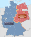
 FRG 1949 - 1990.png 350 × 477; 14 KB
-
 Germanbordershr.JPG 679 × 495; 65 KB
-
 Germany 1949 Status.PNG 514 × 416; 5 KB
-
 Germany after WWII zones F.png 350 × 477; 10 KB
-
 Germany after WWII zones UK.png 350 × 477; 11 KB
-
 Germany after WWII zones USA.png 350 × 477; 10 KB
-
 Germany after WWII zones USSR.png 350 × 477; 11 KB
-
 Germany divided BRD.png 350 × 477; 10 KB
-
 Germany Laender 1947 1990.png 763 × 1 078; 97 KB
-
 Germany lv nordbaden.gif 166 × 225; 5 KB
-
 Germany lv südbaden.gif 166 × 225; 5 KB
-
 Germany lv württemberg.gif 166 × 226; 5 KB
-
 Germany Morgenthau Plan (SVG).svg 668 × 600; 198 KB
-
 Germany Morgenthau Plan-en.svg 1 000 × 900; 129 KB
-
 Germany Morgenthau Plan.png 998 × 896; 146 KB
-
 Germany Occupation Zones 1947 blank.jpg 470 × 626; 61 KB
-
 Germany occupation zones with border He.jpg 842 × 1 148; 805 KB
-
 Germany occupation zones with border.jpg 1 460 × 1 212; 861 KB
-
 Germany.gif 166 × 225; 5 KB
-
 GermanyMorgenthau-hebrew.jpg 998 × 896; 281 KB
-
 Granica polsko-niemiecka.png 200 × 383; 29 KB
-
 Industry Allocation.jpg 480 × 657; 95 KB
-
 Karte Innerdeutsche Grenze-pl.svg 744 × 1 052; 146 KB
-
 Karte Innerdeutsche Grenze.png 956 × 1 131; 331 KB
-
 Karte Innerdeutsche Grenze.svg 1 075 × 1 273; 333 KB
-
 Karte Rheinwiesenlager.png 932 × 1 046; 193 KB
-
 Lands of GDR (1945-1952).svg 618 × 789; 72 KB
-
 LocationDividedGermany.png 250 × 115; 6 KB
-
 Map FRG GDRsvg.svg 592 × 801; 156 KB
-
-
 Map-Germany-1945.svg 3 492 × 2 966; 726 KB
-
 Map-Germany-1947-2.png 3 492 × 2 966; 414 KB
-
 Map-GreaterHesse.svg 650 × 830; 225 KB
-
 Map-SouthBaden.svg 650 × 830; 225 KB
-
 Map-Wuerttemberg-Baden.svg 650 × 830; 225 KB
-
 Map-Wuerttemberg-Hohenzollern.svg 650 × 830; 225 KB
-
 Morgenthau Plan map.svg 671 × 442; 132 KB
-
 Morgenthau-plan-icon-2.png 100 × 100; 3 KB
-
 Morgenthau-plan-icon.png 100 × 100; 3 KB
-
 Morgenthau-plan.png 400 × 375; 17 KB
-
 Occupation zones map of Germany and Austria, March 1946 (159080993).png 4 518 × 3 751; 29,58 MB
-
 Occupied Germany and Berlin.png 452 × 409; 10 KB
-
 Probable Axes of Attack.svg 372 × 530; 135 KB
-
 Soviet Occupied Germany.png 514 × 416; 12 KB
-
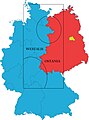
 Trizone.jpg 411 × 498; 82 KB
-
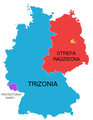 Trizonia.png 464 × 599; 51 KB
-
 Ujerumani 1945.jpg 800 × 679; 112 KB
-
 US Army Germany occupation zones 1945.jpg 1 436 × 1 188; 1,61 MB
-
 Vertreibungsgebiet.jpg 1 094 × 823; 383 KB
-
 Westalis and Ostania map from Spy × Family overlaid on West and East Germany map.jpg 1 513 × 2 047; 297 KB
-
 ZoneFINyalta.jpg 243 × 330; 8 KB
-
 Zonenrandgebiet.png 956 × 1 131; 347 KB
-
 Дислокация соединений 8-й гв. А ВС СССР и V корпуса армии США.png 400 × 544; 202 KB
.png)


.svg)


.svg)


,_circa_1949_(175515517).png)


.png)


