Category:Margam
Vai alla navigazione
Vai alla ricerca
comunità del Galles  | |||||
| Carica un file multimediale | |||||
| Istanza di | |||||
|---|---|---|---|---|---|
| Luogo | Neath Port Talbot, Galles | ||||
| Popolazione |
| ||||
| Superficie |
| ||||
 | |||||
Sottocategorie
Questa categoria contiene le 7 sottocategorie indicate di seguito, su un totale di 7.
B
- Bodvoc Stone (5 F)
I
- Ivy Cottage, Margam (2 F)
M
- Margam Crematorium (3 F)
- Margam Knuckle Yard (60 F)
- Margam TMD (6 F)
File nella categoria "Margam"
Questa categoria contiene 200 file, indicati di seguito, su un totale di 487.
(pagina precedente) (pagina successiva)-
 2010 Wales Neath Port Talbot Community Margam map.svg 512 × 666; 423 KB
-
 2024 Wales Neath Port Talbot Community Margam map.svg 512 × 666; 548 KB
-
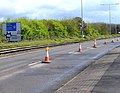
 A complex of cables by M4 - geograph.org.uk - 5843329.jpg 1 600 × 1 199; 656 KB
-

-

-

-

-

-

-

-

-

-

-

-

-

-

-

-

-
-

-

-

-

-

-

-

-

-

-

-
 A late August visit to Margam Abbey (34) - geograph.org.uk - 6260803.jpg 640 × 480; 118 KB
-
 A late August visit to Margam Abbey (35) - geograph.org.uk - 6260804.jpg 640 × 480; 104 KB
-
-

-

-

-

-
-

-
 A late August visit to Margam Abbey (42) - geograph.org.uk - 6260811.jpg 640 × 480; 106 KB
-

-

-

-
-

-

-

-

-

-
-

-

-

-

-
 A late August visit to Margam Abbey (56) - geograph.org.uk - 6260815.jpg 480 × 640; 115 KB
-

-

-

-

-

-

-

-

-

-

-

-

-

-
 A late August visit to Margam Abbey (68) - geograph.org.uk - 6260912.jpg 640 × 480; 105 KB
-

-

-

-

-

-

-

-

-
-

-

-

-
 A48 near Margam Country Park - geograph.org.uk - 2049369.jpg 640 × 480; 45 KB
-
 A48 north of Pyle - geograph.org.uk - 3136372.jpg 2 288 × 1 712; 1,21 MB
-
 A48 south of Old Park Road - geograph.org.uk - 2049364.jpg 640 × 480; 54 KB
-
-

-
 Abbot's Close, Margam - geograph.org.uk - 6170399.jpg 4 000 × 3 000; 3 MB
-
 Abbotts Close - geograph.org.uk - 2049446.jpg 640 × 480; 68 KB
-
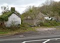
 Aberbaiden Farm - geograph.org.uk - 4925779.jpg 3 264 × 2 448; 1,98 MB
-

-
 An entrance to Margam Country Park - geograph.org.uk - 2993118.jpg 640 × 480; 79 KB
-

-
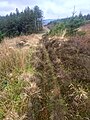 Approaching a track - geograph.org.uk - 6017525.jpg 2 448 × 3 264; 3,75 MB
-
 Bed of Pine Needles - geograph.org.uk - 5375733.jpg 2 448 × 3 264; 3,25 MB
-

-
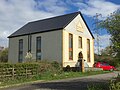
 Beulah Chapel, Margam, Port Talbot-geograph.org.uk-2950560.jpg 640 × 480; 108 KB
-
 Blaen Maelwg - geograph.org.uk - 5375859.jpg 3 264 × 2 448; 4,27 MB
-
 Bluebell bank - geograph.org.uk - 5768217.jpg 2 190 × 2 920; 2,57 MB
-
 Bluebell bank - geograph.org.uk - 5768218.jpg 3 264 × 2 448; 4,49 MB
-
 Boat House Ruin - Margam Park - geograph.org.uk - 2631663.jpg 4 288 × 2 848; 6,73 MB
-

-
 Bridge and Watercourse - geograph.org.uk - 5211754.jpg 3 264 × 2 448; 3,71 MB
-
 British Oxygen Company - geograph.org.uk - 5211779.jpg 3 264 × 2 448; 1,96 MB
-
 Broken earthwork in Cwm Kenfig - geograph.org.uk - 1986333.jpg 1 280 × 800; 224 KB
-
 Brynteg - geograph.org.uk - 5186239.jpg 3 264 × 2 448; 2,37 MB
-

-

-
 Bus stop in Caegarw on A48 - geograph.org.uk - 5824392.jpg 1 600 × 1 143; 672 KB
-
 Canada geese in Margam Country Park - geograph.org.uk - 6155508.jpg 1 024 × 680; 210 KB
-
 Catkins beside Heolcae’r-bont, nr Margam - geograph.org.uk - 4532315.jpg 640 × 480; 191 KB
-

-

-
 Ceuffordd i Fargam - Hollow Way to Margam - geograph.org.uk - 6210933.jpg 1 024 × 768; 222 KB
-

-
 Churchyard and Stones Museum, Margam - geograph.org.uk - 6157866.jpg 1 024 × 680; 281 KB
-
 Circular Mound - geograph.org.uk - 5375728.jpg 3 264 × 2 448; 4,33 MB
-
 Citrus House, Margam Country Park - geograph.org.uk - 6157883.jpg 1 024 × 680; 240 KB
-
 Cleared Timber on Margam Mountain - geograph.org.uk - 1957019.jpg 1 920 × 2 560; 1,87 MB
-
 Coed Cwm Cynffig - geograph.org.uk - 6015080.jpg 3 264 × 2 448; 3,05 MB
-
 Coed Ton Mawr - geograph.org.uk - 5340354.jpg 3 264 × 2 448; 2,7 MB
-

-

-
 Converted Chapel - geograph.org.uk - 4925563.jpg 3 150 × 2 362; 1,34 MB
-
 Converted Chapel - geograph.org.uk - 5320563.jpg 3 264 × 2 448; 2,82 MB
-

-
 Country track to the west of Pyle - geograph.org.uk - 2660793.jpg 480 × 640; 133 KB
-
 Craig Goch - geograph.org.uk - 5340332.jpg 3 264 × 2 448; 2,56 MB
-
 Craig yr Aber - geograph.org.uk - 5121499.jpg 640 × 480; 149 KB
-

-
-
 Crugwyllt Fawr - geograph.org.uk - 5375829.jpg 3 264 × 2 448; 1,95 MB
-
 Cwm Philip - geograph.org.uk - 5542637.jpg 2 394 × 3 192; 1,28 MB
-
 Cwm Philip from the Ogwr Ridgeway Walk - geograph.org.uk - 3793337.jpg 4 000 × 3 000; 3,67 MB
-
 Cwrt Buchan Lane - geograph.org.uk - 2994766.jpg 640 × 578; 71 KB
-
 Cwrt-y-defaid road junction - geograph.org.uk - 2993301.jpg 640 × 347; 61 KB
-

-
 Cyclist on Mynydd Margam - geograph.org.uk - 6017505.jpg 3 264 × 2 448; 2,62 MB
-
 Dam at Craig yr Aber - geograph.org.uk - 2715680.jpg 2 048 × 1 536; 1,36 MB
-
 Dam on Nant Craig yr Aber - geograph.org.uk - 3869620.jpg 2 726 × 1 595; 1,52 MB
-
 Dead tree in Margam Lake - geograph.org.uk - 4459574.jpg 516 × 640; 288 KB
-

-
-

-

-
 Discoloured Water - geograph.org.uk - 4925911.jpg 2 448 × 3 264; 2,41 MB
-
 Disused Dam - geograph.org.uk - 2667750.jpg 1 600 × 1 200; 414 KB
-
 Disused Quarry Building - geograph.org.uk - 4925857.jpg 3 264 × 2 448; 3,71 MB
-
 Disused Railway - geograph.org.uk - 5125536.jpg 2 448 × 3 264; 3,4 MB
-
 Disused Railway - geograph.org.uk - 5320551.jpg 2 448 × 3 264; 2,7 MB
-

-

-
 Dry Play Area - geograph.org.uk - 5320507.jpg 3 264 × 2 448; 2,86 MB
-
 East Lodge, Margam Park - geograph.org.uk - 5340328.jpg 3 264 × 2 448; 2,02 MB
-

-
 Eglwys Nunydd Reservoir - geograph.org.uk - 2596408.jpg 640 × 480; 129 KB
-
 Eglwys Nunydd Reservoir - geograph.org.uk - 3384100.jpg 960 × 791; 110 KB
-
 Eglwys Nunydd Reservoir - geograph.org.uk - 5346218.jpg 2 592 × 1 627; 805 KB
-

-
 Enclosure near Geulan Las - geograph.org.uk - 5375845.jpg 5 016 × 3 190; 7,15 MB
-
 End of a high tension line - geograph.org.uk - 1950979.jpg 1 600 × 1 200; 206 KB
-
 Entrance Gates - geograph.org.uk - 4925526.jpg 3 264 × 2 448; 3,02 MB
-

-

-
-
 Entrance to Margam Park - geograph.org.uk - 5186145.jpg 3 264 × 2 448; 2,66 MB
-

-

-
 Entrance to the car park, Margam Country Park - geograph.org.uk - 3136508.jpg 2 288 × 1 712; 1,26 MB
-
 Entrance to Ton Mawr Farm - geograph.org.uk - 5340341.jpg 4 794 × 3 202; 4,89 MB
-
 Ergyd Isaf - geograph.org.uk - 6017529.jpg 2 448 × 3 264; 3,53 MB
-
 Facade of the former Banqueting House - geograph.org.uk - 6157575.jpg 680 × 1 024; 243 KB
-
 Fallow Deer Buck - Margam Deer Park - geograph.org.uk - 2631540.jpg 4 288 × 2 848; 5,54 MB
-
 Fallow Deer Buck - Margam Deer Park - geograph.org.uk - 2631545.jpg 4 288 × 2 848; 5,96 MB
-
 Fallow Deer Buck - Margam Deer Park - geograph.org.uk - 2631547.jpg 4 288 × 2 848; 5,7 MB
-
 Fallow Deer Immature Buck - Margam Deer Park - geograph.org.uk - 2631542.jpg 4 288 × 2 848; 4,87 MB
-
 Farm Track - geograph.org.uk - 5320660.jpg 3 264 × 2 448; 4,25 MB
-

-
 Ffordd Sant Illtyd - St Illtyd's Walk - geograph.org.uk - 6210953.jpg 1 024 × 768; 214 KB
-
 Ffordd Sant Illtyd - St Illtyd's Way - geograph.org.uk - 6210864.jpg 1 024 × 768; 191 KB
-

-
 Ffynnon Iago - geograph.org.uk - 4925568.jpg 3 077 × 2 308; 1,52 MB
-
 Footbridge at Wernderi - geograph.org.uk - 5347322.jpg 3 264 × 2 448; 3,03 MB
-
 Footbridge at Wernderi - geograph.org.uk - 5347343.jpg 3 264 × 2 448; 3,81 MB
-
 Footbridge over Afon Brombil (geograph 7111779).jpg 3 024 × 4 032; 7,57 MB
-
 Footbridge over Nant Cwm Philip - geograph.org.uk - 5375871.jpg 3 264 × 2 448; 3,75 MB
-
 Footpath above Troed y Rhiw - geograph.org.uk - 6015069.jpg 3 264 × 2 448; 5 MB
-

-

-

-
 Forest Canopy - geograph.org.uk - 5375732.jpg 2 448 × 3 264; 2,22 MB
-
 Forest Track in Craig yr Aber - geograph.org.uk - 1957005.jpg 1 920 × 2 560; 1,86 MB
-
 Forestry at Craig yr Aber - geograph.org.uk - 5259089.jpg 3 264 × 2 448; 3,38 MB
-
 Forestry at Geulan Las - geograph.org.uk - 5375070.jpg 3 264 × 2 448; 2,92 MB
-
 Forestry Workings at Craig yr Aber - geograph.org.uk - 1957015.jpg 3 968 × 2 976; 5,22 MB
-
 Gardens at Margam Park - geograph.org.uk - 6157598.jpg 1 024 × 680; 284 KB
-
 Gate and Fencing - geograph.org.uk - 4925819.jpg 2 448 × 3 264; 2,89 MB
-
 Gate in the wall near Cwm Philip - geograph.org.uk - 2538337.jpg 640 × 480; 114 KB
-

-
 Gate piers at Margam Country Park - geograph.org.uk - 6158896.jpg 1 024 × 680; 256 KB
-
 Gateposts, Margam Country Park - geograph.org.uk - 3015087.jpg 2 592 × 1 944; 1,03 MB


_-_geograph.org.uk_-_6253214.jpg)
_-_geograph.org.uk_-_6260741.jpg)
_-_geograph.org.uk_-_6260746.jpg)
_-_geograph.org.uk_-_6260755.jpg)
_-_geograph.org.uk_-_6260758.jpg)
_-_geograph.org.uk_-_6260766.jpg)
_-_geograph.org.uk_-_6260768.jpg)
_-_geograph.org.uk_-_6260770.jpg)
_-_geograph.org.uk_-_6260772.jpg)
_-_geograph.org.uk_-_6260774.jpg)
_-_geograph.org.uk_-_6260779.jpg)
_-_geograph.org.uk_-_6260720.jpg)
_-_geograph.org.uk_-_6260780.jpg)
_-_geograph.org.uk_-_6260783.jpg)
_-_geograph.org.uk_-_6260784.jpg)
_-_geograph.org.uk_-_6260785.jpg)
_-_geograph.org.uk_-_6260786.jpg)
_-_geograph.org.uk_-_6260787.jpg)
_-_geograph.org.uk_-_6260789.jpg)
_-_geograph.org.uk_-_6260790.jpg)
_-_geograph.org.uk_-_6260792.jpg)
_-_geograph.org.uk_-_6260795.jpg)
_-_geograph.org.uk_-_6260721.jpg)
_-_geograph.org.uk_-_6260796.jpg)
_-_geograph.org.uk_-_6260797.jpg)
_-_geograph.org.uk_-_6260800.jpg)
_-_geograph.org.uk_-_6260801.jpg)
_-_geograph.org.uk_-_6260803.jpg)
_-_geograph.org.uk_-_6260804.jpg)
_-_geograph.org.uk_-_6260805.jpg)
_-_geograph.org.uk_-_6260807.jpg)
_-_geograph.org.uk_-_6260808.jpg)
_-_geograph.org.uk_-_6260778.jpg)
_-_geograph.org.uk_-_6260726.jpg)
_-_geograph.org.uk_-_6260809.jpg)
_-_geograph.org.uk_-_6260810.jpg)
_-_geograph.org.uk_-_6260811.jpg)
_-_geograph.org.uk_-_6260812.jpg)
_-_geograph.org.uk_-_6260814.jpg)
_-_geograph.org.uk_-_6260816.jpg)
_-_geograph.org.uk_-_6260817.jpg)
_-_geograph.org.uk_-_6260818.jpg)
_-_geograph.org.uk_-_6260819.jpg)
_-_geograph.org.uk_-_6260821.jpg)
_-_geograph.org.uk_-_6260728.jpg)
_-_geograph.org.uk_-_6260823.jpg)
_-_geograph.org.uk_-_6260824.jpg)
_-_geograph.org.uk_-_6260825.jpg)
_-_geograph.org.uk_-_6260829.jpg)
_-_geograph.org.uk_-_6260830.jpg)
_-_geograph.org.uk_-_6260793.jpg)
_-_geograph.org.uk_-_6260815.jpg)
_-_geograph.org.uk_-_6260878.jpg)
_-_geograph.org.uk_-_6260882.jpg)
_-_geograph.org.uk_-_6260884.jpg)
_-_geograph.org.uk_-_6260731.jpg)
_-_geograph.org.uk_-_6260886.jpg)
_-_geograph.org.uk_-_6260889.jpg)
_-_geograph.org.uk_-_6260891.jpg)
_-_geograph.org.uk_-_6260893.jpg)
_-_geograph.org.uk_-_6260895.jpg)
_-_geograph.org.uk_-_6260902.jpg)
_-_geograph.org.uk_-_6260905.jpg)
_-_geograph.org.uk_-_6260908.jpg)
_-_geograph.org.uk_-_6260909.jpg)
_-_geograph.org.uk_-_6260912.jpg)
_-_geograph.org.uk_-_6260915.jpg)
_-_geograph.org.uk_-_6260732.jpg)
_-_geograph.org.uk_-_6260917.jpg)
_-_geograph.org.uk_-_6260919.jpg)
_-_geograph.org.uk_-_6260738.jpg)
_-_geograph.org.uk_-_6260740.jpg)


_-_geograph.org.uk_-_3183882.jpg)


.jpg)


