Category:Marin Headlands
Zur Navigation springen
Zur Suche springen
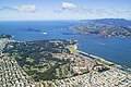
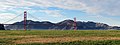
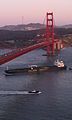
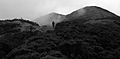
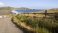
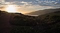
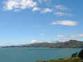
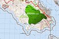
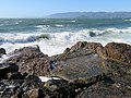
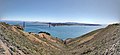
English: The Marin Headlands — within the Golden Gate National Recreation Area, in Marin County, California.
- With habitats and native plants of the Coastal sage and chaparral sub-ecoregion.
peninsula in southern Marin County, California | |||||
| Medium hochladen | |||||
| Ist ein(e) | |||||
|---|---|---|---|---|---|
| Ort | Kalifornien, Pacific States Region | ||||
| offizielle Website | |||||
 | |||||
Unterkategorien
Es werden 15 von insgesamt 15 Unterkategorien in dieser Kategorie angezeigt:
In Klammern die Anzahl der enthaltenen Kategorien (K), Seiten (S), Dateien (D)
7
- 76X Marin Headlands Express (2 D)
B
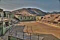
- Batteries at Fort Barry (3 D)
F
G
H
M
O
- Muir Beach Overlook (24 D)
R
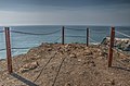
- Rodeo Beach (20 D)
S
T
Medien in der Kategorie „Marin Headlands“
Folgende 144 Dateien sind in dieser Kategorie, von 144 insgesamt.
-
 Fort-Cronkhite-Marin-Headlands-Florin-WLM-12.jpg 4.000 × 3.000; 6,02 MB
-
 Marin Headlands 3.jpg 640 × 480; 71 KB
-
 04-07-00-marin.jpg 2.048 × 1.394; 1,78 MB
-
 04-07-02-marin.jpg 2.048 × 1.402; 1,83 MB
-
 17 31 120 marin.jpg 2.048 × 1.360; 1,34 MB
-
 17-31-022-marin.jpg 2.048 × 1.367; 1,48 MB
-
 17-31-025-marin.jpg 2.048 × 1.340; 1,94 MB
-
 17-31-086-spencer.jpg 2.048 × 1.369; 1,97 MB
-

-

-

-

-

-
 Aerial view - Presidio-crop.jpg 720 × 548; 152 KB
-
 Aerial view - Presidio-whole.jpg 720 × 480; 132 KB
-

-
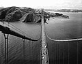
 Golden Gate Bridge, view of Marin Headlands from South Tower, 1984.jpg 4.788 × 3.800; 3,49 MB
-
 Battery Townsley, Fort Cronkhite, Marin Headlands, California.jpg 4.048 × 3.036; 4,62 MB
-
 Battery Wallace Mano Seca Bench.jpg 1.575 × 1.098; 827 KB
-
 BatterySpencer.tif 4.275 × 2.838; 16,02 MB
-
 BatterySpencer2.tif 4.248 × 2.838; 18,1 MB
-
 Bonita Cove (50723).jpg 4.608 × 2.644; 6,49 MB
-
 Bonita Cove (50760).jpg 4.608 × 1.472; 3,08 MB
-
 Braiiins (140376101).jpeg 1.536 × 2.048; 1,09 MB
-
 Brown pelican in flight (50892).jpg 2.327 × 2.592; 5,5 MB
-
 Brown pelicans in Marin Headlands (50892).jpg 3.197 × 2.958; 6,36 MB
-
 Brown pelicans in Marin Headlands (50932).jpg 4.091 × 3.050; 6,6 MB
-
 Brown pelicans in Marin Headlands (50964).jpg 3.758 × 2.874; 5,2 MB
-
 Bunker in Marin Headlands (50691).jpg 4.147 × 3.032; 7,55 MB
-
 CALIFORNIA - NARA - 542798.jpg 3.000 × 2.027; 3,7 MB
-
 CALIFORNIA - NARA - 542807.jpg 3.000 × 2.034; 3,76 MB
-
 California - NARA - 543432.jpg 3.000 × 2.000; 1,15 MB
-
 Chevron fold ribbon cherts.jpg 6.000 × 4.000; 11,19 MB
-
 Choppy Waters (140376107).jpeg 2.048 × 1.536; 639 KB
-
 Coastal Trail in the Marin Headlands - 30134353604.jpg 4.352 × 2.448; 1,56 MB
-
 Coy (48287066526).jpg 4.135 × 3.309; 1,74 MB
-
 Crissy Field with Golden Gate Bridge and Marin Headlands.jpg 8.292 × 3.077; 11,54 MB
-
 Deer in the Woods (10958602034).jpg 4.240 × 2.736; 5,74 MB
-
 Dudleya-on-rocks-Marin.jpg 1.516 × 1.114; 451 KB
-
 Foggy Marin Headlands California Bay Area (28319994443).jpg 5.760 × 3.840; 17,51 MB
-
 Golden Energy.jpg 1.552 × 2.592; 2,23 MB
-
 Golden Gate Bridge - Battery Spencer (28903971656).jpg 5.617 × 3.745; 10,2 MB
-
 Golden Gate bridge from boat.jpg 2.592 × 1.936; 1,94 MB
-
 Golden Gate Bridge view from top, HAER CA-31-30.jpg 4.763 × 3.739; 2,41 MB
-
 Golden Gate National Recreation Area GOGA8090.jpg 3.072 × 2.048; 3,97 MB
-
 Hawk Hill, Marin County.jpg 2.448 × 3.264; 4,49 MB
-
 Headlands280zx.jpg 2.527 × 1.582; 449 KB
-
 Hike out from Kirby Cove.jpg 3.150 × 2.100; 2,89 MB
-
 Hill 88 - Flickr - GregTheBusker.jpg 3.072 × 2.304; 1,9 MB
-
 Lone (164007637).jpg 1.280 × 628; 246 KB
-
 Looking north from Fort Funston.png 3.248 × 2.165; 30,29 MB
-

-
 Marin (164008456).jpg 1.280 × 887; 455 KB
-
 Marin (164008543).jpg 1.280 × 853; 395 KB
-
 Marin County Ca Marin Headlands Hawk Tail Beach ssw PICT0078 19941016.jpg 1.680 × 2.520; 1,74 MB
-
 Marin headlands (164007076).jpg 1.280 × 853; 314 KB
-
 Marin headlands (164008614).jpg 1.280 × 735; 338 KB
-
 Marin Headlands (50745).jpg 4.608 × 3.456; 9,39 MB
-
 Marin Headlands (50803)a.jpg 4.444 × 2.438; 5,7 MB
-
 Marin Headlands (50833).jpg 4.608 × 3.456; 8,43 MB
-
 Marin Headlands (50835).jpg 4.608 × 3.456; 9,12 MB
-
 Marin Headlands (50849).jpg 4.479 × 3.087; 9,62 MB
-
 Marin Headlands (50854).jpg 4.322 × 2.533; 6,57 MB
-
 Marin Headlands (50996).jpg 4.607 × 3.151; 7,6 MB
-
 Marin Headlands - Cliffs near Fort barry.jpg 2.240 × 1.488; 3,74 MB
-
 Marin headlands 6-9-05.jpg 1.280 × 960; 149 KB
-
 Marin headlands across the Golden Gate.jpg 4.532 × 3.016; 2,82 MB
-
 Marin Headlands aerial view from southeast.jpg 3.665 × 688; 737 KB
-
 Marin Headlands banner.jpg 6.999 × 999; 3,38 MB
-
 Marin Headlands in a storm (5291958179).jpg 5.464 × 3.643; 4,03 MB
-
 Marin Headlands with Rodeo Beach.jpg 7.000 × 1.278; 7,66 MB
-
 Marin Headlands.jpg 640 × 480; 91 KB
-
 Marin Headlands2.jpg 570 × 200; 26 KB
-
 Marin-headlands-3jul2005.jpg 1.524 × 2.032; 425 KB
-
 Marincellomap.jpg 2.000 × 1.326; 594 KB
-
 Mile Rock Tunnel boat landing, April 2019.JPG 5.184 × 3.888; 3,74 MB
-
 Mile Rocks Lighthouse 03.jpg 1.048 × 572; 304 KB
-
 Mile Rocks Lighthouse crop.jpg 2.408 × 1.912; 1,14 MB
-
 Mile Rocks Lighthouse.jpg 3.888 × 2.588; 2,92 MB
-
 MileRockselevated2.jpg 1.192 × 790; 468 KB
-
 Mountain view in San Francisco, CA, USA (9479303307) (2).jpg 4.608 × 2.592; 2,82 MB
-
 Muir Beach Waves.JPG 1.920 × 1.440; 756 KB
-
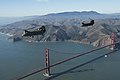 New Chinooks enhance Cal Guard’s mission capability 150109-Z-WQ610-007.jpg 3.200 × 2.128; 2,93 MB
-
 Nike missile (164006232).jpg 1.280 × 853; 139 KB
-
 North Bay (Bay Area) banner Muir Beach Overlook.jpg 3.663 × 522; 688 KB
-
 North Coast in San Francisco, CA, USA (9479159447) (2).jpg 4.608 × 2.592; 2,7 MB
-
 NORTHERN CALIFORNIA - NARA - 543050.jpg 3.000 × 2.053; 810 KB
-
 Northern California Coast as seen from Muir Beach Overlook.jpg 3.663 × 2.454; 6,01 MB
-
 Northward View of Marin Headlands from Point Bonita Lighthouse.jpg 1.000 × 562; 281 KB
-
 Pacific Ocean 1 (214350079).jpeg 1.280 × 853; 170 KB
-
 Pacific Shore.JPG 2.272 × 1.704; 898 KB
-
 Panorama of Battery Townsley, Fort Cronkhite, Marin Headlands, California.jpg 15.360 × 2.630; 11,1 MB
-
 Phalacrocorax penicillatus (1).jpg 683 × 1.024; 118 KB
-
 Pillow Basalts.jpg 5.472 × 3.648; 10,51 MB
-
 Pillow lava cross section.JPG 2.592 × 3.872; 2,99 MB
-
 Pillow lava-Marin.JPG 2.592 × 3.872; 2,11 MB
-
 Point Bonita (50793).jpg 4.608 × 3.336; 7,99 MB
-
 Point Bonita Lighthouse 04.jpg 1.920 × 1.080; 776 KB
-
 Preparation for schooner race 2.jpg 7.777 × 1.236; 6,42 MB
-
 Preparation for schooner race.jpg 7.777 × 1.236; 6,39 MB
-
 Salamander (12733313715).jpg 2.753 × 2.202; 3,83 MB
-
 San Francisco (2018) - 126.jpg 4.000 × 3.000; 2,1 MB
-
 San Francisco (22659855895).jpg 6.016 × 3.839; 16,22 MB
-
 San Francisco and Golden Gate Aerial.jpg 5.472 × 3.648; 21,58 MB
-
 San Francisco Bay, Golden Gate Bridge and Marin Headlands at sunset.jpg 3.000 × 2.740; 6,18 MB
-
 San Francisco from Coastal Trail in Marin Headlands.png 1.733 × 2.600; 21,57 MB
-
 San Francisco from Hawk Hill.jpg 5.904 × 2.710; 2,84 MB
-
 San Francisco, CA - panoramio (5).jpg 2.608 × 1.865; 753 KB
-
 Sea Cliffs (168197484).jpg 3.410 × 1.974; 1,05 MB
-
 Seagulls in Marin Headlands (50902).jpg 3.741 × 2.035; 7,22 MB
-
 Seagulls in Marin Headlands (50993).jpg 3.704 × 1.860; 3,2 MB
-
 SF view11.JPG 1.280 × 960; 410 KB
-
 SF-Marin-Pt Reyes aerial panorama.jpg 4.316 × 2.515; 2,42 MB
-
 Sign for Coyote Ridge on the California Coastal Trail South of Muir Beach.jpg 2.448 × 3.264; 2,9 MB
-
 Sign on the California Coastal Trail South of Muir Beach.jpg 2.448 × 3.264; 2,87 MB
-
 Slickenside in basalt.JPG 1.592 × 2.378; 1,08 MB
-
 Sunset over the bay (8239001675).jpg 4.773 × 1.903; 1,48 MB
-
 Sunset panorama from Tank Hill, June 2017.jpg 7.739 × 2.243; 2,1 MB
-
 The Golden Gate National Recreation Area, San Francisco, California LCCN2013630480.tif 6.144 × 4.096; 144,03 MB
-
 The Golden Gate National Recreation Area, San Francisco, California LCCN2013630481.tif 4.096 × 6.144; 144,04 MB
-
 The Golden Gate National Recreation Area, San Francisco, California LCCN2013630482.tif 6.144 × 2.729; 95,98 MB
-
 The peak (164008366).jpg 1.280 × 853; 377 KB
-
 The view from Coit Tower (4423072051).jpg 3.264 × 2.448; 2,06 MB
-
 Tourist information panel.JPG 2.451 × 3.525; 877 KB
-
 Trentepohlia.JPG 1.872 × 1.253; 1,96 MB
-
 True life (164006514).jpg 1.280 × 766; 317 KB
-
 USA, Kalifornie, San Francisco 04.JPG 1.504 × 1.000; 445 KB
-
 Valleys (164007904).jpg 1.280 × 853; 302 KB
-

-
 View From Bench.jpg 720 × 540; 55 KB
-
 View of Golden Gate Bridge and Marin County from Angel Island. California LCCN2013634643.tif 7.360 × 4.912; 206,9 MB
-
 View of San Francisco from Coastal Trail in Marin Headlands.png 2.041 × 3.062; 30,47 MB
-
 View of the City (162958081).jpg 2.209 × 1.258; 2,51 MB
-
 VU0K0943 (164007351).jpg 1.280 × 853; 285 KB
-
 VU0K1024 (164008141).jpg 1.280 × 723; 388 KB
-
 VU0K1031 (164008257).jpg 934 × 1.280; 533 KB
-
 VU0K1089 (164008476).jpg 1.280 × 853; 268 KB
-
 Calystegia purpurata.jpg 2.272 × 1.704; 890 KB
-
 Seep monkeyflower (Mimulus guttatus) (4736580481).jpg 1.731 × 2.308; 1,86 MB
-
 Sticky Monkey Flower - Mimulus aurantiacus.JPG 3.072 × 2.304; 1,96 MB
-
 Point Bonita, entrance to Bay of San Francisco, looking South, by Bradley & Rulofson.jpg 2.737 × 1.562; 1,2 MB
-
 Point Bonita, entrance to Bay of San Francisco, looking South, by Bradley & Rulofson.png 2.737 × 1.562; 4,44 MB
-
 Chert Marin Headlands.JPG 3.872 × 2.592; 2,78 MB
-
 Chert Marin.JPG 3.872 × 2.592; 2,36 MB


_from_the_Marin_Headlands_within_Golden_Gate_National_Recreation_Area_in_Marin_County,_California.jpg)


.jpg)
.jpeg)
.jpg)
.jpg)
.jpg)
.jpg)
.jpg)


.jpeg)

.jpg)
.jpg)

.jpg)

.jpg)


.jpg)


.jpg)
.jpg)

.jpg)
.jpg)
.jpg)
a.jpg)
.jpg)
.jpg)
.jpg)
.jpg)
.jpg)


.jpg)


_(2).jpg)


.jpg)
_(2).jpg)


.jpeg)

.jpg)


.jpg)

.jpg)
_-_126.jpg)
.jpg)


.jpg)
.jpg)
.jpg)
.jpg)


.jpg)
.jpg)


.jpg)

.jpg)


.jpg)
.jpg)
.jpg)
.jpg)
.jpg)

_(4736580481).jpg)


.jpg)
_banner_Muir_Beach_Overlook.jpg)
.jpg)