Category:Martindale, Cumbria
Vai alla navigazione
Vai alla ricerca
English: Martindale is a valley and civil parish in Cumbria, England, situated within the Lake District National Park between the lakes of Ullswater and Haweswater. The valley is served by a narrow minor road which runs as far as the farm of Dale Head.
Nederlands: Martindale is een plaats en civil parish in het bestuurlijke gebied Eden, in het Engelse graafschap Cumbria. In 2001 telde het dorp 49 inwoners.
Polski: Martindale – wieś i civil parish w Anglii, w Kumbrii, w dystrykcie Eden. W 2001 civil parish liczyła 49 mieszkańców. Ma 11 wymienionych budynków. Ma 2 kościoły.
Simple English: Martindale is a village and civil parish in Eden, Cumbria, England. In 2001 there were 49 people living in Martindale.

village and civil parish in Cumbria, England, UK  | |||||
| Carica un file multimediale | |||||
| Istanza di | |||||
|---|---|---|---|---|---|
| Luogo | Eden, Cumbria, Nord Ovest dell'Inghilterra, Inghilterra | ||||
| Popolazione |
| ||||
 | |||||
Sottocategorie
Questa categoria contiene le 17 sottocategorie indicate di seguito, su un totale di 17.
A
- Angle Tarn (Patterdale) (47 F)
- Angletarn Pikes (24 F)
B
- Beda Fell (17 F)
- Bonscale Pike (11 F)
H
- Hallin Fell (29 F)
K
- The Knott (32 F)
M
- St Martin's Church, Martindale (14 F)
N
- The Nab (24 F)
P
- St Peter's Church, Martindale (12 F)
R
- Rampsgill Head (13 F)
- Rest Dodd (25 F)
S
- Sandwick, Cumbria (13 F)
- Sleet Fell Ford (3 F)
- Steel Knotts (7 F)
W
- Wether Hill, Bampton (22 F)
File nella categoria "Martindale, Cumbria"
Questa categoria contiene 200 file, indicati di seguito, su un totale di 1 038.
(pagina precedente) (pagina successiva)-
 "Lady of the Lake" near Howtown pier, Ullswater - geograph.org.uk - 5981705.jpg 3 599 × 2 399; 1,3 MB
-
 "The perfection of the day was arresting" - geograph.org.uk - 4843160.jpg 1 500 × 788; 988 KB
-
 'He died happy' - geograph.org.uk - 5059892.jpg 800 × 600; 98 KB
-
 A calm evening on Ullswater - geograph.org.uk - 5912921.jpg 4 000 × 3 000; 4,67 MB
-
 A mountain biker on High Raise - geograph.org.uk - 3171605.jpg 800 × 600; 122 KB
-
 A path down Hallin Fell - geograph.org.uk - 4685468.jpg 1 024 × 768; 136 KB
-
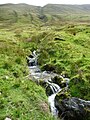
 A previous course of Rampsgill Beck (possibly) - geograph.org.uk - 4697811.jpg 1 024 × 768; 130 KB
-
 A sea of bracken, Martindale - geograph.org.uk - 4697160.jpg 1 024 × 768; 196 KB
-
 A short scramble on Round How - geograph.org.uk - 5174139.jpg 1 500 × 2 000; 641 KB
-

-
 A tree fallen over in Hallinhag Wood - geograph.org.uk - 2135118.jpg 3 872 × 2 592; 5,3 MB
-
 A tributary of Rampsgill Beck - geograph.org.uk - 5917712.jpg 768 × 1 024; 336 KB
-
 A Week before the Floods - geograph.org.uk - 1592837.jpg 640 × 480; 79 KB
-
 Abandoned field above Martindale Old Church - geograph.org.uk - 4696522.jpg 1 024 × 768; 159 KB
-

-
 Abominable Snowman^ - geograph.org.uk - 3391808.jpg 2 560 × 1 920; 780 KB
-
 Above Boredale Hause - geograph.org.uk - 2941298.jpg 2 560 × 1 920; 799 KB
-
 Above Boredale Hause - geograph.org.uk - 5440539.jpg 1 713 × 1 142; 314 KB
-
 Above Dodd Gill - geograph.org.uk - 3393015.jpg 2 560 × 1 920; 2,11 MB
-
 Above Groove Gill - geograph.org.uk - 1387530.jpg 640 × 480; 59 KB
-
 Above Ramps Gill - geograph.org.uk - 3946164.jpg 2 560 × 1 920; 2,07 MB
-
 Above Sandwick - geograph.org.uk - 1949441.jpg 640 × 480; 98 KB
-
 Along the spine between Bannerdale and Boredale - geograph.org.uk - 3000534.jpg 1 024 × 768; 174 KB
-
-
 Ancient yew tree, Martindale old churchyard - geograph.org.uk - 4685511.jpg 1 024 × 768; 182 KB
-
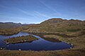
 Angle Tarn (Patterdale) - geograph.org.uk - 5645329.jpg 4 608 × 3 456; 3,43 MB
-
 Angle Tarn - geograph.org.uk - 5055017.jpg 600 × 800; 117 KB
-
 Angle Tarn - geograph.org.uk - 5262108.jpg 960 × 576; 87 KB
-
 Angle Tarn - geograph.org.uk - 5440544.jpg 1 920 × 1 280; 363 KB
-
 Angle Tarn - geograph.org.uk - 5727634.jpg 1 280 × 853; 458 KB
-
 Angle Tarn - geograph.org.uk - 5757128.jpg 1 024 × 768; 185 KB
-
 Angle Tarn - geograph.org.uk - 6434629.jpg 1 280 × 853; 470 KB
-
 Angle Tarn - geograph.org.uk - 6434639.jpg 1 280 × 853; 461 KB
-
 Angle Tarn - geograph.org.uk - 6434646.jpg 1 280 × 853; 439 KB
-
 Angle Tarn - geograph.org.uk - 6447629.jpg 1 024 × 686; 165 KB
-
 Angle Tarn above Patterdale - geograph.org.uk - 6494085.jpg 1 799 × 1 199; 213 KB
-
 Angle Tarn above Patterdale - geograph.org.uk - 6494087.jpg 1 799 × 1 199; 239 KB
-
 Angle Tarn from the north - geograph.org.uk - 5645330.jpg 4 608 × 3 456; 3,14 MB
-
 Angletarn Pikes - geograph.org.uk - 4655989.jpg 640 × 443; 208 KB
-
 Angletarn Pikes - geograph.org.uk - 4804594.jpg 640 × 480; 80 KB
-
 Angletarn Pikes - geograph.org.uk - 5601385.jpg 800 × 600; 82 KB
-
 Anonymous beck falling through drystone wall - geograph.org.uk - 3000889.jpg 768 × 1 024; 449 KB
-
 Approaching Dale Head - geograph.org.uk - 3414848.jpg 1 920 × 2 560; 1,56 MB
-
 Approaching Martindale from Howtown - geograph.org.uk - 1524181.jpg 640 × 480; 115 KB
-
 Approaching Steel Knotts - geograph.org.uk - 3262826.jpg 2 560 × 1 920; 788 KB
-
 Approaching The Knott - geograph.org.uk - 3091598.jpg 2 560 × 1 920; 2,08 MB
-
 Ascending Bonscale Pike - geograph.org.uk - 3260259.jpg 2 560 × 1 920; 542 KB
-
 Ascending Howstead Brow - geograph.org.uk - 4207236.jpg 640 × 480; 81 KB
-
 Ascending Loadpot Hill - geograph.org.uk - 3836196.jpg 2 560 × 1 920; 766 KB
-
 Ascending Steel Knotts - geograph.org.uk - 3391800.jpg 2 560 × 1 920; 760 KB
-
 Ash tree in farmland near Thrang Crag - geograph.org.uk - 5932100.jpg 1 024 × 768; 266 KB
-

-
 Bannerdale - geograph.org.uk - 167994.jpg 640 × 480; 71 KB
-
 Bannerdale Beck - geograph.org.uk - 3002538.jpg 1 024 × 768; 119 KB
-
 Bannerdale Beck below Nab Head - geograph.org.uk - 2998882.jpg 1 024 × 768; 114 KB
-
 Bannerdale Beck, Bannerdale - geograph.org.uk - 4684849.jpg 1 024 × 768; 148 KB
-
 Bannerdale Beck, Martindale - geograph.org.uk - 4696545.jpg 1 024 × 768; 254 KB
-
 Bannerdale Beck, north of Dale Head - geograph.org.uk - 2998921.jpg 1 024 × 768; 147 KB
-
 Bannerdale bridleway - geograph.org.uk - 3000911.jpg 1 024 × 768; 127 KB
-
 Bannerdale sheep - geograph.org.uk - 3000891.jpg 1 024 × 768; 150 KB
-
 Barn at High Ben Green, Martindale - geograph.org.uk - 4697817.jpg 1 024 × 768; 137 KB
-
 Barn Door - geograph.org.uk - 3414864.jpg 1 920 × 2 560; 2,1 MB
-
 Barn in Bannerdale - geograph.org.uk - 3414856.jpg 2 560 × 1 920; 2,18 MB
-
 Barn near Howtown - geograph.org.uk - 2135287.jpg 3 872 × 2 592; 2,85 MB
-
 Barn near Scalehow Wood - geograph.org.uk - 2133901.jpg 3 872 × 2 592; 5,75 MB
-

-
 Beda Fell Summit - geograph.org.uk - 4805937.jpg 640 × 480; 94 KB
-
 Beda Head shelter - geograph.org.uk - 1181461.jpg 640 × 480; 87 KB
-
 Beda Head summit cairn - geograph.org.uk - 1181456.jpg 640 × 480; 98 KB
-
 Below Steel End - geograph.org.uk - 3168159.jpg 3 264 × 2 448; 1,57 MB
-
 Black Crag - geograph.org.uk - 3413700.jpg 2 560 × 1 920; 2,01 MB
-
 Boat in Howtown Bay - geograph.org.uk - 5723531.jpg 1 600 × 1 066; 228 KB
-
 Boggy ground on Beda Fell ridge - geograph.org.uk - 4696568.jpg 1 024 × 768; 187 KB
-
 Boggy ground, Beda Fell - geograph.org.uk - 4696612.jpg 1 024 × 768; 164 KB
-
 Boggy pool on Beda Head - geograph.org.uk - 4696665.jpg 1 024 × 768; 149 KB
-
 Bonscale Pike - geograph.org.uk - 5221315.jpg 640 × 480; 90 KB
-
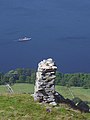
 Bonscale Tower - geograph.org.uk - 3045502.jpg 640 × 480; 89 KB
-
 Bonscale Tower - geograph.org.uk - 4652959.jpg 4 000 × 3 000; 5,06 MB
-
 Bonscale Tower(s) - geograph.org.uk - 4305891.jpg 2 048 × 1 536; 1,1 MB
-
 Sign Post - geograph.org.uk - 651010.jpg 480 × 640; 77 KB
-
 Boredale - geograph.org.uk - 1822300.jpg 3 456 × 2 304; 1,29 MB
-
 Boredale - geograph.org.uk - 2232744.jpg 3 456 × 2 304; 1,85 MB
-
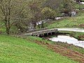
 Boredale and the bridge at Nettleslack - geograph.org.uk - 2886525.jpg 1 600 × 1 067; 504 KB
-
 Boredale Beck - geograph.org.uk - 2266407.jpg 3 264 × 2 448; 2,6 MB
-
 Boredale Beck - geograph.org.uk - 2999126.jpg 1 024 × 768; 120 KB
-
 Boredale Beck - geograph.org.uk - 3413697.jpg 2 560 × 1 920; 960 KB
-
 Boredale from Hallin Bank - geograph.org.uk - 3338522.jpg 4 608 × 3 456; 3,93 MB
-
 Boredale Hause - geograph.org.uk - 1745674.jpg 640 × 480; 78 KB
-
 Boredale Hause from path to Place Fell - geograph.org.uk - 3031762.jpg 1 600 × 1 198; 371 KB
-
 Boredale Head - geograph.org.uk - 1822288.jpg 3 456 × 2 304; 1,52 MB
-
 Boredale viewed from Hallin Fell - geograph.org.uk - 1312223.jpg 640 × 426; 62 KB
-
 Boredale's first or last tall trees - geograph.org.uk - 3002858.jpg 1 024 × 768; 119 KB
-

-
 Boundary stone, Loadpot Hill - geograph.org.uk - 4400169.jpg 800 × 600; 177 KB
-
 Bracken on the ridge top, near Winter Crag - geograph.org.uk - 3000635.jpg 1 024 × 768; 134 KB
-
 Bridge End viewed from Hallin Fell - geograph.org.uk - 1312213.jpg 640 × 426; 69 KB
-
 Bridge over Bannerdale Beck - geograph.org.uk - 4696536.jpg 640 × 384; 98 KB
-
 Bridge over Boredale Beck - geograph.org.uk - 4317486.jpg 2 048 × 1 536; 1,53 MB
-
 Bridge over Howegrain Beck - geograph.org.uk - 3853180.jpg 640 × 425; 174 KB
-
 Bridge over Howegrain Beck - geograph.org.uk - 4317466.jpg 2 048 × 1 536; 1,76 MB
-
 Bridge over Howegrain Beck - geograph.org.uk - 4697649.jpg 1 024 × 768; 207 KB
-
 Bridge over Howegrain Beck, Martindale - geograph.org.uk - 4697668.jpg 1 024 × 768; 193 KB
-
 Bridge over Sandwick Beck - geograph.org.uk - 3168970.jpg 3 264 × 2 448; 2,6 MB
-
 Bridge, Howgrain Beck - geograph.org.uk - 909395.jpg 640 × 480; 137 KB
-
 Bridleway above How Town - geograph.org.uk - 2037165.jpg 640 × 468; 97 KB
-
 Bridleway above Ullswater - geograph.org.uk - 4331121.jpg 2 048 × 1 536; 1,87 MB
-
 Bridleway approaching Boredale Head - geograph.org.uk - 3002876.jpg 1 024 × 768; 104 KB
-
 Bridleway down Boredale - geograph.org.uk - 3002864.jpg 1 024 × 768; 106 KB
-
 Bridleway down The Coombs - geograph.org.uk - 2998954.jpg 1 024 × 768; 139 KB
-
 Bridleway Sandwick to Christy Bridge - geograph.org.uk - 1181468.jpg 640 × 480; 129 KB
-
 Bridleway to Winter Crag, Martindale - geograph.org.uk - 4697675.jpg 1 024 × 768; 181 KB
-
 Bridleway towards Patterdale - geograph.org.uk - 4317494.jpg 2 048 × 1 536; 1,35 MB
-
 British Summer Time On Loadpot Hill - geograph.org.uk - 3392368.jpg 2 560 × 1 920; 1,75 MB
-
 Brothers Water as seen from Angletarn Pikes - geograph.org.uk - 6493823.jpg 1 799 × 1 199; 418 KB
-
 Brunt Stones - geograph.org.uk - 1387527.jpg 640 × 480; 86 KB
-
 Buck Crag from the north-west - geograph.org.uk - 984231.jpg 488 × 640; 111 KB
-
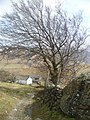
 Buildings at Martindale - geograph.org.uk - 1171959.jpg 640 × 480; 108 KB
-
 Cairn above Cat Crag - geograph.org.uk - 5174310.jpg 2 000 × 1 500; 585 KB
-
 Cairn at the north end of Sleet Fell - geograph.org.uk - 909140.jpg 640 × 480; 69 KB
-
-
 Cairn behind The Bungalow - geograph.org.uk - 4715096.jpg 640 × 480; 93 KB
-
 Cairn on Bonscale Pike - geograph.org.uk - 4305885.jpg 2 048 × 1 536; 1,21 MB
-
 Cairn on Rampsgill Head - geograph.org.uk - 6463048.jpg 2 000 × 1 500; 1,71 MB
-
 Cairn on Wether Hill - geograph.org.uk - 3836423.jpg 2 560 × 1 920; 934 KB
-
 Cairn, High Raise - geograph.org.uk - 2051341.jpg 2 560 × 1 920; 1,1 MB
-
 Cairn, Low Birk Fell - geograph.org.uk - 1056077.jpg 640 × 480; 63 KB
-
 Cairn, The Knight - geograph.org.uk - 909226.jpg 640 × 480; 87 KB
-
 Cairns at the top of High Raise - geograph.org.uk - 6463091.jpg 2 000 × 1 500; 1,82 MB
-
 Canoeing in Gowbarrow Bay - geograph.org.uk - 5722470.jpg 1 600 × 1 066; 349 KB
-
 Canoes on Ullswater - geograph.org.uk - 6119995.jpg 640 × 480; 389 KB
-
 Cars parked below the Bungalow - geograph.org.uk - 1583794.jpg 640 × 480; 94 KB
-
 Chapel in the Hause - geograph.org.uk - 1822309.jpg 3 456 × 2 085; 1,2 MB
-
 Cheaply-repaired drystone wall, Bannerdale - geograph.org.uk - 4684834.jpg 1 024 × 768; 169 KB
-
 Christy Bridge and Winter Crag Farm - geograph.org.uk - 3380985.jpg 2 592 × 1 944; 2,12 MB
-
 Christy Bridge, Martindale.jpg 640 × 480; 125 KB
-
 Clearing in the woodland in Ramps Gill - geograph.org.uk - 5932052.jpg 1 024 × 768; 348 KB
-
 Climbing The Hause - geograph.org.uk - 5816116.jpg 4 210 × 2 805; 1,61 MB
-
 Climbing towards Beda Fell - geograph.org.uk - 3590601.jpg 2 592 × 1 944; 1,58 MB
-
 Complex ruined sheepfold, Ramps Gill - geograph.org.uk - 3003532.jpg 1 024 × 768; 164 KB
-
 Cornice above Cote Farm - geograph.org.uk - 3393026.jpg 2 560 × 1 920; 743 KB
-
 Cote Farm - geograph.org.uk - 3393031.jpg 2 560 × 1 920; 927 KB
-
 Cote Farm seen from Pikeawassa - geograph.org.uk - 4310236.jpg 2 048 × 1 536; 1 016 KB
-
 Cote Farm, Fusedale - geograph.org.uk - 2998986.jpg 1 024 × 768; 124 KB
-
 Cotehow - geograph.org.uk - 789094.jpg 640 × 577; 87 KB
-
 Crag rim at Rampsgill Head - geograph.org.uk - 4840995.jpg 1 500 × 1 000; 1,55 MB
-
 Crags and trees, west of Lanty Tarn - geograph.org.uk - 4697236.jpg 1 024 × 768; 168 KB
-
 Crags on Rampsgill Head - geograph.org.uk - 3035158.jpg 2 560 × 1 920; 1,33 MB
-
 Crossing Peat Hags on The Nab - geograph.org.uk - 6454954.jpg 2 000 × 1 500; 1,73 MB
-
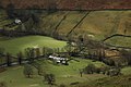
 Dale Head Farm - geograph.org.uk - 3590797.jpg 2 592 × 1 944; 1,87 MB
-
 Dale Head farm lives up to its name - geograph.org.uk - 1581052.jpg 640 × 480; 59 KB
-

-
 Dale Head Farm, Martindale - geograph.org.uk - 4685191.jpg 1 024 × 768; 138 KB
-
 Dale Head, Martindale - geograph.org.uk - 5899383.jpg 4 000 × 3 000; 4,9 MB
-
 Damaged but surviving in Ramps Gill - geograph.org.uk - 5932043.jpg 1 024 × 768; 221 KB
-
 Deciduous wood in Ramps Gill - geograph.org.uk - 5932061.jpg 1 024 × 768; 360 KB
-
 Deer forest - geograph.org.uk - 2197239.jpg 640 × 480; 55 KB
-
 Deer in Bannerdale - geograph.org.uk - 5440117.jpg 1 920 × 1 280; 525 KB
-
 Deer in Martindale - geograph.org.uk - 1583762.jpg 640 × 480; 94 KB
-
 Deer Wallow - geograph.org.uk - 3135132.jpg 2 560 × 1 920; 2,04 MB
-
 Derelict wall, below Heck Crag, Bannerdale - geograph.org.uk - 4684844.jpg 1 024 × 768; 175 KB
-
 Descending Loadpot Hill - geograph.org.uk - 3262822.jpg 2 560 × 1 920; 980 KB
-
 Descent to Ullswater by Scalehow Beck - geograph.org.uk - 4658939.jpg 4 000 × 3 000; 4,84 MB
-
 Dodd Gill - geograph.org.uk - 3393020.jpg 2 560 × 1 920; 442 KB
-
 Dodd Gill - geograph.org.uk - 3393024.jpg 2 560 × 1 920; 2,05 MB
-
 Dodd Gill, Fusedale - geograph.org.uk - 2999067.jpg 1 024 × 768; 218 KB
-
 Doe Green - geograph.org.uk - 1181490.jpg 640 × 480; 134 KB
-
 Doe Green - geograph.org.uk - 1822257.jpg 3 437 × 2 277; 1,84 MB
-
 Doe Green - geograph.org.uk - 1885567.jpg 1 600 × 1 068; 426 KB
-
 Doe Green - geograph.org.uk - 6445583.jpg 1 024 × 634; 158 KB
-
 Dog in lifejacket, Ullswater - geograph.org.uk - 2037525.jpg 640 × 363; 84 KB
-
 Down the hill to Howtown - geograph.org.uk - 5811087.jpg 5 472 × 3 648; 3,09 MB
-
 Drift on Place Fell - geograph.org.uk - 3413713.jpg 2 560 × 1 920; 1,98 MB
-
 Dry gully below Red Crag - geograph.org.uk - 5917479.jpg 1 024 × 768; 228 KB
-
 Dry stone wall on the Straits of Riggindale - geograph.org.uk - 6476255.jpg 2 000 × 1 500; 1,92 MB
-
 Dry stone walls by the Howtown path - geograph.org.uk - 2944201.jpg 640 × 480; 106 KB
-
 Drystone wall below the Angle Tarn path - geograph.org.uk - 3002571.jpg 1 024 × 768; 144 KB
-
 Drystone wall built up with wire fencing - geograph.org.uk - 2998359.jpg 1 024 × 768; 173 KB
-
 Drystone wall by Satura Crag - geograph.org.uk - 5757129.jpg 1 024 × 758; 273 KB
-
 Drystone wall climbing to meet the path - geograph.org.uk - 3002583.jpg 1 024 × 768; 190 KB
-
 Drystone wall climbing up towards Nab End - geograph.org.uk - 5932484.jpg 1 024 × 768; 229 KB
-
 Drystone wall in Ramps Gill - geograph.org.uk - 3003478.jpg 1 024 × 768; 144 KB
-
 Drystone wall, Bannerdale - geograph.org.uk - 4685173.jpg 1 024 × 768; 151 KB
-
 Drystone walls in Bannerdale - geograph.org.uk - 3000871.jpg 1 024 × 768; 161 KB
-
 Drystone walls, Bannerdale - geograph.org.uk - 5933473.jpg 1 024 × 768; 225 KB
-
 Eastern approach to Martindale - geograph.org.uk - 5026597.jpg 1 024 × 683; 919 KB
-
 Enclosures in Boredale - geograph.org.uk - 4556782.jpg 1 500 × 1 000; 2,07 MB
-
 Entrance to Garth Heads - geograph.org.uk - 3636932.jpg 640 × 425; 389 KB
-

-
 Faint quad bike tracks in Ramps Gill - geograph.org.uk - 5933251.jpg 1 024 × 768; 239 KB
-
 Fall, Scalehow Beck - geograph.org.uk - 3956959.jpg 2 560 × 1 920; 2,03 MB
-
 Fallen Oaks - geograph.org.uk - 2428737.jpg 1 920 × 2 560; 2,13 MB
-
 Falls on Scalehow Beck - geograph.org.uk - 892996.jpg 640 × 425; 108 KB
-
 Farm at Dale Head - geograph.org.uk - 3170551.jpg 640 × 480; 105 KB
-
 Farm buildings at Dale Head, Martindale - geograph.org.uk - 5899385.jpg 4 000 × 3 000; 4,88 MB
-
 Farm buildings at Dale Head, Martindale - geograph.org.uk - 5899388.jpg 4 000 × 3 000; 4,69 MB
-
 Farmer's gated route, Bannerdale - geograph.org.uk - 2998369.jpg 1 024 × 768; 149 KB
-
 Farmland with trees, Cote Farm, Fusedale - geograph.org.uk - 4697634.jpg 1 024 × 768; 128 KB
-
 Feeding Herdwicks on the Coombs - geograph.org.uk - 3389932.jpg 2 247 × 1 459; 495 KB
-
 Fence and gate with notice - geograph.org.uk - 5388315.jpg 1 500 × 789; 1,03 MB
-
 Fences are the new walls, High Ben Green - geograph.org.uk - 4697683.jpg 1 024 × 768; 126 KB


_-_geograph.org.uk_-_4697811.jpg)


_-_geograph.org.uk_-_5645329.jpg)


_-_geograph.org.uk_-_4305891.jpg)


