Category:Matlock, Derbyshire
Aller à la navigation
Aller à la recherche
Deutsch: Matlock ist eine Stadt in der Grafschaft Derbyshire in England. Sie liegt im Tal des Flusses Derwent an der südöstlichen Grenze des Peak-District-Nationalparks, ca. 35 km nördlich von Derby. Die Stadt ist Verwaltungssitz sowohl der Grafschaft als auch des Distrikts Derbyshire Dales.
English: Matlock is the county town of Derbyshire, England. It is situated at the south eastern edge of the Peak District, and is twinned with the French town Eaubonne. The former spa resort Matlock Bath lies immediately south of the town on the A6. Matlock, as a town, has a population of 10,689. The wider population of the Matlock urban area is approximately 20,000 (including Darley Dale and Matlock Bath). Often, the Matlock area is considered to include Wirksworth, due to the close proximity of the two towns. This would bring the area's population closer to 30,000.
Italiano: Matlock è un paese di 9.496 abitanti, capoluogo della contea del Derbyshire, in Inghilterra.
Norsk bokmål: Matlock er administrasjonsbyen i Derbyshire og distriktet Derbyshire Dales i England. Den var tidligere et kursted, og ligger ved elven Derwent.
Polski: Matlock – stolica hrabstwa Derbyshire w Anglii. Miasto jest położone na południowym skraju Peak District i jest miastem partnerskim francuskiego Eaubonne. Wioska Matlock Bath leży na południu miasta przy drodze głównej A6. Matlock jest oddalone o ok. 14,5 km na południowy zachód od Chesterfield i otoczone jest przez miasta: Derby (oddalone o ok. 30,5 km), Sheffield (ok. 32 km) i Nottingham (ok. 46 km). Droga główna A6 prowadzi dalej do metropolitalnego obszaru Stockport (oddalonego o ok. 48 km od Matlock) i miasta Manchester (ok. 72 km od Matlock). Geograficznie Matlock leży w centralnej Anglii, w zachodniej części hrabstwa Derbyshire w tzw. Derbyshire Dales – dystrykcie, który obejmuje takie miasta jak Wirksworth i Bakewell. Przemysł na tym obszarze jest stosunkowo słabo rozwinięty, czego głównym powodem jest upadek zakładów produkcyjnych. Możliwości zatrudnienia oprócz stanowisk urzędowych i w turystyce są niewielkie. Wielu mieszkańców Matlock dojeżdża obecnie do pracy do Chesterfield i konurbacji South Yorkshire. W 2005 roku w ramach inicjatywy rządowej o nazwie The Nothern Way zaproponowano włączenie Matlock do nowo utworzonego Regionu Miasta Sheffield, co ostatecznie oznaczałoby reorganizację Rady Regionalnej i Rady Hrabstwa. Jednak jak do tej pory nie ma ustalonego terminu wdrożenia tej inicjatywy.
Română: Matlock este un oraş în Regatul Unit, reşedinţa comitatului Derbyshire, regiunea East Midlands, Anglia. Oraşul se află în districtul Derbyshire Dales a cărui reşedinţă este.
localité britannique  | |||||
| Téléverser des médias | |||||
| Nature de l’élément | |||||
|---|---|---|---|---|---|
| Lieu | Matlock Town, Derbyshire Dales, Derbyshire, Midlands de l'Est, Angleterre | ||||
| Population |
| ||||
| Superficie |
| ||||
| À ne pas confondre avec | |||||
 | |||||
Sous-catégories
Cette catégorie comprend 18 sous-catégories, dont les 18 ci-dessous.
A
B
- Bank Road, Matlock (5 F)
D
- The Duke William, Matlock (6 F)
F
G
- St Giles Church, Matlock (9 F)
H
L
- Lumsdale conservation area (43 F)
M
- Masson Hill Quarry (1 F)
- Matlock bandstand (4 F)
- Matlock Bridge (6 F)
- Matlock Town Hall (2 F)
P
- Pic Tor War Memorial (1 F)
S
- Smedley's Hydro (8 F)
T
W
- Wheatsheaf Farm, Matlock (4 F)
Pages dans la catégorie « Matlock, Derbyshire »
Cette catégorie comprend seulement la page ci-dessous.
Média dans la catégorie « Matlock, Derbyshire »
Cette catégorie comprend 241 fichiers, dont les 200 ci-dessous.
(page précédente) (page suivante)-

-
 "To provide rest for the aged" - geograph.org.uk - 1638037.jpg 640 × 480 ; 114 kio
-
 15 Knowlestone Place, Matlock.jpg 4 319 × 3 239 ; 3,47 Mio
-
 5 Knowleston Place, Matlock.jpg 4 035 × 3 027 ; 2,54 Mio
-
 7-13 Knowleston Place, Matlock.jpg 3 833 × 2 875 ; 2,87 Mio
-
 86-92 Church Street, Matlock.jpg 4 320 × 3 240 ; 3,97 Mio
-
 A Bit of a tip - geograph.org.uk - 1241448.jpg 640 × 480 ; 92 kio
-
 A6 and River Derwent, Derwent Valley (geograph 6126350).jpg 1 024 × 768 ; 209 kio
-
 A6 Bypass - geograph.org.uk - 1196857.jpg 640 × 480 ; 76 kio
-

-

-
 A632 Limetree Road - Junction with A615 - geograph.org.uk - 1196777.jpg 640 × 480 ; 76 kio
-
 Adjacent Methodist Chapels - geograph.org.uk - 1638017.jpg 640 × 476 ; 74 kio
-
 Alabaster Peep Egg "Present From Matlock", Fotomuseum Antwerpen.jpg 1 000 × 667 ; 385 kio
-
 Alabaster Peep Egg "Present From Matlock", Fotomuseum Antwerpen2.jpg 667 × 1 000 ; 435 kio
-
 Alabaster Peep Egg, Fotomuseum Antwerp, Belgium, 2016-07-23, 1.jpg 3 648 × 5 472 ; 4,3 Mio
-
 Alabaster Peep Egg, Fotomuseum Antwerp, Belgium, 2016-07-23, 2.jpg 3 648 × 5 472 ; 4,29 Mio
-
 Amos Green - 1800 - ref Green-Matlock-B07563.jpg 2 250 × 1 456 ; 387 kio
-
 Autumn view of Bonsall Moor - geograph.org.uk - 313834.jpg 640 × 480 ; 55 kio
-
 Bailey's Mill - geograph.org.uk - 1639001.jpg 640 × 480 ; 121 kio
-
 Bailey's Tump - geograph.org.uk - 1771893.jpg 2 048 × 1 536 ; 1,73 Mio
-
 Bakewell Road - geograph.org.uk - 1200669.jpg 640 × 480 ; 75 kio
-
 Bakewell Road in Matlock - geograph.org.uk - 3090447.jpg 3 812 × 2 732 ; 1,64 Mio
-
 Bentley Brook at Bailey's Mill - geograph.org.uk - 1639074.jpg 640 × 465 ; 99 kio
-
 Bottom Moor (Fallen Tree and Derelict Building) - geograph.org.uk - 309954.jpg 640 × 480 ; 181 kio
-
 Bottom Moor - (Derelict Building with Moss) - geograph.org.uk - 340269.jpg 640 × 480 ; 189 kio
-
 Bottom Moor - (Derelict Building with Moss) - geograph.org.uk - 341021.jpg 640 × 480 ; 190 kio
-

-
 Bridge of Local Government - geograph.org.uk - 1637996.jpg 640 × 480 ; 73 kio
-
 Bridge over the River Derwent (geograph 5861653).jpg 4 320 × 3 240 ; 4,05 Mio
-
 Chesterfield Road, Matlock - geograph.org.uk - 1522583.jpg 640 × 479 ; 79 kio
-
 Chimneys at Matlock - geograph.org.uk - 1522628.jpg 640 × 479 ; 114 kio
-
 Clock tower in Matlock - geograph.org.uk - 1088862.jpg 640 × 480 ; 71 kio
-
 Cobs and cakes - geograph.org.uk - 1638023.jpg 640 × 581 ; 115 kio
-
 Converted mill on Matlock Green - geograph.org.uk - 1638044.jpg 640 × 480 ; 78 kio
-
 County Hall, Matlock - geograph.org.uk - 1638004.jpg 480 × 640 ; 85 kio
-

-
 Crown Hotel Matlock.jpg 1 276 × 1 007 ; 52 kio
-
 Crown Square - geograph.org.uk - 1200661.jpg 640 × 480 ; 86 kio
-
 Crown Square seen from bridge over the river - geograph.org.uk - 1288093.jpg 640 × 404 ; 74 kio
-
 Dale Road (A6) - Viewed from Car Park - geograph.org.uk - 643646.jpg 640 × 480 ; 96 kio
-
 Dale Road Matlock - geograph.org.uk - 1119867.jpg 640 × 371 ; 62 kio
-
 Dale Road Matlock August 2010.jpg 1 280 × 960 ; 312 kio
-
 Darley Dale - Whitworth Hospital.jpg 1 600 × 1 230 ; 560 kio
-
 Derelict building at Bailey's Mill - geograph.org.uk - 1639031.jpg 640 × 480 ; 133 kio
-
 Descending to Matlock, on a new road - geograph.org.uk - 1231988.jpg 640 × 480 ; 76 kio
-
 Development of Sainsburys, Matlock - geograph.org.uk - 1088881.jpg 640 × 480 ; 66 kio
-
 Drabbles Road, Matlock - geograph.org.uk - 1637969.jpg 640 × 480 ; 82 kio
-
 Dry Stone Wall and an avenue of Beech Trees - geograph.org.uk - 543807.jpg 640 × 480 ; 165 kio
-
 Dry Stone Wall in the process of being repaired - geograph.org.uk - 543774.jpg 640 × 480 ; 168 kio
-
 Drytooling Masson Lees Peak District.jpg 1 975 × 1 975 ; 1,4 Mio
-
 Duke of Wellington, Matlock - geograph.org.uk - 1522588.jpg 640 × 485 ; 80 kio
-
 Fields around Matlock - geograph.org.uk - 1639155.jpg 640 × 480 ; 58 kio
-
 Fingerpost on Limestone Way, nearly gone - geograph.org.uk - 1639161.jpg 640 × 480 ; 97 kio
-
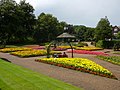 Flower gardens, Matlock - geograph.org.uk - 1640053.jpg 640 × 480 ; 110 kio
-
 Footbridge over River Derwent - geograph.org.uk - 1288233.jpg 640 × 419 ; 99 kio
-
 Footbridge over River Derwent to Hall Leys Park - geograph.org.uk - 1288198.jpg 640 × 427 ; 110 kio
-
 Footbridge over the River Derwent, Matlock - geograph.org.uk - 1639116.jpg 640 × 480 ; 94 kio
-
 Footpath ascending from Matlock - geograph.org.uk - 1639147.jpg 640 × 480 ; 66 kio
-
 Footpath crossing at Matlock Mill - geograph.org.uk - 1735450.jpg 853 × 1 280 ; 306 kio
-
 Footpath from Red Lion to Limetree Road - geograph.org.uk - 1196790.jpg 640 × 480 ; 96 kio
-
 Former tramway shelter in Hall Leys Park - geograph.org.uk - 1288163.jpg 421 × 640 ; 120 kio
-
 G VI R wallbox (ref DE4 906) - geograph.org.uk - 1522595.jpg 479 × 640 ; 125 kio
-
 Greenhills Farm, Matlock - geograph.org.uk - 1639202.jpg 640 × 480 ; 60 kio
-
 Gritstone Road - geograph.org.uk - 1522581.jpg 640 × 479 ; 79 kio
-
 Hall Leys park - geograph.org.uk - 1088868.jpg 640 × 480 ; 119 kio
-
 Hall Leys Park in Matlock town - geograph.org.uk - 1088856.jpg 640 × 480 ; 80 kio
-
 Hall Leys Pleasure Ground (15456968378).jpg 2 500 × 1 618 ; 799 kio
-
 Harboro' Rocks (7872912792).jpg 3 216 × 2 144 ; 3,46 Mio
-
 Heading for goal - geograph.org.uk - 1539417.jpg 640 × 480 ; 53 kio
-
 Highfields School - geograph.org.uk - 1522575.jpg 640 × 426 ; 57 kio
-
 Highfields School - geograph.org.uk - 1522577.jpg 640 × 479 ; 106 kio
-
 Highfields school 01.jpg 550 × 133 ; 19 kio
-
 Hilly street - Flickr - Monika Kostera (urbanlegend).jpg 4 608 × 3 456 ; 6,09 Mio
-
 Holt Lane Tunnel, Matlock - geograph.org.uk - 1639138.jpg 640 × 480 ; 120 kio
-

-
 Image-Ernest Baileys.jpg 350 × 258 ; 27 kio
-
 Inside the Matlock egg.jpg 3 520 × 4 176 ; 12,45 Mio
-
 John Smedley Lea Mills, Matlock.jpg 290 × 200 ; 13 kio
-
 John Smedley Lea Mills.jpg 2 848 × 4 288 ; 5,84 Mio
-

-
 Lime Tree Hill - geograph.org.uk - 1522590.jpg 640 × 445 ; 82 kio
-
 Lime Tree Hill - geograph.org.uk - 1522591.jpg 640 × 479 ; 98 kio
-
 Looking down Rockside Steps - geograph.org.uk - 1522634.jpg 479 × 640 ; 103 kio
-
 Lovely view.JPG 2 560 × 1 920 ; 1,19 Mio
-
 Matlock - Bailey's Mill.jpg 1 229 × 1 600 ; 395 kio
-
 Matlock - Chapels on Bank Road.jpg 2 048 × 1 536 ; 702 kio
-
 Matlock - County Offices - Colonnade Stonework - geograph.org.uk - 1774093.jpg 1 600 × 1 314 ; 366 kio
-
 Matlock - County Offices from Hall Leys Park - geograph.org.uk - 1353839.jpg 640 × 480 ; 92 kio
-

-
 Matlock - Crown Buildings.JPG 2 272 × 1 704 ; 836 kio
-
 Matlock - Derwent House - geograph.org.uk - 1412053.jpg 640 × 480 ; 106 kio
-
 Matlock - Evans Jeweller.jpg 1 600 × 1 200 ; 602 kio
-
 Matlock - Fingerpost on Limestone Way - geograph.org.uk - 619174.jpg 640 × 480 ; 139 kio
-
 Matlock - footbridge to Pic Tor (Geograph-2242688-by-Dave-Bevis).jpg 1 600 × 1 173 ; 668 kio
-
 Matlock - former market hall.jpg 1 600 × 1 181 ; 543 kio
-
 Matlock - HSBC Bank on Dale Road (Geograph-2242878-by-Dave-Bevis).jpg 1 600 × 1 200 ; 347 kio
-
 Matlock - Methodist ^ United Reformed Church - geograph.org.uk - 2368012.jpg 1 600 × 1 200 ; 599 kio
-
 Matlock - NatWest Bank.jpg 1 161 × 1 600 ; 411 kio
-
 Matlock - Olde Englishe Hotel.jpg 1 600 × 1 217 ; 487 kio
-
 Matlock - pool with a view.jpg 1 600 × 1 173 ; 508 kio
-
 Matlock - railway bridge and Holt Terrace.jpg 1 600 × 1 171 ; 561 kio
-
 Matlock - railway bridge over River Derwent (geograph 2242669).jpg 1 600 × 1 200 ; 636 kio
-
 Matlock - Riber Castle from Lime Tree Road - geograph.org.uk - 1353828.jpg 480 × 640 ; 85 kio
-
 Matlock - Rockside Hall from top of Bank Road.jpg 1 936 × 1 416 ; 2,24 Mio
-
 Matlock - Rutland Court.JPG 1 926 × 1 420 ; 1,69 Mio
-
 Matlock - shops on Matlock Green - geograph.org.uk - 1353832.jpg 640 × 480 ; 94 kio
-
 Matlock - terrace on Knowleston Place - geograph.org.uk - 1412050.jpg 480 × 640 ; 133 kio
-
 Matlock - The Gate Inn.JPG 2 011 × 1 484 ; 1,62 Mio
-
 Matlock - Town from start of Limestone Way - geograph.org.uk - 619169.jpg 640 × 480 ; 109 kio
-
 Matlock - View from the new Bus Station - geograph.org.uk - 643691.jpg 640 × 480 ; 69 kio
-

-
 Matlock Bank - geograph.org.uk - 5518176.jpg 1 600 × 1 279 ; 431 kio
-
 Matlock Bank showing hydropathic Derbyshire England.jpg 1 070 × 835 ; 178 kio
-
 Matlock Bank showing hydropathic, Derbyshire, England-LCCN2002696700.jpg 3 680 × 2 738 ; 3,17 Mio
-
 Matlock Bank showing hydropathic, Derbyshire, England-LCCN2002696700.tif 3 680 × 2 738 ; 28,83 Mio
-
 Matlock Bank, Rutland Street - geograph.org.uk - 1522604.jpg 640 × 479 ; 97 kio
-
 Matlock Bank, Rutland Street - geograph.org.uk - 1522606.jpg 473 × 640 ; 98 kio
-
 Matlock Bank, Rutland Street - geograph.org.uk - 1522607.jpg 479 × 640 ; 106 kio
-
 Matlock boundary sign. - geograph.org.uk - 152609.jpg 640 × 480 ; 137 kio
-
 Matlock Bridge shops - geograph.org.uk - 1119859.jpg 640 × 460 ; 71 kio
-
 Matlock clock tower - geograph.org.uk - 652977.jpg 640 × 480 ; 55 kio
-
 Matlock Cricket Club and Matlock Town FC - geograph.org.uk - 1638027.jpg 640 × 480 ; 55 kio
-
 Matlock Dale (North) - geograph.org.uk - 1309332.jpg 640 × 480 ; 99 kio
-
 Matlock Derbyshire banner.JPG 2 800 × 400 ; 821 kio
-
 Matlock Derbyshire.JPG 3 872 × 2 592 ; 4,15 Mio
-
 Matlock from Rockside - geograph.org.uk - 1522625.jpg 640 × 479 ; 101 kio
-
 Matlock houses on the A632 - geograph.org.uk - 1803268.jpg 640 × 480 ; 63 kio
-
 Matlock Mill - geograph.org.uk - 1735421.jpg 1 280 × 885 ; 256 kio
-
 Matlock Mill - geograph.org.uk - 1735429.jpg 848 × 1 280 ; 335 kio
-
 Matlock Mill - geograph.org.uk - 1735444.jpg 839 × 1 280 ; 185 kio
-
 Matlock Mill - geograph.org.uk - 1735447.jpg 1 280 × 853 ; 296 kio
-
 Matlock Mill - geograph.org.uk - 1735453.jpg 1 280 × 829 ; 227 kio
-
 Matlock Mill Malthouse - geograph.org.uk - 1735431.jpg 1 280 × 828 ; 320 kio
-
 Matlock Pleasure Grounds - geograph.org.uk - 937450.jpg 640 × 439 ; 118 kio
-
 Matlock Riberview.jpg 290 × 193 ; 32 kio
-
 Matlock South Parade and Heights of Abraham Derbyshire England.jpg 1 070 × 835 ; 178 kio
-
 Matlock South Parade and Heights of Abraham, Derbyshire, England-LCCN2002696699.jpg 3 679 × 2 738 ; 3,2 Mio
-
 Matlock South Parade and Heights of Abraham, Derbyshire, England-LCCN2002696699.tif 3 679 × 2 738 ; 28,82 Mio
-
 Matlock Town Football Club, Causeway Lane, Derbyshire.jpg 2 304 × 3 072 ; 1,12 Mio
-
 Matlock town from High Tor - geograph.org.uk - 426717.jpg 640 × 480 ; 123 kio
-
 Matlock Town Main Stand.jpg 3 552 × 2 000 ; 2,14 Mio
-
 Matlock Town v Derby County.jpg 3 872 × 2 176 ; 3,24 Mio
-
 Matlock with promenade and Heights of Jacob Derbyshire England.jpg 1 073 × 835 ; 161 kio
-
 Matlock with promenade and Heights of Jacob, Derbyshire, England-LCCN2002696698.jpg 3 690 × 2 738 ; 2,95 Mio
-
 Matlock with promenade and Heights of Jacob, Derbyshire, England-LCCN2002696698.tif 3 690 × 2 738 ; 28,91 Mio
-
 Matlock's Station Masters House - geograph.org.uk - 406746.jpg 640 × 480 ; 155 kio
-
 Matlock, Derbyshire (viewed from a cable car).jpg 338 × 450 ; 18 kio
-
 Matlock, Derbyshire ... Postal Services. (6244172441).jpg 4 320 × 3 240 ; 5,26 Mio
-
 Matlock, Derbyshire ... Smedley Street Post Office - closed. DE4 911 (6244167147).jpg 4 320 × 3 240 ; 5,98 Mio
-

-
 Matlock, Derbyshire.jpg 1 600 × 1 200 ; 267 kio
-
 Matlock, The Switzerland of England.jpg 1 217 × 2 000 ; 299 kio
-
 Matlocktown.png 461 × 256 ; 218 kio
-
 MatlockTownFC.jpg 2 560 × 1 920 ; 1,85 Mio
-
 Mill chimney, Matlock, comp.jpg 1 655 × 2 513 ; 991 kio
-
 Mill chimney, Matlock.jpg 1 655 × 2 513 ; 2,07 Mio
-
 Municipal gardens and frozen pond - geograph.org.uk - 1639106.jpg 640 × 480 ; 78 kio
-
 New A6 bridge over the Derwent (geograph 2336107).jpg 640 × 427 ; 71 kio
-
 New road development A6 at Matlock - geograph.org.uk - 1088875.jpg 640 × 480 ; 70 kio
-
 Old tramway depot - geograph.org.uk - 1522599.jpg 640 × 479 ; 75 kio
-
 Old tramway depot - geograph.org.uk - 1522601.jpg 640 × 479 ; 70 kio
-
 Old tramway depot - geograph.org.uk - 1522605.jpg 640 × 479 ; 84 kio
-
 On the A6 between Matlock and Matlock Bath - geograph.org.uk - 1639913.jpg 640 × 480 ; 78 kio
-
 Ordnance Survey One-Inch Sheet 111 Buxton & Matlock, Published 1962.jpg 8 251 × 9 878 ; 12,75 Mio
-
 Ordnance Survey One-Inch Sheet 111 Buxton and Matlock, Published 1947.jpg 8 165 × 9 535 ; 12,98 Mio
-
 Ordnance Survey One-Inch Sheet 45 Buxton & Matlock, Published 1923.jpg 11 908 × 8 825 ; 13,36 Mio
-
 Ordnance Survey One-Inch Tourist Map of the Peak District, Published 1924.jpg 12 011 × 15 987 ; 89,55 Mio
-

-
 Paddle gear - geograph.org.uk - 1735437.jpg 853 × 1 280 ; 339 kio
-
 Petrol Station in Knowleston Place - geograph.org.uk - 1196874.jpg 640 × 480 ; 92 kio
-
 Post Office, Matlock Bridge - geograph.org.uk - 1372923.jpg 640 × 426 ; 54 kio
-
 Postcard of Switzerland View, Matlock.jpg 4 083 × 2 638 ; 11,36 Mio
-
 Power of the Sun.JPG 2 560 × 1 920 ; 955 kio
-
 Putting up the Crimbo lights , Matlock Park (6355514221).jpg 2 736 × 3 447 ; 10,2 Mio
-
 Rave at The Grand Pavilion, Matlock Bath (7th December 2019).jpg 1 942 × 2 212 ; 1,24 Mio
-
 Red Cross House - geograph.org.uk - 1638992.jpg 640 × 480 ; 74 kio
-
 River Derwent - Viewed from Car Park on Dale Road - geograph.org.uk - 643657.jpg 640 × 480 ; 131 kio
-
 River Derwent and Hall Leys Park - geograph.org.uk - 1288111.jpg 640 × 405 ; 94 kio
-
 River Derwent flood height marks - geograph.org.uk - 1288250.jpg 640 × 427 ; 105 kio
-
 River Derwent near Hall Leys Park - geograph.org.uk - 1288174.jpg 640 × 427 ; 100 kio
-
 River Derwent seen from footbridge - geograph.org.uk - 1288270.jpg 640 × 427 ; 101 kio
-
 Riverbank Guest House, Matlock - geograph.org.uk - 1407616.jpg 640 × 480 ; 84 kio
-
 Rockside Hydro - geograph.org.uk - 1522638.jpg 640 × 479 ; 75 kio
-
 Rockside Steps (1) - geograph.org.uk - 1522623.jpg 479 × 640 ; 137 kio
-
 Rockside Steps (2) - geograph.org.uk - 1522632.jpg 479 × 640 ; 107 kio
-
 Roundabout, Matlock Bridge - geograph.org.uk - 1372691.jpg 640 × 426 ; 51 kio
-
 Sluice gear - geograph.org.uk - 1735439.jpg 826 × 1 280 ; 300 kio
-
 Smedley Street - geograph.org.uk - 1522617.jpg 640 × 479 ; 92 kio
-
 Smedley Street, Matlock - geograph.org.uk - 1637988.jpg 640 × 480 ; 59 kio
-
 Stile and hole in the wall - geograph.org.uk - 1639194.jpg 640 × 480 ; 108 kio
-

-
 Table tennis tables at hall leys park matlock.jpg 5 184 × 3 456 ; 8,84 Mio
-
 Tansley Wood Mills, Lumsdale Road, Matlock - geograph.org.uk - 1639054.jpg 640 × 480 ; 49 kio
-
 Terrace on Knowleston Place - geograph.org.uk - 1196832.jpg 640 × 480 ; 84 kio
-
 The Horseshoe, Lime Tree Road, Matlock Green - geograph.org.uk - 1639100.jpg 640 × 480 ; 51 kio
-
 The Maazi - geograph.org.uk - 1529666.jpg 640 × 427 ; 70 kio
-
 The Pavilion, Matlock Cricket Club - geograph.org.uk - 1529096.jpg 640 × 480 ; 110 kio
-
 The Rectory, Old Matlock.jpg 3 456 × 2 304 ; 2,8 Mio
-
 The Red Lion, Matlock Green - geograph.org.uk - 30089.jpg 640 × 480 ; 133 kio
.jpg)


.jpg)


_-_geograph.org.uk_-_309954.jpg)
_-_geograph.org.uk_-_340269.jpg)
_-_geograph.org.uk_-_341021.jpg)


.jpg)


_-_Viewed_from_Car_Park_-_geograph.org.uk_-_643646.jpg)


_-_geograph.org.uk_-_1522595.jpg)


.jpg)
.jpg)


.jpg)


.jpg)

.jpg)


.jpg)


_-_geograph.org.uk_-_1309332.jpg)


.jpg)
.jpg)
.jpg)


.jpg)


.jpg)
.jpg)


_-_geograph.org.uk_-_1522623.jpg)
_-_geograph.org.uk_-_1522632.jpg)


