Category:Mauritania
Mine navigeerimisribale
Mine otsikasti
Aafrika riigid: Alžir · Angol · Benin · Botsvan · Burkina Faso · Burundi · Čad · Džibuti · Efiopii · Egipt‡ · Ekvatorialine Gvinei · Eritrei · Esvatini · Gabon · Gambii · Gan · Gvinei · Gvinei-Bisau · Kabo Verde · Kamerun · Kenii · Keskafrikan Tazovaldkund · Komoran Sared · Kongon Demokratine Tazovaldkund · Kongon Tazovaldkund · Kot d'Ivuar · Lesoto · Liberii · Livii · Madagaskar · Malavi · Mali · Marok · Mavrikii · Mavritanii · Mozambik · Namibii · Niger · Nigerii · Ruand · San Tome da Prinsipi · Seišelan Sared · Senegal · Sjerra Leone · Somali · Sudan · Suviafrikan Tazovaldkund · Suvisudan · Tanzanii · Togo · Tunis · Ugand · Zambii · Zimbabve
Osaliselt tunnustatud: Ambazonia · Azawad · Puntland · Sahrawi Arab Democratic Republic · Somaliland – Muud territooriumid: Bir Tawil · Canary Islands · Ceuta · Madeira · Mayotte · Melilla · Réunion · Saint Helena, Ascension and Tristan da Cunha · Scattered Islands in the Indian Ocean · Western Sahara
‡: partly located in Africa

| Category Mauritania on sister projects: | |||||||||
|---|---|---|---|---|---|---|---|---|---|
Wikinews |
Commons
|
Wikivoyage | |||||||
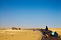
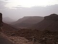
sovereign state in West Africa and North Africa  Bareina, a small desert village in the south of Mauritania.  .svg) | |||||
| Laadi fail üles | |||||
| Hääldus | |||||
|---|---|---|---|---|---|
| Üksikjuht nähtusest |
| ||||
| Osa objektist | |||||
| Nimetatud ... järgi | |||||
| Kultuur | |||||
| Asukoht |
| ||||
| Asukoha veekogu | |||||
| Keskus | |||||
| Seadusandlik kogu |
| ||||
| Täidesaatev võimuorgan | |||||
| Ametlik keel | |||||
| Hümn |
| ||||
| Rahaühik |
| ||||
| Riigipea |
| ||||
| Valitsusjuht |
| ||||
| Asutamise või loomise aeg |
| ||||
| Kõrgeim tipp |
| ||||
| Rahvaarv |
| ||||
| Pindala |
| ||||
| Vahetas välja selle | |||||
| Tippdomeen | |||||
| Mitte segamini ajada | |||||
 | |||||
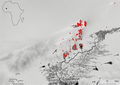
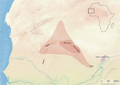
English: The Islamic Republic of Mauritania is located in northern West Africa, in the western Maghreb region.
Français : La République islamique de Mauritanie est située au nord de l'Afrique de l'Ouest, à l'ouest de la région du Maghreb.
Română: Mauritania este o ţară din vestul Africii.
日本語: モーリタニア(モーリタニア・イスラム共和国)に関するカテゴリ。
العربية : هذا التصنيف هو للصور المتعلقة بموريتانيا.

Alakategorijad
Neciš kategorijas om 16 alakategorijad; omа kaik 16 alakategorijad.
!
A
G
H
N
P
- Postcards of Mauritania (1 P)
S
V
~
- Gallery pages of Mauritania (5 L)
- Wikivoyage banners of Mauritania (10 P)
- Copyright rules of Mauritania (12 L)
Lehtpoled "Mauritania"-kategorijas
Neciš kategorijas om vaiše üks' ozutadud lehtpol'.
Mediafailad "Mauritania"-kategorijas
Nece 200 failad oma neciš kategorijas; kaikes om 221.
(enzne lehtpol') (uz' lehtpol')-
 24 Hour Operation (15163855921).jpg 4282 × 2848; 1,77 mb
-
 A Bend In The Tracks (14979885968).jpg 4282 × 2848; 1,7 mb
-
 A Boat's Perspective (15166837705).jpg 4282 × 2848; 1,58 mb
-
 A Functional Mosque (14980169000).jpg 2848 × 4282; 1,78 mb
-
 A Place To Relax (14980119127).jpg 4282 × 2848; 2,1 mb
-
 A Sign Of Change (14980238227).jpg 4282 × 2848; 2,1 mb
-
 A Tough Life (15163662141).jpg 4282 × 2848; 1,57 mb
-
 A View To Take In (15143502026).jpg 3746 × 2837; 1,99 mb
-
 Adviser 2023.jpg 400 × 400; 26 kb
-
 AFR V2 D118 Ancient form of Mauritania according to Bourguignat's hypothetis.jpg 1747 × 1361; 508 kb
-
 Akjoujt & Inchiri Region, Mauritania (34852247446).jpg 12 620 × 13 088; 34,35 mb
-
 Alioune In Terjit (15143665386).jpg 4282 × 2848; 2,31 mb
-
 AMF logo.pdf 2083 × 2083; 52 kb
-
 An ancient Qur'an (14979883900).jpg 4282 × 2848; 1,12 mb
-
Ane Muritani - Mouna Mint Dendeny.webm 3m 20s, 1920×1080; 121,1 mb
-

-
 Another Oasis (14979906650).jpg 4282 × 2848; 1,41 mb
-
 Aoujeft, Mauritania - panoramio.jpg 1600 × 1200; 436 kb
-
 Applying modern stage theory to Mauritania- a prescription to encourage entrepreneurship (IA applyingmodernst1094544685).pdf 1275 × 1650, 78 lehtpoled; 924 kb
-
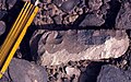
 Archaeological site of Koumbi Saleh.jpg 580 × 460; 199 kb
-
 Artifacts (14980042507).jpg 4282 × 2848; 2,82 mb
-
 At Museo de la Naturaleza y el Hombre 2023 042.jpg 6960 × 4640; 12,01 mb
-
 At Museo de la Naturaleza y el Hombre 2023 045.jpg 4640 × 6960; 11,01 mb
-
 Back to the lowlands. (15143467276).jpg 4282 × 2848; 2,5 mb
-
-
-
 Batariyyaflag.jpg 746 × 448; 12 kb
-
 Bell Sud-Ouest PND.jpg 4352 × 3264; 2,18 mb
-
 Berber Icon (15163646141).jpg 4282 × 2848; 1,74 mb
-
 Best Road Contender? (15166524625).jpg 4282 × 2848; 3,85 mb
-
 Best View In Mauritania (14980010810).jpg 4282 × 2848; 1,39 mb
-
 Blue... on Nouakchott’s market, Mauritania (32876069588).jpg 3367 × 5051; 3,45 mb
-
 Boat Workshop (15166455852).jpg 4282 × 2848; 1,55 mb
-
 Bye (27604433).jpeg 800 × 600; 89 kb
-
 Central Mausoleum of the Column Tomb.jpg 580 × 521; 251 kb
-
 Central Mausoleum.jpg 580 × 251; 178 kb
-

-
 Chegga Artisanal Mining.jpg 7702 × 5137; 16,6 mb
-
 Cheikh Saad bouh et sa famille.jpg 480 × 551; 51 kb
-
 Chinguetti (14979972967).jpg 4282 × 2848; 1,66 mb
-
 Choum (zzzzzzz....) (15166106932).jpg 4282 × 2848; 3,69 mb
-
 Cluster 9 funerary monuments in their landscape context.jpg 2128 × 1479; 396 kb
-
 Comment faire pousser des légumes dans un environnement aussi aride?.jpg 3024 × 4032; 3,19 mb
-
 Complex compound subdivisions in the central area of Akreijit.webp 1865 × 1110; 163 kb
-

-

-
 COVID-19 Outbreak Cases in Mauritania.png 2000 × 2225; 113 kb
-
 Crafted Bowl (15163420941).jpg 4282 × 2848; 3,54 mb
-
 Densities of sites, permanent water, and impermanent water.webp 969 × 1204; 179 kb
-
 Descente de dune de sable en Fatbike lors du Raid TransMauritania.jpg 1600 × 1068; 119 kb
-
 Desert All The Way (14980000637).jpg 4282 × 2848; 1,98 mb
-
 Devourer Of Mountains (14979970960).jpg 4282 × 2848; 1,81 mb
-
 Dhar Adrar (14980053867).jpg 4282 × 2848; 1,9 mb
-
 Documented site locations, permanent water, and impermanent water.webp 1854 × 1313; 184 kb
-
 Dome Home (14980106868).jpg 4282 × 2848; 3,45 mb
-
 Don't Fall In (15143778006).jpg 4282 × 2848; 1,52 mb
-
 Donkey? Mule? Ass? (14979936549).jpg 4282 × 2848; 1,92 mb
-
 Dunes rondes.jpg 4608 × 3456; 2,79 mb
-
 Dupuis-Yacouba-Maxar map and satellite image.png 1652 × 1555; 1010 kb
-
 Election symbol of UDP (Mauritania).png 524 × 477; 35 kb
-
 ELwelyvallphoto.jpg 455 × 507; 33 kb
-
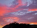
 Epic Sunset (15143634796).jpg 4282 × 2848; 883 kb
-
 Ever Changing Land (15163835361).jpg 4282 × 2848; 2,17 mb
-
 FCMauritania logo.jpg 699 × 384; 88 kb
-
 Field boundary on the western shore of Lake Fati.png 1652 × 1105; 652 kb
-
 Flatness (14979919879).jpg 4282 × 2848; 1,91 mb
-
-
 Glow In The Sky (15166600415).jpg 4282 × 2848; 1,56 mb
-
-
-
 Gridded site complex in Dhar Tagant.jpg 2128 × 1171; 407 kb
-
 Guelb er Richat (Eye Of The Sahara) (14980036258).jpg 4282 × 2848; 1,51 mb
-
 GUELB RICHAT Ombilic (central zone).jpg 1280 × 960; 213 kb
-
 Gzana.PNG 470 × 278; 193 kb
-
 Hard worker man getting refreshed.jpg 3024 × 4032; 3,29 mb
-
 HELLO? I'M IN THE DESERT! (15166322342).jpg 2848 × 4282; 2,05 mb
-
 Hotel Communal Room (14980032697).jpg 4282 × 2848; 3,71 mb
-
 Individual Burial from the Column Tomb.jpg 580 × 435; 358 kb
-
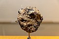
 Iron Ore (14979812080).jpg 4282 × 2848; 1,33 mb
-
 Leaving The Oasis (14980100797).jpg 4282 × 2848; 2,2 mb
-
 Life In The Desert (14980148230).jpg 4282 × 2848; 1,76 mb
-
 Logo ANZF.pdf 2083 × 2083; 64 kb
-
 Logo commune arafat.pdf 2083 × 2083; 61 kb
-
 Logo commune ksar.pdf 2083 × 2083; 116 kb
-
 Logo of RFD (Mauritania).png 686 × 686; 31 kb
-
 Logo of the National Assembly of Mauritania.png 440 × 241; 22 kb
-
 Logo of the National Democratic Alliance (Mauritania).png 500 × 500; 76 kb
-
 Logo of UDP (Mauritania).png 499 × 500; 161 kb
-
 Macgregor profile.jpg 799 × 933; 300 kb
-
 Making Tracks (15163656751).jpg 4282 × 2848; 2,23 mb
-
 Manuscripts (15163552831).jpg 4282 × 2848; 1,49 mb
-
 Mauritania Exports Treemap 2017.svg 900 × 900; 171 kb
-
 Mauritanian National Assembly.jpg 448 × 298; 66 kb
-
 Mesmerising Scenery (15143766686).jpg 4282 × 2848; 2,06 mb
-
 Meule sur un site du Baten de Tichitt.jpg 580 × 430; 236 kb
-
 Modernity Near Antiquity (15166706765).jpg 4282 × 2848; 2,17 mb
-
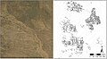
 Monuments that were visible in four different visualisation types.jpg 535 × 535; 223 kb
-

-
 Mountains Ahead (14980076239).jpg 4282 × 2848; 2,82 mb
-
 Mountains And Gorges (15143495516).jpg 4282 × 2848; 3,76 mb
-
 Mule and Cart (14979740240).jpg 4002 × 2837; 1,59 mb
-
-
 Naha Mint Mouknass.jpg 216 × 321; 26 kb
-
 Nameless Mountain (15163615571).jpg 4282 × 2848; 1,11 mb
-
 No Man's Land (14980052438).jpg 4282 × 2848; 2 mb
-
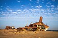 Nouadhibou Ship Graveyard (15166442855).jpg 4282 × 2848; 2,16 mb
-
 Nouadhibou Station (14979783600).jpg 4282 × 2848; 1,68 mb
-
 Nouakchott In A Nutshell (15166829265).jpg 4282 × 2848; 1,82 mb
-
 Oblique false-colour 3D rendering of an example tumulus.jpg 624 × 992; 184 kb
-
 Ouadane (14979872039).jpg 4282 × 2848; 2,19 mb
-
 Our Home For 17 Hours (14979781720).jpg 4282 × 2848; 1,85 mb
-
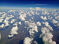
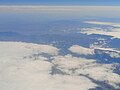
 Paysage du Maghreb du ciel 10.jpg 4608 × 3456; 3,3 mb
-
 Paysage du Maghreb du ciel 11.jpg 4608 × 3456; 3,56 mb
-
 Paysage du Maghreb du ciel 12.jpg 4608 × 3456; 3,89 mb
-
 Paysage du Maghreb du ciel 13.jpg 4608 × 3456; 3,71 mb
-
 Paysage du Maghreb du ciel 14.jpg 4608 × 3456; 3,69 mb
-
 Paysage du Maghreb du ciel 15.jpg 4608 × 3456; 3,46 mb
-
 Paysage du Maghreb du ciel 16.jpg 4608 × 3456; 4,03 mb
-
 Paysage du Maghreb du ciel 17.jpg 4608 × 3456; 4,54 mb
-
 Paysage du Maghreb du ciel 18.jpg 4608 × 3456; 2,33 mb
-
 Paysage du Maghreb du ciel 19.jpg 4608 × 3456; 2,52 mb
-
 Paysage du Maghreb du ciel 2.jpg 4608 × 3456; 2,34 mb
-
 Paysage du Maghreb du ciel 20.jpg 9216 × 6912; 18,73 mb
-
 Paysage du Maghreb du ciel 21.jpg 9216 × 6912; 18,42 mb
-
 Paysage du Maghreb du ciel 22.jpg 4608 × 3456; 3,12 mb
-
 Paysage du Maghreb du ciel 23.jpg 9216 × 6912; 14,62 mb
-
 Paysage du Maghreb du ciel 24.jpg 9216 × 6912; 14,86 mb
-
 Paysage du Maghreb du ciel 25.jpg 9216 × 6912; 15,38 mb
-
 Paysage du Maghreb du ciel 26.jpg 4608 × 3456; 2,93 mb
-
 Paysage du Maghreb du ciel 27.jpg 4608 × 3456; 2,66 mb
-
 Paysage du Maghreb du ciel 3.jpg 4608 × 3456; 2,95 mb
-
 Paysage du Maghreb du ciel 4.jpg 4608 × 3456; 2,77 mb
-
 Paysage du Maghreb du ciel 5.jpg 4608 × 3456; 2,71 mb
-
 Paysage du Maghreb du ciel 6.jpg 4608 × 3456; 2,83 mb
-
 Paysage du Maghreb du ciel 7.jpg 4608 × 3456; 2,92 mb
-
 Paysage du Maghreb du ciel 8.jpg 4608 × 3456; 3,74 mb
-
 Paysage du Maghreb du ciel 9.jpg 4608 × 3456; 3,9 mb
-
 Paysage du Maghreb du ciel.jpg 4608 × 3456; 2,28 mb
-
 Petite jarre du village v.72 (échelle - 10 cm).jpg 428 × 500; 112 kb
-
 Pickup Truck Of Champions (15163867811).jpg 4282 × 2848; 1,74 mb
-
 Plan of the entire funerary complex of the Column Tomb.jpg 580 × 509; 155 kb
-
 Planet Earth? (14979883179).jpg 4282 × 2848; 1,32 mb
-
 Poids de filet en grès (échelle - 3 cm), Dhar Tichitt-Oualata.jpg 580 × 228; 110 kb
-
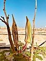
 Pointes de flèches, Dhar Tichitt-Oualata.jpg 580 × 457; 212 kb
-
 Poor Dog (14979900910).jpg 4282 × 2848; 2,9 mb
-
 Port de l'amitie.pdf 2083 × 2083; 37 kb
-
 Possible pillar structures in village sites of the Mali Lakes Region.webp 1652 × 2314; 565 kb
-
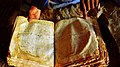 Quran in Chinguetti.jpg 3359 × 1866; 804 kb
-
 Rain..... (15143547306).jpg 4282 × 2848; 1,23 mb
-
 Ready For My Closeup (15143622166).jpg 4282 × 2848; 3,66 mb
-
 Reg De L'Adrar (14980127258).jpg 4282 × 2848; 1,91 mb
-

-

-

-
 Satellite view of Tumuli Cluster 8 from Dhar Tagant.jpg 2128 × 1402; 495 kb
-
 Schematic plan of the central mausoleum.jpg 580 × 486; 132 kb
-
 Settlements And Farms (14979884308).jpg 4282 × 2848; 1,97 mb
-
 Ships Of The Desert (14979977017).jpg 4282 × 2848; 1,15 mb
-
 Shipwreck and Truck wreck. (15143397506).jpg 4282 × 2848; 1,36 mb
-
 Simply Red (27604437).jpeg 2048 × 1360; 332 kb
-
-
 Size-based distribution of funerary tumuli.jpg 802 × 954; 163 kb
-
 Skywards (14979963129).jpg 4282 × 2848; 3,92 mb
-
 Slogan rim arabic.png 763 × 119; 39 kb
-
 Slow Down (27604439).jpeg 2048 × 1360; 346 kb
-

-
 Statuettes zoomorphes du village, Dhar Tichitt.jpg 580 × 438; 129 kb
-
 Stone pillar structure at Fati 6.webp 1652 × 1108; 421 kb
-
 Straight As An Arrow (14979885527).jpg 4282 × 2848; 1,6 mb
-
 Structural diagram of burial.jpg 543 × 945; 61 kb
-
 Stuck (52501294985).jpg 4896 × 2752; 7,49 mb
-
 Sunrise On The Train (14979910647).jpg 4282 × 2848; 1,23 mb
-
 Sunset (52501295190).jpg 4896 × 2752; 4,05 mb
-

-
 Tea Again (15163635441).jpg 4282 × 2848; 3,1 mb
-
 Tea In The Shade (15163673591).jpg 4282 × 2848; 2,19 mb
-
 Tea time in Mauritania 1.jpg 2738 × 4096; 3 mb
-
 Tea time in Mauritania 3.jpg 4096 × 2738; 3,3 mb
-
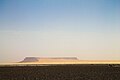
 The Adrar Plateau (14980145940).jpg 4282 × 2848; 2,22 mb
-
 The Ancient Town Of Azougui (14980043160).jpg 4282 × 2848; 1,76 mb
-
 The Atlantic! (15163458151).jpg 4282 × 2848; 2,69 mb
-
 The Cairn (14979999598).jpg 4282 × 2848; 1,87 mb
-
 The Call Of The Sahara (14979891929).jpg 4282 × 2848; 1,83 mb
-
 The Car Is The Star (15166584925).jpg 4209 × 2845; 2 mb
-
 The Desert From The Train (15166097542).jpg 4282 × 2848; 1,03 mb
-
 The Edge Of The Lake? (15166249032).jpg 4282 × 2848; 1,39 mb
-
 The First Sunset (15143800576).jpg 4282 × 2848; 1,8 mb
-
 The Guestbook (15166543505).jpg 4282 × 2848; 1,6 mb
-
 The Iron Ore Train! (14979764289).jpg 4282 × 2848; 1,14 mb
-
 The Library (15163558221).jpg 4282 × 2848; 2,15 mb
-
 The Oasis Boundary (15166297942).jpg 4282 × 2848; 2,36 mb
-
 The Real Deal (14979899809).jpg 4282 × 2848; 1,32 mb
-
 The Salt Pan (15163654261).jpg 4282 × 2848; 3,16 mb
-
 The Sign To Nowhere (15166428402).jpg 4282 × 2848; 2,38 mb
-
 The Streets Of Maata Moulana (15143393436).jpg 4282 × 2848; 1,95 mb
-
 The Well (15166573175).jpg 4282 × 2848; 2 mb
-
 The Wind On The Train (14979827070).jpg 4282 × 2848; 1,03 mb
-
 Tichitt culture and the Malian Lakes Region.webp 1866 × 1322; 126 kb
-
 Tichitt Tradition drystone tumulus.jpg 388 × 214; 112 kb
-
 Travel times based on the generation of isochrones.jpg 811 × 916; 344 kb
.jpg)
.jpg)
.jpg)
.jpg)
.jpg)
.jpg)
.jpg)
.jpg)


.jpg)
.jpg)
.jpg)

.jpg)


.jpg)


.jpg)


.jpg)
.jpg)
.jpg)
.jpg)
.jpeg)


.jpg)


.jpg)
_(15166106932).jpg)


.svg)


.jpg)

.jpg)
.jpg)
.jpg)

.jpg)
.jpg)
.jpg)


.png)

.jpg)
.jpg)

.jpg)

.jpg)


_(14980036258).jpg)
.jpg)


.jpg)
.jpg)

.jpg)
.jpg)
.jpg)
.png)

.png)
.png)

.jpg)
.jpg)


.jpg)

.jpg)


.jpg)
.jpg)
.jpg)


.jpg)
.jpg)
.jpg)
.jpg)
.jpg)

.jpg)
.jpg)


.jpg)
.jpg)

.jpg)

.jpg)


.jpg)
.jpg)
.jpg)
.jpg)

.jpg)


.jpg)
.jpg)
.jpg)
.jpeg)


.jpg)
.jpeg)


.jpg)
.jpg)
.jpg)

.jpg)
.jpg)


.jpg)
.jpg)
.jpg)
.jpg)
.jpg)
.jpg)
.jpg)
.jpg)
.jpg)
.jpg)
.jpg)
.jpg)
.jpg)
.jpg)
.jpg)
.jpg)
.jpg)
.jpg)
.jpg)


.jpg)
,_Dhar_Tichitt-Oualata.jpg)
.jpg)
Kategorijad:
- Sovereign states by name
- Countries of Africa by name
- Countries of West Africa
- Countries of the Maghreb
- Greater Middle East
- Arab world
- Member states of the United Nations
- Member states of the Organisation of Islamic Cooperation
- Members of the African Union
- Islamic republics
- Republics
- States and territories established in 1960
- 1960 establishments in Africa