Category:Mayor Island / Tūhua
Vai alla navigazione
Vai alla ricerca

isola della Nuova Zelanda   | |||||
| Carica un file multimediale | |||||
| Istanza di | |||||
|---|---|---|---|---|---|
| Luogo | Baia dell'Abbondanza, Nuova Zelanda | ||||
| Situato sul mare / lago / fiume | |||||
| Popolazione |
| ||||
| Superficie |
| ||||
| Altezza sul mare |
| ||||
 | |||||
English: Mayor Island (or Tuhua) is a dormant shield volcano located off the Bay of Plenty coast of New Zealand's North Island. It lies beneath the waves. The island is believed to have risen from the sea about 7000 years ago. Hot springs abound, and there are two small crater lakes, Green Lake and Black Lake. These lie within two overlapping calderas formed in explosive eruptions 36,000 and 6,340 years ago. Mayor Island has exhibited a wide range of eruptive styles, including fire fountains, Strombolian explosions, extrusion of lava domes, phreatomagmatic explosions, Plinian falls and ignimbrite. The most recent lava flows have been dated at between 500 and 1,000 years old.
Sottocategorie
Questa categoria contiene le 5 sottocategorie indicate di seguito, su un totale di 5.
+
- Maps of Mayor Island (2 F)
- Remote views of Mayor Island (4 F)
E
File nella categoria "Mayor Island / Tūhua"
Questa categoria contiene 23 file, indicati di seguito, su un totale di 23.
-
 1 mount maunganui sea island.jpg 750 × 1 000; 755 KB
-
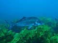
 Blue mao mao and trevally at Mayor Island MPA PC146160.JPG 3 648 × 2 736; 1,85 MB
-
 Blue Moki at Mayor Island MPA PC156212.JPG 3 648 × 2 736; 1,95 MB
-
 Bluefish at Mayor Island MPA PC146136.JPG 3 648 × 2 736; 2,16 MB
-
 Crater Bay, Mayor Island PB154518.JPG 3 648 × 2 736; 2,41 MB
-
 Elysia sp at Mayor Island PB154610.JPG 3 648 × 2 736; 2,3 MB
-
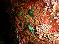
 Gem nudibranch at Mayor Island PB164667.JPG 3 648 × 2 736; 2,29 MB
-
 Marblefish at Mayor Island PB154591.JPG 3 648 × 2 736; 2,1 MB
-
 Mayor Island (2).jpg 900 × 678; 223 KB
-
 Mayor Island MPA PC156167.JPG 3 648 × 2 736; 2,21 MB
-
 Mayor Island Track, Mayor Island, New Zealand - panoramio (1).jpg 6 000 × 3 376; 3,22 MB
-
 Mayor Island Track, Mayor Island, New Zealand - panoramio (2).jpg 6 000 × 3 376; 11,63 MB
-
 Mayor Island Track, Mayor Island, New Zealand - panoramio (3).jpg 6 000 × 3 376; 5,22 MB
-
 Mayor Island Track, Mayor Island, New Zealand - panoramio (4).jpg 6 000 × 3 376; 12,72 MB
-
 Mayor Island Track, Mayor Island, New Zealand - panoramio (5).jpg 6 000 × 3 376; 12,72 MB
-
 Mayor Island Track, Mayor Island, New Zealand - panoramio (6).jpg 6 000 × 3 376; 4,5 MB
-
 Mayor Island Track, Mayor Island, New Zealand - panoramio.jpg 6 000 × 3 376; 10,2 MB
-
 Mayor Island Tuhua 07.jpg 3 035 × 1 707; 1,98 MB
-
 Mayor Island.jpg 900 × 1 192; 500 KB
-
 Shoreline at Crater Bay, Mayor Island PB154625.JPG 3 648 × 2 736; 2,1 MB
-
 Sunrise approaching Mayor Island PC146097.JPG 3 648 × 2 736; 2,04 MB
-
 Tuhualite-96825.jpg 719 × 571; 87 KB
-
 Вулкан Мэр (Новая Зеландия).jpg 640 × 421; 43 KB


.jpg)

.jpg)
.jpg)
.jpg)
.jpg)
.jpg)
.jpg)


.jpg)
Categorie:
- Islands of New Zealand by name
- Islands in Bay of Plenty
- Shield volcanoes in New Zealand
- Lava domes in New Zealand
- Rhyolite volcanoes in New Zealand
- Volcanic zones in New Zealand
- Holocene volcanoes in New Zealand
- Holocene caldera-forming eruptions in New Zealamd
- Partially submarine volcanoes in New Zealand
- Inactive volcanoes in New Zealand
- Island volcanoes in New Zealand