Category:Meall Ghaordaidh
Zur Navigation springen
Zur Suche springen
Berg im Vereinigten Königreich  | |||||
| Medium hochladen | |||||
| Ist ein(e) | |||||
|---|---|---|---|---|---|
| Ort |
| ||||
| Gebirgszug | |||||
| Schartenhöhe |
| ||||
| Höhe über dem Meeresspiegel |
| ||||
 | |||||
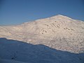
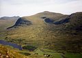
Meall Ghaordaidh is a mountain in the southern Highlands of Scotland. It lies to the north Loch Tay, to the west of Ben Lawers and to the north of the village of Killin. It is 1039 m high, and listed as a Munro and a Marilyn.
Medien in der Kategorie „Meall Ghaordaidh“
Folgende 22 Dateien sind in dieser Kategorie, von 22 insgesamt.
-
 Coire Ghaordaidh - geograph.org.uk - 1064715.jpg 640 × 480; 47 KB
-
 Coire Ghaordaidh - geograph.org.uk - 1069203.jpg 640 × 480; 52 KB
-

-
 Fence, Meall Taurnaigh - geograph.org.uk - 1067162.jpg 640 × 480; 55 KB
-
 Glen Lyon from Meall Ghaordhaidh - geograph.org.uk - 1203060.jpg 640 × 480; 69 KB
-
 Loch Lyon from Meall Ghaordaidh - geograph.org.uk - 1017851.jpg 640 × 480; 57 KB
-
 Lochan nan Geadas - geograph.org.uk - 1557379.jpg 640 × 480; 92 KB
-
 Meall Ghaordaidh - geograph.org.uk - 1064722.jpg 640 × 480; 59 KB
-
 Meall Ghaordaidh behind bars - geograph.org.uk - 1063702.jpg 480 × 640; 55 KB
-
 Meall Ghaordaidh.jpg 640 × 452; 60 KB
-
 Meall Taurnaigh - geograph.org.uk - 1067150.jpg 640 × 454; 62 KB
-

-

-

-
 Stone on ridge near Meall Ghaordaidh - geograph.org.uk - 570774.jpg 627 × 470; 83 KB
-

-

-
 The trig point on Meall Ghaordaidh - geograph.org.uk - 94403.jpg 640 × 463; 85 KB
-

-
 Below Meall Ghaordaidh - geograph.org.uk - 636832.jpg 638 × 440; 63 KB
-
 River Lyon at Pubil - geograph.org.uk - 8286.jpg 640 × 447; 77 KB
-


