Category:Mears Ashby
Aller à la navigation
Aller à la recherche
village britannique  | |||||
| Téléverser des médias | |||||
| Nature de l’élément | |||||
|---|---|---|---|---|---|
| Lieu | North Northamptonshire, Northamptonshire, Midlands de l'Est, Angleterre | ||||
| Population |
| ||||
 | |||||
Sous-catégories
Cette catégorie comprend 2 sous-catégories, dont les 2 ci-dessous.
M
S
- Sywell Reservoir (14 F)
Média dans la catégorie « Mears Ashby »
Cette catégorie comprend 31 fichiers, dont les 31 ci-dessous.
-
 Bakehouse Lane - geograph.org.uk - 3930977.jpg 640 × 480 ; 64 kio
-
 Beside Sywell Wood - geograph.org.uk - 5601973.jpg 480 × 640 ; 77 kio
-
 Bridleway near Sywell - geograph.org.uk - 5601971.jpg 480 × 640 ; 76 kio
-
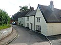
 Entrance to Mears Ashby - geograph.org.uk - 4170306.jpg 640 × 466 ; 70 kio
-
 Footpath exit - geograph.org.uk - 5601984.jpg 480 × 640 ; 126 kio
-
 Former Sheep Wash, below Sywell Reservoir - geograph.org.uk - 4390355.jpg 1 333 × 1 000 ; 1,46 Mio
-
 Highfield Road, Mears Ashby - geograph.org.uk - 2583548.jpg 3 072 × 2 304 ; 3,24 Mio
-
 Lady's Lane, Mears Ashby - geograph.org.uk - 2583524.jpg 2 000 × 1 500 ; 835 kio
-
 Mears Ashby - geograph.org.uk - 5547048.jpg 640 × 480 ; 428 kio
-
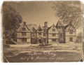 Mears Ashby Hall.png 1 115 × 860 ; 1,5 Mio
-
 Mears Ashby phone box - geograph.org.uk - 5601985.jpg 480 × 640 ; 64 kio
-
 Mears Ashby, Glebe Road - geograph.org.uk - 5547062.jpg 640 × 480 ; 456 kio
-
 Near Wood Lodge Farm - geograph.org.uk - 5601969.jpg 480 × 640 ; 118 kio
-
 Outflow from Sywell Reservoir - geograph.org.uk - 6361874.jpg 1 600 × 1 066 ; 648 kio
-
 Steps down to the filter beds and car park - geograph.org.uk - 6361894.jpg 1 600 × 1 066 ; 396 kio
-
 Suburban willow, Wellingborough Road, Mears Ashby - geograph.org.uk - 2583628.jpg 1 480 × 2 000 ; 1 Mio
-
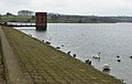
 Sywell Country Park - geograph.org.uk - 1904997.jpg 640 × 480 ; 110 kio
-
 Sywell Country Park - geograph.org.uk - 1906319.jpg 640 × 480 ; 101 kio
-
 Sywell Country Park - geograph.org.uk - 1908139.jpg 640 × 480 ; 57 kio
-
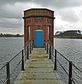
 Sywell Reservoir and valve tower - geograph.org.uk - 6361892.jpg 1 600 × 1 066 ; 308 kio
-
 Sywell Reservoir bridge to valve tower - geograph.org.uk - 4390300.jpg 1 000 × 1 015 ; 962 kio
-
 Sywell Reservoir dam and valve tower - geograph.org.uk - 4390266.jpg 1 588 × 1 000 ; 1,3 Mio
-
 Sywell Reservoir Pump House - geograph.org.uk - 4390359.jpg 1 395 × 1 000 ; 1,19 Mio
-
 The former vicarage, Mears Ashby - geograph.org.uk - 2583542.jpg 2 000 × 1 486 ; 890 kio
-
 The War Memorial, Mears Ashby - geograph.org.uk - 2583530.jpg 1 509 × 2 000 ; 1,26 Mio
-
 Towards Mears Ashby - geograph.org.uk - 5601980.jpg 480 × 640 ; 70 kio
-
 Towards Mears Ashby - geograph.org.uk - 5601982.jpg 480 × 640 ; 83 kio
-
 Unnamed Road near Mears Ashby - geograph.org.uk - 5547034.jpg 640 × 480 ; 416 kio
-
 Wellingborough Road, Mears Ashby - geograph.org.uk - 2583622.jpg 2 000 × 1 495 ; 647 kio
-
 Farmland - geograph.org.uk - 148038.jpg 640 × 480 ; 93 kio
-
 Hardwick Lodge - geograph.org.uk - 149636.jpg 640 × 480 ; 113 kio


