Category:Memphrémagog Regional County Municipality
Zur Navigation springen
Zur Suche springen
regional county municipality in Quebec, Canada  | |||||
| Medium hochladen | |||||
| Ist ein(e) | |||||
|---|---|---|---|---|---|
| Ort | Estrie, Québec, Kanada | ||||
| Hauptstadt | |||||
| Datum der Gründung, Erstellung, Entstehung, Erbauung |
| ||||
| Einwohnerzahl |
| ||||
| Fläche |
| ||||
| offizielle Website | |||||
 | |||||
Unterkategorien
Es werden 19 von insgesamt 19 Unterkategorien in dieser Kategorie angezeigt:
In Klammern die Anzahl der enthaltenen Kategorien (K), Seiten (S), Dateien (D)
A
B
E
H
- Hatley, Quebec (township) (6 D)
L
M
N
O
P
R
- Rivière aux Cerises (4 D)
S
- Saint-Étienne-de-Bolton (7 D)
Medien in der Kategorie „Memphrémagog Regional County Municipality“
Folgende 14 Dateien sind in dieser Kategorie, von 14 insgesamt.
-
 Aerial View of North Hatley.png 1.823 × 798; 1,45 MB
-
 Birdseye View of Lake Memphremagog LCCN2013646451.jpg 5.004 × 1.232; 1,24 MB
-
 Birdseye View of Lake Memphremagog LCCN2013646451.tif 5.004 × 1.232; 17,66 MB
-
 Elephant Mount from Georgeville Heights - panoramio.jpg 3.872 × 2.592; 2,33 MB
-
 Georgeville 1840.jpg 389 × 259; 16 KB
-
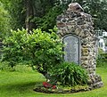 Georgeville, Quebec - monument aux braves.jpg 2.297 × 2.081; 1,83 MB
-
 Knowlton's Landing, Memphramagog, Quebec (I0001711).tif 1.259 × 961; 3,47 MB
-
 Mont Elephant from Georgeville at sunset - panoramio.jpg 3.872 × 2.592; 1,83 MB
-
 Mont Elephant from Georgeville Heights - panoramio.jpg 3.872 × 2.592; 2,3 MB
-
 Pluie sur la route - panoramio.jpg 800 × 524; 212 KB
-
 Qc Memphremagog 2.png 421 × 483; 15 KB
-
 Qc Memphremagog.png 920 × 1.160; 34 KB
-
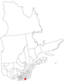
 Quebec MRC Memphrémagog location map.svg 1.630 × 2.000; 500 KB
-
 Vue du sommet du mont Orford.jpg 3.024 × 4.032; 4,04 MB


