Category:Mendham, Suffolk
Aller à la navigation
Aller à la recherche
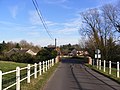
English: Mendham is a village and civil parish in the Mid Suffolk district of Suffolk in eastern England. Located on the east bank of the River Waveney around a mile east of Harleston, in 2005 its population was 440.[1] The parish includes the hamlets of Withersdale Street. The Mendham Marshes are also within the parish boundaries.
localité britannique du comté anglais de Suffolk | |||||
| Téléverser des médias | |||||
| Nature de l’élément | |||||
|---|---|---|---|---|---|
| Lieu | Mid Suffolk, Suffolk, Angleterre de l'Est, Angleterre | ||||
 | |||||
- ↑ Erreur de référence : Balise
<ref>incorrecte : aucun texte n’a été fourni pour les références nomméespopulation
Sous-catégories
Cette catégorie comprend 6 sous-catégories, dont les 6 ci-dessous.
Média dans la catégorie « Mendham, Suffolk »
Cette catégorie comprend 233 fichiers, dont les 200 ci-dessous.
(page précédente) (page suivante)-
 Access road to Grove End House - geograph.org.uk - 3906565.jpg 640 × 427 ; 204 kio
-
 Access road to Middleton Hall - geograph.org.uk - 3900404.jpg 640 × 424 ; 201 kio
-
 Alders on a field's edge - geograph.org.uk - 3900531.jpg 640 × 576 ; 229 kio
-
 Approach to Foxes Lane on Hollow Lane - geograph.org.uk - 3900491.jpg 640 × 480 ; 256 kio
-
 Approaching Pegg's Hill - geograph.org.uk - 3906624.jpg 640 × 480 ; 131 kio
-
 Approaching Target Hill on Sconch Beck Road - geograph.org.uk - 3900415.jpg 640 × 413 ; 229 kio
-
 B1123 Metfield Road - geograph.org.uk - 2744963.jpg 3 072 × 2 304 ; 1,37 Mio
-
 B1123 Metfield Road - geograph.org.uk - 2744971.jpg 3 072 × 2 304 ; 1,32 Mio
-
 B1123 Metfield Road, Withersdale Street - geograph.org.uk - 4398498.jpg 3 072 × 2 304 ; 1,87 Mio
-
 B1123 The Street, Withersdale road junction - geograph.org.uk - 2744820.jpg 3 072 × 2 304 ; 1,34 Mio
-
 B1123 The Street, Withersdale ^ The Street Postbox - geograph.org.uk - 2744814.jpg 3 072 × 2 304 ; 1,42 Mio
-
 B1123 The Street, Withersdale ^ The Street Postbox - geograph.org.uk - 2744824.jpg 3 072 × 2 304 ; 1,33 Mio
-
 B1123 Withersdale Road - geograph.org.uk - 3518788.jpg 3 072 × 2 304 ; 1,3 Mio
-
 B1123 Withersdale Road - geograph.org.uk - 3520365.jpg 3 072 × 2 304 ; 1,3 Mio
-
 Barn conversions in Hunters Lane - geograph.org.uk - 3906549.jpg 640 × 480 ; 217 kio
-
 Bins awaiting collection near the Old Vicarage - geograph.org.uk - 3900534.jpg 640 × 480 ; 185 kio
-
 Bridge over ditch beside Metfield Road - geograph.org.uk - 3900497.jpg 640 × 480 ; 210 kio
-
 Bridge over Sconch Beck - geograph.org.uk - 3900418.jpg 640 × 480 ; 263 kio
-
 Bridge over the River Waveney, Mendham - geograph.org.uk - 2648978.jpg 640 × 480 ; 191 kio
-
 Bridge over the River Waveney, Mendham - geograph.org.uk - 2983134.jpg 4 320 × 3 240 ; 3,89 Mio
-
 Bridleway past The Greenways - geograph.org.uk - 3906638.jpg 480 × 640 ; 228 kio
-
 Bridleway to Grove End House - geograph.org.uk - 2744230.jpg 3 072 × 2 304 ; 1,66 Mio
-
 Bridleway to The Greenways - geograph.org.uk - 2744796.jpg 3 072 × 2 304 ; 1,34 Mio
-
 Bridleway to The Greenways - geograph.org.uk - 2744800.jpg 3 072 × 2 304 ; 1,34 Mio
-

-
 Bus Shelter,Telephone Box ^ Sir Alfred Munnings Hotel Postbox - geograph.org.uk - 2768916.jpg 2 304 × 3 072 ; 1,46 Mio
-
 Cereal crop beside Foxes Lane, Mendham - geograph.org.uk - 3900471.jpg 640 × 480 ; 173 kio
-
 Cereal crop beside Hollow Lane - geograph.org.uk - 3900493.jpg 640 × 424 ; 125 kio
-
 Cereal crop beside Hunters Lane - geograph.org.uk - 3906554.jpg 640 × 416 ; 149 kio
-
 Cereal crop beside Sconch Beck Road - geograph.org.uk - 3900408.jpg 640 × 480 ; 195 kio
-
 Cereal crop by Grove Farm - geograph.org.uk - 3906567.jpg 640 × 407 ; 139 kio
-
 Cereal crop in field beside Withersdale Road - geograph.org.uk - 3900453.jpg 640 × 480 ; 172 kio
-
 Cereal crops in fields by Greshaw Farm - geograph.org.uk - 3900780.jpg 640 × 425 ; 148 kio
-
 Cottages in Mendham - geograph.org.uk - 3900429.jpg 640 × 455 ; 140 kio
-
 Cottages in The Street, Mendham - geograph.org.uk - 3900433.jpg 640 × 480 ; 152 kio
-
 Country road towards Harleston, Norfolk - geograph.org.uk - 2197012.jpg 700 × 525 ; 219 kio
-
 Culvert beneath the road - geograph.org.uk - 2196968.jpg 700 × 525 ; 279 kio
-
 Daffodils by the entrance to Thorpe Hall - geograph.org.uk - 3900503.jpg 640 × 422 ; 209 kio
-
 Dangerous bend near Mendham Priory - geograph.org.uk - 4340005.jpg 640 × 480 ; 175 kio
-
 Denny's Hill, Mendham - geograph.org.uk - 3900421.jpg 640 × 480 ; 173 kio
-
 Denny's Hill, Mendham - geograph.org.uk - 3900425.jpg 640 × 480 ; 166 kio
-
 Disused telephone box, Mendham - geograph.org.uk - 2983150.jpg 4 320 × 3 240 ; 3,98 Mio
-
 Ditch beside Foxes Lane - geograph.org.uk - 3900482.jpg 640 × 480 ; 258 kio
-
 Ditch beside Foxes Lane, Mendham - geograph.org.uk - 3900463.jpg 640 × 480 ; 183 kio
-
 Ditch beside Mundy's Road - geograph.org.uk - 3900762.jpg 640 × 480 ; 208 kio
-
 Ditch by Thorpe Hall - geograph.org.uk - 3900505.jpg 640 × 480 ; 243 kio
-
 Ditch in fields beside Mundy's Road - geograph.org.uk - 3900776.jpg 584 × 640 ; 202 kio
-
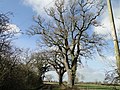 English oaks - geograph.org.uk - 4340028.jpg 640 × 480 ; 221 kio
-
 Entering Withersdale Street - geograph.org.uk - 4398494.jpg 3 072 × 2 304 ; 1,77 Mio
-
 Entering Withersdale Street on the B1123 The Street - geograph.org.uk - 2744823.jpg 3 072 × 2 304 ; 1,36 Mio
-
 Farm sheds in Withersdale Road - geograph.org.uk - 3900442.jpg 640 × 480 ; 161 kio
-
 Field beside Foxes Lane, Mendham - geograph.org.uk - 3900470.jpg 640 × 424 ; 160 kio
-
 Field boundary by Highfields Farm - geograph.org.uk - 3900518.jpg 640 × 480 ; 195 kio
-
 Field boundary hedge by the Old Vicarage - geograph.org.uk - 3900536.jpg 640 × 480 ; 125 kio
-
-
 Field of Oilseed Rape - geograph.org.uk - 4340025.jpg 640 × 480 ; 145 kio
-
 Fields beside Hunter's Lane - geograph.org.uk - 3900500.jpg 640 × 480 ; 161 kio
-
 Fields beside Mundy's Road - geograph.org.uk - 3900770.jpg 640 × 433 ; 149 kio
-
 Fields beside Withersdale Road - geograph.org.uk - 3900454.jpg 640 × 480 ; 151 kio
-
 Fields by Highfields Farm - geograph.org.uk - 3900511.jpg 640 × 480 ; 175 kio
-
 Fields by Lodge Farm - geograph.org.uk - 3906626.jpg 640 × 480 ; 147 kio
-
 Fields by Mendham village - geograph.org.uk - 3900456.jpg 640 × 480 ; 147 kio
-
 Fields by Pegg's Hill - geograph.org.uk - 3906628.jpg 640 × 480 ; 114 kio
-
 Fields by Sandpit Hill - geograph.org.uk - 3900516.jpg 640 × 480 ; 172 kio
-
 Flowering oilseed rape beside Mundy's Road - geograph.org.uk - 3900767.jpg 640 × 480 ; 210 kio
-
 Footpath and stile. east of Mendham - geograph.org.uk - 2196963.jpg 700 × 525 ; 242 kio
-
 Footpath by Highfields Farm - geograph.org.uk - 3900510.jpg 640 × 480 ; 206 kio
-
 Footpath past Grove Farm - geograph.org.uk - 3906562.jpg 640 × 415 ; 180 kio
-
 Footpath to Church Farm - geograph.org.uk - 3906537.jpg 640 × 480 ; 123 kio
-
 Footpath to Hill Mount - geograph.org.uk - 3906546.jpg 640 × 480 ; 169 kio
-
 Footpath to Hollow Lane - geograph.org.uk - 2767897.jpg 3 072 × 2 304 ; 1,39 Mio
-
 Footpath to Kett's Farm - geograph.org.uk - 3900522.jpg 640 × 480 ; 168 kio
-
 Footpath to Mundy's Farm - geograph.org.uk - 3900483.jpg 640 × 480 ; 159 kio
-
 Footpath to the site of St Mary's Priory - geograph.org.uk - 3906703.jpg 640 × 480 ; 195 kio
-
 Foxes Lane - geograph.org.uk - 2768054.jpg 3 072 × 2 304 ; 1,48 Mio
-
 Foxes Lane off Sandpit Hill, Metfield, Suffolk - geograph.org.uk - 2197000.jpg 700 × 525 ; 119 kio
-
 Foxes Lane sign - geograph.org.uk - 2768058.jpg 3 072 × 2 304 ; 1,61 Mio
-
 Headstone of Allan James Chenery at Withersdale - geograph.org.uk - 4395452.jpg 768 × 1 024 ; 475 kio
-
 House by Denny's Hill - geograph.org.uk - 3900428.jpg 640 × 480 ; 148 kio
-
 Houses in Mendham Street - geograph.org.uk - 2196935.jpg 700 × 525 ; 181 kio
-
 Hunter's Lane approaching Metfield Road - geograph.org.uk - 3900501.jpg 640 × 480 ; 143 kio
-
 Hunters Lane sign - geograph.org.uk - 2744968.jpg 3 072 × 2 304 ; 1,63 Mio
-
 Hunters Lane, Withersdale Street - geograph.org.uk - 2744967.jpg 3 072 × 2 304 ; 1,25 Mio
-
-
 Ivy-clad trees - geograph.org.uk - 3900526.jpg 640 × 480 ; 247 kio
-
 Lane junction by Pegg's Hill - geograph.org.uk - 3906632.jpg 640 × 420 ; 121 kio
-
 Lane that becomes a footpath, Mendham. Suffolk - geograph.org.uk - 2197008.jpg 700 × 525 ; 138 kio
-
 Long shed near Gray's Farm - geograph.org.uk - 3900476.jpg 640 × 444 ; 175 kio
-
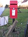
 Marsh George V Postbox - geograph.org.uk - 2767946.jpg 1 980 × 2 640 ; 2,44 Mio
-
 Marsh George V Postbox - geograph.org.uk - 2767950.jpg 1 980 × 2 640 ; 1,96 Mio
-
 Marsh George V Postbox - geograph.org.uk - 2767958.jpg 1 980 × 2 640 ; 2,07 Mio
-
 Marsh George V Postbox - geograph.org.uk - 2767960.jpg 2 304 × 3 072 ; 1,4 Mio
-
 Mendham and Withersdale Village Hall - geograph.org.uk - 2178785.jpg 580 × 435 ; 123 kio
-
 Mendham Marshes - geograph.org.uk - 550614.jpg 640 × 480 ; 99 kio
-
 Mendham Primary School - geograph.org.uk - 2196945.jpg 700 × 525 ; 181 kio
-
 Mendham Primary School - geograph.org.uk - 3900430.jpg 640 × 480 ; 188 kio
-
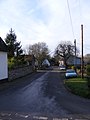
 Mendham Road - geograph.org.uk - 2744808.jpg 2 304 × 3 072 ; 1,48 Mio
-
 Mendham Road - geograph.org.uk - 2767912.jpg 3 072 × 2 304 ; 1,41 Mio
-
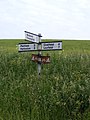
 Metfield Road junction at Withersdale Cross - geograph.org.uk - 2744802.jpg 3 072 × 2 304 ; 1,64 Mio
-
 Middleton Hall Ford - geograph.org.uk - 3343162.jpg 3 872 × 2 592 ; 4,62 Mio
-
 Mill Lane - geograph.org.uk - 3520243.jpg 3 072 × 2 304 ; 1,36 Mio
-
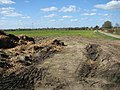
 Muck heap in field beside Hunters Lane - geograph.org.uk - 3906560.jpg 640 × 480 ; 149 kio
-
 Muck heap in field by Highfields Farm - geograph.org.uk - 3900512.jpg 640 × 480 ; 181 kio
-
 Mundy's Lane junction, Mendham, Suffolk - geograph.org.uk - 2197004.jpg 700 × 525 ; 257 kio
-
 Mundy's Lane, Mendham, Suffolk - geograph.org.uk - 2196974.jpg 700 × 525 ; 153 kio
-
 Mundy's Road, the road out of Mendham - geograph.org.uk - 2196959.jpg 700 × 525 ; 140 kio
-
 Mundys Lane sign - geograph.org.uk - 2768264.jpg 3 072 × 2 304 ; 1,49 Mio
-
 Mundys Lane, Mendham - geograph.org.uk - 2768262.jpg 3 072 × 2 304 ; 1,39 Mio
-
 New hedge beside Foxes Lane - geograph.org.uk - 3900465.jpg 640 × 480 ; 186 kio
-
 Notice at Withersdale Village Hall - geograph.org.uk - 2744956.jpg 2 304 × 3 072 ; 1,67 Mio
-
 Oilseed rape crop - geograph.org.uk - 3900759.jpg 640 × 480 ; 207 kio
-
 Oilseed rape crop by Mundy's Farm - geograph.org.uk - 3900757.jpg 640 × 480 ; 186 kio
-
 Oilseed rape crop by Pegg's Hill - geograph.org.uk - 3906630.jpg 640 × 480 ; 238 kio
-
 Old shed and Nissen hut by Gray's Farm - geograph.org.uk - 3900478.jpg 640 × 480 ; 159 kio
-
 One up one down in The Street, Mendham - geograph.org.uk - 3900438.jpg 516 × 640 ; 158 kio
-
 Pasture beside Sconch Beck Road - geograph.org.uk - 3900410.jpg 640 × 480 ; 200 kio
-
 Pasture beside Sconch Beck Road - geograph.org.uk - 3900411.jpg 640 × 480 ; 167 kio
-
 Pasture beside Withersdale Road - geograph.org.uk - 3900446.jpg 640 × 434 ; 162 kio
-
 Pasture by Sconch Beck - geograph.org.uk - 3900405.jpg 640 × 480 ; 168 kio
-
 Pasture land - geograph.org.uk - 898702.jpg 640 × 480 ; 84 kio
-
 Pastures by Priory Farm - geograph.org.uk - 3906702.jpg 640 × 480 ; 165 kio
-
 Pillbox in Church Lane - geograph.org.uk - 2768974.jpg 3 072 × 2 304 ; 1,54 Mio
-
 Pillbox near All Saints Church, Mendham - geograph.org.uk - 5658372.jpg 3 024 × 2 268 ; 3,14 Mio
-
 Priory Farm - the farmhouse - geograph.org.uk - 3906701.jpg 640 × 480 ; 124 kio
-

-
 Remains of Mendham Priory Suffolk by Henry Davy.jpg 750 × 587 ; 172 kio
-
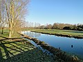 River Waveney from Mendham Bridge - geograph.org.uk - 2196910.jpg 700 × 525 ; 200 kio
-

-
 Rivulet feeding the River Waveney at Mendham - geograph.org.uk - 5658367.jpg 2 268 × 3 024 ; 2,14 Mio
-
 Road Junction - geograph.org.uk - 4040718.jpg 1 024 × 768 ; 207 kio
-
 Road junction, Mendham - geograph.org.uk - 2983142.jpg 4 320 × 3 240 ; 3,7 Mio
-
 Road to Withersale Street - geograph.org.uk - 2744226.jpg 3 072 × 2 304 ; 1,63 Mio
-
 Road to Withersale Street - geograph.org.uk - 2744799.jpg 3 072 × 2 304 ; 1,36 Mio
-
 Road to Withersdale Street junction - geograph.org.uk - 2744227.jpg 3 072 × 2 304 ; 1,4 Mio
-
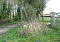
 Roadsign at the Road to Withersdale Street junction - geograph.org.uk - 2744229.jpg 2 304 × 3 072 ; 1,4 Mio
-
 Roadsign on Metfield Road - geograph.org.uk - 2744806.jpg 2 304 × 3 072 ; 1,31 Mio
-
 Roadsign on Mill Lane - geograph.org.uk - 3520236.jpg 2 304 × 3 072 ; 1,33 Mio
-
 Roadsign on Mill Lane - geograph.org.uk - 3520244.jpg 2 304 × 3 072 ; 1,64 Mio
-
 Roadsign on Mill Lane - geograph.org.uk - 4452460.jpg 2 253 × 2 995 ; 4,56 Mio
-
 Roadsign on Withersdale Road - geograph.org.uk - 2767998.jpg 2 304 × 3 072 ; 1,29 Mio
-
 Roadsign on Withersdale Road - geograph.org.uk - 2768268.jpg 2 304 × 3 072 ; 1,5 Mio
-
 Roadworks by Target Hill - geograph.org.uk - 3900380.jpg 640 × 472 ; 177 kio
-
 Roadworks on the access road to the Old Vicarage - geograph.org.uk - 3900529.jpg 640 × 480 ; 153 kio
-
 Sandpit Hill with temporary sign advising 10MPH - geograph.org.uk - 4340010.jpg 630 × 480 ; 195 kio
-
 Scary^ - geograph.org.uk - 2196978.jpg 700 × 525 ; 233 kio
-
 Sconch Beck by Target Hill - geograph.org.uk - 3900403.jpg 640 × 480 ; 236 kio
-
 Sewage works on the Harleston Road at Metfield - geograph.org.uk - 2196993.jpg 700 × 525 ; 283 kio
-
 Shed by Gray's Farm - geograph.org.uk - 3900473.jpg 640 × 444 ; 141 kio
-
 Sheds and barns near Gray's Farm - geograph.org.uk - 3900474.jpg 640 × 439 ; 161 kio
-
 Sheds by Weston House Farm - geograph.org.uk - 3900787.jpg 640 × 365 ; 104 kio
-
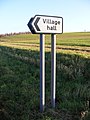 Sign to Withersdale Village Hall - geograph.org.uk - 2744958.jpg 2 304 × 3 072 ; 1,42 Mio
-
-
 Sir Alfred Munnings Hotel Postbox - geograph.org.uk - 2768919.jpg 2 304 × 3 072 ; 1,63 Mio
-
 Sir Alfred Munnings Hotel Postbox - geograph.org.uk - 2768923.jpg 2 304 × 3 072 ; 1,63 Mio
-
 Stile on footpath by Highfields Farm - geograph.org.uk - 3900508.jpg 640 × 445 ; 224 kio
-
 Stile on the Angles Way long distance footpath - geograph.org.uk - 3900419.jpg 640 × 480 ; 213 kio
-
 Straw bale stacks - geograph.org.uk - 3900445.jpg 635 × 640 ; 190 kio
-
 Swans on the River Waveney at Mendham - geograph.org.uk - 2196924.jpg 700 × 525 ; 147 kio
-
 Telephone and post box, Mendham - geograph.org.uk - 2983141.jpg 4 320 × 3 240 ; 4,77 Mio
-
 Telephone Box ^ Sir Alfred Munnings Hotel Postbox - geograph.org.uk - 2768948.jpg 2 304 × 3 072 ; 1,6 Mio
-
 The Dell, Mendham - geograph.org.uk - 2614394.jpg 480 × 640 ; 338 kio
-
 The Old School House, Mendham - geograph.org.uk - 2196951.jpg 700 × 525 ; 192 kio
-
 The River Waveney at Mendham - geograph.org.uk - 5658356.jpg 3 024 × 2 268 ; 1,41 Mio
-
 The Street Bridge, Mendham - geograph.org.uk - 2768981.jpg 3 072 × 2 304 ; 1,24 Mio
-
 The Street in Mendham village - geograph.org.uk - 362434.jpg 640 × 438 ; 85 kio
-
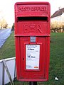
 The Street Postbox - geograph.org.uk - 2744816.jpg 2 304 × 3 072 ; 1,41 Mio
-
 The Street Postbox - geograph.org.uk - 2744817.jpg 2 304 × 3 072 ; 1,35 Mio
-
 The Street, Mendham - geograph.org.uk - 2768286.jpg 2 304 × 3 072 ; 1,26 Mio
-
 The Street, Mendham - geograph.org.uk - 2768990.jpg 3 072 × 2 304 ; 1,43 Mio
-
 The Street, Mendham - geograph.org.uk - 2983139.jpg 4 320 × 3 240 ; 3,88 Mio
-
 The Street, Mendham - geograph.org.uk - 2983140.jpg 4 320 × 3 240 ; 3,97 Mio
-
 The Street, Mendham - geograph.org.uk - 2983144.jpg 4 320 × 3 240 ; 3,89 Mio
-
 The Street, Mendham - geograph.org.uk - 4398441.jpg 3 072 × 2 304 ; 1,79 Mio
-
 The Street, Mendham - geograph.org.uk - 4398471.jpg 3 072 × 2 304 ; 1,9 Mio
-
 The Street, Mendham Bridge - geograph.org.uk - 2768966.jpg 3 072 × 2 304 ; 1,33 Mio
-
 Tilted poles beside Hunters Lane - geograph.org.uk - 3906559.jpg 640 × 480 ; 87 kio
-
 To Mendham on Foxes Lane - geograph.org.uk - 3900461.jpg 640 × 480 ; 158 kio
-
 To Mendham on Withersdale Road - geograph.org.uk - 3900447.jpg 640 × 437 ; 108 kio
-
 Tree on field boundary - geograph.org.uk - 3900519.jpg 480 × 640 ; 162 kio
-
 Trees beside unnamed lane - geograph.org.uk - 3900525.jpg 640 × 443 ; 198 kio
-
 Trees on field boundary - geograph.org.uk - 3900521.jpg 539 × 640 ; 173 kio
-
 Unsuitable for heavy goods vehicles - geograph.org.uk - 2033184.jpg 640 × 480 ; 98 kio
-
 View along Foxes Lane - geograph.org.uk - 3900517.jpg 640 × 480 ; 128 kio
-
 View along Grove Lane - geograph.org.uk - 3906568.jpg 640 × 480 ; 165 kio
-
 View along Hollow Lane - geograph.org.uk - 3900492.jpg 640 × 480 ; 274 kio
-
 View along Hunter's Lane - geograph.org.uk - 3900502.jpg 515 × 640 ; 168 kio
-
 View along Hunters Lane - geograph.org.uk - 3906544.jpg 640 × 480 ; 127 kio
-
 View along Mundy's Road - geograph.org.uk - 3900761.jpg 640 × 425 ; 148 kio
-
 View along Sconch Beck Road - geograph.org.uk - 3900414.jpg 640 × 480 ; 260 kio
-
 View along The Street, Mendham - geograph.org.uk - 3900431.jpg 640 × 528 ; 238 kio
-
 View along Withersdale Road, Mendham - geograph.org.uk - 3900439.jpg 640 × 480 ; 122 kio
-
 View from Denny's Hill - geograph.org.uk - 3900422.jpg 640 × 395 ; 123 kio
-
 View north along Hollow Lane - geograph.org.uk - 3900494.jpg 640 × 480 ; 237 kio
-
 View towards barn conversions in Hunters Lane - geograph.org.uk - 3906556.jpg 640 × 480 ; 118 kio
-
 View towards Glenmore Farm - geograph.org.uk - 3900791.jpg 640 × 480 ; 159 kio
-
 View towards Greshaw Farm - geograph.org.uk - 3900782.jpg 640 × 512 ; 123 kio
-
 View towards Grove End House - geograph.org.uk - 3906563.jpg 640 × 439 ; 183 kio
-
 View towards Highfields Farm - geograph.org.uk - 3900515.jpg 640 × 426 ; 172 kio
-
 Water Mill - geograph.org.uk - 425486.jpg 640 × 480 ; 81 kio
-
 Withersdale Road - geograph.org.uk - 2767983.jpg 2 304 × 3 072 ; 1,27 Mio


