Category:Mepal
Aller à la navigation
Aller à la recherche
English: Mepal is a village in Cambridgeshire, England. Mepal is part of the East Cambridgeshire district, and is located just north of the A142 road between Ely and Chatteris. It has a pub and a post office.
localité britannique du comté anglais de Cambridgeshire  | |||||
| Téléverser des médias | |||||
| Nature de l’élément | |||||
|---|---|---|---|---|---|
| Lieu | East Cambridgeshire, Cambridgeshire, Angleterre de l'Est, Angleterre | ||||
| Population |
| ||||
| Réputé identique à | Mepal (page en doublon, paroisse civile) | ||||
 | |||||
Sous-catégories
Cette catégorie comprend 2 sous-catégories, dont les 2 ci-dessous.
M
- St Mary Church, Mepal (2 F)
V
- Mepal village sign (3 F)
Média dans la catégorie « Mepal »
Cette catégorie comprend 217 fichiers, dont les 200 ci-dessous.
(page précédente) (page suivante)-
 A red scarecrow - geograph.org.uk - 1842834.jpg 2 848 × 2 136 ; 2,97 Mio
-
 A view from Mepal viaduct - The Ouse washes - geograph.org.uk - 6323150.jpg 5 184 × 3 888 ; 3,15 Mio
-
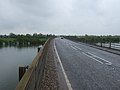
 A142 bridge at Mepal - geograph.org.uk - 2712074.jpg 1 600 × 1 200 ; 503 kio
-
 A142 bridge at Mepal - geograph.org.uk - 2712125.jpg 1 600 × 1 200 ; 870 kio
-
 A142 crossing the Ouse Washes - geograph.org.uk - 2712146.jpg 1 600 × 1 200 ; 577 kio
-
 A142 Ireton's Way - geograph.org.uk - 5120673.jpg 640 × 481 ; 40 kio
-
 A142 Ireton's Way - geograph.org.uk - 5120690.jpg 640 × 480 ; 71 kio
-
 A142 near Hiam's Farm - geograph.org.uk - 5120682.jpg 640 × 481 ; 45 kio
-
 A142 towards Ely - geograph.org.uk - 2938259.jpg 640 × 480 ; 65 kio
-
 A142 towards Ely - geograph.org.uk - 2938264.jpg 640 × 480 ; 47 kio
-
 A142 towards Ely - geograph.org.uk - 2938285.jpg 640 × 480 ; 52 kio
-
 A142 viaduct - geograph.org.uk - 5840392.jpg 1 024 × 768 ; 158 kio
-
 Agricultural buildings south of Mepal - geograph.org.uk - 5838911.jpg 1 000 × 696 ; 155 kio
-
 Along Catchwater Drain - geograph.org.uk - 4834355.jpg 480 × 640 ; 74 kio
-
 Along Catchwater Drain - geograph.org.uk - 4834362.jpg 480 × 640 ; 56 kio
-
 Along Catchwater Drain - geograph.org.uk - 4834364.jpg 480 × 640 ; 64 kio
-
 Along Catchwater Drain - geograph.org.uk - 4834368.jpg 480 × 640 ; 60 kio
-

-

-

-
 Beside Hundred Foot Drain, Mepal - geograph.org.uk - 4834327.jpg 480 × 640 ; 40 kio
-
 Beside Hundred Foot Drain, Mepal - geograph.org.uk - 4834328.jpg 640 × 480 ; 45 kio
-
 Beside Hundred Foot Drain, Mepal - geograph.org.uk - 4834332.jpg 480 × 640 ; 48 kio
-
 Block Fen sand and gravel quarry - geograph.org.uk - 2855232.jpg 1 600 × 1 200 ; 583 kio
-
 Blockmoor Fen near Mepal - geograph.org.uk - 3543253.jpg 4 320 × 3 240 ; 5,42 Mio
-
 Bridge on A142 - geograph.org.uk - 5349285.jpg 4 608 × 3 456 ; 4,22 Mio
-
 Bridge over the washes at Mepal - The Ouse Washes - geograph.org.uk - 6322979.jpg 5 184 × 3 888 ; 4,01 Mio
-
 Cereal crop north of Mepal - geograph.org.uk - 3562217.jpg 4 320 × 3 240 ; 5,63 Mio
-
 Counter drain - geograph.org.uk - 2712172.jpg 1 600 × 1 200 ; 597 kio
-
 Counter Drain and Mepal pumping station - geograph.org.uk - 2953652.jpg 4 320 × 3 240 ; 5,15 Mio
-
 Counter Drain at Mepal pumping station - geograph.org.uk - 1189094.jpg 640 × 427 ; 82 kio
-
 Counter Drain near Fortrey's Hall - The Ouse Washes near Mepal - geograph.org.uk - 2953642.jpg 4 320 × 3 240 ; 5,46 Mio
-
 Counter Drain, near Mepal pumping station - geograph.org.uk - 1189061.jpg 640 × 427 ; 75 kio
-
 Cows on the Ouse Washes - geograph.org.uk - 4739207.jpg 2 560 × 1 920 ; 1,77 Mio
-
 Crossing the Ouse Washes at sunset - geograph.org.uk - 5692591.jpg 4 032 × 3 024 ; 2,52 Mio
-
 Detail of pumping station - geograph.org.uk - 439982.jpg 426 × 640 ; 144 kio
-
 Detail of pumping station - geograph.org.uk - 439986.jpg 426 × 640 ; 143 kio
-
 Digger at Low Bank Farm - geograph.org.uk - 1053732.jpg 427 × 640 ; 76 kio
-
 Ditch by Ouse Washes - geograph.org.uk - 4739167.jpg 2 560 × 1 920 ; 1,86 Mio
-
 Drain at Black Bridge - geograph.org.uk - 2938277.jpg 640 × 480 ; 56 kio
-
 Drain near Husbandry Farm - geograph.org.uk - 2938268.jpg 640 × 480 ; 64 kio
-
 Drained farmland - geograph.org.uk - 788427.jpg 640 × 480 ; 87 kio
-
 Early winter flooding near Mepal - The Ouse Washes - geograph.org.uk - 6323775.jpg 4 032 × 3 024 ; 1,66 Mio
-
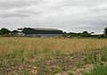
 Elean Business Park - geograph.org.uk - 5838884.jpg 1 024 × 768 ; 182 kio
-
 Engine Bank - geograph.org.uk - 4739165.jpg 2 560 × 1 920 ; 1,8 Mio
-
 Engine Bank - geograph.org.uk - 4739168.jpg 2 560 × 1 920 ; 1,74 Mio
-
 Farm building, White Gate Farm - geograph.org.uk - 2938356.jpg 640 × 480 ; 60 kio
-
 Farm buildings off Sutton Road, Mepal - geograph.org.uk - 2938355.jpg 640 × 480 ; 64 kio
-
 Farmland, Mepal Fen - geograph.org.uk - 2938273.jpg 640 × 480 ; 66 kio
-
 Fen and flooded Ouse washes near Mepal, aerial 2019 - geograph.org.uk - 6303865.jpg 1 024 × 683 ; 126 kio
-
 Field track - geograph.org.uk - 5349288.jpg 4 608 × 3 456 ; 5,69 Mio
-
 Fishing lake by Ouse Washes - geograph.org.uk - 4739164.jpg 2 560 × 1 920 ; 2,14 Mio
-
 Fishing pit by Toll Farm - geograph.org.uk - 2712181.jpg 1 600 × 1 128 ; 652 kio
-
 Flood plain of the New Bedford River - geograph.org.uk - 378798.jpg 640 × 427 ; 82 kio
-
 Flood water near Mepal - The Ouse Washes - geograph.org.uk - 6323794.jpg 4 032 × 3 024 ; 3,26 Mio
-
 Flooded washes near Mepal - The Ouse Washes - geograph.org.uk - 6323001.jpg 5 067 × 3 801 ; 2,66 Mio
-
 Flooding near Mepal Causeway - The Ouse Washes - geograph.org.uk - 6323201.jpg 4 973 × 3 731 ; 3,15 Mio
-
 Fly fishing on the far shore at Mepal pits - geograph.org.uk - 3498747.jpg 4 320 × 3 240 ; 5,29 Mio
-
 Footbridge crossing the Counter Drain near Mepal - geograph.org.uk - 2953506.jpg 4 320 × 3 240 ; 5,36 Mio
-
 Footpath on the river bank near Mepal - The Ouse Washes - geograph.org.uk - 6323013.jpg 5 055 × 3 791 ; 4,13 Mio
-
 Footpath to Ouse Washes - geograph.org.uk - 2712117.jpg 1 600 × 1 200 ; 625 kio
-
 Footpath under bridge at Mepal - geograph.org.uk - 2712066.jpg 1 600 × 1 200 ; 776 kio
-
 Fortrey Hall pumping station - geograph.org.uk - 4852376.jpg 1 600 × 1 200 ; 949 kio
-
 FP towards Mepal - geograph.org.uk - 4834372.jpg 480 × 640 ; 48 kio
-
 FP towards Mepal - geograph.org.uk - 4834373.jpg 480 × 640 ; 64 kio
-
 Horses grazing the counterwash - geograph.org.uk - 2712249.jpg 1 600 × 1 200 ; 660 kio
-
 Horses grazing the counterwash - geograph.org.uk - 2712252.jpg 1 600 × 1 200 ; 622 kio
-
 House in Bridge Road - geograph.org.uk - 5840112.jpg 1 000 × 750 ; 143 kio
-
 House near Mepal Bridge - geograph.org.uk - 1010605.jpg 427 × 640 ; 52 kio
-
 Hundred Foot Drain, Mepal - geograph.org.uk - 4834324.jpg 480 × 640 ; 45 kio
-
 Jarosite, KFe3-3(OH)6(SO4)2 - geograph.org.uk - 460813.jpg 480 × 640 ; 429 kio
-
 Lake, Outdoor Centre - geograph.org.uk - 2938258.jpg 640 × 480 ; 93 kio
-
 Late spring flooding - The Ouse Washes at Mepal - geograph.org.uk - 2955063.jpg 4 320 × 3 240 ; 5,34 Mio
-
 Layby on Witcham Road - geograph.org.uk - 2854948.jpg 1 600 × 1 200 ; 552 kio
-
 Man before birds - The Ouse Washes at Mepal - geograph.org.uk - 2955078.jpg 4 320 × 3 240 ; 5,58 Mio
-
 Manor Farm, Mepal - geograph.org.uk - 6705861.jpg 1 600 × 1 200 ; 265 kio
-
 Mepal Bridge at sunset - geograph.org.uk - 632886.jpg 640 × 427 ; 50 kio
-
 Mepal church - geograph.org.uk - 4834378.jpg 480 × 640 ; 60 kio
-
 Mepal Outdoor Centre - geograph.org.uk - 2938261.jpg 640 × 480 ; 45 kio
-
 Mepal Outdoor Centre, Cambridgeshire - geograph.org.uk - 3498750.jpg 4 320 × 3 240 ; 5,39 Mio
-
 Mepal pits - geograph.org.uk - 3498738.jpg 4 320 × 3 240 ; 5,88 Mio
-
 Mepal pumping station - geograph.org.uk - 629806.jpg 640 × 415 ; 79 kio
-
 Mepal pumping station - geograph.org.uk - 629811.jpg 640 × 414 ; 74 kio
-
 Mepal pumping station on Engine Bank - geograph.org.uk - 2950446.jpg 4 320 × 3 240 ; 5,6 Mio
-
 Mepal recycling centre - geograph.org.uk - 5839938.jpg 1 000 × 800 ; 248 kio
-
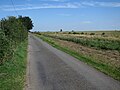
 Mepal Road towards Witcham - geograph.org.uk - 2938359.jpg 640 × 480 ; 77 kio
-
 Mepal sunset - geograph.org.uk - 631585.jpg 427 × 640 ; 47 kio
-
 Mepal Village Hall - geograph.org.uk - 5838942.jpg 1 000 × 695 ; 132 kio
-
 Mosaic Mural, Mepal Village Hall - geograph.org.uk - 5839271.jpg 1 000 × 919 ; 309 kio
-
 Nesting swan near Fortrey's Hall - geograph.org.uk - 4015408.jpg 4 320 × 3 240 ; 5,52 Mio
-
 Old barn in Mepal - geograph.org.uk - 6705867.jpg 1 600 × 1 200 ; 371 kio
-
 Old Bedford River - geograph.org.uk - 2712158.jpg 1 600 × 1 200 ; 443 kio
-
 Old Bedford River in flood - geograph.org.uk - 2938280.jpg 640 × 480 ; 33 kio
-
 Old Bedford River in flood - geograph.org.uk - 632882.jpg 640 × 427 ; 62 kio
-
 On the edge of Ireton's Way (A142) near Mepal - geograph.org.uk - 3562212.jpg 4 320 × 3 240 ; 5,5 Mio
-
 Ouse Washes - geograph.org.uk - 2712134.jpg 1 600 × 1 200 ; 484 kio
-
 Ouse Washes - geograph.org.uk - 2855129.jpg 1 600 × 1 200 ; 728 kio
-
 Ouse Washes - geograph.org.uk - 4739200.jpg 2 560 × 1 920 ; 1,64 Mio
-
 Ouse Washes near Mepal - geograph.org.uk - 6705858.jpg 1 600 × 1 200 ; 343 kio
-
 Outdoor Centre at Mepal pits - geograph.org.uk - 3498757.jpg 4 320 × 3 240 ; 5,21 Mio
-
 Poles in the flood water near Mepal - The Ouse Washes - geograph.org.uk - 6323153.jpg 5 184 × 3 888 ; 2,77 Mio
-
 Private fly fishing lake - Mepal pits - geograph.org.uk - 3498746.jpg 4 320 × 3 240 ; 5,53 Mio
-
 Pumping Station - geograph.org.uk - 6448787.jpg 3 867 × 2 900 ; 3,4 Mio
-
 Reflections at Mepal - geograph.org.uk - 1053735.jpg 427 × 640 ; 53 kio
-
 Ridge and furrow field - geograph.org.uk - 2854974.jpg 1 600 × 1 200 ; 759 kio
-
 River and dike become one - The Ouse Washes at Mepal - geograph.org.uk - 2955096.jpg 4 320 × 3 240 ; 5,51 Mio
-
 River Close, Mepal - geograph.org.uk - 2712106.jpg 1 600 × 1 200 ; 581 kio
-
 Road accident near Mepal - The Ouse Washes - geograph.org.uk - 6323016.jpg 5 055 × 3 791 ; 3,49 Mio
-
 Rolls of hay off Mepal Road - geograph.org.uk - 3562898.jpg 4 320 × 3 240 ; 5,5 Mio
-
 Sailing boats at Mepal Outdoor Centre - geograph.org.uk - 3498728.jpg 4 320 × 3 240 ; 5,48 Mio
-
 Setting sun over the Hundred Foot Washes - geograph.org.uk - 636308.jpg 640 × 480 ; 48 kio
-
 Shallow flooding on the Ouse Washes - geograph.org.uk - 4852362.jpg 1 600 × 1 182 ; 670 kio
-
 St Mary's cemetery, Mepal - geograph.org.uk - 2712094.jpg 1 600 × 1 200 ; 673 kio
-
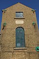
 St Mary, Mepal - East - geograph.org.uk - 5854638.jpg 900 × 684 ; 539 kio
-
 St Mary, Mepal - Font - geograph.org.uk - 5854636.jpg 674 × 900 ; 486 kio
-
 St Mary, Mepal - geograph.org.uk - 5854635.jpg 900 × 675 ; 473 kio
-
 St Mary, Mepal - Organ - geograph.org.uk - 5854640.jpg 636 × 900 ; 420 kio
-
 St Mary, Mepal - West end - geograph.org.uk - 5854641.jpg 900 × 675 ; 456 kio
-
 St Mary, Mepal - Window - geograph.org.uk - 5854637.jpg 160 × 900 ; 252 kio
-
 Sunset near Mepal - The Ouse Washes - geograph.org.uk - 6323002.jpg 5 184 × 3 888 ; 2,24 Mio
-
 Sunset on Mepal fishing lake - geograph.org.uk - 1053729.jpg 427 × 640 ; 75 kio
-
 Sunset on the flood water near Mepal - The Ouse Washes - geograph.org.uk - 6323806.jpg 3 931 × 2 949 ; 1,32 Mio
-
 Sunset on the Hundred Foot Washes - geograph.org.uk - 1053723.jpg 427 × 640 ; 90 kio
-
 Sunset over the Hundred Foot Washes - geograph.org.uk - 1053739.jpg 640 × 424 ; 74 kio
-
 Sunset over the Hundred Foot Washes - geograph.org.uk - 635676.jpg 640 × 461 ; 37 kio
-
 Sunset over the Hundred Foot Washes - geograph.org.uk - 636293.jpg 480 × 640 ; 37 kio
-

-

-
 Swan family in Counter Drain - geograph.org.uk - 4739182.jpg 2 560 × 1 920 ; 2,12 Mio
-
 Swans on the flooded wash near Mepal - The Ouse Washes - geograph.org.uk - 6323160.jpg 5 184 × 3 888 ; 4,78 Mio
-
 Swans on the old causeway at Mepal - The Ouse Washes - geograph.org.uk - 6323788.jpg 4 032 × 3 024 ; 1,43 Mio
-
 Teasels on the bank - The Ouse Washes near Mepal - geograph.org.uk - 4015977.jpg 4 320 × 3 240 ; 5,73 Mio
-
 The Anchor Inn (East) - geograph.org.uk - 355323.jpg 640 × 357 ; 75 kio
-
 The Anchor Inn (North East) - geograph.org.uk - 355324.jpg 640 × 456 ; 93 kio
-
 The Anchor Inn Sign - geograph.org.uk - 355322.jpg 511 × 640 ; 116 kio
-
 The Counter Drain near Mepal - The Ouse Washes - geograph.org.uk - 6323204.jpg 5 013 × 3 759 ; 3,08 Mio
-
 The Grove - geograph.org.uk - 355328.jpg 640 × 479 ; 125 kio
-
 The New Bedford River - geograph.org.uk - 5840308.jpg 1 024 × 768 ; 125 kio
-
 The Old Bedford River in flood at Mepal - The Ouse Washes - geograph.org.uk - 6323778.jpg 4 032 × 3 024 ; 3,41 Mio
-

-
 The Round House, Mepal - geograph.org.uk - 5838924.jpg 1 000 × 751 ; 194 kio
-
 The Rushway - geograph.org.uk - 2854985.jpg 1 600 × 1 200 ; 926 kio
-
 The Rushway - geograph.org.uk - 4834343.jpg 640 × 480 ; 64 kio
-
 The Rushway, Mepal - geograph.org.uk - 1011900.jpg 640 × 427 ; 135 kio
-
 The Three Pickerels - geograph.org.uk - 5840123.jpg 1 000 × 759 ; 183 kio
-
 Three Pickerels Bridge - geograph.org.uk - 961251.jpg 640 × 480 ; 74 kio
-
 Tollhouse by School Lane. Mepal (geograph 6077211).jpg 640 × 508 ; 324 kio
-
 Towards Mepal Bridge - geograph.org.uk - 4834319.jpg 480 × 640 ; 42 kio
-
 Towards Mepal church - geograph.org.uk - 4834376.jpg 640 × 480 ; 62 kio
-
 Towards The Rushway - geograph.org.uk - 4834339.jpg 480 × 640 ; 67 kio
-
 Track to Mepal Bridge - geograph.org.uk - 4834382.jpg 480 × 640 ; 107 kio
-
 Track to Mepal Quarry - geograph.org.uk - 2938262.jpg 640 × 480 ; 38 kio
-
 Tree and fields - geograph.org.uk - 5351457.jpg 4 608 × 3 456 ; 5,3 Mio
-
 Under Mepal Bridge - geograph.org.uk - 1053712.jpg 640 × 427 ; 58 kio
-
 Very dry Ouse Washes - geograph.org.uk - 4267929.jpg 1 600 × 1 200 ; 673 kio
-
 View from The Rushway - geograph.org.uk - 4834346.jpg 640 × 480 ; 55 kio
-
 White Gate Farm - geograph.org.uk - 2938360.jpg 640 × 480 ; 77 kio
-
 Whooper Swans off Engine Bank - geograph.org.uk - 2855070.jpg 1 600 × 1 200 ; 532 kio
-
 Wildfowlers' hides on the Ouse Washes - geograph.org.uk - 4852390.jpg 1 600 × 1 200 ; 707 kio
-
 Willow on the wash near Mepal - The Ouse Washes - geograph.org.uk - 6323006.jpg 5 184 × 3 888 ; 4,83 Mio
-
 Witcham Gravel (geograph 5380892).jpg 1 600 × 1 200 ; 274 kio
-
 Witcham Road - geograph.org.uk - 2854958.jpg 1 600 × 1 200 ; 519 kio
-
 Witcham Road, Mepal, heading east - geograph.org.uk - 2938350.jpg 640 × 480 ; 73 kio
-
 Work compound near Fortrey Hall - geograph.org.uk - 4739191.jpg 2 560 × 1 920 ; 1,64 Mio
-
 A policeman's lot is not a happy one^ - geograph.org.uk - 379476.jpg 480 × 640 ; 138 kio
-
 Access road to Fortrey Hall Farm - geograph.org.uk - 1189109.jpg 640 × 427 ; 106 kio
-
 Angling lake at Block Fen - geograph.org.uk - 1186937.jpg 640 × 427 ; 101 kio
-
 Angling lake at Block Fen - geograph.org.uk - 1189012.jpg 640 × 427 ; 107 kio
-
 Bedingham's Drove - geograph.org.uk - 378748.jpg 640 × 427 ; 62 kio
-
 Blaby's Drove - geograph.org.uk - 378761.jpg 640 × 427 ; 52 kio
-
 Bridge over murky water - geograph.org.uk - 379493.jpg 640 × 480 ; 103 kio
-
 Bridge over the Hundred Foot Washes at Mepal - geograph.org.uk - 636302.jpg 480 × 640 ; 48 kio
-
 Brush diesel, Mepal Pumping Station - geograph.org.uk - 628643.jpg 640 × 433 ; 91 kio
-
-
 Byway to Blockmoor Farm - geograph.org.uk - 378756.jpg 640 × 427 ; 90 kio
-
 Drain north of Black Bridge - geograph.org.uk - 514328.jpg 640 × 480 ; 98 kio
-
 Drying washland - geograph.org.uk - 551165.jpg 640 × 480 ; 60 kio
-
 Fen landscape - geograph.org.uk - 439995.jpg 640 × 426 ; 109 kio
-
 Fortrey memorial 1-2 - geograph.org.uk - 458569.jpg 640 × 480 ; 56 kio
-
 Fortrey memorial 2-2 - geograph.org.uk - 458574.jpg 640 × 480 ; 56 kio
-
 Fortrey's Bridge - geograph.org.uk - 439971.jpg 640 × 426 ; 141 kio
-
 Fortrey's Hall - geograph.org.uk - 439962.jpg 640 × 426 ; 139 kio
-
 Fortrey's Hall - geograph.org.uk - 458535.jpg 640 × 480 ; 106 kio
-
 Gault hole - geograph.org.uk - 439989.jpg 640 × 426 ; 126 kio
-
 Hundred Foot Washes - geograph.org.uk - 633298.jpg 640 × 427 ; 41 kio
-
 Hundred Foot Washes, Mepal - geograph.org.uk - 636305.jpg 480 × 640 ; 43 kio
-
 Lake at Block Fen - geograph.org.uk - 514335.jpg 640 × 480 ; 112 kio
-
 Lake at Block Fen - geograph.org.uk - 514343.jpg 640 × 480 ; 93 kio
-
 Langwood Fen, track and lake - geograph.org.uk - 514336.jpg 640 × 480 ; 84 kio
-
 Mepal Bridge, Mepal, Cambs - geograph.org.uk - 226918.jpg 640 × 480 ; 275 kio
-
 New and Old Bedford Rivers at Mepal - geograph.org.uk - 632887.jpg 640 × 401 ; 30 kio
-
 New Bedford River - geograph.org.uk - 633293.jpg 640 × 427 ; 66 kio
-
 New Bedford River and the Hundred Foot Washes - geograph.org.uk - 633295.jpg 640 × 420 ; 50 kio
-
 New Bedford River and the Hundred Foot Washes - geograph.org.uk - 633296.jpg 640 × 427 ; 48 kio
-
 New Bedford River at Mepal - geograph.org.uk - 632884.jpg 640 × 427 ; 35 kio
-
 New Bedford River, Mepal - geograph.org.uk - 633291.jpg 640 × 427 ; 45 kio
-
 New Bedford River, Mepal - geograph.org.uk - 636319.jpg 480 × 640 ; 44 kio
-
 New Bedford River, Mepal, Cambs - geograph.org.uk - 226903.jpg 640 × 480 ; 246 kio
-
 New Bedford River, near Mepal - geograph.org.uk - 633292.jpg 640 × 427 ; 65 kio
-
 North Fen - geograph.org.uk - 378759.jpg 640 × 427 ; 69 kio


6(SO4)2_-_geograph.org.uk_-_460813.jpg)


_near_Mepal_-_geograph.org.uk_-_3562212.jpg)


_-_geograph.org.uk_-_355323.jpg)
_-_geograph.org.uk_-_355324.jpg)


.jpg)


.jpg)


