Category:Mercator projection
Przejdź do nawigacji
Przejdź do wyszukiwania
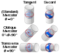
English: The Mercator projection is a cylindrical map projection presented by the Flemish geographer and cartographer Gerardus Mercator in 1569. It became the standard map projection for nautical purposes because of its ability to represent lines of constant course, known as rhumb lines or loxodromes, as straight segments. While the linear scale is equal in all directions around any point, thus preserving the angles and the shapes of small objects (which makes the projection conformal), the Mercator projection distorts the size and shape of large objects, as the scale increases from the equator to the poles, where it becomes infinite.
This category should be used for all media relating to the Mercator projection other than maps using it, which should be placed in the more specific category Category:Maps with Mercator projection.
English: This map-projection-related category exists in the following hierarchy:
- Category:Map projections
- Category:Maps by projection
- Category:Mercator projection – media related to the Mercator projection other than maps
- Category:Maps with Mercator projection (“Category:Mercator projections”) – maps made using the Mercator projection
cylindrical map projection invented by Gerardus Mercator in 1569   relation between the Mercator projection and the true size of each country | |||||
| Prześlij plik multimedialny | |||||
| Jest to |
| ||||
|---|---|---|---|---|---|
| Nazwano imieniem | |||||
| Odkrywca lub wynalazca | |||||
| Data odkrycia |
| ||||
| |||||
Podkategorie
Poniżej wyświetlono 3 spośród wszystkich 3 podkategorii tej kategorii.
M
- Mercatorfläche (Bonn) (1 plik)
T
Pliki w kategorii „Mercator projection”
Poniżej wyświetlono 33 spośród wszystkich 33 plików w tej kategorii.
-
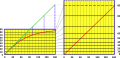
 Cyl proj scale 3examples.svg 410 × 270; 46 KB
-

-
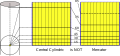
 Central cylindrical light projection.svg 512 × 384; 97 KB
-
 Comparison of Mercator projections.svg 512 × 455; 55 KB
-
 Cyl proj scale merc.svg 500 × 300; 36 KB
-
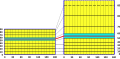
 Cyl proj scale secant.svg 520 × 190; 82 KB
-
 Hyperbolic Japanese Tiling (28677250671).jpg 6000 × 3000; 8,67 MB
-
 Mercator and angles.svg 400 × 164; 54 KB
-
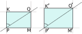
 Mercator and central cylindrical.png 470 × 219; 24 KB
-
 Mercator and central cylindrical.svg 495 × 229; 42 KB
-
 Mercator and shapes.svg 353 × 237; 77 KB
-
 Mercator and straightened rhumb.png 978 × 471; 59 KB
-
 Mercator and straightened rhumb.svg 944 × 456; 124 KB
-
 Mercator by Wright stretching.svg 492 × 238; 108 KB
-
 Mercator projection ar.png 1500 × 656; 207 KB
-
 Mercator projections vs rotation.gif 800 × 339; 4,22 MB
-
 Mercator robinson sinusoïdaal.PNG 2507 × 1000; 237 KB
-
 Mercator scale elements.svg 280 × 117; 19 KB
-
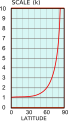 Mercator scale plot.svg 132 × 233; 47 KB
-
 Mercator y plot.svg 154 × 232; 82 KB
-
 National Atlas Mercator.gif 280 × 164; 12 KB
-
 Netzentwuerfe.png 797 × 2161; 242 KB
-
 Podziałka złożona dla Merkatora.png 3001 × 1168; 143 KB
-
 Proiezione Mercatore.svg 4000 × 2480; 776 KB
-
 Rhumb line vs great-circle arc.png 1854 × 2254; 865 KB
-
 Scale drawing of mercator map projection.jpg 1056 × 741; 109 KB
-
 Usgs map mercator-ko.svg 413 × 181; 525 KB
-
 Usgs map mercator.svg 413 × 181; 525 KB
-
 Vergrotende breedte.PNG 800 × 800; 23 KB
-
 View of different world displays, 1719.jpg 851 × 1021; 170 KB
-
 World Scale from DMA Series 1150 map.png 3301 × 890; 14 KB
-
 Μερκατορική προβολή 1834.jpg 3456 × 4608; 2,95 MB
-
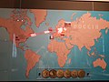 Музей Обуховского завода. Санкт-Петербург. Карта экпорта продукции.jpg 4128 × 3096; 3,4 MB

.jpg)


.jpg)


