Category:Metropolitan Borough of Wirral
ナビゲーションに移動
検索に移動

metropolitan borough of Merseyside, in North West England   | |||||
| メディアをアップロード | |||||
| 分類 | |||||
|---|---|---|---|---|---|
| 場所 | マージーサイド, ノース・ウェスト・イングランド, イングランド | ||||
| 隣接・位置する水域 | |||||
| 行政中心地 | |||||
| 立法府 |
| ||||
| 成立日 |
| ||||
| 人口 |
| ||||
| 面積 |
| ||||
| 以下と異なる | |||||
| 公式ウェブサイト | |||||
 | |||||
Български: Община „Уиръл“ е една от петте административни единици в област (графство) Мърсисайд, регион Северозападна Англия.
Brezhoneg: Distrig Wirral, e ledenez Wirral, a zo unan eus distrigoù Merseyside, e Bro-Saoz. Deuet eo da vezañ er pleustr un aotrouniezh unvan abaoe freuz Kuzul-Kontelezh Merseyside e 1986.
Dansk: Wirral er en halvø, der ligger på grænsen mellem Merseyside og Cheshire i det nordvestlige England. Floden Mersey danner grænsen mod øst. Mod nord går halvøen ud i det irske hav. Mod vest danner floden Dee grænsen mod Wales.
Deutsch: Wirral ist ein Metropolitan Borough im Metropolitan County Merseyside in England, der nach der Halbinsel The Wirral benannt ist. Der Borough umfasst die nördliche Hälfte dieser Halbinsel und liegt am River Mersey gegenüber von Liverpool. An der Nordseite wird er durch die Irische See begrenzt. Verwaltungssitz ist die Stadt Wallasey. Zum Bezirk gehören außerdem die Orte Bebington, Bidston, Birkenhead, Heswall, Hoylake, New Brighton und West Kirby.
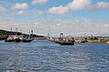
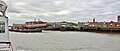
English: The Metropolitan Borough of Wirral is a metropolitan borough of Merseyside, in North West England. It has a population of 320,295, and encompasses of the northern part of the Wirral Peninsula. Major settlements include Birkenhead, Wallasey, Bebington, Heswall, Hoylake and West Kirby. The city of Liverpool over the Mersey, faces the northeastern side of the Wirral. Bordering is the River Mersey to the east, the Irish Sea to the north and the River Dee to the west; the borough of Cheshire West and Chester occupies the remainder of the Wirral Peninsula and borders the borough of Wirral to the south.
Français : Le district métropolitain du Wirral (en anglais : Metropolitan Borough of Wirral) est un district métropolitain du Merseyside.
Italiano: Wirral è un Metropolitan Borough del Merseyside, Inghilterra, Regno Unito, con sede a Wallasey.
日本語: ウィラル (Wirral) は、 イングランド・マージーサイドの大都市バラである。2008年の推定人口は311,200人、面積は160km2で、ウィラル半島の北部に位置する。タウンであるバーケンヘッドは、行政的にはウィラルに属している。マージー川の対岸はリヴァプールで、位置的にはウィラルから北東方面にあたる。
Nederlands: Wirral is een Engels district in het graafschap Merseyside en telt 312.293 inwoners. De oppervlakte bedraagt 157,1 km².
Norsk bokmål: Wirral er et administrativt distrikt i Merseyside i England. Det omfatter den nordlige delen av halvøya Wirral-halvøya. I likhet med de andre distriktene er det en Metropolitan Borough, som er selvstyrt. Distriktet grenser mot Liverpool på den andre siden av Mersey mot øst, Irskesjøen mot nord og elven Dee i vest.
Polski: Metropolitan Borough of Wirral – dystrykt metropolitalny w hrabstwie ceremonialnym Merseyside w Anglii.
Română: Wirral este un Burg Metropolitan în cadrul Comitatului Metropolitan Merseyside în regiunea North West England. Principalele localități sunt Birkenhead, Wallasey, Bebington, Heswall și Hoylake.
Simple English: Wirral is a metropolitan borough in Merseyside, North West England, which occupies the northern part of the Wirral Peninsula, more commonly known as Wirral.
Svenska: Wirral är ett storstadsdistrikt i Merseyside i Nordvästra England i Storbritannien. Det ligger på halvön med samma namn.
اردو: میٹروپولیٹن برو ویرل ( انگریزی: Metropolitan Borough of Wirral) برطانیہ کا ایک میٹروپولیٹن بورو جو مرزیسائڈ میں واقع ہے۔
下位カテゴリ
このカテゴリに属する 37 個のサブカテゴリのうち、 37 個を表示しています。
カテゴリ「Metropolitan Borough of Wirral」にあるメディア
このカテゴリに属する 4,284 個のファイルのうち、 200 個を表示しています。
(前のページ) (次のページ)-
 'Brian' on Birkenhead Road, Seacombe – 1964 - geograph.org.uk - 6496505.jpg 1,280 × 843;280キロバイト
-
 'Crab' type locomotive 42942 at Birkenhead – 1966 - geograph.org.uk - 6723232.jpg 1,280 × 853;281キロバイト
-
 'Happy Days' sculpture in memory of Simon Wallis - geograph.org.uk - 5272844.jpg 767 × 1,024;196キロバイト
-

-
 'NO BATHING' notice outside the Marine Lake - geograph.org.uk - 2216472.jpg 640 × 480;103キロバイト
-
 'Six seagulls and a lighthouse' New Brighton - geograph.org.uk - 2738070.jpg 1,024 × 768;111キロバイト
-
 'The Old Rathbone' in Hillbark Road, Frankby - geograph.org.uk - 5985337.jpg 1,600 × 1,200;453キロバイト
-
 'The Riverview', Birkenhead - geograph.org.uk - 3836505.jpg 640 × 481;68キロバイト
-
 1 Cavendish Road, Birkenhead - geograph.org.uk - 6735417.jpg 1,024 × 774;466キロバイト
-
 1 to 7 Neston Road - geograph.org.uk - 4961318.jpg 640 × 480;78キロバイト
-
 1-18 Hamilton Square, Birkenhead - geograph.org.uk - 6704548.jpg 1,024 × 651;368キロバイト
-
 1-6 Mortimer Street, Birkenhead - geograph.org.uk - 6722182.jpg 753 × 1,024;385キロバイト
-
 1-7 Charing Cross, Birkenhead - geograph.org.uk - 6720948.jpg 1,024 × 693;366キロバイト
-
 10-32 York Street, Bromborough Pool Village - geograph.org.uk - 6727735.jpg 1,024 × 757;338キロバイト
-
 11 Clifton Road, Birkenhead - geograph.org.uk - 6736049.jpg 1,024 × 760;369キロバイト
-
 11-13 Market Street, Birkenhead - geograph.org.uk - 6707089.jpg 771 × 1,024;337キロバイト
-
 111 Eastham Village Road, Eastham - geograph.org.uk - 6724407.jpg 1,024 × 760;473キロバイト
-
 118 Conway Street, Birkenhead - geograph.org.uk - 6720898.jpg 1,024 × 621;319キロバイト
-
 12-13 Rock Park, Birkenhead - geograph.org.uk - 6728461.jpg 1,024 × 768;367キロバイト
-
 12-14 Market Street, Birkenhead - geograph.org.uk - 6704572.jpg 1,024 × 748;361キロバイト
-
 19-34 Hamilton Square, Birkenhead - geograph.org.uk - 6704541.jpg 1,024 × 538;320キロバイト
-
 2-4 Pool Street, Birkenhead - geograph.org.uk - 6730065.jpg 1,024 × 774;347キロバイト
-
 20-24 Village Road, Birkenhead - geograph.org.uk - 6729235.jpg 1,024 × 764;325キロバイト
-
 24 Clifton Road, Birkenhead - geograph.org.uk - 6736057.jpg 832 × 1,024;414キロバイト
-
 24-28 Hamilton Street, Birkenhead - geograph.org.uk - 6707053.jpg 1,024 × 834;362キロバイト
-
 257 Grange Road, Birkenhead - geograph.org.uk - 6720924.jpg 1,024 × 735;341キロバイト
-
 27 Clifton Road, Birkenhead - geograph.org.uk - 6736063.jpg 1,024 × 782;389キロバイト
-
 28-50 Argyle Street, Birkenhead - geograph.org.uk - 6707096.jpg 1,024 × 783;321キロバイト
-
 29-33 Argyle Street, Birkenhead - geograph.org.uk - 6707100.jpg 1,024 × 772;372キロバイト
-
 30-40 Hamilton Street, Birkenhead - geograph.org.uk - 6707061.jpg 1,024 × 774;398キロバイト
-
 32-44 Conway Street, Birkenhead - geograph.org.uk - 6722178.jpg 1,024 × 768;402キロバイト
-
 35-50 Hamilton Square, Birkenhead - geograph.org.uk - 6704543.jpg 1,024 × 845;417キロバイト
-
 40 Clifton Road, Birkenhead - geograph.org.uk - 6736068.jpg 795 × 1,024;398キロバイト
-
 42-44 Hamilton Street, Birkenhead - geograph.org.uk - 6707072.jpg 1,024 × 778;350キロバイト
-
 458 New Chester Road, Birkenhead - geograph.org.uk - 6728467.jpg 1,024 × 818;344キロバイト
-
 51-57 Hamilton Square, Birkenhead - geograph.org.uk - 6704557.jpg 1,024 × 624;350キロバイト
-
 52 Market Street, Hoylake - geograph.org.uk - 6737732.jpg 1,024 × 769;375キロバイト
-
 52-54 Hamilton Street, Birkenhead - geograph.org.uk - 6707086.jpg 1,024 × 754;435キロバイト
-
 56 Hamilton Street, Birkenhead - geograph.org.uk - 6707082.jpg 1,024 × 768;331キロバイト
-
 58-63 Hamilton Square, Birkenhead - geograph.org.uk - 6704552.jpg 1,024 × 763;514キロバイト
-
 59 Shrewsbury Road, Birkenhead - geograph.org.uk - 6729239.jpg 1,024 × 768;472キロバイト
-
 6 Duncan Street, Birkenhead - geograph.org.uk - 6722185.jpg 765 × 1,024;418キロバイト
-
 72 Grosvenor Street, Wallasey - geograph.org.uk - 6736784.jpg 1,024 × 765;364キロバイト
-
 76 Hamilton Street, Birkenhead - geograph.org.uk - 6707079.jpg 1,024 × 810;343キロバイト
-
 88 Caldy Road - geograph.org.uk - 2550957.jpg 4,000 × 3,000;5.88メガバイト
-
 92-104 Chester Street, Birkenhead - geograph.org.uk - 6707094.jpg 1,024 × 670;264キロバイト
-
 96 Caldy Road - geograph.org.uk - 2550925.jpg 2,666 × 2,484;1.23メガバイト
-
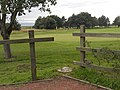
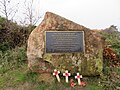 A 2016 commemorative stone on Thurstaston Common - geograph.org.uk - 5985212.jpg 1,600 × 1,201;637キロバイト
-
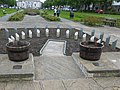
 A barrel buoy on the beach with wind turbines beyond - geograph.org.uk - 5432193.jpg 4,013 × 2,752;5.93メガバイト
-

-
 A Birkenhead Glegg boundary stone on Thurstaston Common - geograph.org.uk - 5985085.jpg 1,200 × 1,600;761キロバイト
-
 A Birkenhead Glegg boundary stone on Thurstaston Common - geograph.org.uk - 5985110.jpg 1,200 × 1,600;642キロバイト
-
 A bootscraper in Hamilton Street, Birkenhead - geograph.org.uk - 5997092.jpg 1,196 × 1,600;485キロバイト
-
 A breakwater - geograph.org.uk - 5379352.jpg 4,438 × 2,514;6.54メガバイト
-
 A breakwater at New Brighton - geograph.org.uk - 5378865.jpg 4,461 × 2,538;4.91メガバイト
-
 A breakwater off Leasowe - geograph.org.uk - 5370706.jpg 4,547 × 2,606;4.75メガバイト
-
 A bus stop on Barnston Road - geograph.org.uk - 5509469.jpg 4,277 × 2,900;7.16メガバイト
-
 A busy road junction - geograph.org.uk - 5313820.jpg 4,128 × 2,322;4.05メガバイト
-
 A closed church - geograph.org.uk - 5404607.jpg 4,303 × 2,640;5.19メガバイト
-
 A closed road - geograph.org.uk - 5586837.jpg 4,592 × 3,056;5.79メガバイト
-

-
 A cyclist overtakes the horseriders - geograph.org.uk - 5508664.jpg 3,571 × 2,854;7.89メガバイト
-
 A dog training centre - geograph.org.uk - 5406151.jpg 4,589 × 2,739;6.41メガバイト
-
 A fallen tree in a pond in Central Park - geograph.org.uk - 5378053.jpg 4,592 × 3,056;7.21メガバイト
-
 A feeder road for the M53 - geograph.org.uk - 5381131.jpg 4,138 × 2,826;7.82メガバイト
-
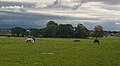 A field with horses grazing - geograph.org.uk - 5510672.jpg 4,578 × 2,519;7.03メガバイト
-
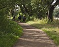
 A footpath in Royden Country Park - geograph.org.uk - 5526265.jpg 4,592 × 3,056;7.77メガバイト
-
 A footpath through woodland off Norwich Drive - geograph.org.uk - 5430936.jpg 2,698 × 3,662;5.81メガバイト
-
 A fungal growth on a hawthorn tree - geograph.org.uk - 5449367.jpg 4,592 × 3,056;7.49メガバイト
-

-
 A green oasis in Tranmere - geograph.org.uk - 3916402.jpg 1,024 × 768;295キロバイト
-
 A green on Heswell Golf course - geograph.org.uk - 2041785.jpg 640 × 480;151キロバイト
-
 A less famous Lily Savage - geograph.org.uk - 3071132.jpg 640 × 480;82キロバイト
-
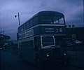 A Leyland Titan bus in Birkenhead Bus Station - geograph.org.uk - 3637855.jpg 1,472 × 1,232;280キロバイト
-
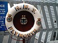 A lifebelt on HMS Plymouth - geograph.org.uk - 6234260.jpg 640 × 480;51キロバイト
-
 A Lifeguard station on the sea wall - geograph.org.uk - 5368305.jpg 4,397 × 2,614;5.13メガバイト
-
 A memorial gateway - geograph.org.uk - 5378808.jpg 2,351 × 3,475;6.16メガバイト
-
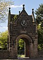 A memorial gateway - geograph.org.uk - 5378825.jpg 2,462 × 3,372;5.12メガバイト
-
 A memorial to those who served at RAF West Kirby who were lost - geograph.org.uk - 5405875.jpg 3,056 × 3,249;6.56メガバイト
-
 A new road^ - geograph.org.uk - 5446530.jpg 4,592 × 2,721;7.89メガバイト
-
 A new road^ - geograph.org.uk - 5446573.jpg 4,430 × 2,637;7.9メガバイト
-
 A path between the games courts and the beach - geograph.org.uk - 5443676.jpg 4,592 × 3,056;7.66メガバイト
-
 A path between the games courts and the beach - geograph.org.uk - 5443713.jpg 4,592 × 2,871;7.72メガバイト
-
 A Path in Arrowe Country Park - geograph.org.uk - 4654448.jpg 640 × 481;682キロバイト
-
 A path junction on the Wirral Way - geograph.org.uk - 5581661.jpg 4,592 × 2,974;7.83メガバイト
-
 A playing field at Ridgewood Park - geograph.org.uk - 5581041.jpg 4,361 × 2,925;6.99メガバイト
-
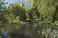
 A pond by Landican Lane - geograph.org.uk - 5508323.jpg 4,592 × 3,056;7.16メガバイト
-
 A pre-Worboys road sign on the B5141 in Caldy - geograph.org.uk - 5133220.jpg 769 × 1,024;267キロバイト
-
 A seat with a sea view, Wallasey - geograph.org.uk - 5370829.jpg 4,347 × 2,838;1.3メガバイト
-
-
 A single walker on the beach with a wind farm in the distance - geograph.org.uk - 5380463.jpg 4,420 × 2,541;6.27メガバイト
-
 A slipway and the beach off North Parade - geograph.org.uk - 5442479.jpg 4,535 × 2,536;7.23メガバイト
-
 A slipway off Hoylake promenade - geograph.org.uk - 5432217.jpg 4,506 × 2,745;5.32メガバイト
-
 A slipway off the promenade at Wallasey - geograph.org.uk - 2993291.jpg 4,182 × 2,783;6.4メガバイト
-
 A small open space in Port Sunlight model village - geograph.org.uk - 5480594.jpg 4,179 × 2,781;7.92メガバイト
-

-
 A small, well manicured, wooded area - geograph.org.uk - 5480551.jpg 4,592 × 2,440;7.82メガバイト
-
 A snowy aftermath - geograph.org.uk - 6724016.jpg 3,024 × 4,032;2.54メガバイト
-
 A stroll along the beach - geograph.org.uk - 2146681.jpg 640 × 480;82キロバイト
-
 A Tesco Express - geograph.org.uk - 5406532.jpg 4,441 × 2,483;5.64メガバイト
-
 A track into farmland - geograph.org.uk - 5406033.jpg 4,446 × 2,819;7.68メガバイト
-
 A track through woodland - geograph.org.uk - 5405925.jpg 3,434 × 2,805;6.44メガバイト
-
 A variety of bollards on Argyle Street South - geograph.org.uk - 3916396.jpg 1,024 × 768;166キロバイト
-
-
 A view of a flock of birds over Hilbre - geograph.org.uk - 2216481.jpg 640 × 480;84キロバイト
-
 A view of the Dee estuary - geograph.org.uk - 4013727.jpg 640 × 480;126キロバイト
-
 A windfarm in Liverpool Bay - geograph.org.uk - 5370317.jpg 4,379 × 2,530;4.56メガバイト
-
 A windsurfer off the Mersey estuary - geograph.org.uk - 5371770.jpg 3,184 × 2,263;2.92メガバイト
-
 A Wirral Enigma - geograph.org.uk - 3199106.jpg 640 × 428;61キロバイト
-
 A wood sculpture - geograph.org.uk - 5464152.jpg 2,143 × 3,056;5.86メガバイト
-
 A wood sculpture - geograph.org.uk - 5581586.jpg 3,629 × 2,850;7.89メガバイト
-
 A41 passes under New Ferry Road - geograph.org.uk - 3332697.jpg 640 × 480;63キロバイト
-
 A41 road bridge in Bromborough - geograph.org.uk - 4230866.jpg 1,024 × 768;343キロバイト
-
 A41, junction with B5137 - geograph.org.uk - 5877119.jpg 4,320 × 3,240;2.71メガバイト
-
 A5137 approaching M53 junction 4 - geograph.org.uk - 1927987.jpg 640 × 480;62キロバイト
-
 A5137 in Brimstage - geograph.org.uk - 1927948.jpg 640 × 480;92キロバイト
-
 A540 Chester Road - geograph.org.uk - 1927959.jpg 640 × 480;61キロバイト
-
 A540, Thurstaston approaching roundabout - geograph.org.uk - 6186270.jpg 640 × 480;74キロバイト
-
 A551 Arrowe Park Road - geograph.org.uk - 3897144.jpg 640 × 481;87キロバイト
-

-
 A551, Leasowe Road - geograph.org.uk - 1916729.jpg 640 × 480;44キロバイト
-
 A553 Birkenhead Road - geograph.org.uk - 2781269.jpg 640 × 480;64キロバイト
-
 A553 Hoylake Road - geograph.org.uk - 2781257.jpg 640 × 480;32キロバイト
-
 A554 towards New Brighton - geograph.org.uk - 3869912.jpg 640 × 480;87キロバイト
-
 Access ramp on North Parade Hoylake - geograph.org.uk - 2870335.jpg 1,600 × 1,198;285キロバイト
-
 Access road north of Bidston - geograph.org.uk - 6195101.jpg 1,024 × 768;156キロバイト
-
 Access road off Seacombe Promenade - geograph.org.uk - 3867861.jpg 640 × 480;96キロバイト
-
 Access road to the sailing school - geograph.org.uk - 2212966.jpg 640 × 480;105キロバイト
-
 Access road, north east of Chester High Road - geograph.org.uk - 2980114.jpg 640 × 480;114キロバイト
-
 Access to race track - geograph.org.uk - 2980107.jpg 640 × 480;64キロバイト
-
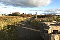
 Access to Thurstaston Common - geograph.org.uk - 5985255.jpg 1,600 × 1,200;779キロバイト
-
 Access to Tranmere Oil Terminal only - geograph.org.uk - 5463358.jpg 4,268 × 2,841;7.33メガバイト
-
 Accident Route - geograph.org.uk - 2153391.jpg 3,200 × 2,200;6.97メガバイト
-
 Across the Marine Lake - geograph.org.uk - 6370702.jpg 4,129 × 1,893;1.33メガバイト
-
 Across the Mersey to Liverpool - geograph.org.uk - 5609580.jpg 800 × 600;76キロバイト
-
 Adaston Avenue, Hooton - geograph.org.uk - 2552158.jpg 586 × 398;86キロバイト
-
 Adventure golf course, New Brighton - geograph.org.uk - 5794597.jpg 2,000 × 1,500;447キロバイト
-
 Adverts on railway trucks, East Float, Birkenhead - geograph.org.uk - 5631789.jpg 2,000 × 1,500;578キロバイト
-
 Aerial of West Float - Birkenhead - geograph.org.uk - 5948485.jpg 2,796 × 1,782;1.87メガバイト
-
 Afloat at last - geograph.org.uk - 2280390.jpg 1,200 × 803;135キロバイト
-
 Aft end of Unterseeboot 534 - geograph.org.uk - 3339491.jpg 640 × 480;70キロバイト
-
 Al Fresco scene at the Irby Mill pub - geograph.org.uk - 3801348.jpg 1,024 × 768;191キロバイト
-
 Albert Dock and ferry terminal, Birkenhead - geograph.org.uk - 5632369.jpg 2,000 × 1,500;273キロバイト
-
 Alderley Road Cottages and Church - geograph.org.uk - 6010581.jpg 640 × 480;65キロバイト
-
 Aldford Close - geograph.org.uk - 5314062.jpg 4,128 × 2,322;3.94メガバイト
-
 Alfred Dock - geograph.org.uk - 3867841.jpg 640 × 480;53キロバイト
-
 Alfred Dock - geograph.org.uk - 5404379.jpg 5,184 × 3,456;1.8メガバイト
-
 Alfred Dock - geograph.org.uk - 6403436.jpg 5,739 × 3,826;4.08メガバイト
-

-
 Alfred Dock, Birkenhead - geograph.org.uk - 6723694.jpg 1,024 × 755;337キロバイト
-
 All in a row - geograph.org.uk - 2173537.jpg 3,274 × 2,280;5.81メガバイト
-
 All that's left of the lifeboat slipway - geograph.org.uk - 2049469.jpg 633 × 415;113キロバイト
-
 Alldays ^ Onions Ltd. - geograph.org.uk - 5375238.jpg 2,560 × 1,536;1.82メガバイト
-
 Alldays ^ Onions Ltd. Forge - geograph.org.uk - 5375260.jpg 1,536 × 2,560;2.29メガバイト
-
 Allport Road shops - geograph.org.uk - 2155548.jpg 640 × 480;89キロバイト
-
 Allport Road, Bromborough - geograph.org.uk - 6349923.jpg 800 × 600;191キロバイト
-
 Allport Road-Brookhurst Road junction - geograph.org.uk - 2155563.jpg 640 × 480;97キロバイト
-
 Almost deserted beach, West Kirby - geograph.org.uk - 4853967.jpg 1,024 × 768;108キロバイト
-
 Along the beach at Meols - geograph.org.uk - 6370562.jpg 3,648 × 1,744;1.32メガバイト
-
 Along the beach at Meols - geograph.org.uk - 6370565.jpg 3,521 × 1,683;1メガバイト
-
 Along the Gayton Sands walkway - geograph.org.uk - 4872252.jpg 2,048 × 1,536;762キロバイト
-
 Alongside Leasowe lighthouse - geograph.org.uk - 2189866.jpg 640 × 480;128キロバイト
-
 Altcar Drive - geograph.org.uk - 3708160.jpg 640 × 960;1.15メガバイト
-
 An M53 motorway bridge over a railway viewed from Landican Lane - geograph.org.uk - 5508375.jpg 4,592 × 3,056;7.11メガバイト
-
 An oak tree on Station Road - geograph.org.uk - 5510403.jpg 4,008 × 2,593;7.88メガバイト
-
 An Odd Notice, Port Sunlight - geograph.org.uk - 3808759.jpg 1,600 × 1,558;696キロバイト
-

-
 An unconvincing bench mark on Rock Ferry Esplanade - geograph.org.uk - 4866533.jpg 4,608 × 3,456;6.51メガバイト
-
 Analemmatic sun-dial - geograph.org.uk - 3213375.jpg 3,648 × 2,736;4.91メガバイト
-
 Analemmatic Sundial, Port Sunlight - geograph.org.uk - 4013345.jpg 640 × 480;141キロバイト
-
 Anchor - geograph.org.uk - 2280387.jpg 1,200 × 803;165キロバイト
-
 Anchor at Egremont - geograph.org.uk - 5379781.jpg 3,184 × 2,123;1.82メガバイト
-
 Anchor Inn - geograph.org.uk - 2530783.jpg 4,000 × 3,000;6.04メガバイト
-
 Ancient well on track off Gayton Farm Road - geograph.org.uk - 3741485.jpg 1,600 × 1,200;808キロバイト
-
 Ancient Yew tree, Eastham church - geograph.org.uk - 4948172.jpg 640 × 480;113キロバイト
-
 Andrew Gibson House - geograph.org.uk - 6405043.jpg 6,000 × 4,000;4.83メガバイト
-
 Apartment buildings, Wellington Road, New Brighton - geograph.org.uk - 5794613.jpg 2,000 × 1,500;343キロバイト
-

-
 Apple Avenue - geograph.org.uk - 5447943.jpg 4,401 × 2,850;7.57メガバイト
-
 Apple trees and horses - geograph.org.uk - 5448067.jpg 4,253 × 2,839;7.88メガバイト
-
 Approach signs for Frankby village - geograph.org.uk - 3107266.jpg 1,600 × 1,198;451キロバイト
-
 Approaching Eastham Locks - geograph.org.uk - 2537579.jpg 640 × 426;46キロバイト
-
 Approaching Eastham Locks - geograph.org.uk - 4784708.jpg 1,600 × 1,064;349キロバイト
-
 Approaching Hilbre Island - geograph.org.uk - 3523550.jpg 640 × 465;338キロバイト
-
 Approaching Hilbre Island - geograph.org.uk - 5263052.jpg 640 × 480;89キロバイト
-
 Approaching junction 5 on the M53 for the A41 - geograph.org.uk - 6434188.jpg 2,700 × 2,025;438キロバイト
-
 Approaching Little Hilbre - geograph.org.uk - 5281985.jpg 640 × 480;165キロバイト
-
 Approaching Mersey Ferries Seacombe terminal, Wallasey - geograph.org.uk - 5363157.jpg 5,303 × 2,015;1.34メガバイト
-
-

-
 Approaching Seacombe Ferry Terminal - geograph.org.uk - 5732635.jpg 4,032 × 3,024;1.81メガバイト
-
-
 Argyle Street South, Birkenhead - geograph.org.uk - 5627188.jpg 2,000 × 1,500;491キロバイト
-
 Arrowe Bridge - geograph.org.uk - 5404303.jpg 5,184 × 2,940;1.88メガバイト
-
 Arrowe Brook Farm, Greasby - geograph.org.uk - 3519336.jpg 640 × 480;63キロバイト
-
 Arrowe Brook from Town Meadow Lane - geograph.org.uk - 2905830.jpg 800 × 600;125キロバイト
-
 Arrowe Brook from Town Meadow Lane - geograph.org.uk - 2905832.jpg 800 × 600;134キロバイト
-
 Arrowe Brook Lane - geograph.org.uk - 6166644.jpg 800 × 600;102キロバイト
-
 Arrowe Brook Road - geograph.org.uk - 6166649.jpg 800 × 600;110キロバイト
-
 Arrowe Country Park, Birkenhead - geograph.org.uk - 4654451.jpg 640 × 481;621キロバイト


_Water_Board_Stop_Valve_marker_-_geograph.org.uk_-_5788568.jpg)


_-_geograph.org.uk_-_6350537.jpg)


