Category:Mickleton, County Durham
Aller à la navigation
Aller à la recherche
English: Mickleton is a village and civil parish in Teesdale, in the Pennines of England. It was historically located in the North Riding of Yorkshire but along with the rest of the former Startforth Rural District it was transferred to County Durham for administrative and ceremonial purposes on 1 April 1974, under the provisions of the Local Government Act 1972. Mickleton is situated by the meeting of the Lune River, as it leaves Lunedale, and joins the Tees, behind Mickleton on the Lunedale Hills looms the Bronze Age burial site of Kirkcarrion.
village britannique  | |||||
| Téléverser des médias | |||||
| Nature de l’élément | |||||
|---|---|---|---|---|---|
| Lieu | comté de Durham, Durham, Angleterre du Nord-Est, Angleterre | ||||
| Réputé identique à | Mickleton (page en doublon, paroisse civile) | ||||
 | |||||
Sous-catégories
Cette catégorie comprend 4 sous-catégories, dont les 4 ci-dessous.
B
- Beckstones Wath Footbridge (4 F)
- Blacksmith's Arms, Mickleton (3 F)
L
- Laithkirk Viaduct (6 F)
W
- West Pasture (2 F)
Média dans la catégorie « Mickleton, County Durham »
Cette catégorie comprend 257 fichiers, dont les 200 ci-dessous.
(page précédente) (page suivante)-
 A curious depression - geograph.org.uk - 4392259.jpg 4 320 × 3 240 ; 2,91 Mio
-
 A dip on the Tees Railway Walk - geograph.org.uk - 3628071.jpg 640 × 480 ; 97 kio
-
 A happy bull (1) - geograph.org.uk - 3627669.jpg 640 × 480 ; 78 kio
-
 A happy bull (2) - geograph.org.uk - 3627678.jpg 640 × 480 ; 92 kio
-
 A tributary of Oundle Sike - geograph.org.uk - 6412684.jpg 1 600 × 900 ; 461 kio
-
 Above Grassholme Reservoir - geograph.org.uk - 6272296.jpg 3 888 × 5 184 ; 5,5 Mio
-
 Access to farmland, under the former Tees Valley Railway - geograph.org.uk - 6412664.jpg 1 600 × 1 200 ; 974 kio
-
 Access track below Lund Hill - geograph.org.uk - 6413300.jpg 1 600 × 1 200 ; 667 kio
-
 Across the lake to Stake Hill - geograph.org.uk - 4392242.jpg 4 320 × 3 240 ; 2,9 Mio
-
 Along the Tees railway path - geograph.org.uk - 4879306.jpg 4 320 × 3 240 ; 3,44 Mio
-
 Approaching Mickleton Station from the west - geograph.org.uk - 6412678.jpg 1 600 × 1 200 ; 648 kio
-
 Autumn birch by the Teesdale Railway walk - geograph.org.uk - 2156280.jpg 3 240 × 3 840 ; 2,48 Mio
-
 B6277 entering Mickleton - geograph.org.uk - 3666544.jpg 1 500 × 1 000 ; 1,41 Mio
-
 B6277 north west of Romaldkirk - geograph.org.uk - 2249162.jpg 640 × 480 ; 41 kio
-
 Back Road to Town Fields, Mickleton - geograph.org.uk - 22915.jpg 360 × 480 ; 37 kio
-
 Bail Green Farm - geograph.org.uk - 3258913.jpg 3 540 × 2 586 ; 3,72 Mio
-
 Barn at Beckhead. - geograph.org.uk - 3990678.jpg 640 × 480 ; 71 kio
-
 Beckstones Wath footbridge - geograph.org.uk - 4880656.jpg 4 051 × 3 039 ; 2,27 Mio
-
 Beckstones Wath footbridge over the River Tees - geograph.org.uk - 6312960.jpg 5 312 × 2 988 ; 6,96 Mio
-
 Beckstones Wath footbridge over the River Tees - geograph.org.uk - 6312998.jpg 5 312 × 2 988 ; 6,17 Mio
-
 Beckstones Wath rapid on the Tees - geograph.org.uk - 2245886.jpg 3 840 × 2 880 ; 1,58 Mio
-
 Bench on the Tees Railway Path - geograph.org.uk - 6412737.jpg 2 432 × 1 824 ; 3,2 Mio
-
 Blacksmiths Arms, Mickleton - geograph.org.uk - 4701078.jpg 1 600 × 1 065 ; 553 kio
-
 Boggy terrain on moorland south-east of Grassholme Reservoir - geograph.org.uk - 2689917.jpg 1 500 × 946 ; 1,23 Mio
-
 Boggy valley south-east of Cote House - geograph.org.uk - 2513360.jpg 1 024 × 768 ; 232 kio
-
 Boundary Fence - geograph.org.uk - 1321995.jpg 640 × 480 ; 53 kio
-
 Boundary stone on Caple Rigg - geograph.org.uk - 2701952.jpg 1 125 × 1 500 ; 1,44 Mio
-
 Bridge over Eller Beck - geograph.org.uk - 2515425.jpg 1 024 × 768 ; 337 kio
-
 Brock Scar - geograph.org.uk - 1636000.jpg 640 × 427 ; 83 kio
-
 Brock Scar by Wester Beck - geograph.org.uk - 2158144.jpg 3 840 × 2 580 ; 1,3 Mio
-
 Brock Scar Farm - geograph.org.uk - 3627623.jpg 640 × 480 ; 62 kio
-
 Brock Scar Farm in Lunedale - geograph.org.uk - 3258462.jpg 3 648 × 2 736 ; 2,6 Mio
-
 Brownberry - geograph.org.uk - 1636031.jpg 640 × 427 ; 75 kio
-
 Brownberry Force - geograph.org.uk - 1257685.jpg 480 × 640 ; 134 kio
-
 Buttercup meadow above Lunedale - geograph.org.uk - 3009880.jpg 800 × 600 ; 146 kio
-
 Byway , Mickleton - geograph.org.uk - 1974183.jpg 600 × 450 ; 423 kio
-
 Car Park and Picnic Area, Mickleton - geograph.org.uk - 1974209.jpg 600 × 450 ; 217 kio
-
 Cattle grid - geograph.org.uk - 1299591.jpg 640 × 427 ; 81 kio
-
 Cattle grid on Kelton Lane - geograph.org.uk - 3259361.jpg 3 648 × 2 736 ; 2,44 Mio
-
 Conifer woodland above Wester Beck at West Pasture in Lunedale - geograph.org.uk - 3253906.jpg 3 648 × 2 736 ; 2,79 Mio
-
 Cote House Farm - geograph.org.uk - 3627680.jpg 640 × 480 ; 81 kio
-
 Cottage near Lund Hill - geograph.org.uk - 1756912.jpg 2 048 × 1 536 ; 1,76 Mio
-
 Cottages at West End, Mickleton - geograph.org.uk - 4701135.jpg 1 600 × 1 065 ; 665 kio
-
 Course of an old railway branch - geograph.org.uk - 4879317.jpg 4 320 × 3 240 ; 4,02 Mio
-
 Cows grazing - geograph.org.uk - 1715836.jpg 3 648 × 2 736 ; 4,56 Mio
-
 Crossroads , Romaldkirk Moor - geograph.org.uk - 228008.jpg 640 × 332 ; 52 kio
-
 Dales barn - geograph.org.uk - 1300136.jpg 640 × 427 ; 96 kio
-
 Dam, Grassholme Reservoir - geograph.org.uk - 2512180.jpg 1 024 × 768 ; 261 kio
-
 Dead mail drop on West Pasture Lane - geograph.org.uk - 2158100.jpg 4 320 × 3 240 ; 2,22 Mio
-
 Decaying railway wagon by the road to Botany - geograph.org.uk - 2161374.jpg 4 320 × 3 240 ; 1,76 Mio
-
 Depression beside Grassholme Reservoir - geograph.org.uk - 2689416.jpg 1 500 × 1 007 ; 1,16 Mio
-
 Derelict farm buildings - geograph.org.uk - 1300124.jpg 640 × 427 ; 92 kio
-
 Derelict farmhouse above Mickleton - geograph.org.uk - 2164188.jpg 3 840 × 2 700 ; 1,11 Mio
-
 Disused lime kilns, West Pasture Road - geograph.org.uk - 2513286.jpg 1 024 × 768 ; 300 kio
-
 Disused limestone quarry, off road to Hury - geograph.org.uk - 2513319.jpg 1 024 × 768 ; 261 kio
-
 Disused railway viaduct near Mickleton - geograph.org.uk - 2779500.jpg 3 072 × 2 304 ; 1,06 Mio
-
 Drive to Lund Hill from the B6277 in County Durham - geograph.org.uk - 2499150.jpg 3 648 × 2 736 ; 2,84 Mio
-
 Dropped bridge at Lund Hill - geograph.org.uk - 6413298.jpg 1 600 × 1 200 ; 779 kio
-
 Dropped bridge near East Field - geograph.org.uk - 6413306.jpg 1 600 × 1 200 ; 662 kio
-
 Dropped bridge, east of Mickleton Station picnic area - geograph.org.uk - 6412681.jpg 1 600 × 1 200 ; 852 kio
-
 Dropped railway bridge near Mickleton's West End - geograph.org.uk - 6412662.jpg 1 600 × 1 200 ; 769 kio
-
 East Field Farm - geograph.org.uk - 3628065.jpg 640 × 480 ; 74 kio
-
 Easter Beck flowing towards Grassholme Reservoir - geograph.org.uk - 3258439.jpg 2 827 × 2 333 ; 3,02 Mio
-
 End of the track, Brownberry plantation - geograph.org.uk - 1768354.jpg 3 072 × 2 304 ; 3,25 Mio
-
 Entrance for footpath off Kelton Lane - geograph.org.uk - 3259385.jpg 3 648 × 2 736 ; 3,26 Mio
-
 Entrance for path to bird hide at Grasshome Reservoir Nature Reserve - geograph.org.uk - 3259392.jpg 3 648 × 2 736 ; 4,12 Mio
-
 Farm building at Beck Head - geograph.org.uk - 5517217.jpg 640 × 480 ; 52 kio
-
 Farm buildings below Lund Hill - geograph.org.uk - 3628037.jpg 640 × 480 ; 111 kio
-
 Farmhouse at East Field Farm - geograph.org.uk - 3259080.jpg 2 540 × 1 820 ; 1,62 Mio
-
 Farmhouse at East Field House Farm - geograph.org.uk - 3259113.jpg 3 534 × 2 578 ; 2,97 Mio
-
 Farmland near Middleton-in-Teesdale - geograph.org.uk - 4254728.jpg 640 × 383 ; 107 kio
-
 Farmland south of Mickleton Station - geograph.org.uk - 6412723.jpg 1 600 × 1 200 ; 654 kio
-
 Field Barn Conversion into House. - geograph.org.uk - 1974214.jpg 600 × 450 ; 206 kio
-
 Field south of Mickleton - geograph.org.uk - 2690106.jpg 1 500 × 960 ; 1,01 Mio
-
 Fields in Teesdale - geograph.org.uk - 4745663.jpg 2 592 × 1 944 ; 1,38 Mio
-
 Fields south of Mickleton - geograph.org.uk - 662475.jpg 640 × 480 ; 76 kio
-
 Fishing in the sun - geograph.org.uk - 4392229.jpg 4 320 × 3 240 ; 2,94 Mio
-
 Footbridge near West Pasture Farm - geograph.org.uk - 2512094.jpg 1 024 × 768 ; 321 kio
-
 Footpath from Cote House Road over Eller Beck - geograph.org.uk - 2161353.jpg 4 320 × 3 240 ; 5,58 Mio
-
 Forest ride above Harker Springs - geograph.org.uk - 1768341.jpg 960 × 1 280 ; 329 kio
-
 Forest track, Brownberry - geograph.org.uk - 1768392.jpg 3 072 × 2 304 ; 3 Mio
-
 Former Farmhouse, Mickleton - geograph.org.uk - 1974200.jpg 600 × 450 ; 328 kio
-
 Former stone quarry, above Hayberry Well - geograph.org.uk - 6413314.jpg 1 600 × 1 200 ; 704 kio
-
 Grass harvest at West Pasture - geograph.org.uk - 3122086.jpg 1 500 × 843 ; 1,22 Mio
-
 Grassholme Bridge - geograph.org.uk - 2510566.jpg 1 024 × 769 ; 230 kio
-
 Grassholme Bridge from the north-east - geograph.org.uk - 2510631.jpg 1 024 × 768 ; 240 kio
-
 Grassholme Lane off Kelton Lane - geograph.org.uk - 3259354.jpg 3 648 × 2 736 ; 2,07 Mio
-
 Grassholme Lane up from Grassholme Bridge - geograph.org.uk - 3259805.jpg 3 648 × 2 736 ; 3,2 Mio
-
 Grassholme Reservoir - geograph.org.uk - 4392234.jpg 4 320 × 2 160 ; 1,46 Mio
-
 Grassholme Reservoir - geograph.org.uk - 5517045.jpg 640 × 480 ; 79 kio
-
 Grassholme Reservoir - geograph.org.uk - 5517237.jpg 640 × 480 ; 57 kio
-
 Grassholme Reservoir, Lunesdale - geograph.org.uk - 4696778.jpg 1 024 × 678 ; 185 kio
-
 Grassy slope with six trees - geograph.org.uk - 4887720.jpg 1 500 × 979 ; 1,19 Mio
-
 Harker Springs - geograph.org.uk - 1635876.jpg 640 × 427 ; 95 kio
-
 Harvested upland hay fields near The Acres - geograph.org.uk - 2515452.jpg 1 024 × 768 ; 304 kio
-
 Hay bales by the Tees Railway path - geograph.org.uk - 3801416.jpg 4 320 × 3 240 ; 5,53 Mio
-
 Hay field north of Eller Beck - geograph.org.uk - 2515443.jpg 1 024 × 768 ; 283 kio
-
 Hayberries - geograph.org.uk - 2690887.jpg 1 500 × 843 ; 1,35 Mio
-

-
 Heather moor at Swarthy Top - geograph.org.uk - 2690175.jpg 1 500 × 932 ; 996 kio
-
 Heatherlea - geograph.org.uk - 1636188.jpg 640 × 317 ; 63 kio
-
 Hoping for a bite - geograph.org.uk - 4392226.jpg 2 878 × 2 963 ; 1,13 Mio
-
 Houses at Whitbridge, Mickleton - geograph.org.uk - 4701138.jpg 1 600 × 1 065 ; 668 kio
-
 How - geograph.org.uk - 3259365.jpg 3 648 × 2 736 ; 3,4 Mio
-
 In Lunedale - geograph.org.uk - 6272312.jpg 5 184 × 3 888 ; 4,23 Mio
-
 Infilled bridge, Tees Railway Path - geograph.org.uk - 6412726.jpg 1 600 × 1 200 ; 800 kio
-
 Inlet, Grassholme Reservoir - geograph.org.uk - 5517084.jpg 640 × 480 ; 66 kio
-
 Kelton Lane westwards - geograph.org.uk - 3259369.jpg 3 648 × 2 736 ; 3,02 Mio
-
 Kirkcarrion from the south bank of Grassholme Reservoir - geograph.org.uk - 2510711.jpg 1 024 × 770 ; 216 kio
-
 Ladder stile above Hury Reservoir - geograph.org.uk - 5517119.jpg 640 × 480 ; 64 kio
-
 Ladder stile for footpath from minor road in Lunedale - geograph.org.uk - 3255136.jpg 3 508 × 2 540 ; 4,05 Mio
-
 Lady's Bedstraw (Galium verum) - geograph.org.uk - 2515435.jpg 1 024 × 770 ; 459 kio
-
 Landslip at Grassholme Reservoir - geograph.org.uk - 4929929.jpg 1 500 × 865 ; 1,23 Mio
-
 Lane descending to Cote House Road - geograph.org.uk - 2186858.jpg 2 000 × 1 500 ; 3,51 Mio
-
 Lane Head - geograph.org.uk - 1635984.jpg 640 × 423 ; 69 kio
-
 Lane Head - geograph.org.uk - 2692411.jpg 1 500 × 1 125 ; 1,7 Mio
-
 Large barn off Bail Hill Road, Mickleton - geograph.org.uk - 6412731.jpg 1 600 × 1 200 ; 563 kio
-
 Lime kiln by West Pasture Road - geograph.org.uk - 2776201.jpg 640 × 480 ; 95 kio
-
 Looking down on the River Tees - geograph.org.uk - 5557214.jpg 1 600 × 1 067 ; 210 kio
-
 Looking north down Hury Road - geograph.org.uk - 2513330.jpg 1 024 × 768 ; 250 kio
-
 Low Side, Mickleton - geograph.org.uk - 1974188.jpg 600 × 450 ; 320 kio
-
 Low Side, Mickleton - geograph.org.uk - 4745667.jpg 2 592 × 1 944 ; 1,54 Mio
-
 Lumps, bumps and ewes - geograph.org.uk - 4392220.jpg 4 315 × 2 345 ; 2,59 Mio
-
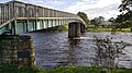
 Lune Viaduct - geograph.org.uk - 5865104.jpg 1 024 × 768 ; 224 kio
-
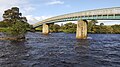
 Lune Viaduct near Laithkirk - geograph.org.uk - 2515468.jpg 1 024 × 768 ; 325 kio
-
 Marsh around Eller Beck - geograph.org.uk - 2514548.jpg 1 024 × 768 ; 320 kio
-
 Marsh orchid by Eller Beck - geograph.org.uk - 2515416.jpg 768 × 1 024 ; 150 kio
-
 Mickleton Service Station - geograph.org.uk - 2499145.jpg 3 648 × 2 736 ; 2,16 Mio
-
 Mickleton Village Hall - geograph.org.uk - 1974204.jpg 600 × 450 ; 254 kio
-
 Mickleton's West End - geograph.org.uk - 6412668.jpg 1 600 × 1 200 ; 678 kio
-
 Mickleton, from Mickleton Station picnic area - geograph.org.uk - 6412679.jpg 1 600 × 1 200 ; 556 kio
-
 Moorland descending to Lune valley with hills beyond - geograph.org.uk - 2701788.jpg 1 500 × 901 ; 962 kio
-
 Moorland on south side of Selset Reservoir - geograph.org.uk - 6009273.jpg 1 500 × 944 ; 1,2 Mio
-
 Muck spreading at Mickleton - geograph.org.uk - 4879331.jpg 4 320 × 3 240 ; 5,14 Mio
-
 Non stop past Mickleton - geograph.org.uk - 4879325.jpg 3 240 × 4 320 ; 4,38 Mio
-
 Obstructed footpath off Kelton Lane - geograph.org.uk - 3259372.jpg 3 648 × 2 736 ; 3,08 Mio
-
 Old railway cutting at Mickleton - geograph.org.uk - 3628073.jpg 640 × 480 ; 93 kio
-
 Old workings above Swarthy Mere - geograph.org.uk - 2164162.jpg 3 072 × 3 840 ; 1,6 Mio
-
 Over the bridge - geograph.org.uk - 4880661.jpg 3 240 × 4 320 ; 2,17 Mio
-
 Parish Boundary Marker and Stile - geograph.org.uk - 21801.jpg 640 × 480 ; 86 kio
-
 Path on the old railway near Mickleton - geograph.org.uk - 2779495.jpg 3 072 × 2 304 ; 1,19 Mio
-
 Permissive path on south side of Grassholme Reservoir - geograph.org.uk - 2511942.jpg 1 024 × 768 ; 240 kio
-
 Picnic Area next to the B6281 in County Durham - geograph.org.uk - 2500013.jpg 3 648 × 2 736 ; 2,23 Mio
-
 Pillar by Brownberry Plantation - geograph.org.uk - 3627592.jpg 640 × 480 ; 58 kio
-
 Pillar by Brownberry Plantation - geograph.org.uk - 3627595.jpg 640 × 480 ; 87 kio
-
 Pipely Bridge - geograph.org.uk - 3801406.jpg 4 320 × 3 240 ; 5,63 Mio
-
 Plantation on Lund Hill - geograph.org.uk - 4745669.jpg 2 592 × 1 944 ; 1,67 Mio
-
 Plantation on Lund Hill - geograph.org.uk - 6412758.jpg 1 600 × 1 200 ; 542 kio
-
 Railway Spur from Tees Valley Railway and Field Barn - geograph.org.uk - 5150087.jpg 4 896 × 3 672 ; 6,64 Mio
-
 Rainbow over Sorrow Sike - geograph.org.uk - 6413317.jpg 1 793 × 1 345 ; 602 kio
-
 Recently rolled pasture near Eastfield - geograph.org.uk - 6235330.jpg 4 608 × 3 456 ; 7,3 Mio
-
 Red metal barn at Hayberries - geograph.org.uk - 6413310.jpg 1 600 × 1 200 ; 522 kio
-
 River Lune from Laithkirk Viaduct - geograph.org.uk - 1974224.jpg 600 × 450 ; 452 kio
-
 River Lune west of Laithkirk viaduct - geograph.org.uk - 2517346.jpg 768 × 1 024 ; 378 kio
-
 River Tees - geograph.org.uk - 21805.jpg 640 × 480 ; 99 kio
-
 River Tees above Egglesburn - geograph.org.uk - 2344932.jpg 640 × 480 ; 88 kio
-
 River Tees from Beckstone Wath Footbridge - geograph.org.uk - 1974169.jpg 600 × 450 ; 229 kio
-
 River Tees from Beckstones Wath Footbridge - geograph.org.uk - 1974171.jpg 600 × 450 ; 303 kio
-
 Road Bridge over The Tees Railway Path - geograph.org.uk - 6175858.jpg 4 608 × 3 456 ; 7,75 Mio
-
 Road over Grassholme Bridge - geograph.org.uk - 3253882.jpg 3 648 × 2 736 ; 3,31 Mio
-
 Road to Baldersdale west of Brownberry Plantation - geograph.org.uk - 2399087.jpg 1 024 × 768 ; 186 kio
-
 Road to Baldersdale west of Brownberry Plantation - geograph.org.uk - 2399102.jpg 1 024 × 768 ; 181 kio
-
 Road to Mickleton - geograph.org.uk - 1974205.jpg 600 × 450 ; 265 kio
-
 Roadside seat overlooking Grassholme Reservoir - geograph.org.uk - 3258469.jpg 2 705 × 2 024 ; 2,15 Mio
-
 Robinson Well and Spring, Mickleton - geograph.org.uk - 1974193.jpg 600 × 450 ; 405 kio
-
 Romaldkirk Moor Trig pillar - geograph.org.uk - 1919842.jpg 2 592 × 1 944 ; 1,04 Mio
-
 Selset Reservoir dam from the east - geograph.org.uk - 2399157.jpg 3 000 × 1 312 ; 593 kio
-
 Selset Weir - geograph.org.uk - 2689433.jpg 1 500 × 1 125 ; 1 Mio
-
 Sewage Works Serving the Village of Mickleton - geograph.org.uk - 22920.jpg 640 × 480 ; 76 kio
-
 Sheep grazing on slope of dam - geograph.org.uk - 6010372.jpg 1 500 × 854 ; 1,09 Mio
-
 Sheep in lower Lunedale - geograph.org.uk - 3627674.jpg 640 × 480 ; 86 kio
-
 Sheep pasture by Tofts Road - geograph.org.uk - 2775635.jpg 640 × 480 ; 86 kio
-
 Sign for Robinson Well and Spring, Mickleton - geograph.org.uk - 1974197.jpg 600 × 450 ; 384 kio
-
 Site of Mickleton station, 2003 - geograph.org.uk - 5376581.jpg 2 398 × 1 583 ; 2,38 Mio
-
 Slopes of Lund Hill - geograph.org.uk - 3628035.jpg 640 × 480 ; 98 kio
-
 Small inlet, Grassholme Reservoir - geograph.org.uk - 4392236.jpg 4 320 × 3 240 ; 2,94 Mio
-
 Small Tortoiseshell (Aglais urticae) on thistle - geograph.org.uk - 2514533.jpg 1 024 × 769 ; 162 kio
-
 Solitary house above the River Lune - geograph.org.uk - 5850249.jpg 1 600 × 1 067 ; 289 kio
-
 South shore path at Grassholme - geograph.org.uk - 4392248.jpg 4 320 × 3 240 ; 3,64 Mio
-
 Stone pillar at Brownberry - geograph.org.uk - 4392603.jpg 4 320 × 3 240 ; 4,59 Mio
-
 Stone pillar by Kelton Moss - geograph.org.uk - 4392610.jpg 4 320 × 3 240 ; 3,53 Mio
-
 Swarthy Top - geograph.org.uk - 1639934.jpg 640 × 427 ; 81 kio
-
 Tees Rail Walk at Mickleton - geograph.org.uk - 3627954.jpg 640 × 480 ; 135 kio
-
 Tees Railway path between Mickleton and Romaldkirk - geograph.org.uk - 6153656.jpg 4 608 × 3 456 ; 5,43 Mio
-
 Tees Railway path between Mickleton and Romaldkirk - geograph.org.uk - 6153666.jpg 4 608 × 3 456 ; 7,51 Mio
-
 Tees Railway path between Mickleton and Romaldkirk - geograph.org.uk - 6175813.jpg 4 608 × 3 456 ; 7,9 Mio
-
 Tees Railway path near Mickleton - geograph.org.uk - 6153679.jpg 4 608 × 3 456 ; 7,17 Mio
-
 Tees Railway Path, below Lund Hill - geograph.org.uk - 6412744.jpg 2 432 × 1 824 ; 2,98 Mio
-
 Tees Railway Walk at Mickleton - geograph.org.uk - 3628044.jpg 640 × 480 ; 108 kio
-
 Tees Valley Railway Walk - geograph.org.uk - 1974211.jpg 600 × 450 ; 290 kio
-
 Tees Valley Railway Walking Trail - geograph.org.uk - 5158194.jpg 1 066 × 800 ; 361 kio
-
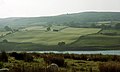
 Teesdale - geograph.org.uk - 2481591.jpg 1 280 × 960 ; 642 kio
-
 Teesdale Railway Walk - geograph.org.uk - 1715793.jpg 3 648 × 2 736 ; 5,16 Mio
-

-
 Teesdale Sailing Club at Grassholme Reservoir - geograph.org.uk - 2512144.jpg 1 024 × 768 ; 246 kio
-
 Teesdale Sailing Club training centre - geograph.org.uk - 3259819.jpg 3 648 × 2 736 ; 2,98 Mio
-
 The Acres - geograph.org.uk - 2515457.jpg 1 024 × 768 ; 309 kio
-
 The B6277 in Mickleton - geograph.org.uk - 4745665.jpg 2 592 × 1 944 ; 1,33 Mio
-
 The Blacksmiths Arms, Mickleton - geograph.org.uk - 4701094.jpg 1 065 × 1 600 ; 510 kio
-
 The Crown at Mickleton - geograph.org.uk - 4701095.jpg 1 600 × 1 065 ; 528 kio


_-_geograph.org.uk_-_3627669.jpg)
_-_geograph.org.uk_-_3627678.jpg)


_-_geograph.org.uk_-_2515435.jpg)


_on_thistle_-_geograph.org.uk_-_2514533.jpg)


