Category:Middleton, Greater Manchester
Vai alla navigazione
Vai alla ricerca
English: Middleton, Greater Manchester
town in Metropolitan Borough of Rochdale, Greater Manchester, England  | |||||
| Carica un file multimediale | |||||
| Istanza di | |||||
|---|---|---|---|---|---|
| Luogo | Metropolitan Borough of Rochdale, Grande Manchester, Nord Ovest dell'Inghilterra, Inghilterra | ||||
| Distinto da | |||||
 | |||||
Sottocategorie
Questa categoria contiene le 20 sottocategorie indicate di seguito, su un totale di 20.
A
B
- Bowlee (34 F)
C
- The Courteeners (1 F)
H
J
- J.W. Lees Brewery (15 F)
L
M
- Middleton Bus Station (6 F)
O
R
S
- Stake Hill, Greater Manchester (19 F)
T
File nella categoria "Middleton, Greater Manchester"
Questa categoria contiene 152 file, indicati di seguito, su un totale di 152.
-
 33-37 Middleton Gardens.jpg 3 564 × 2 154; 1,51 MB
-
 343 to 349 Oldham Road, Middleton - geograph.org.uk - 3846039.jpg 3 072 × 1 728; 2,64 MB
-
 36 Mellalieu Street.jpg 4 608 × 2 592; 4,03 MB
-
 A large mown grassy area - geograph.org.uk - 1917696.jpg 3 583 × 2 373; 3,77 MB
-
 A reed-filled pond - geograph.org.uk - 1917671.jpg 3 872 × 2 592; 6,07 MB
-
 A576 between Rhodes and Middleton - geograph.org.uk - 2717932.jpg 3 569 × 2 660; 4,09 MB
-
 A576 Manchester Old Road - geograph.org.uk - 5640728.jpg 640 × 480; 61 KB
-
 A6046 at Top of Hebers - geograph.org.uk - 5299343.jpg 640 × 480; 44 KB
-
 A6046 Hollin Lane - geograph.org.uk - 5299332.jpg 640 × 512; 86 KB
-
 A627(M), Thornham - geograph.org.uk - 330739.jpg 640 × 478; 100 KB
-

-

-

-
 Aerial photograph of north Manchester.jpg 2 048 × 1 536; 2,97 MB
-
 Approaching Lever Bridge - geograph.org.uk - 1821374.jpg 2 816 × 2 112; 2,23 MB
-
 Arkholme.jpg 4 608 × 2 592; 6,03 MB
-
 Ashbourne Avenue, Middletons - geograph.org.uk - 2145153.jpg 640 × 480; 122 KB
-
 B36126.jpg 3 024 × 4 032; 2,15 MB
-
 B36134.jpg 3 024 × 4 032; 4,59 MB
-
 B36141.jpg 3 024 × 4 032; 4,09 MB
-
 Bandstand in Jubilee Park, Middleton - geograph.org.uk - 2329223.jpg 640 × 456; 180 KB
-
 Bandstand, Jubilee Park, Middleton - geograph.org.uk - 700604.jpg 640 × 480; 160 KB
-
 Bee-keeping near Bowlee - geograph.org.uk - 3003145.jpg 3 407 × 2 271; 3,24 MB
-
 Blackley Golf Club - geograph.org.uk - 3566324.jpg 3 872 × 2 592; 4,49 MB
-
 Boarshaw Cemetery Entrance, Middleton - geograph.org.uk - 4086363.jpg 2 522 × 1 802; 1,72 MB
-

-
 Boarshaw Lane - geograph.org.uk - 1964271.jpg 800 × 600; 179 KB
-
 Boarshaw Lane - geograph.org.uk - 2504409.jpg 3 872 × 2 592; 5,37 MB
-
 Boarshaw Lane Bridge - geograph.org.uk - 1964266.jpg 800 × 600; 191 KB
-
 Booth Bridge - geograph.org.uk - 63654.jpg 640 × 480; 112 KB
-
 British Vita Factory - geograph.org.uk - 6485257.jpg 6 000 × 3 276; 1,84 MB
-

-

-
 Choc Ices all round on Boarshaw Lane - geograph.org.uk - 385288.jpg 640 × 461; 139 KB
-
 Clubhouse, North Manchester Golf Club - geograph.org.uk - 4304808.jpg 640 × 480; 336 KB
-
 Crossing over the M62 near Castleton, Greater Manchester - panoramio.jpg 3 072 × 2 304; 1,76 MB
-
 Durnford Street, Middleton - geograph.org.uk - 2695607.jpg 4 000 × 2 248; 1,27 MB
-

-
 Eliot Walk, Middleton - geograph.org.uk - 2145165.jpg 640 × 480; 110 KB
-

-
 Flush Bracket at Middleton, Church.jpg 3 024 × 4 032; 2,66 MB
-
 Flush Bracket at Middleton, Lodge Mill.jpg 3 024 × 4 032; 2,88 MB
-
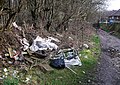 Fly tipping north of Middleton - geograph.org.uk - 2308908.jpg 640 × 456; 180 KB
-
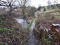 Footbridge over Wince Brook - geograph.org.uk - 2144871.jpg 640 × 480; 209 KB
-
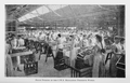 Fruit Picking in the C.W.S. Middleton Preserve Works.png 2 830 × 1 818; 3,69 MB
-
 Gaval Walk, Middleton - geograph.org.uk - 2144377.jpg 640 × 480; 129 KB
-
 Glade Wood Hill - geograph.org.uk - 4456739.jpg 2 560 × 1 920; 2,92 MB
-
 Grimshaw Lane, Middleton - geograph.org.uk - 2144873.jpg 640 × 480; 117 KB
-
 Grimshaw Lane, Middleton - geograph.org.uk - 2144896.jpg 640 × 480; 115 KB
-
 Grimshaw Lane, Middletons - geograph.org.uk - 2144898.jpg 640 × 480; 115 KB
-
 Guildford Grove, Middleton - geograph.org.uk - 2145155.jpg 640 × 480; 90 KB
-
 Hatters Farm - geograph.org.uk - 62981.jpg 640 × 480; 87 KB
-
 Hayfield Close, Middleton - geograph.org.uk - 2145151.jpg 640 × 480; 192 KB
-

-
 Hollin Lane - geograph.org.uk - 62990.jpg 640 × 480; 81 KB
-
 Hopwood Clough - geograph.org.uk - 86830.jpg 640 × 480; 354 KB
-
 Hopwood Nature Reserve - geograph.org.uk - 5120548.jpg 1 600 × 1 200; 329 KB
-
 Hopwood Woods - geograph.org.uk - 3993577.jpg 3 264 × 2 448; 4,09 MB
-

-
 Houses on Kirkway, Middleton - geograph.org.uk - 5920071.jpg 640 × 480; 73 KB
-
 Houses on Langdale Drive, Middleton - geograph.org.uk - 5922198.jpg 4 898 × 3 110; 3,33 MB
-
 Houses on Manchester New Road (A664) - geograph.org.uk - 5920063.jpg 640 × 480; 61 KB
-
 Houses on Mills Hill Road, Middleton - geograph.org.uk - 5920193.jpg 640 × 480; 78 KB
-
 Hyde Square, Middleton - geograph.org.uk - 2144517.jpg 640 × 480; 129 KB
-
 JPT bus 454 (ST59 JPT), 5 December 2009.jpg 1 600 × 1 200; 383 KB
-
 Jubilee Park, Middleton - geograph.org.uk - 700607.jpg 640 × 480; 201 KB
-
 Keep the flag frying - geograph.org.uk - 911965.jpg 640 × 458; 104 KB
-
 Kenyon's Farm - geograph.org.uk - 2504397.jpg 3 872 × 2 592; 3,72 MB
-
 Kingsway, Middleton - geograph.org.uk - 5922384.jpg 3 945 × 3 151; 2,79 MB
-
 Kirkway, Middleton - geograph.org.uk - 2329237.jpg 640 × 456; 137 KB
-
 Kirkway, Middleton - geograph.org.uk - 5920075.jpg 640 × 451; 93 KB
-
 Lever Bridge over the River Irk.jpg 2 816 × 2 112; 1,94 MB
-
 Mainway East, Middleton - geograph.org.uk - 5922365.jpg 5 184 × 3 888; 7,78 MB
-
 Manchester New Road (A664) - geograph.org.uk - 5920068.jpg 640 × 480; 112 KB
-
 Market Place, Middleton.jpg 3 872 × 2 592; 2,76 MB
-
 Middleton - Brook House - geograph.org.uk - 2239054.jpg 640 × 480; 56 KB
-
 Middleton - geograph.org.uk - 78496.jpg 640 × 480; 265 KB
-

-
 Middleton - Lark Hill at Townley Street - geograph.org.uk - 2239163.jpg 1 944 × 2 592; 1,46 MB
-
 Middleton - Lark Hill roundabout - geograph.org.uk - 2239047.jpg 2 592 × 1 944; 1,75 MB
-
 Middleton - Temple Street from Oldham Road - geograph.org.uk - 2239021.jpg 1 944 × 2 592; 1,52 MB
-

-
 Middleton Cricket Club - Entrance - geograph.org.uk - 2991466.jpg 1 600 × 1 200; 423 KB
-
 Middleton Cricket Club - Pavilion - geograph.org.uk - 2991459.jpg 1 600 × 1 200; 330 KB
-
 Middleton Gardens - geograph.org.uk - 6379932.jpg 1 280 × 856; 892 KB
-
 Middleton Gardens, Greater Manchester (2).jpg 4 320 × 3 240; 2,86 MB
-
 Middleton Gardens.jpg 4 320 × 3 240; 3,61 MB
-
 Middleton Main Outfall, River Irk - geograph.org.uk - 1820509.jpg 2 816 × 2 112; 2,33 MB
-
 Middleton Market - geograph.org.uk - 2124023.jpg 800 × 600; 366 KB
-
 Middleton Market - geograph.org.uk - 2124027.jpg 800 × 600; 345 KB
-
 Middleton Market Place - geograph.org.uk - 6379925.jpg 1 280 × 779; 765 KB
-
 Middleton Market, Greater Manchester (1).jpg 4 320 × 3 240; 3,23 MB
-
 Middleton Shopping Centre - geograph.org.uk - 4313224.jpg 3 072 × 1 728; 1,17 MB
-
 Middleton, Vitafoam - geograph.org.uk - 5263791.jpg 1 024 × 768; 179 KB
-
 Middleton, Whit Brook - geograph.org.uk - 3666506.jpg 640 × 480; 383 KB
-
 Millbeck Social Club - geograph.org.uk - 1907084.jpg 3 872 × 2 592; 4,35 MB
-
 Mosedale Road, Middleton - geograph.org.uk - 5920516.jpg 640 × 480; 69 KB
-
 Muck Heap - geograph.org.uk - 4456750.jpg 2 560 × 1 920; 3,17 MB
-
 Oaken Bank Wood - geograph.org.uk - 2110488.jpg 800 × 600; 672 KB
-
 Old Milestone by the A664, Rochdale Road, Middleton (geograph 6056417).jpg 535 × 1 024; 189 KB
-
 Oldham boundary, Greengate, Chadderton (geograph 2329273).jpg 640 × 480; 98 KB
-
 Oldham Road - geograph.org.uk - 1700952.jpg 1 024 × 768; 220 KB
-
 Over the fields to Stanycliffe - geograph.org.uk - 2326688.jpg 2 048 × 1 536; 1,35 MB
-
 Over the fields to the A664 - geograph.org.uk - 2326695.jpg 640 × 480; 51 KB
-
 Pond and pylon, Higher Boarshaw - geograph.org.uk - 5949175.jpg 640 × 412; 55 KB
-
 Pond in Rochdale, Greater Manchester - geograph.org.uk - 48292.jpg 640 × 480; 182 KB
-

-

-

-

-
 River Irk - geograph.org.uk - 1700840.jpg 1 024 × 768; 341 KB
-
 River Irk - geograph.org.uk - 1700845.jpg 1 024 × 768; 410 KB
-
 River Irk, Middleton - geograph.org.uk - 2145076.jpg 640 × 480; 169 KB
-
 River Irk, Middleton - geograph.org.uk - 2145077.jpg 480 × 640; 97 KB
-
 Rochdale Road, Middleton.jpg 640 × 465; 92 KB
-
 Rudyard Avenue, Middleton - geograph.org.uk - 2145148.jpg 640 × 480; 118 KB
-
 Rugby posts at Hopwood Hall College - geograph.org.uk - 1917716.jpg 3 671 × 2 480; 949 KB
-
 Saxon Street, Middleton - geograph.org.uk - 2144882.jpg 640 × 480; 142 KB
-
 Searness Road, Langley, Greater Manchester - panoramio.jpg 3 072 × 2 304; 1,83 MB
-

-

-
 Shop on Manchester New Road, Middleton - geograph.org.uk - 5922371.jpg 4 024 × 2 740; 2,62 MB
-

-
 St Leonard's Passage Middleton - geograph.org.uk - 699570.jpg 640 × 480; 166 KB
-
 St Leonard's Square, Blue plaque - geograph.org.uk - 2145036.jpg 626 × 468; 199 KB
-
 Staircase and Exedra, Jubilee Park.jpg 4 608 × 2 592; 5,56 MB
-
 Steps off Baker Street, Middleton - geograph.org.uk - 2144789.jpg 640 × 480; 165 KB
-
 Sunset over Hazelhurst Drive - geograph.org.uk - 2618537.jpg 640 × 467; 39 KB
-
 Tapios Bar ^ Restaurant - geograph.org.uk - 2862395.jpg 3 186 × 2 715; 3,28 MB
-
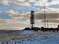 Telecommunications masts, Stott Lane - geograph.org.uk - 2189411.jpg 800 × 600; 258 KB
-

-
 Tesco Express, Middleton - geograph.org.uk - 5920510.jpg 640 × 480; 77 KB
-
 The changing face of Middleton - geograph.org.uk - 1821109.jpg 3 872 × 2 592; 2,01 MB
-
 The paviilion - Middleton Cricket Club - geograph.org.uk - 4086381.jpg 2 505 × 1 670; 1,25 MB
-
 Thornham New Road - geograph.org.uk - 475259.jpg 640 × 459; 104 KB
-
 Three Pitts Allotments, Middleton - geograph.org.uk - 5949184.jpg 640 × 438; 75 KB
-
 Times Street, Middleton - geograph.org.uk - 2144865.jpg 480 × 640; 74 KB
-
 Townley Street - geograph.org.uk - 1950286.jpg 800 × 600; 119 KB
-
 Track towards the Rochdale Canal - geograph.org.uk - 5949178.jpg 640 × 448; 69 KB
-
 Truffet Park bowling green - geograph.org.uk - 4592660.jpg 1 600 × 900; 513 KB
-
 Truffet Park Path - geograph.org.uk - 4593013.jpg 1 600 × 900; 469 KB
-
 Truffet Park Play Area - geograph.org.uk - 4592917.jpg 1 024 × 576; 202 KB
-
 Uldale Drive, Middleton - geograph.org.uk - 2144370.jpg 640 × 480; 130 KB
-
 Victorian Electricity - geograph.org.uk - 1704664.jpg 640 × 480; 105 KB
-
 View from Alkrington Hall - geograph.org.uk - 63025.jpg 640 × 170; 11 KB
-
 Waiting for a bus on Windermere Road - panoramio.jpg 2 048 × 1 536; 1,12 MB
-
 Welcome to Middleton - geograph.org.uk - 2161303.jpg 1 024 × 768; 125 KB
-
 Wince Brook - geograph.org.uk - 78548.jpg 640 × 480; 334 KB
-
 Windermere Road, Middleton - geograph.org.uk - 5922379.jpg 640 × 458; 92 KB
-
 Wood Street, Langley.jpg 2 048 × 1 536; 323 KB
-
 Wood Street, Middleton - geograph.org.uk - 2144491.jpg 640 × 480; 122 KB
-
 Woodside Farm - geograph.org.uk - 1917655.jpg 3 872 × 2 475; 3,98 MB


,_Thornham_-_geograph.org.uk_-_330739.jpg)


,_Middleton_-_geograph.org.uk_-_5920521.jpg)


_-_geograph.org.uk_-_5920063.jpg)


,_5_December_2009.jpg)


_-_geograph.org.uk_-_5920068.jpg)


.jpg)


.jpg)


.jpg)
.jpg)


_-_geograph.org.uk_-_5920544.jpg)
_-_geograph.org.uk_-_5920550.jpg)

_-_geograph.org.uk_-_5920494.jpg)


_-_geograph.org.uk_-_5920493.jpg)


