Category:Mihara, Hiroshima
Vai alla navigazione
Vai alla ricerca
city in Hiroshima Prefecture, Japan  | |||||
| Carica un file multimediale | |||||
| Istanza di | |||||
|---|---|---|---|---|---|
| Luogo | prefettura di Hiroshima, Giappone | ||||
| Forma giuridica |
| ||||
| Data di fondazione o creazione |
| ||||
| Popolazione |
| ||||
| Superficie |
| ||||
| Ha sostituito |
| ||||
| sito web ufficiale | |||||
 | |||||
Sottocategorie
Questa categoria contiene le 16 sottocategorie indicate di seguito, su un totale di 16.
B
- Baikihira Kofun (13 F)
K
- Kabutoyama Kofun (Mihara) (2 F)
- Kosagijima (33 F)
- Kurotani Kofun (6 F)
M
- Mihara Sports Park (3 F)
- Mitoshiro Kofun (24 F)
P
S
- Sadamaru Kofun Group (13 F)
- Sagishima (89 F)
- Sankeien (Mihara) (4 F)
- Sukunejima (25 F)
T
U
- Uryujima (3 F)
File nella categoria "Mihara, Hiroshima"
Questa categoria contiene 200 file, indicati di seguito, su un totale di 214.
(pagina precedente) (pagina successiva)-
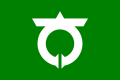
 Emblem of Mihara, Hiroshima.jpg 318 × 262; 17 KB
-
 Emblem of Mihara, Hiroshima.svg 500 × 500; 919 byte
-
 Flag of Mihara, Hiroshima.svg 600 × 400; 961 byte
-
 Aeon Mihara 20120526.JPG 2 816 × 2 112; 2,27 MB
-
 Anchor of Kouan maru.JPG 2 592 × 1 728; 416 KB
-
 Aoki-seto.jpg 4 080 × 3 072; 4 MB
-
 Bridge of Sanyo Shinkansen on Nutagawa River from train of Sanyo Main Line.jpg 3 999 × 3 000; 3,37 MB
-
 Central Forest Park 中央森林公園 - panoramio.jpg 5 844 × 3 896; 7,53 MB
-

-
 Container 【 22U6 】 DKKU 001024(6)---No,1 【 Pictures taken in Japan 】.jpg 1 024 × 768; 257 KB
-
 Container 【 22U6 】 DKKU 001024(6)---No,2 【 Pictures taken in Japan 】.jpg 1 024 × 768; 170 KB
-
 Daiwa Mukunasi Kani Post Office.JPG 2 592 × 1 728; 1,41 MB
-
 Emblem of Daiwa, Hiroshima (1955–2005).jpg 79 × 80; 3 KB
-
 Emblem of Daiwa, Hiroshima (1955–2005).svg 309 × 317; 1 KB
-
 Emblem of Hongō, Hiroshima (1976–2005).jpg 110 × 110; 7 KB
-
 Emblem of Hongō, Hiroshima (1976–2005).svg 104 × 104; 3 KB
-
 Emblem of Kui, Hiroshima (1974–2005).jpg 101 × 99; 4 KB
-
 Emblem of Kui, Hiroshima (1974–2005).svg 500 × 500; 426 byte
-
 Emblem of Mihara, Hiroshima (1937–2005).jpg 160 × 96; 6 KB
-
 Emblem of Mihara, Hiroshima (1937–2005).svg 255 × 172; 1 KB
-
 Ex Hongo town office 20120526-1.JPG 4 000 × 3 000; 4,12 MB
-
 Ex Hongo town office 20120526-2.JPG 4 000 × 3 000; 4 MB
-
 Flag of Daiwa, Hiroshima (1955–2005).jpg 152 × 109; 4 KB
-
 Flag of Daiwa, Hiroshima (1955–2005).svg 600 × 400; 2 KB
-
 Flag of Hongō, Hiroshima (1976–2005).jpg 152 × 109; 5 KB
-
 Flag of Hongō, Hiroshima (1976–2005).svg 600 × 400; 3 KB
-
 Flag of Mihara, Hiroshima (1937–2005).jpg 145 × 97; 5 KB
-
 Flag of Mihara, Hiroshima (1937–2005).svg 600 × 400; 2 KB
-
 Forest Hills Garden 森山園 - panoramio.jpg 6 000 × 4 000; 7,25 MB
-
 Fountain in front of Mihara Station.jpg 3 937 × 2 953; 2,44 MB
-
 From the sky , 佐木島上空から - panoramio.jpg 3 648 × 2 736; 902 KB
-
 Fuji grand mihara.jpg 1 920 × 1 282; 460 KB
-
 Hiroshima Airport Hotel 廣島機場旅館 - panoramio.jpg 6 000 × 4 000; 5,86 MB
-
 Hiroshima Airport Hotel 廣島機場飯店 - panoramio (1).jpg 6 000 × 4 000; 4,26 MB
-
 Hiroshima Airport Hotel 廣島機場飯店 - panoramio.jpg 5 707 × 3 805; 3,65 MB
-
 Hiroshima Airport Hotel 廣島空港旅館 - panoramio (1).jpg 6 000 × 4 000; 5,97 MB
-
 Hiroshima Airport Hotel 廣島空港旅館 - panoramio.jpg 6 000 × 4 000; 8,1 MB
-
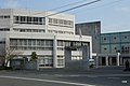
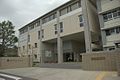
 Hiroshima pref Mihara highschool.jpg 1 555 × 1 166; 251 KB
-
 Hiroshimakendo 33 Mihara City 1.jpg 5 184 × 3 888; 5,35 MB
-
 Hosojima Island and Innoshima Island from train of Sanyo Main Line.jpg 3 925 × 2 944; 2,22 MB
-
 House in Sunami.jpg 1 024 × 683; 298 KB
-
 Ikuchijima Island and Omishima Island from train of Kure Line 2.jpg 3 950 × 2 962; 1,91 MB
-
 Ikuchijima Island and Omishima Island from train of Kure Line 3.jpg 4 032 × 3 024; 1,85 MB
-
 Ikuchijima Island and Omishima Island from train of Kure Line.jpg 4 032 × 3 024; 1,94 MB
-
 Inamura castle.jpg 909 × 682; 380 KB
-
 Itosaki (127683047).jpeg 2 048 × 1 365; 448 KB
-
 Itozaki Port from high-speed ferry for Habu Port.jpg 3 982 × 2 987; 2,55 MB
-
 Iwashijima Island, Hosojima Island and Kosagijima Island from train of Kure Line.jpg 4 006 × 3 005; 2,2 MB
-
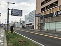
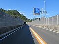
 Japan National Route 185 in front of Itozaki Station.jpg 4 032 × 3 024; 3,68 MB
-
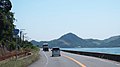
 Japan National Route 185 near Mihara Port.jpg 3 951 × 2 964; 3,33 MB
-
 Koneshima Island and Omishima Island from train of Kure Line.jpg 3 941 × 2 956; 2,35 MB
-
 Koneshima Island from train of Kure Line 1.jpg 3 963 × 2 972; 1,79 MB
-
 Koneshima Island from train of Kure Line 2.jpg 4 000 × 3 000; 1,77 MB
-
 Koneshima Island from train of Kure Line 3.jpg 3 989 × 2 992; 2,29 MB
-
 Koneshima Island from train of Kure Line 4.jpg 3 915 × 2 936; 2,27 MB
-
 Koneshima Island from train of Kure Line 5.jpg 3 993 × 2 995; 2,38 MB
-
 Koneshima Island from train of Kure Line 6.jpg 4 032 × 3 024; 2,79 MB
-
 Koneshima Island, Ikuchijima Island and Omishima Island from train of Kure Line.jpg 3 963 × 2 972; 1,59 MB
-
 Koneshima Island, Omishima Island and Uryujima Island from train of Kure Line 1.jpg 3 986 × 2 989; 2,42 MB
-
 Koneshima Island, Omishima Island and Uryujima Island from train of Kure Line 2.jpg 4 003 × 3 002; 1,84 MB
-
 Kosagijima Island and Sagishima Island from train of Kure Line 2.jpg 3 982 × 2 987; 2,92 MB
-
 Kosagijima Island and Sagishima Island from train of Kure Line.jpg 4 032 × 3 024; 1,97 MB
-
-

-
 Kui gankai.jpg 2 592 × 1 944; 2,14 MB
-
 Manhole cover of Mihara, Hiroshima.jpg 2 905 × 3 873; 4,77 MB
-
 Map Mihara en.png 1 281 × 901; 44 KB
-
 Map of BISAN Area , Hiroshima 1929.jpg 5 280 × 4 213; 14,7 MB
-
 Marine Road in front of Mihara Station.jpg 4 032 × 3 024; 3,18 MB
-
 MIHARA Castle Town 1644.jpg 5 286 × 4 500; 10,93 MB
-
 MIHARA Castle Town 1873.jpg 5 284 × 4 735; 3,9 MB
-
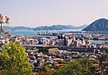
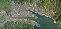 Mihara city center area Aerial photograph.2010.jpg 10 799 × 5 256; 21,65 MB
-
 Mihara city Daisan jhs.jpg 1 555 × 1 166; 368 KB
-
 Mihara City Fire Department Fire Station 1.jpg 5 184 × 3 888; 4,19 MB
-
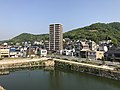
 Mihara City from train of Sanyo Main Line.jpg 3 978 × 2 983; 2,14 MB
-
 Mihara City Hall Daiwa Branch 1.jpg 5 184 × 3 888; 4,69 MB
-
 Mihara City Hall Hongo Branch 1.jpg 4 816 × 3 439; 3,19 MB
-
 MIHARA city map 1945.jpg 5 000 × 3 787; 4,74 MB
-
 Mihara city Minami elem-sch.jpg 1 538 × 1 152; 214 KB
-
 Mihara Higashi High School 01.JPG 2 592 × 1 728; 1,33 MB
-
 Mihara Higashi High School 02.JPG 2 592 × 1 728; 1,31 MB
-
 Mihara in Hiroshima Prefecture Ja.svg 780 × 700; 29 KB
-
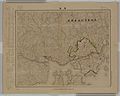
 Mihara in Hiroshima Prefecture.png 1 281 × 901; 44 KB
-
 Mihara International Hotel 20180430.jpg 3 925 × 2 944; 2,87 MB
-
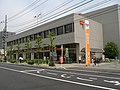 Mihara Post Office.JPG 1 280 × 960; 446 KB
-
 Mihara Station (14100053364).jpg 4 000 × 3 000; 1,46 MB
-
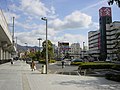
 Mihara Station Citizens' Square 20180429.jpg 3 932 × 2 949; 2,07 MB
-
 Mihara Station Citizens' Square from platform of Mihara Station.jpg 3 986 × 2 989; 2,45 MB
-
 Mihara, Hiroshima.svg 686 × 631; 23 KB
-
 Mihara-stationsouth gate.jpg 1 600 × 1 200; 154 KB
-
 Mihara.jpg 640 × 446; 62 KB
-
 Mihara2.jpg 640 × 409; 60 KB
-
 Mount Fudekageyama and Mount Ryuozan from high-speed ferry for Habu Port 2.jpg 3 945 × 2 959; 2,18 MB
-
 Mount Fudekageyama and Mount Ryuozan from high-speed ferry for Habu Port 3.jpg 3 978 × 2 983; 2,11 MB
-
 Mount Fudekageyama and Mount Ryuozan from high-speed ferry for Habu Port.jpg 4 018 × 3 014; 2,61 MB
-
 Mount Nohatayama and Mount Sakurayama from site of Tenshu of Mihara Castle.jpg 4 032 × 3 024; 3,68 MB
-
 Mount Ohatayama and Mount Nohatayama from site of Tenshu of Mihara Castle.jpg 3 999 × 2 999; 2,99 MB
-
 Mount Ohatayama from site of Tenshu of Mihara Castle.jpg 4 032 × 3 024; 3,35 MB
-
 Mount Sakurayama from site of Tenshu of Mihara Castle 1.jpg 3 999 × 2 999; 3,33 MB
-
 Mount Yonedayama and Sanyo Main Line on east side of Mihara Station.jpg 3 951 × 2 964; 3,32 MB
-
 Mt.Fudekage(筆影山より) - panoramio.jpg 1 600 × 1 200; 482 KB
-
 Nihonmatsu Kofun, sekkan.jpg 6 010 × 3 990; 11,31 MB
-
 Niitaka Hall (Mihara), -25 Nov. 2012.jpg 3 264 × 2 448; 1,21 MB
-
 Niitakayama Castle and Takayama Castle, enkei.jpg 6 016 × 4 000; 7,13 MB
-
 Niitakayamajyo.jpg 3 504 × 2 336; 6,84 MB
-
 Nutagawa Mihara.jpg 1 600 × 1 200; 381 KB
-
 Nutagawa River from train of Kure Line 2.jpg 3 949 × 2 962; 2,12 MB
-
 Nutagawa River from train of Kure Line 3.jpg 4 000 × 3 000; 2,24 MB
-
 Nutagawa River from train of Kure Line.jpg 3 979 × 2 984; 2 MB
-
 Nutahigashicho Katashima, Mihara, Hiroshima Prefecture 723-0145, Japan - panoramio.jpg 2 048 × 1 536; 1,33 MB
-
 Omishima Island and Hiroshima Factory of Imabari Shipbuilding from train of Kure Line.jpg 4 032 × 3 024; 2,23 MB
-
 Omishima Island and Okunoshima Island from train of Kure Line 2.jpg 3 995 × 2 997; 2,27 MB
-
 Omishima Island and Okunoshima Island from train of Kure Line 3.jpg 3 995 × 2 997; 2,27 MB
-
 Omishima Island and Okunoshima Island from train of Kure Line.jpg 3 965 × 2 974; 1,63 MB
-
 Omishima Island and Uryujima Island from train of Kure Line.jpg 3 978 × 2 984; 2,12 MB
-
 Omishima Island from train of Kure Line.jpg 3 902 × 2 926; 3,37 MB
-
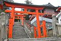
 Oshima Shrine (14119709113).jpg 4 000 × 3 000; 2,35 MB
-
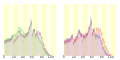 Population distribution of Mihara, Hiroshima, Japan.svg 512 × 256; 22 KB
-
 R185-001.jpg 1 920 × 1 080; 319 KB
-
 R185-2020-161.jpg 1 920 × 1 080; 259 KB
-
 R185-2020-194.jpg 1 920 × 1 080; 449 KB
-
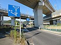
 Route2 Mihara Bypass Hiroshima Mihara City1.jpg 5 184 × 3 888; 4,24 MB
-
 Route2 Mihara Bypass Hiroshima Mihara City2.jpg 5 184 × 3 888; 5,32 MB
-
 Route2 Mihara City3.jpg 4 439 × 3 288; 2,63 MB
-

-
 Sagishima Island and Ikuchijima Island from train of Kure Line near Sunami Seaside Park.jpg 3 877 × 2 908; 1,96 MB
-
 Sagishima Island from train of Kure Line near Sunami Seaside Park 2.jpg 4 015 × 3 011; 2,19 MB
-
 Sagishima Island from train of Kure Line near Sunami Seaside Park 3.jpg 3 983 × 2 987; 2,36 MB
-
 Sagishima Island from train of Kure Line near Sunami Seaside Park.jpg 4 032 × 3 024; 3,09 MB
-
 Sanyo Expressway and Nutagawa River from train of Sanyo Main Line 2.jpg 3 879 × 2 910; 2,57 MB
-
 Sanyo Expressway and Nutagawa River from train of Sanyo Main Line.jpg 3 859 × 2 895; 2,63 MB
-
 Sanyo Expressway from train of Sanyo Main Line.jpg 3 775 × 2 831; 3,33 MB
-
 Sanyo Hakusyoku Cement-201908.jpg 4 020 × 3 018; 2,13 MB
-
 Sanyo Main Line on east side of Mihara Station.jpg 3 927 × 2 945; 3,39 MB
-
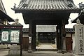
 Seishin-ji temple.jpg 1 100 × 737; 361 KB
-
 Seto Inland Sea view.jpg 5 184 × 3 456; 6,64 MB
-
 Shimanami shinkin bank.JPG 3 648 × 2 432; 3,29 MB
-
 Shinmeiichi.jpg 472 × 402; 44 KB
-
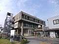
 Shiyakusyo.JPG 676 × 381; 81 KB
-
 Site of Niitakayama Castle and Nutagawa River from train of Sanyo Main Line.jpg 3 769 × 2 827; 3,07 MB
-
 Statue of Kobayakawa Takakage.jpg 949 × 1 293; 632 KB
-
 Sukunejima Island and Hosojima Island from high-speed ferry for Habu Port 2.jpg 4 001 × 3 001; 2 MB
-
 Sunamihaouse.jpg 800 × 533; 143 KB
-
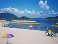 Sunamikaihinkouen.jpg 640 × 480; 49 KB
-
 Takayamajyo.jpg 3 504 × 2 336; 7,65 MB
-
 Takeoff - panoramio.jpg 2 549 × 3 849; 2,66 MB
-
 Tsujidou-mihara-03.jpg 5 472 × 3 648; 7,98 MB
-
 Tsujidou-mihara-04.jpg 5 472 × 3 648; 9,65 MB
-
 View from ship of Omishima Ferry (north) 3.jpg 4 013 × 3 010; 2,03 MB
-
 View from ship of Omishima Ferry (northeast) 2.jpg 4 032 × 3 024; 2,52 MB
-
 View from ship of Omishima Ferry (northeast).jpg 3 972 × 2 979; 2,36 MB
-
 View from site of Tenshu of Mihara Castle (northeast).jpg 4 032 × 3 024; 2,97 MB
-
 View in front of Itozaki Station.jpg 4 032 × 3 024; 4,01 MB
-
 View in front of Mihara Station 3.jpg 4 007 × 3 006; 2,73 MB
-
 View in front of Mihara Station 4.jpg 3 973 × 2 980; 4,44 MB
-
 View in front of Mihara Station at night.jpg 3 839 × 2 880; 2,63 MB
-
 View in front of Mihara Station.jpg 3 925 × 2 944; 2,24 MB
-
 View of Itozaki Port from high-speed ferry for Habu Port 2.jpg 3 943 × 2 957; 2,32 MB
-
 View of Itozaki Port from high-speed ferry for Habu Port.jpg 3 925 × 2 944; 2,14 MB
-
 View of Mihara Port and Itozaki Port from high-speed ferry for Habu Port.jpg 4 032 × 3 024; 2,54 MB
-
 Waku-gawa, Mihara.jpg 2 816 × 5 184; 6,47 MB
-
 Yamami Mihara Athletic Stadium.jpg 1 325 × 1 005; 403 KB
-
 Yamami Mihara Athletic Stadium.png 1 190 × 951; 2,46 MB
-
 Yano-gankai.jpg 1 280 × 960; 479 KB
-
 Yokomi-haiji-ato, gaikan.jpg 6 016 × 4 000; 10,14 MB
-
 Yorikanetown Miharacity Hiroshimapref.JPG 1 920 × 1 080; 987 KB
-
 やっさ祭り2.jpg 640 × 418; 33 KB
-
 ハイキング 白滝山八畳岩 - panoramio.jpg 3 264 × 2 448; 1,53 MB
-
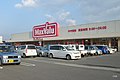 マックスバリュ本郷店 (Supermarket) - panoramio.jpg 1 200 × 800; 520 KB
-
 三原市すなみ海浜公園.jpg 1 200 × 800; 541 KB
-
 三原市久井支所.jpg 1 200 × 800; 513 KB
-
 三原市大和支所 Mihara city Daiwa branch office - panoramio.jpg 1 200 × 800; 409 KB
-
 三原市宇根山天文台.jpg 1 200 × 800; 416 KB
-
 三原市宇根山家族旅行村.jpg 1 200 × 800; 570 KB
-
 三原市立宮浦中学校.jpg 1 100 × 734; 370 KB
-
 三原市立幸崎中学校.jpg 1 200 × 800; 401 KB
-
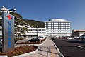 三原赤十字病院.jpg 3 072 × 2 048; 6,07 MB
-
 久井稲生神社.jpg 1 200 × 800; 548 KB
-
 久井稲生神社参道.jpg 1 200 × 800; 611 KB
-
 住吉神社 Sumiyoshi shrine - panoramio.jpg 2 816 × 2 112; 2,15 MB
-
 北方公民館 (Public hall) - panoramio.jpg 1 200 × 800; 601 KB
-
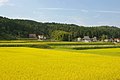 大和町の田んぼ Rice field - panoramio.jpg 1 200 × 798; 569 KB
-
 女王滝 Jouoh Waterfall - panoramio.jpg 1 400 × 938; 807 KB
-
 如水館中学・高等学校 Josuikan school - panoramio.jpg 1 100 × 734; 281 KB
-
 寂静寺 (Temple) - panoramio.jpg 1 200 × 800; 470 KB
-
 山門より瀬戸内海を望む - panoramio.jpg 3 264 × 2 448; 2,3 MB
-
 広島県立総合技術高等学校.jpg 1 100 × 737; 144 KB
-
 広島空港方向 - panoramio.jpg 3 264 × 2 448; 1,75 MB
-
 廣島三景園 Hiroshima Sankei-en - panoramio.jpg 4 000 × 3 000; 2,57 MB
-
 廣島三景園 Sankei-en Hiroshima - panoramio.jpg 3 906 × 2 928; 2,91 MB
-
 廣島機場旅館 Hiroshima Airport Hotel - panoramio.jpg 6 000 × 4 000; 5 MB
-
 廣島機場飯店 Hiroshima Airport Hotel - panoramio (1).jpg 6 000 × 4 000; 6,71 MB
-
 廣島機場飯店 Hiroshima Airport Hotel - panoramio.jpg 6 000 × 4 000; 7,1 MB
-
 廣島空港旅館 Hiroshima Airport Hotel - panoramio (1).jpg 5 870 × 3 912; 8,41 MB
-
 廣島空港旅館 Hiroshima Airport Hotel - panoramio (2).jpg 6 000 × 4 000; 4,65 MB
-
 廣島空港旅館 Hiroshima Airport Hotel - panoramio.jpg 6 000 × 4 000; 6,02 MB
-
 新高山眺望 - panoramio.jpg 1 400 × 928; 403 KB
-
 松寿寺.jpg 1 200 × 800; 591 KB
-
 椋梨川.jpg 1 100 × 734; 362 KB
-
 消火活動uh 災害派遣等 34.jpg 1 024 × 682; 373 KB


_%E3%80%90_Pictures_taken_in_Japan_%E3%80%91_%E5%BA%83%E5%B3%B6%E7%9C%8C%E4%B8%89%E5%8E%9F%E5%B8%82%E6%92%AE%E5%BD%B1%E6%99%82%E6%9C%9F2018%E5%B9%B407%E6%9C%88.jpg)
---No,1_%E3%80%90_Pictures_taken_in_Japan_%E3%80%91.jpg)
---No,2_%E3%80%90_Pictures_taken_in_Japan_%E3%80%91.jpg)


.jpeg)


.jpg)


,_-25_Nov._2012.jpg)


.jpg)


_-_panoramio.jpg)


_-_panoramio.jpg)


_-_panoramio.jpg)


.jpg)
.svg)
.jpg)
.svg)
.jpg)
.svg)
.jpg)
.svg)
.jpg)
.svg)
.jpg)
.svg)
.jpg)
.svg)
.jpg)
.jpg)
.jpg)
_3.jpg)
_2.jpg)
.jpg)
.jpg)
.jpg)
.jpg)