Category:Milford, Surrey
Aller à la navigation
Aller à la recherche
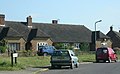
English: Milford is a large village, situated south west of Godalming in Surrey, England. Primarily Milford is a commuter town for Guildford or London. Nearby villages include Witley, Elstead and Eashing, and the hamlets of Enton and Hydestile. It is situated in the Borough of Waverley which was recently voted the 4th best place to live in the UK in a Channel 4 poll. [1]
Nederlands: Milford is een plaats in het bestuurlijke gebied Waverley, in het Engelse graafschap Surrey. De plaats telt 3.934 inwoners.
village britannique  | |||||
| Téléverser des médias | |||||
| Nature de l’élément | |||||
|---|---|---|---|---|---|
| Lieu | Witley, Waverley, Surrey, Angleterre du Sud-Est, Angleterre | ||||
 | |||||
Sous-catégories
Cette catégorie comprend 10 sous-catégories, dont les 10 ci-dessous.
A
- Aaron Hill, Surrey (1 F)
H
- Milford Hospital (2 F)
M
- Milford Baptist Church (4 F)
- Milford House (6 F)
- Milford railway station (15 F)
R
- Rodborough School (1 F)
S
- St Joseph's Church, Milford (5 F)
W
- Milford War Memorial, Surrey (12 F)
Média dans la catégorie « Milford, Surrey »
Cette catégorie comprend 56 fichiers, dont les 56 ci-dessous.
-
 20mph sign in Rake Lane - geograph.org.uk - 1625568.jpg 640 × 480 ; 129 kio
-
 30mph sign in Rake Lane - geograph.org.uk - 1625502.jpg 640 × 480 ; 113 kio
-
 Aaron's Hill - geograph.org.uk - 19541.jpg 640 × 395 ; 70 kio
-
 Christmas Trees - geograph.org.uk - 187668.jpg 640 × 428 ; 61 kio
-
 Crossroads on the A286 seen from a footpath - geograph.org.uk - 1351894.jpg 640 × 360 ; 68 kio
-
 Distant white van in Oxted Green - geograph.org.uk - 1626898.jpg 640 × 480 ; 122 kio
-
 Dovecote by The Refectory, Milford, Surrey 01.jpg 4 000 × 3 000 ; 3,06 Mio
-
 Dovecote by The Refectory, Milford, Surrey 02.jpg 1 270 × 1 372 ; 1,13 Mio
-
 Eashing Mill - geograph.org.uk - 690116.jpg 640 × 480 ; 97 kio
-
 Garden Centre - geograph.org.uk - 589301.jpg 640 × 480 ; 82 kio
-
 Heath View Road - geograph.org.uk - 1626892.jpg 640 × 480 ; 80 kio
-
 Houses in Oxted Green - geograph.org.uk - 1626894.jpg 640 × 480 ; 76 kio
-
 Junction of Heath View Road and Oxted Green - geograph.org.uk - 1626857.jpg 640 × 480 ; 100 kio
-
 Junction of Oxted Green and Petworth Road - geograph.org.uk - 1626922.jpg 640 × 480 ; 94 kio
-
 Lamppost in Martins Wood - geograph.org.uk - 1626916.jpg 640 × 480 ; 69 kio
-
 Looking eastwards in Oxted Green - geograph.org.uk - 1626893.jpg 640 × 480 ; 78 kio
-

-

-
 Looking towards Rake Mill House in Rake Lane - geograph.org.uk - 1625529.jpg 640 × 480 ; 102 kio
-
 Looking westwards in Oxted Green - geograph.org.uk - 1626890.jpg 640 × 480 ; 94 kio
-
 Milford Cemetery - geograph.org.uk - 1351915.jpg 360 × 640 ; 61 kio
-
 Mousehill Down - geograph.org.uk - 187667.jpg 640 × 428 ; 53 kio
-
 Moushill Lane, Milford - geograph.org.uk - 2451196.jpg 640 × 480 ; 95 kio
-
 National Trust sign in Oxted Green - geograph.org.uk - 1626852.jpg 640 × 480 ; 141 kio
-
 Old west Surrey (Page 32) BHL41412705.jpg 2 215 × 3 411 ; 873 kio
-
 Oxted Green - geograph.org.uk - 1626849.jpg 640 × 480 ; 133 kio
-
 Path and road junction in Oxted Green - geograph.org.uk - 1626861.jpg 640 × 480 ; 121 kio
-

-
 Priority system in Rake Lane - geograph.org.uk - 1625649.jpg 640 × 480 ; 96 kio
-
 School Lodge in Rake Lane - geograph.org.uk - 1625661.jpg 640 × 480 ; 75 kio
-
 Station Approach, Witley - geograph.org.uk - 1542815.jpg 640 × 480 ; 120 kio
-
 Station Lane on a snowy Saturday morning - geograph.org.uk - 1625475.jpg 640 × 480 ; 114 kio
-
 Still icy in places in Oxted Green - geograph.org.uk - 1626924.jpg 640 × 480 ; 74 kio
-
 Sweetwater Pond by Water Lane near Milford - geograph.org.uk - 1350057.jpg 640 × 480 ; 102 kio
-
 The Harbour in Oxted Green - geograph.org.uk - 1626933.jpg 640 × 480 ; 98 kio
-
 The Refectory pub, Portsmouth Road, Milford (June 2015) (1).jpg 4 600 × 3 000 ; 3,06 Mio
-
 The Refectory pub, Portsmouth Road, Milford (June 2015) (2).jpg 4 600 × 2 600 ; 2,72 Mio
-
 The Refectory, Milford.jpg 3 264 × 2 448 ; 1,27 Mio
-
 Three houses - geograph.org.uk - 1350000.jpg 640 × 360 ; 81 kio
-
 Views across the Jubilee Field in Milford, Surrey.jpg 994 × 970 ; 239 kio
-
 Western end of Rake Lane - geograph.org.uk - 1626934.jpg 480 × 640 ; 104 kio
-
 Witley - Rodborough Technology College - geograph.org.uk - 165195.jpg 640 × 480 ; 128 kio
-
 Eashing, cottages east of the bridge - geograph.org.uk - 1410511.jpg 640 × 480 ; 96 kio
-
 Eashing, peculiar debris in the River Wey - geograph.org.uk - 1410505.jpg 640 × 480 ; 82 kio
-
 Farm building at Hydstile crossroads, Hambledon - geograph.org.uk - 171745.jpg 640 × 480 ; 102 kio
-
 Footbridge in woodland garden, Tuesley, Busbridge - geograph.org.uk - 148730.jpg 640 × 480 ; 178 kio
-
 Hydestile crossroads, Hambledon - geograph.org.uk - 145218.jpg 640 × 480 ; 94 kio
-

-
 Milford - Cemetery - geograph.org.uk - 165205.jpg 640 × 480 ; 112 kio
-
 Milford - geograph.org.uk - 19537.jpg 640 × 475 ; 92 kio
-
 Milford Bypass - geograph.org.uk - 187666.jpg 640 × 428 ; 45 kio
-
 Polytunnel - geograph.org.uk - 187558.jpg 640 × 480 ; 63 kio
-

-
 Secretts - geograph.org.uk - 19536.jpg 640 × 480 ; 124 kio
-
 Secretts Garden Centre near Milford - geograph.org.uk - 99507.jpg 640 × 480 ; 175 kio
-
 Tuesley Lane - geograph.org.uk - 19545.jpg 640 × 443 ; 111 kio


_BHL41412705.jpg)


_(1).jpg)
_(2).jpg)


