Category:Milnrow
Vai alla navigazione
Vai alla ricerca
English: Milnrow (pop. 12,500) is a suburban town within the Metropolitan Borough of Rochdale, in Greater Manchester, England.
Italiano: Milnrow è un paese di 12.541 abitanti della contea della Greater Manchester, in Inghilterra.
Nederlands: Milnrow is een plaats in het bestuurlijke gebied Rochdale, in het Engelse graafschap Greater Manchester. De plaats telt 12.776 inwoners.
town in Rochdale, Greater Manchester, UK  | |||||
| Carica un file multimediale | |||||
| Istanza di | |||||
|---|---|---|---|---|---|
| Luogo | Metropolitan Borough of Rochdale, Grande Manchester, Nord Ovest dell'Inghilterra, Inghilterra | ||||
 | |||||
Sottocategorie
Questa categoria contiene le 10 sottocategorie indicate di seguito, su un totale di 10.
File nella categoria "Milnrow"
Questa categoria contiene 200 file, indicati di seguito, su un totale di 269.
(pagina precedente) (pagina successiva)-
-
 208 to 198 Rochdale Road, Firgrove - geograph.org.uk - 4452032.jpg 1 632 × 918; 532 KB
-
 A bridleway junction - geograph.org.uk - 1774996.jpg 3 732 × 2 438; 2,17 MB
-
 A collection of signs on the A672 - geograph.org.uk - 97127.jpg 640 × 459; 95 KB
-
 A grassy area amid the housing developments - geograph.org.uk - 2054821.jpg 3 872 × 2 592; 3,99 MB
-
 A green stone wall - geograph.org.uk - 2271841.jpg 640 × 427; 340 KB
-
 A junction of tracks - geograph.org.uk - 1732332.jpg 640 × 480; 119 KB
-
 A short cut - geograph.org.uk - 2274182.jpg 427 × 640; 276 KB
-
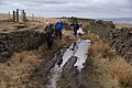 A wet part of the bridleway - geograph.org.uk - 1775009.jpg 3 872 × 2 592; 4,41 MB
-
 A640 heading north - geograph.org.uk - 3467475.jpg 640 × 480; 68 KB
-
 A664 junction with Milnrow road - geograph.org.uk - 1430392.jpg 640 × 480; 61 KB
-
 Alley at the back of Beal Croft Walk - geograph.org.uk - 2545742.jpg 400 × 600; 228 KB
-
 Alley from Weir Road to Stock Grove - geograph.org.uk - 2510153.jpg 400 × 600; 226 KB
-
 Alley to Croft Head Drive - geograph.org.uk - 2510145.jpg 400 × 600; 268 KB
-
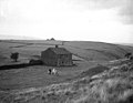
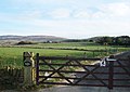
 Annis Hill Farm - geograph.org.uk - 2070575.jpg 3 797 × 2 480; 3,74 MB
-
 Annis Hill Farm, Milnrow - geograph.org.uk - 5724345.jpg 3 840 × 2 160; 3,75 MB
-
 Another Alley - geograph.org.uk - 2294707.jpg 360 × 640; 223 KB
-
 Approaching Turnough - geograph.org.uk - 5681578.jpg 1 600 × 1 200; 471 KB
-
 ASDA supermarket distribution centre - geograph.org.uk - 4795454.jpg 1 024 × 768; 123 KB
-
 Ashes Fold - geograph.org.uk - 2274175.jpg 640 × 427; 290 KB
-
 Ashes Lane View.jpg 3 264 × 2 176; 1,38 MB
-
 Ashfield Lane, Milnrow - geograph.org.uk - 1883254.jpg 640 × 466; 86 KB
-
 Banded fleece of Milnrow.png 580 × 506; 119 KB
-
 Banks, Tunshill, Milnrow, 2007 - geograph.org.uk - 347318.jpg 640 × 480; 112 KB
-
 Beal Croft Walk - geograph.org.uk - 2545736.jpg 600 × 400; 236 KB
-
 Bell Lane - geograph.org.uk - 450400.jpg 640 × 480; 157 KB
-
 Bell Lane leaving Kiln Lane, Milnrow - geograph.org.uk - 6117872.jpg 2 000 × 1 500; 1 009 KB
-
 Bentgate Downstream.jpg 1 600 × 1 200; 584 KB
-
 Bib Knowl - geograph.org.uk - 680970.jpg 640 × 415; 81 KB
-
 Binns Pasture - geograph.org.uk - 1775025.jpg 3 872 × 2 592; 3,46 MB
-
 Birchinley Hall, near Milnrow - geograph.org.uk - 83822.jpg 640 × 455; 113 KB
-
 Birchinley Stables - geograph.org.uk - 1692157.jpg 1 024 × 768; 253 KB
-
 BobbinMilnraa.jpg 3 872 × 2 592; 3,92 MB
-
 Boggy area seen from Tunshill Lane, Milnrow - geograph.org.uk - 6117875.jpg 2 000 × 1 500; 1 017 KB
-
 Booth Hollings Mill (geograph 6386907).jpg 640 × 427; 96 KB
-
 Branch Road - geograph.org.uk - 1704034.jpg 1 024 × 768; 354 KB
-
 Branch Road, Smithy Bridge - geograph.org.uk - 578236.jpg 640 × 470; 108 KB
-
 Bridge carrying Tunshill Lane over the M62, Milnrow - geograph.org.uk - 6117893.jpg 2 000 × 1 500; 1,05 MB
-
 Bridge Street - Milnrow - geograph.org.uk - 4793340.jpg 3 545 × 2 088; 1,81 MB
-
 Bridleway beneath Sir Isaac Newton Way - geograph.org.uk - 2618141.jpg 640 × 480; 132 KB
-
 Bridleway on Deep Lane - geograph.org.uk - 6117882.jpg 2 000 × 1 500; 1,13 MB
-
 Broad Carr - geograph.org.uk - 1704191.jpg 1 024 × 768; 286 KB
-
 Broad Lane - geograph.org.uk - 5947602.jpg 4 473 × 3 526; 5,09 MB
-
 Bunker and green, Tunshill Golf Club - geograph.org.uk - 5946375.jpg 640 × 451; 101 KB
-
 Bus stop on New Broad Lane (B6194) - geograph.org.uk - 5946206.jpg 640 × 494; 139 KB
-
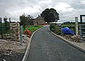
 Business Park Link Road, Milnrow - geograph.org.uk - 1522831.jpg 640 × 480; 165 KB
-
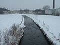
 Butterworth Hall Brook - geograph.org.uk - 1495317.jpg 640 × 480; 122 KB
-
 Butterworth Hall Brook 1.JPG 3 264 × 2 448; 1,53 MB
-
 Butterworth Hall Brook Claylands Head.JPG 3 264 × 2 448; 1,6 MB
-
 Butterworth Hall Brook Milnrow.jpg 3 264 × 2 176; 1,47 MB
-
 Butterworth Hall Brook River Beal.JPG 3 264 × 2 176; 1,42 MB
-
 Butterworth Hall Brook.JPG 1 600 × 1 200; 443 KB
-
 Butterworth Hall Mill , 1996 - geograph.org.uk - 345763.jpg 584 × 412; 33 KB
-
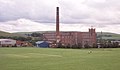 Butterworth Hall Mill.jpg 439 × 257; 76 KB
-
 Butterworth Hall, Milnrow - geograph.org.uk - 3846218.jpg 3 072 × 1 728; 1,22 MB
-
 ButterworthRochdaleAncientParish.png 450 × 492; 25 KB
-
 Circus at Birchinley Hall - geograph.org.uk - 1097304.jpg 640 × 480; 65 KB
-
 Club house, Tunshill Golf Club - geograph.org.uk - 5946371.jpg 640 × 464; 107 KB
-
 Cotswold Crescent - geograph.org.uk - 2295861.jpg 640 × 360; 234 KB
-
 Croft Head Drive Milnrow - geograph.org.uk - 1600329.jpg 640 × 480; 193 KB
-
 Crossing on Rochdale Road, Firgrove - geograph.org.uk - 5946392.jpg 640 × 477; 62 KB
-
 Cycle trail junction, Dixon Green - geograph.org.uk - 2592013.jpg 640 × 467; 167 KB
-
 Daly's alley - geograph.org.uk - 2310978.jpg 640 × 427; 302 KB
-
 Derelict Land - geograph.org.uk - 2271861.jpg 640 × 427; 227 KB
-
 Eafield Avenue - geograph.org.uk - 2363269.jpg 640 × 427; 227 KB
-
 Eafield Avenue Junction - geograph.org.uk - 2293408.jpg 640 × 360; 218 KB
-
 Eat your greens - geograph.org.uk - 1208189.jpg 640 × 448; 123 KB
-

-
 Elizabethan Way and path alongside - geograph.org.uk - 4613831.jpg 640 × 480; 91 KB
-
 Elizabethan Way Roundabout - geograph.org.uk - 1430356.jpg 640 × 480; 52 KB
-
 End of Sir Isaac Newton Way - geograph.org.uk - 1918784.jpg 640 × 489; 96 KB
-
 End of the road - geograph.org.uk - 1883156.jpg 480 × 640; 72 KB
-
 Entering Milnrow on the A663 - geograph.org.uk - 3467467.jpg 640 × 480; 55 KB
-
 Entrance to Broadshaw Farm - geograph.org.uk - 2591988.jpg 640 × 462; 126 KB
-
 Entrance to Diggate Farm - geograph.org.uk - 2591972.jpg 640 × 474; 169 KB
-
 Farm Road - geograph.org.uk - 1692172.jpg 1 024 × 768; 279 KB
-
 Firgrove Working Men's Club - geograph.org.uk - 2313195.jpg 2 592 × 1 944; 1,84 MB
-
 Flash House Farm - geograph.org.uk - 3091702.jpg 2 048 × 1 536; 774 KB
-
 Flash House Farm, Milnrow - geograph.org.uk - 5946362.jpg 640 × 480; 70 KB
-
 Florence Street Electricity Sub-station - geograph.org.uk - 751229.jpg 640 × 477; 111 KB
-
 Former Fire Station, Milnrow - geograph.org.uk - 5947589.jpg 640 × 480; 96 KB
-
-
 Garside Farm - geograph.org.uk - 2543986.jpg 3 872 × 2 592; 3,92 MB
-
 Geese in a field - geograph.org.uk - 1231073.jpg 640 × 486; 130 KB
-
 Grazing off Kiln Lane - geograph.org.uk - 3467486.jpg 640 × 480; 40 KB
-
 Grazing off Tunshill Lane - geograph.org.uk - 5946360.jpg 640 × 442; 68 KB
-
 Grazing off Wildhouse Lane - geograph.org.uk - 3467491.jpg 640 × 480; 47 KB
-
 Hanging Lees Reservoir.JPG 3 264 × 2 448; 1,53 MB
-
 Harbour Lane North - geograph.org.uk - 2298841.jpg 640 × 428; 242 KB
-
 Hollingworth BEC - geograph.org.uk - 2114340.jpg 3 264 × 2 448; 1,29 MB
-
 Holroyds works - geograph.org.uk - 2310111.jpg 640 × 428; 236 KB
-
 Horses grazing near Birchinley Farm - geograph.org.uk - 2070579.jpg 3 727 × 2 489; 2,99 MB
-
 Houses on Kiln Lane, Milnrow - geograph.org.uk - 5946339.jpg 640 × 480; 96 KB
-
 Houses on Moss Avenue - geograph.org.uk - 5946403.jpg 640 × 453; 73 KB
-
 Houses on Rochdale Road, Firgrove - geograph.org.uk - 5946377.jpg 640 × 392; 58 KB
-
 Houses on Rochdale Road, Firgrove - geograph.org.uk - 5946378.jpg 640 × 418; 77 KB
-
 Houses on Rochdale Road, Firgrove - geograph.org.uk - 5947578.jpg 4 478 × 2 912; 2,67 MB
-
 Hurstead Road another view - geograph.org.uk - 2366957.jpg 640 × 427; 207 KB
-

-
 Into the countryside - geograph.org.uk - 2271849.jpg 640 × 427; 266 KB
-
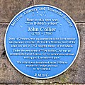 John Collier blue plaque.jpg 674 × 674; 239 KB
-

-
 John Milne Table Table, Milnrow - geograph.org.uk - 5946263.jpg 640 × 480; 78 KB
-
 Jubilee Park - geograph.org.uk - 1755034.jpg 2 816 × 2 112; 1,59 MB
-
 Junction 21 - geograph.org.uk - 1918762.jpg 640 × 480; 104 KB
-
 Junction 21 of the M62 at Milnrow, from the air - geograph.org.uk - 4738460.jpg 1 024 × 657; 167 KB
-
 Kensington Close - geograph.org.uk - 2295875.jpg 640 × 360; 200 KB
-
 Kiln Lane - geograph.org.uk - 1704077.jpg 1 024 × 768; 310 KB
-
 Kiln Lane from 'The Gallows' - geograph.org.uk - 2276909.jpg 640 × 427; 267 KB
-
 Kiln Lane near to the school entrance - geograph.org.uk - 6117870.jpg 2 000 × 1 500; 1,2 MB
-
 Kiln Lane towards Bridge Street - geograph.org.uk - 2273459.jpg 640 × 427; 253 KB
-
 Kiln Lane towards Wildhouse Lane - geograph.org.uk - 2273463.jpg 640 × 427; 283 KB
-
 Kiln Lane, Milnrow - geograph.org.uk - 5946344.jpg 640 × 455; 140 KB
-
 Kiln Lane, Milnrow - geograph.org.uk - 5946357.jpg 640 × 480; 59 KB
-
 Kingsway Business Park - geograph.org.uk - 1918750.jpg 640 × 399; 101 KB
-

-
 Kingsway Business Park from the air - geograph.org.uk - 5954866.jpg 1 024 × 768; 300 KB
-
 Kingsway Business Park, Marketing Pod - geograph.org.uk - 1883222.jpg 640 × 480; 117 KB
-
 Ladyhouse Close, Milnrow - geograph.org.uk - 2063015.jpg 800 × 600; 263 KB
-
 Ladyhouse Lane, Milnrow - geograph.org.uk - 2063009.jpg 800 × 600; 323 KB
-
 Ladyhouse Lane, Milnrow - geograph.org.uk - 2440051.jpg 1 944 × 1 704; 2,1 MB
-
 Lone Tree, Lower Lane, Rochdale - geograph.org.uk - 1013505.jpg 640 × 480; 64 KB
-
 Lower Crows Nest farm - geograph.org.uk - 2276928.jpg 640 × 427; 258 KB
-
 Lower Crows Nest farm another view - geograph.org.uk - 2276932.jpg 640 × 427; 236 KB
-
 Lower Lane - geograph.org.uk - 662230.jpg 640 × 480; 144 KB
-
 Lower Lane Farm - geograph.org.uk - 1601539.jpg 640 × 421; 56 KB
-
 Lower Lane, Rochdale - geograph.org.uk - 1013498.jpg 640 × 480; 105 KB
-
 Lowhouse Close - geograph.org.uk - 2363278.jpg 640 × 427; 274 KB
-
 Lowhouse Close, Cross Gates - geograph.org.uk - 3467482.jpg 640 × 480; 64 KB
-
 M62 construction in Milnrow.jpg 640 × 481; 104 KB
-
 M62 Junction 21 Milnrow - geograph.org.uk - 502579.jpg 640 × 480; 106 KB
-
 M62 motorway from Tunshill.jpg 3 470 × 1 690; 1,28 MB
-
 Malvern Close - geograph.org.uk - 2295847.jpg 640 × 360; 178 KB
-
 Marketing pod, Kingsway Business Park (geograph 2618144).jpg 640 × 480; 112 KB
-

-
 Marsh and bog in Milnrow - geograph.org.uk - 2302054.jpg 1 024 × 768; 555 KB
-
 Meeting room, St James'.jpg 6 000 × 4 000; 10,02 MB
-
 Merlin Road - geograph.org.uk - 2310982.jpg 640 × 427; 242 KB
-
 Milnow Library - geograph.org.uk - 5946302.jpg 640 × 480; 85 KB
-
 Milnrow (14450572318).jpg 2 554 × 3 831; 8,81 MB
-
 Milnrow - Lowhouse Close - geograph.org.uk - 1522865.jpg 640 × 480; 170 KB
-
 Milnrow - Sandringham Drive - geograph.org.uk - 1522871.jpg 640 × 480; 178 KB
-
 Milnrow - Smith Hill - geograph.org.uk - 1522867.jpg 640 × 480; 203 KB
-
 Milnrow - the edge of suburbia - geograph.org.uk - 83588.jpg 640 × 430; 101 KB
-
 Milnrow - Wild House Lane - geograph.org.uk - 1522835.jpg 640 × 480; 229 KB
-
Milnrow and Newhey Gazette.ogv 57 s, 384 × 288; 5,44 MB
-
 Milnrow Bridge - geograph.org.uk - 2592034.jpg 640 × 460; 185 KB
-
 Milnrow Cars - geograph.org.uk - 2293432.jpg 640 × 428; 217 KB
-
 Milnrow Compound - geograph.org.uk - 5250684.jpg 2 557 × 1 609; 714 KB
-
 Milnrow Cricket Club - Clubhouse - geograph.org.uk - 2463643.jpg 1 600 × 1 200; 172 KB
-
 Milnrow Cricket Club - Scoreboard - geograph.org.uk - 2463873.jpg 1 600 × 1 200; 261 KB
-
 Milnrow from Carr Farm - geograph.org.uk - 4498693.jpg 1 632 × 918; 388 KB
-
 Milnrow Generals.png 585 × 560; 61 KB
-
 Milnrow Memorial Park - Car Park - geograph.org.uk - 1917098.jpg 800 × 600; 189 KB
-
 Milnrow Memorial Park - geograph.org.uk - 1917084.jpg 1 365 × 1 024; 522 KB
-
 Milnrow, Lower Lane, Farm cottage - geograph.org.uk - 4465513.jpg 3 894 × 3 409; 2,02 MB
-
 Milnrow, Lower Lane, Pyche - geograph.org.uk - 4465497.jpg 3 958 × 3 281; 2,59 MB
-
 Milnrow.jpg 1 347 × 1 035; 923 KB
-
 Moss Bridge Road blocked by rockfall - geograph.org.uk - 2720214.jpg 640 × 435; 66 KB
-

-

-

-
 New industrial development - geograph.org.uk - 2066812.jpg 3 662 × 2 480; 3,18 MB
-
 Newhey - geograph.org.uk - 41761.jpg 640 × 480; 109 KB
-
 Newhey Road, Milnrow - geograph.org.uk - 5946298.jpg 640 × 480; 67 KB
-
 Newhey Road, Milnrow - geograph.org.uk - 681913.jpg 640 × 480; 102 KB
-
 Nigher Moss Avenue - geograph.org.uk - 5946410.jpg 640 × 433; 64 KB
-
 Norman Hill Reservoir.jpg 1 600 × 1 200; 575 KB
-
 Old milestone, Milnrow - geograph.org.uk - 561529.jpg 480 × 640; 134 KB
-
 Old Property, Lower Lane, Rochdale - geograph.org.uk - 1013502.jpg 640 × 480; 72 KB
-
 Old road between Hylands and Wild House - geograph.org.uk - 1884271.jpg 640 × 480; 162 KB
-

-
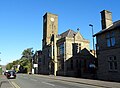
 Parish Church of St Ann, Belfield - geograph.org.uk - 5946400.jpg 640 × 480; 86 KB
-
 Parsonage Walk and Terrace - geograph.org.uk - 2272896.jpg 640 × 427; 298 KB
-
 Pennine Bridleway, Piethorne - geograph.org.uk - 428201.jpg 640 × 468; 104 KB
-
 Pennine Bridleway, Piethorne - geograph.org.uk - 511260.jpg 640 × 480; 108 KB
-
 Pennine Bridleway, Piethorne Valley - geograph.org.uk - 559131.jpg 640 × 483; 131 KB
-
 Piethorne Brook Norman Hill.JPG 3 264 × 2 176; 1,37 MB
-
 Piethorne Brook Ogden Reservoir.JPG 3 264 × 2 448; 1,57 MB
-
 Piethorne Brook River Beal.JPG 3 264 × 2 448; 1,51 MB
-
 Piethorne Brook.jpg 3 264 × 2 448; 1,54 MB
-
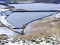
 Piethorne Reservoir.jpg 1 600 × 1 200; 220 KB
-
 Play area in Firgrove - geograph.org.uk - 2313214.jpg 2 592 × 1 944; 907 KB
-
 Plot F Is Still Available - geograph.org.uk - 1522826.jpg 640 × 480; 160 KB
-
 Pond at Kingsway Business Park Site - geograph.org.uk - 3693038.jpg 640 × 480; 294 KB
-
 Poppies - geograph.org.uk - 173158.jpg 640 × 480; 174 KB
-
 Post Office on Dale Street, Milnrow - geograph.org.uk - 5947607.jpg 5 184 × 3 888; 7,58 MB
-
 Public footpath off Pennine Drive, Milnrow - geograph.org.uk - 6117816.jpg 1 971 × 1 356; 896 KB
-
 Public open space off Severn Drive - geograph.org.uk - 6117847.jpg 2 000 × 1 500; 1,29 MB
-
 Puddly track approaching Birchinley Farm - geograph.org.uk - 2070591.jpg 3 802 × 2 494; 4,16 MB
-
 Railway bridge over Kingsway (A664) - geograph.org.uk - 5946405.jpg 640 × 480; 79 KB
-
 Raines Crest - geograph.org.uk - 2310989.jpg 640 × 427; 221 KB
-
 Raines Crest another view - geograph.org.uk - 2366961.jpg 640 × 427; 257 KB
-
 Redundant Farm Equipment - geograph.org.uk - 63660.jpg 640 × 480; 141 KB
-
 River Beal from Milnrow Bridge.jpg 640 × 480; 189 KB
-
 River Beal, Milnrow - geograph.org.uk - 1518902.jpg 640 × 480; 172 KB
-
 Road Kingsway Business Park - geograph.org.uk - 1883162.jpg 640 × 480; 109 KB
-
 Roadside stone, Milnrow - geograph.org.uk - 561537.jpg 480 × 640; 95 KB
-
 Rochdale Road, Firgrove - geograph.org.uk - 2311792.jpg 2 592 × 1 944; 632 KB
-
 Rochdale Way - geograph.org.uk - 41772.jpg 640 × 480; 96 KB


.jpg)


_-_geograph.org.uk_-_5946206.jpg)


.jpg)


.jpg)


_-_geograph.org.uk_-_5946405.jpg)


