Category:Milton, Vale of White Horse
Aller à la navigation
Aller à la recherche
localité britannique du comté anglais d'Oxfordshire  Maenordy Milton | |||||
| Téléverser des médias | |||||
| Nature de l’élément | |||||
|---|---|---|---|---|---|
| Lieu | Vale of White Horse, Oxfordshire, Angleterre du Sud-Est, Angleterre | ||||
| À ne pas confondre avec | |||||
| site officiel | |||||
 | |||||
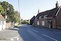
English: Milton is a village and civil parish in Oxfordshire, England. Until 1974 it was part of Berkshire.
Sous-catégories
Cette catégorie comprend 6 sous-catégories, dont les 6 ci-dessous.
Média dans la catégorie « Milton, Vale of White Horse »
Cette catégorie comprend 183 fichiers, dont les 183 ci-dessous.
-
 A new business unit - geograph.org.uk - 5263753.jpg 640 × 426 ; 65 kio
-
 A34 at Milton Interchange - geograph.org.uk - 3103562.jpg 640 × 480 ; 72 kio
-
 A34 bridge over eastbound A4130, Didcot - geograph.org.uk - 5873844.jpg 1 600 × 1 066 ; 677 kio
-
 A34 Footbridge serving Milton Lane - geograph.org.uk - 2533788.jpg 3 648 × 2 736 ; 1,89 Mio
-
 A34 near Milton Manor - geograph.org.uk - 3294973.jpg 640 × 480 ; 435 kio
-
 A34 nears Milton Interchange - geograph.org.uk - 3103553.jpg 640 × 480 ; 57 kio
-
 A34 northbound - geograph.org.uk - 3341386.jpg 640 × 480 ; 49 kio
-
 A34 northbound - geograph.org.uk - 3341395.jpg 640 × 480 ; 55 kio
-
 A34 northbound - geograph.org.uk - 3341399.jpg 640 × 480 ; 59 kio
-
 A34 northbound - geograph.org.uk - 5637547.jpg 640 × 428 ; 81 kio
-
 A34 northbound - geograph.org.uk - 5637580.jpg 640 × 428 ; 92 kio
-
 A34 northbound - geograph.org.uk - 5637587.jpg 640 × 428 ; 107 kio
-
 A34 northbound - geograph.org.uk - 5637590.jpg 640 × 428 ; 92 kio
-
 A34 slip road for A4130 - geograph.org.uk - 2533784.jpg 3 648 × 2 736 ; 1,66 Mio
-
 A34 south of Milton - geograph.org.uk - 3103570.jpg 640 × 481 ; 52 kio
-
 A34, Milton - geograph.org.uk - 3294967.jpg 640 × 480 ; 385 kio
-
 A4130 junction with B4017 - geograph.org.uk - 3284454.jpg 3 354 × 2 234 ; 1,11 Mio
-
 A4130 passing Mill Farm - geograph.org.uk - 3671404.jpg 640 × 448 ; 70 kio
-
 A4130 turning off A34 southbound - geograph.org.uk - 6263380.jpg 640 × 454 ; 49 kio
-
 Abingdon Road at the A34 junction - geograph.org.uk - 6065747.jpg 1 848 × 1 162 ; 1,19 Mio
-
 Abingdon Road at the A34 junction - geograph.org.uk - 6066623.jpg 1 920 × 1 280 ; 870 kio
-
 Abingdon Road at the entrance to Milton Hill - geograph.org.uk - 6310155.jpg 1 920 × 1 280 ; 986 kio
-
 Abingdon Road at the entrance to Milton Hill - geograph.org.uk - 6310157.jpg 1 882 × 1 220 ; 1,11 Mio
-
 Abingdon Road at the entrance to Milton Hill - geograph.org.uk - 6310158.jpg 1 920 × 1 280 ; 1,08 Mio
-
 Abingdon Road entering Milton - geograph.org.uk - 6310207.jpg 1 920 × 1 280 ; 1,26 Mio
-
 Abingdon Road, Rowstock - geograph.org.uk - 6311287.jpg 1 848 × 1 164 ; 1,65 Mio
-
 Abingdon Road, Steventon - geograph.org.uk - 6129313.jpg 1 920 × 1 280 ; 964 kio
-
 Bank at the estate - geograph.org.uk - 2635211.jpg 1 024 × 683 ; 157 kio
-
 Benchmark on barn at Manor Farm - geograph.org.uk - 2198330.jpg 800 × 600 ; 172 kio
-
 Benchmark on Building ^63, Milton Park - geograph.org.uk - 2100822.jpg 600 × 800 ; 128 kio
-

-
 Benchmark on Milton Bridge - geograph.org.uk - 2100986.jpg 1 024 × 768 ; 289 kio
-

-
 Benchmark on ^16 Lambe Avenue - geograph.org.uk - 2101021.jpg 600 × 800 ; 189 kio
-
 BP Connect filling station at Didcot Services - geograph.org.uk - 3402503.jpg 3 648 × 2 736 ; 1,98 Mio
-
 Bus shelter by the tree - geograph.org.uk - 2640219.jpg 1 024 × 683 ; 250 kio
-
 Car Park - geograph.org.uk - 6018785.jpg 640 × 480 ; 49 kio
-
 Chancel Window - geograph.org.uk - 2638321.jpg 533 × 800 ; 138 kio
-
 Chancel Window on St Blaise - geograph.org.uk - 2636009.jpg 533 × 800 ; 97 kio
-
 Churchyard on the north side - geograph.org.uk - 2637768.jpg 1 024 × 683 ; 231 kio
-
 Clock on top - geograph.org.uk - 2640131.jpg 683 × 1 024 ; 272 kio
-
 Coming to the Interchange - geograph.org.uk - 4923334.jpg 1 024 × 768 ; 114 kio
-
 Communications tower by Reading Road, Rowstock - geograph.org.uk - 6309456.jpg 1 920 × 1 280 ; 1,13 Mio
-
 Cones by the Road - geograph.org.uk - 4923345.jpg 1 024 × 768 ; 174 kio
-
 Coronation tree - geograph.org.uk - 2635998.jpg 1 024 × 683 ; 249 kio
-
 Courtyard Inn - geograph.org.uk - 6186431.jpg 1 600 × 1 200 ; 305 kio
-
 Cross on Abingdon Road, Steventon - geograph.org.uk - 6129312.jpg 1 872 × 1 204 ; 1,18 Mio
-
 Crossing at the end - geograph.org.uk - 2634445.jpg 1 024 × 683 ; 135 kio
-
 Detail on the Chancel window - geograph.org.uk - 2638336.jpg 1 024 × 683 ; 198 kio
-
 Detail on the downpipe - geograph.org.uk - 2640051.jpg 1 024 × 683 ; 175 kio
-
 Didcot Service Area - geograph.org.uk - 2029930.jpg 800 × 600 ; 235 kio
-
 Didcot Services - geograph.org.uk - 77159.jpg 640 × 480 ; 73 kio
-
 Disused bridge - geograph.org.uk - 2634365.jpg 1 024 × 683 ; 248 kio
-
 Door to a crypt - geograph.org.uk - 2636002.jpg 533 × 800 ; 195 kio
-
 Entrance to Grove Farm - geograph.org.uk - 2456969.jpg 2 988 × 2 152 ; 618 kio
-
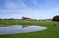 Fish Pond near Milton - geograph.org.uk - 2456943.jpg 3 252 × 2 152 ; 710 kio
-
 Footbridge over A34 near Milton Interchange - geograph.org.uk - 6263374.jpg 640 × 432 ; 61 kio
-
 Footpath, Milton - geograph.org.uk - 3167104.jpg 2 366 × 1 776 ; 1,53 Mio
-
 Gated off bridge - geograph.org.uk - 2633330.jpg 1 024 × 683 ; 250 kio
-
 Give Way - geograph.org.uk - 2634740.jpg 1 024 × 683 ; 142 kio
-
 Harvester pub - geograph.org.uk - 6018782.jpg 640 × 480 ; 60 kio
-
 Harvester, Milton Gate - geograph.org.uk - 5024758.jpg 640 × 426 ; 48 kio
-
 Hay Field near Milton - geograph.org.uk - 2537270.jpg 1 600 × 1 200 ; 449 kio
-
 Heading to Swindon - geograph.org.uk - 2634925.jpg 1 024 × 683 ; 115 kio
-
 Headstop on the chancel window - geograph.org.uk - 2638347.jpg 533 × 800 ; 135 kio
-
 Headstop on the chancel window 2 - geograph.org.uk - 2638352.jpg 533 × 800 ; 162 kio
-
 High Street Steventon at the junction of Abingdon Road - geograph.org.uk - 6065746.jpg 1 920 × 1 280 ; 1,57 Mio
-
 High Street towards Didcot - geograph.org.uk - 2640212.jpg 1 024 × 683 ; 180 kio
-
 Land near the interchange - geograph.org.uk - 2634384.jpg 1 024 × 683 ; 163 kio
-
 Layby on the A34 - geograph.org.uk - 3294963.jpg 640 × 480 ; 401 kio
-
 Lights and cones - geograph.org.uk - 2634408.jpg 1 024 × 683 ; 117 kio
-
 Looking down the island - geograph.org.uk - 2634433.jpg 1 024 × 683 ; 119 kio
-
 Looking towards Milton Interchange - geograph.org.uk - 2633327.jpg 1 024 × 683 ; 153 kio
-
 Manor at the end - geograph.org.uk - 2636165.jpg 533 × 800 ; 145 kio
-
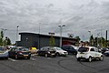
 Marshall Volkswagen, Milton - geograph.org.uk - 6306981.jpg 1 864 × 1 188 ; 1,14 Mio
-
 Marshalls VW - geograph.org.uk - 6186440.jpg 1 600 × 1 200 ; 331 kio
-
 McDonald's on the corner - geograph.org.uk - 2634725.jpg 1 024 × 683 ; 170 kio
-
 Memorial by the gate - geograph.org.uk - 2635999.jpg 1 024 × 683 ; 291 kio
-
 Milton , Grassy Field - geograph.org.uk - 4050875.jpg 4 062 × 2 698 ; 7,52 Mio
-
 Milton , Railway Track - geograph.org.uk - 4060796.jpg 3 961 × 2 631 ; 5,9 Mio
-
 Milton , Roadside - geograph.org.uk - 4060809.jpg 4 288 × 2 848 ; 5,67 Mio
-
 Milton , The A4131 - geograph.org.uk - 4050885.jpg 4 134 × 2 746 ; 6,45 Mio
-
 Milton , The A4131 - geograph.org.uk - 4050886.jpg 4 105 × 2 727 ; 5,48 Mio
-
 Milton Bridge - geograph.org.uk - 2100993.jpg 800 × 600 ; 111 kio
-
 Milton Business Park - geograph.org.uk - 1232488.jpg 640 × 402 ; 62 kio
-
 Milton Gate - geograph.org.uk - 6186421.jpg 1 600 × 1 200 ; 317 kio
-
 Milton Gate, Costa - geograph.org.uk - 4975016.jpg 3 679 × 2 455 ; 4,11 Mio
-
 Milton Gate, Harvester - geograph.org.uk - 4975013.jpg 4 884 × 3 146 ; 6,65 Mio
-
 Milton Gate, Harvester - geograph.org.uk - 4975036.jpg 3 678 × 2 456 ; 3,93 Mio
-
 Milton Gate, The extent of the development so far - geograph.org.uk - 4975029.jpg 4 850 × 3 057 ; 7,37 Mio
-
 Milton Gate, Units under construction - geograph.org.uk - 4975022.jpg 5 472 × 3 606 ; 6,2 Mio
-
 Milton Gate, Units under construction - geograph.org.uk - 4975031.jpg 5 520 × 3 680 ; 7,67 Mio
-
 Milton Gate, Vauxhall car dealership - geograph.org.uk - 4975004.jpg 5 520 × 3 680 ; 6,81 Mio
-
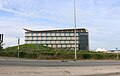
 Milton Heights - geograph.org.uk - 2634429.jpg 1 024 × 683 ; 216 kio
-
 Milton Hill House - geograph.org.uk - 3600147.jpg 4 320 × 3 240 ; 5,15 Mio
-
 Milton Manor - geograph.org.uk - 4482710.jpg 3 264 × 2 448 ; 2,74 Mio
-
 Milton Park - geograph.org.uk - 3300851.jpg 640 × 480 ; 78 kio
-
 Milton Park - geograph.org.uk - 3300859.jpg 640 × 480 ; 71 kio
-
 Milton Park Estate - geograph.org.uk - 5362659.jpg 640 × 426 ; 52 kio
-
 Milton Park Estate - geograph.org.uk - 5362660.jpg 640 × 426 ; 54 kio
-
 Milton Park Estate - geograph.org.uk - 5362669.jpg 640 × 426 ; 75 kio
-
 Milton Park Estate - geograph.org.uk - 5646402.jpg 640 × 317 ; 32 kio
-

-
 Milton Park Stores ^ Barclays Bank - geograph.org.uk - 2537983.jpg 3 528 × 2 592 ; 1 019 kio
-
 Milton Park, The Canopy - geograph.org.uk - 2676641.jpg 3 496 × 2 544 ; 878 kio
-
 Milton Road south of Brook Farm - geograph.org.uk - 3308405.jpg 1 024 × 683 ; 182 kio
-
 Milton United Football Ground - geograph.org.uk - 1245343.jpg 640 × 350 ; 38 kio
-
 Milton United Football Ground - geograph.org.uk - 1245345.jpg 640 × 386 ; 58 kio
-
 Milton United's former ground in Milton - geograph.org.uk - 4603435.jpg 1 500 × 960 ; 132 kio
-
 Milton, service station - geograph.org.uk - 1954302.jpg 1 024 × 754 ; 117 kio
-
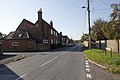
 High Street, Milton - geograph.org.uk - 1234070.jpg 640 × 403 ; 62 kio
-
 Mini roundabout at High Street-Sutton Road junction - geograph.org.uk - 3308487.jpg 1 024 × 683 ; 176 kio
-
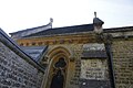
 More church detail - geograph.org.uk - 2638364.jpg 1 024 × 683 ; 218 kio
-
 New Dealership - geograph.org.uk - 4749261.jpg 1 024 × 768 ; 112 kio
-
 Odd entrance - geograph.org.uk - 2638272.jpg 533 × 800 ; 138 kio
-
 Old gated track - geograph.org.uk - 2634737.jpg 1 024 × 683 ; 191 kio
-
 Old Moor, Milton - geograph.org.uk - 3167147.jpg 1 600 × 1 190 ; 728 kio
-
 On top of the down pipe - geograph.org.uk - 2640112.jpg 426 × 640 ; 96 kio
-
 Outbuildings at Manor Farm - geograph.org.uk - 3308575.jpg 1 024 × 683 ; 183 kio
-
 Outbuildings, Manor Farm, Milton - geograph.org.uk - 3167180.jpg 2 480 × 1 773 ; 1,49 Mio
-
 Parade ground - geograph.org.uk - 2635218.jpg 1 024 × 683 ; 166 kio
-
 Part of Milton Park Estate - geograph.org.uk - 2109191.jpg 3 232 × 2 632 ; 1,93 Mio
-
 Pasture, Milton - geograph.org.uk - 6178696.jpg 1 024 × 768 ; 198 kio
-
 Pond in the Woods - geograph.org.uk - 3167121.jpg 1 600 × 1 200 ; 876 kio
-
 Pumphouse beside Backhill Lane - geograph.org.uk - 2101108.jpg 809 × 1 024 ; 275 kio
-
 Q - Gardens farm shop at Milton Hill - geograph.org.uk - 1308855.jpg 640 × 417 ; 58 kio
-
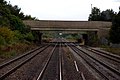
 Railway at Milton Park - geograph.org.uk - 4494109.jpg 1 200 × 807 ; 1,39 Mio
-
 Ridgeway Volkswagen - geograph.org.uk - 5263754.jpg 640 × 426 ; 43 kio
-
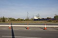
 Roadworks on the A34 at the A4130 - geograph.org.uk - 4638065.jpg 1 600 × 1 303 ; 895 kio
-
 Roundabout at Milton Interchange - geograph.org.uk - 3671389.jpg 640 × 497 ; 56 kio
-
 Schnauzer Crossing Bridge Near Milton Village.jpg 4 032 × 4 032 ; 5 Mio
-
 Sheep in a field near Drayton - geograph.org.uk - 1355043.jpg 640 × 427 ; 83 kio
-
 Sir Mortimer's Terrace - geograph.org.uk - 3308463.jpg 1 024 × 683 ; 187 kio
-
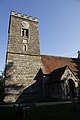
 St Blaise from the north east - geograph.org.uk - 2637763.jpg 1 024 × 683 ; 179 kio
-
 St. Blaise Churchyard - geograph.org.uk - 2636001.jpg 1 024 × 683 ; 276 kio
-
 Stained Glass in St Blaise - geograph.org.uk - 2636154.jpg 533 × 800 ; 85 kio
-
 Sutton Road - geograph.org.uk - 3300622.jpg 640 × 480 ; 70 kio
-
 Telecom mast - geograph.org.uk - 5362662.jpg 640 × 426 ; 72 kio
-
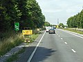 The A34 northbound towards the A4130 - geograph.org.uk - 4688863.jpg 1 600 × 1 200 ; 595 kio
-
 The Admiral Benbow - geograph.org.uk - 2635220.jpg 1 024 × 683 ; 187 kio
-
 The bridge to Milton - geograph.org.uk - 1537436.jpg 640 × 427 ; 72 kio
-
 The Courtyard Hotel, Steventon - geograph.org.uk - 6099662.jpg 1 852 × 1 168 ; 1 013 kio
-
 The creed on the wall - geograph.org.uk - 2636011.jpg 426 × 640 ; 60 kio
-
 The Harvester, Steventon - geograph.org.uk - 6099658.jpg 1 858 × 1 178 ; 963 kio
-
 The High Street Milton - geograph.org.uk - 2640209.jpg 1 024 × 683 ; 170 kio
-
 The Italian garden at Milton Hill House - geograph.org.uk - 3600123.jpg 4 320 × 3 240 ; 5,5 Mio
-
 The Manor Gates - geograph.org.uk - 2640152.jpg 1 024 × 683 ; 299 kio
-
 The Old Farm Shop, Rowstock - geograph.org.uk - 6129314.jpg 1 920 × 1 280 ; 1,12 Mio
-
 The Orange Way after Wiltshire (154) - geograph.org.uk - 3554969.jpg 800 × 600 ; 204 kio
-
 The Orange Way after Wiltshire (155) - geograph.org.uk - 3554978.jpg 800 × 600 ; 202 kio
-
 The Orange Way after Wiltshire (156) - geograph.org.uk - 3554983.jpg 800 × 600 ; 174 kio
-
 The Orange Way after Wiltshire (157) - geograph.org.uk - 3554985.jpg 600 × 800 ; 99 kio
-
 The Orange Way after Wiltshire (158) - geograph.org.uk - 3554992.jpg 800 × 600 ; 115 kio
-
 The Orange Way after Wiltshire (159) - geograph.org.uk - 3555000.jpg 800 × 600 ; 103 kio
-
 The Orange Way after Wiltshire (160) - geograph.org.uk - 3555006.jpg 800 × 600 ; 122 kio
-
 The Pack Horse - geograph.org.uk - 1933716.jpg 3 512 × 2 736 ; 3,02 Mio
-
 The Park Centre in Milton Business Park - geograph.org.uk - 1232492.jpg 640 × 427 ; 117 kio
-
 The Squire Barrett Recreation Ground - geograph.org.uk - 3167138.jpg 1 024 × 786 ; 283 kio
-
 This way to McDonald's - geograph.org.uk - 2634727.jpg 1 024 × 683 ; 183 kio
-
 Towards Didcot - geograph.org.uk - 2633329.jpg 1 024 × 683 ; 210 kio
-
 Towards Didcot - geograph.org.uk - 2634734.jpg 1 024 × 683 ; 150 kio
-
 Towards New Farm - geograph.org.uk - 2634921.jpg 1 024 × 683 ; 178 kio
-
 Towards the interchange - geograph.org.uk - 2633324.jpg 1 024 × 683 ; 192 kio
-
 Tower on St Blaise - geograph.org.uk - 2636161.jpg 533 × 800 ; 103 kio
-
 Track to New Farm - geograph.org.uk - 2634919.jpg 533 × 800 ; 89 kio
-
 Tree aged thirty-six but first planted in 1911 - geograph.org.uk - 3553106.jpg 800 × 600 ; 166 kio
-
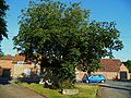 Tree twice planted in Milton - geograph.org.uk - 3553096.jpg 800 × 600 ; 183 kio
-
 Trees by the A34 - geograph.org.uk - 5362671.jpg 640 × 352 ; 44 kio
-
 Trees lining the A34 - geograph.org.uk - 5646406.jpg 640 × 590 ; 48 kio
-
 Trees on Steventon Hill - geograph.org.uk - 5024755.jpg 640 × 273 ; 20 kio
-
 Up towards Steventon Hill - geograph.org.uk - 2633326.jpg 1 024 × 683 ; 160 kio
-
 Vauxhall Cars - geograph.org.uk - 6186437.jpg 1 600 × 1 200 ; 300 kio
-

-
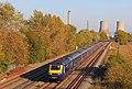
 View from a Reading-Swindon train - buildings at Milton Park - geograph.org.uk - 5520941.jpg 1 600 × 1 200 ; 655 kio
-

-
 View of the chancel roof - geograph.org.uk - 2640095.jpg 1 024 × 683 ; 148 kio
-
 View towards the estate - geograph.org.uk - 2634397.jpg 1 024 × 683 ; 156 kio
-
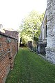 Wall by the west end - geograph.org.uk - 2636162.jpg 533 × 800 ; 143 kio
-
 Water Tower - geograph.org.uk - 1933692.jpg 3 648 × 2 736 ; 2,84 Mio
-
 Window on the north side - geograph.org.uk - 2640044.jpg 533 × 800 ; 139 kio
-
 Words by the window - geograph.org.uk - 2636010.jpg 1 200 × 800 ; 167 kio
-
 Wreaths at the base - geograph.org.uk - 2636000.jpg 533 × 800 ; 187 kio
-
 ^104 and ^102 High Street - geograph.org.uk - 3308561.jpg 1 024 × 683 ; 166 kio


_-_geograph.org.uk_-_2198281.jpg)


_-_geograph.org.uk_-_3554969.jpg)
_-_geograph.org.uk_-_3554978.jpg)
_-_geograph.org.uk_-_3554983.jpg)
_-_geograph.org.uk_-_3554985.jpg)
_-_geograph.org.uk_-_3554992.jpg)
_-_geograph.org.uk_-_3555000.jpg)
_-_geograph.org.uk_-_3555006.jpg)


