Category:Minsterworth
Aller à la navigation
Aller à la recherche
village britannique Mar2006.jpg) | |||||
| Téléverser des médias | |||||
| Nature de l’élément | |||||
|---|---|---|---|---|---|
| Lieu | Tewkesbury, Gloucestershire, Angleterre du Sud-Ouest, Angleterre | ||||
| Baigné par | |||||
 | |||||
English: Minsterworth is a village in Gloucestershire, UK. It lies on the border of Gloucester, on the north bank of the River Severn (effectively on the western side of the river) and on the A48 road between Gloucester and Chepstow, at . Minsterworth has a parish council.
Sous-catégories
Cette catégorie comprend 2 sous-catégories, dont les 2 ci-dessous.
C
- Calcott's Green (5 F)
S
- St Peter's Church, Minsterworth (17 F)
Média dans la catégorie « Minsterworth »
Cette catégorie comprend 173 fichiers, dont les 173 ci-dessous.
-
 'Private Elvering', Elmore Back - geograph.org.uk - 783473.jpg 426 × 640 ; 76 kio
-
 A twilight Severn Bore - geograph.org.uk - 3529147.jpg 1 024 × 680 ; 92 kio
-
 A view towards Windmill Hill - geograph.org.uk - 4180907.jpg 1 024 × 768 ; 197 kio
-
 A48 at Minsterworth - geograph.org.uk - 2153621.jpg 800 × 600 ; 320 kio
-
 A48 at Minsterworth Garage - geograph.org.uk - 3280908.jpg 640 × 480 ; 31 kio
-
 A48 at Minsterworth village boundary - geograph.org.uk - 3280879.jpg 640 × 480 ; 34 kio
-
 A48 at Walmore Hill, Minsterworth - geograph.org.uk - 541498.jpg 640 × 445 ; 57 kio
-
 A48 dualling at Minsterworth - geograph.org.uk - 2238046.jpg 800 × 600 ; 471 kio
-
 A48 east of Duni Farm - geograph.org.uk - 3280888.jpg 640 × 480 ; 41 kio
-
 A48 near the Apple Tree Inn, Minsterworth - geograph.org.uk - 6302361.jpg 640 × 480 ; 94 kio
-
 A48 near The Elms - geograph.org.uk - 3280898.jpg 640 × 481 ; 31 kio
-
 A48 towards Gloucester - geograph.org.uk - 6302332.jpg 800 × 600 ; 144 kio
-
 A48 towards Gloucester - geograph.org.uk - 6302353.jpg 800 × 600 ; 124 kio
-
 A48 towards Gloucester - geograph.org.uk - 6302365.jpg 800 × 600 ; 111 kio
-
 A48 towards Gloucester - geograph.org.uk - 6302374.jpg 800 × 600 ; 141 kio
-
 A48, Minsterworth - geograph.org.uk - 6302350.jpg 800 × 600 ; 137 kio
-
 Abandoned building by the River Severn - geograph.org.uk - 4181606.jpg 1 024 × 768 ; 186 kio
-
 Abandoned house near Minsterworth - geograph.org.uk - 1328623.jpg 640 × 426 ; 102 kio
-
 After the Bore - geograph.org.uk - 4405358.jpg 4 256 × 2 832 ; 3,55 Mio
-
 Approaching a bend on the A48 - geograph.org.uk - 6302345.jpg 800 × 600 ; 81 kio
-
 Approaching Minsterworth - geograph.org.uk - 4181889.jpg 1 024 × 768 ; 154 kio
-
 Brick built barn, Duni Farm - geograph.org.uk - 6302336.jpg 800 × 600 ; 135 kio
-
 Bridge over Long Brook - geograph.org.uk - 1319733.jpg 640 × 480 ; 114 kio
-
 Brook Farm near Oakle Street - geograph.org.uk - 1812871.jpg 3 008 × 2 000 ; 1,52 Mio
-
 Brook near Brook Farm - geograph.org.uk - 2300199.jpg 600 × 800 ; 391 kio
-
 Building beside the River Severn - geograph.org.uk - 1328485.jpg 426 × 640 ; 109 kio
-
 Building by the Severn - geograph.org.uk - 1320688.jpg 480 × 640 ; 92 kio
-
 Building by the Severn - geograph.org.uk - 4405295.jpg 4 256 × 2 832 ; 4,86 Mio
-
 Building by the Severn - geograph.org.uk - 4405303.jpg 4 256 × 2 832 ; 4,5 Mio
-
 Building on the banks of the Severn - geograph.org.uk - 2277207.jpg 2 816 × 2 112 ; 1,73 Mio
-
 Building on the river bank at Minsterworth - geograph.org.uk - 783500.jpg 640 × 426 ; 105 kio
-
 Bull in field^ - geograph.org.uk - 2213364.jpg 800 × 600 ; 379 kio
-
 Bury Lane, Minsterworth - geograph.org.uk - 1812891.jpg 3 008 × 2 000 ; 1,55 Mio
-
 Buttercups on Calcott's Green - geograph.org.uk - 1332344.jpg 640 × 426 ; 165 kio
-
 Buttercups, Corn Ham, Minsterworth - geograph.org.uk - 1331633.jpg 640 × 426 ; 128 kio
-
 Calcott's Green - geograph.org.uk - 4776870.jpg 1 600 × 901 ; 713 kio
-

-
 Church Lane, Minsterworth - geograph.org.uk - 1320662.jpg 640 × 480 ; 99 kio
-
 Church Lane, Minsterworth - geograph.org.uk - 5129715.jpg 1 024 × 768 ; 180 kio
-
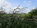
 Clay Hill - geograph.org.uk - 1318723.jpg 640 × 480 ; 101 kio
-
 Clay Hill - geograph.org.uk - 1319621.jpg 640 × 480 ; 99 kio
-
 Clay Hill - geograph.org.uk - 2238037.jpg 800 × 600 ; 446 kio
-
 Cormorants in a tree by the River Severn - geograph.org.uk - 4181530.jpg 1 024 × 768 ; 165 kio
-
 Corn Ham, Minsterworth - geograph.org.uk - 1330664.jpg 640 × 426 ; 76 kio
-
 Cottage in Minsterworth - geograph.org.uk - 1332385.jpg 640 × 426 ; 96 kio
-
 Drain at Calcott's Green - geograph.org.uk - 4776867.jpg 1 600 × 927 ; 709 kio
-
 Drain on Minsterworth Ham - geograph.org.uk - 2804057.jpg 1 024 × 577 ; 334 kio
-
 Drainage channel on Minsterworth Ham - geograph.org.uk - 1812912.jpg 3 008 × 2 000 ; 1,59 Mio
-
 Duni Farm - geograph.org.uk - 6302334.jpg 800 × 600 ; 105 kio
-
 Duni Farm, Minsterworth - geograph.org.uk - 783467.jpg 426 × 640 ; 74 kio
-
 Duni Villa - geograph.org.uk - 6302153.jpg 800 × 600 ; 103 kio
-
 Early morning rainclouds over May Hill - geograph.org.uk - 2234096.jpg 800 × 534 ; 284 kio
-
 Elizabeth II postbox on the A48 near Denny Hill - geograph.org.uk - 6308638.jpg 2 956 × 4 746 ; 3,65 Mio
-
 Fields near Minsterworth - geograph.org.uk - 6302342.jpg 800 × 600 ; 72 kio
-
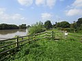
 Floodline by the River Severn - geograph.org.uk - 683141.jpg 640 × 425 ; 224 kio
-
 Footbridge near Denny Hill - geograph.org.uk - 2277231.jpg 2 816 × 2 112 ; 1,73 Mio
-
 Footpath and pumping station - geograph.org.uk - 4181623.jpg 1 024 × 768 ; 124 kio
-
 Footpath and stream near Denny Hill - geograph.org.uk - 2277227.jpg 2 816 × 2 112 ; 1,99 Mio
-
 Footpath and the barn - geograph.org.uk - 4358915.jpg 3 264 × 2 448 ; 1,52 Mio
-
 Footpath to Denny Hill - geograph.org.uk - 2300189.jpg 800 × 600 ; 407 kio
-
 Footpath to the Severn - geograph.org.uk - 2213374.jpg 800 × 600 ; 330 kio
-
 Former railway wagon on banks of the Severn - geograph.org.uk - 2277218.jpg 2 816 × 2 112 ; 1,54 Mio
-
 Gloucestershire Way at Minsterworth - geograph.org.uk - 1328464.jpg 640 × 426 ; 86 kio
-
 Gloucestershire Way near Minsterworth - geograph.org.uk - 1320667.jpg 640 × 480 ; 126 kio
-
 Gloucestershire Way this way - geograph.org.uk - 2238029.jpg 640 × 480 ; 115 kio
-
 Grazing near Appithorne - geograph.org.uk - 6302371.jpg 800 × 600 ; 98 kio
-
 Haymaking on the banks of the Severn - geograph.org.uk - 3529171.jpg 1 024 × 680 ; 242 kio
-
 Highcross Farm, Minsterworth - geograph.org.uk - 1328550.jpg 640 × 426 ; 114 kio
-
 Highcross Farm, Minsterworth - geograph.org.uk - 1331645.jpg 640 × 426 ; 110 kio
-
 Houses on the A48 - geograph.org.uk - 6302362.jpg 800 × 543 ; 78 kio
-
 Icy Watery Lane - geograph.org.uk - 2213348.jpg 800 × 600 ; 384 kio
-
 Jeffroy's Farm - geograph.org.uk - 2213345.jpg 800 × 600 ; 366 kio
-
 Lane to Minsterworth - geograph.org.uk - 1331642.jpg 426 × 640 ; 101 kio
-
 Lane to Minsterworth Ham - geograph.org.uk - 4181912.jpg 1 024 × 768 ; 234 kio
-
 Levee by the Severn - geograph.org.uk - 1321466.jpg 640 × 480 ; 99 kio
-
 Long Brook - geograph.org.uk - 1319708.jpg 480 × 640 ; 119 kio
-
 LynPaddockMinsterworth(BobEmbleton)Mar2006.jpg 640 × 479 ; 104 kio
-
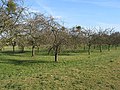
 Mature orchard at Minsterworth - geograph.org.uk - 1328542.jpg 640 × 426 ; 116 kio
-
 Meadow by the Severn - geograph.org.uk - 1320665.jpg 640 × 480 ; 98 kio
-
 Meadow near Clay Hill - geograph.org.uk - 1319689.jpg 640 × 480 ; 98 kio
-
 Meadowland near Minsterworth - geograph.org.uk - 1330746.jpg 640 × 426 ; 88 kio
-
 Mid-summer twilight Severn Bore - geograph.org.uk - 3529158.jpg 1 024 × 680 ; 107 kio
-
 Midsummer evening sky - geograph.org.uk - 3529162.jpg 680 × 1 024 ; 72 kio
-
 Minsterworth Village Hall - geograph.org.uk - 2325542.jpg 2 816 × 2 112 ; 1,96 Mio
-
 New houses, Minsterworth - geograph.org.uk - 6302347.jpg 800 × 600 ; 96 kio
-
 New houses, Minsterworth - geograph.org.uk - 6302351.jpg 640 × 480 ; 60 kio
-
 November Cottage at Calcotts Green (geograph 1812905).jpg 3 008 × 2 000 ; 1,59 Mio
-
 Oak tree near Hygrove House - geograph.org.uk - 3495930.jpg 1 024 × 680 ; 221 kio
-
 Oak tree on Minsterworth Ham - geograph.org.uk - 1331653.jpg 640 × 426 ; 80 kio
-
 Oakle Street junction on the A48 - geograph.org.uk - 1812881.jpg 3 008 × 2 000 ; 1,63 Mio
-
 Oakle Street towards the A48 - geograph.org.uk - 3995789.jpg 1 600 × 1 064 ; 468 kio
-
 Orchard by the Gloucestershire Way - geograph.org.uk - 1320693.jpg 640 × 480 ; 107 kio
-
 Orchard in winter - geograph.org.uk - 683110.jpg 640 × 480 ; 185 kio
-
 Pasture land at Brook Farm near Oakle Street - geograph.org.uk - 1812876.jpg 3 008 × 2 000 ; 1,53 Mio
-
 Path from the Severn bank - geograph.org.uk - 4181679.jpg 1 024 × 768 ; 146 kio
-
 Phone box near Calcott's Green - geograph.org.uk - 3205293.jpg 640 × 427 ; 117 kio
-
 Pool in meadowland near Minsterworth - geograph.org.uk - 1328560.jpg 640 × 426 ; 76 kio
-
 Railway towards Lydney - geograph.org.uk - 6302375.jpg 800 × 600 ; 122 kio
-
 Rather overgrown footbridge - geograph.org.uk - 4181514.jpg 1 024 × 768 ; 218 kio
-
 Ready for the bore - geograph.org.uk - 592689.jpg 640 × 421 ; 52 kio
-
 Repaired breach - geograph.org.uk - 4181541.jpg 1 024 × 768 ; 179 kio
-
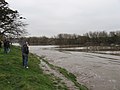
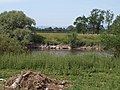 River Severn - geograph.org.uk - 1938058.jpg 640 × 480 ; 108 kio
-
 River Severn - geograph.org.uk - 4181516.jpg 1 024 × 768 ; 215 kio
-
 River Severn - geograph.org.uk - 5668461.jpg 4 032 × 3 024 ; 3,08 Mio
-
 River Severn and May Hill - geograph.org.uk - 3714644.jpg 800 × 600 ; 301 kio
-
 River Severn at Minsterworth - geograph.org.uk - 1320197.jpg 640 × 480 ; 106 kio
-
 River Severn at Minsterworth - geograph.org.uk - 1320271.jpg 640 × 422 ; 88 kio
-
 River Severn at Minsterworth - geograph.org.uk - 1812900.jpg 3 008 × 2 000 ; 1,55 Mio
-
 River Severn upstream from Minsterworth - geograph.org.uk - 3529168.jpg 1 024 × 680 ; 198 kio
-
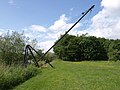 Riverside crane, Minsterworth - geograph.org.uk - 1320135.jpg 640 × 480 ; 79 kio
-
 Road to Minsterworth Ham - geograph.org.uk - 1332274.jpg 640 × 426 ; 92 kio
-
 Ruin beside the River Severn - geograph.org.uk - 1328537.jpg 640 × 426 ; 116 kio
-
 Same gate, different sign, similar meaning - geograph.org.uk - 4776627.jpg 1 600 × 901 ; 759 kio
-
 Service station on the A48 - geograph.org.uk - 6302369.jpg 800 × 530 ; 84 kio
-
 Severn Bore near Minsterworth - geograph.org.uk - 2277203.jpg 2 816 × 2 112 ; 1,66 Mio
-
 Severn Bore passing Minsterworth - geograph.org.uk - 2325546.jpg 2 816 × 2 112 ; 1,45 Mio
-
 Severn Bore.jpg 6 163 × 5 000 ; 2,43 Mio
-
 Severn flood meadows - geograph.org.uk - 2213366.jpg 800 × 600 ; 426 kio
-
 Severn floodplain - geograph.org.uk - 2234081.jpg 800 × 600 ; 385 kio
-
 Sharp bend on the A48 - geograph.org.uk - 3088280.jpg 3 215 × 2 315 ; 1,4 Mio
-
 Sign for the Apple Tree Inn, Minsterworth - geograph.org.uk - 6302359.jpg 630 × 800 ; 120 kio
-
-
 Snowdrops through beech leaves - geograph.org.uk - 683063.jpg 640 × 506 ; 258 kio
-
 Speed Camera on the A48 - geograph.org.uk - 2153617.jpg 800 × 601 ; 345 kio
-
 Stranded boats at Minsterworth - geograph.org.uk - 1328497.jpg 640 × 426 ; 116 kio
-
 Sunrise over the A48 - geograph.org.uk - 2234084.jpg 800 × 600 ; 368 kio
-
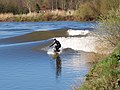 Surfing the Severn bore. Minsterworth. 21-3-07 - geograph.org.uk - 379254.jpg 640 × 480 ; 118 kio
-
 Telephone Exchange on the A48 - geograph.org.uk - 6302152.jpg 640 × 487 ; 104 kio
-
 The Apple Tree Inn, Minsterworth - geograph.org.uk - 6302358.jpg 800 × 563 ; 117 kio
-
 The Apple Tree on the A48 - geograph.org.uk - 141722.jpg 640 × 480 ; 72 kio
-
 The Elms, Minsterworth - geograph.org.uk - 2213381.jpg 800 × 600 ; 368 kio
-
 The Gloucester Way - north and south from the A48. - geograph.org.uk - 1947297.jpg 2 048 × 1 536 ; 1,27 Mio
-
 The river bank at Minsterworth church - geograph.org.uk - 1835649.jpg 4 288 × 2 848 ; 3 Mio
-
 The River Severn - geograph.org.uk - 4181536.jpg 1 024 × 768 ; 189 kio
-
 The River Severn at Minsterworth - geograph.org.uk - 1328571.jpg 640 × 426 ; 68 kio
-
 The River Severn near Minsterworth - geograph.org.uk - 783463.jpg 640 × 426 ; 55 kio
-
 The Severn at Minsterworth - geograph.org.uk - 6109440.jpg 1 600 × 900 ; 765 kio
-
 The Severn Bank - geograph.org.uk - 4181522.jpg 1 024 × 768 ; 175 kio
-
 The Severn bank and footpath - geograph.org.uk - 4181532.jpg 1 024 × 768 ; 176 kio
-
 The Severn bank at Minsterworth - geograph.org.uk - 4180894.jpg 1 024 × 768 ; 203 kio
-
 The Severn Bore - geograph.org.uk - 4405329.jpg 4 256 × 2 832 ; 4,61 Mio
-
 The Severn Bore arriving at Minsterworth - geograph.org.uk - 1835657.jpg 4 288 × 2 848 ; 3 Mio
-
 The Severn Bore, downstream from Minsterworth - geograph.org.uk - 46814.jpg 640 × 480 ; 115 kio
-
 The Severn Bore, near Hempsted, Gloucestershire (1 of 9) - geograph.org.uk - 2318982.jpg 1 440 × 1 080 ; 376 kio
-
 The Severn Bore, near Hempsted, Gloucestershire (2 of 9) - geograph.org.uk - 2318983.jpg 1 440 × 1 080 ; 700 kio
-
 The Severn Bore, near Hempsted, Gloucestershire (3 of 9) - geograph.org.uk - 2318985.jpg 1 440 × 946 ; 570 kio
-
 The Severn Bore, near Hempsted, Gloucestershire (4 of 9) - geograph.org.uk - 2318987.jpg 1 440 × 1 080 ; 335 kio
-
 The Severn Bore, near Hempsted, Gloucestershire (8 of 9) - geograph.org.uk - 2318991.jpg 1 440 × 1 080 ; 481 kio
-
 The Severn Bore, spring 1967 - geograph.org.uk - 3274020.jpg 1 024 × 681 ; 590 kio
-
 The Vale of Gloucester 1 - geograph.org.uk - 2120347.jpg 640 × 427 ; 211 kio
-
 The Vale of Gloucester 2 - geograph.org.uk - 2120353.jpg 640 × 480 ; 241 kio
-
 The Vale of Gloucester 3 - geograph.org.uk - 2120358.jpg 640 × 480 ; 243 kio
-
 Track and footpath - geograph.org.uk - 2804063.jpg 1 024 × 577 ; 315 kio
-
 Track from the river to the road - geograph.org.uk - 1834633.jpg 4 288 × 2 848 ; 3,09 Mio
-
 Track on Corn Ham - geograph.org.uk - 4180903.jpg 1 024 × 768 ; 206 kio
-
 Tree trunk on the Severn floodplain - geograph.org.uk - 1330706.jpg 426 × 640 ; 112 kio
-
 View to Denny Hill - geograph.org.uk - 2301459.jpg 800 × 600 ; 391 kio
-
 Waiting for the Bore on the banks of the Severn - geograph.org.uk - 2277215.jpg 2 816 × 2 112 ; 1,72 Mio
-
 Waiting for the Severn Bore - geograph.org.uk - 4358924.jpg 2 560 × 1 920 ; 2,83 Mio
-
 Waiting for the Severn Bore - geograph.org.uk - 4405316.jpg 4 256 × 2 832 ; 3,53 Mio
-
 Walkers in the sun - geograph.org.uk - 1331650.jpg 426 × 640 ; 87 kio
-
 Washed up after the floods - geograph.org.uk - 683125.jpg 640 × 480 ; 204 kio
-

-
 Building by the River Severn - geograph.org.uk - 683104.jpg 640 × 480 ; 199 kio
-
 Farmland between Churcham and Minsterworth - geograph.org.uk - 597750.jpg 640 × 472 ; 140 kio
-
 Flood defences along the Severn - geograph.org.uk - 683052.jpg 640 × 422 ; 186 kio
-
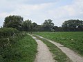
 Footpath to Minsterworth - geograph.org.uk - 683036.jpg 640 × 447 ; 145 kio
-
 Footpath to Minsterworth from Churcham - geograph.org.uk - 597732.jpg 640 × 480 ; 148 kio
-
 Gloucestershire Way Footpath - geograph.org.uk - 683011.jpg 640 × 480 ; 149 kio
-
 Public road to Minsterworth - geograph.org.uk - 683070.jpg 640 × 480 ; 208 kio
-
 Railway line to Gloucester from South Wales - geograph.org.uk - 597743.jpg 640 × 480 ; 132 kio
-
 Single fungus in pasture - geograph.org.uk - 597783.jpg 640 × 631 ; 95 kio
-
 Winter poplars at the end of a garden - geograph.org.uk - 683041.jpg 480 × 640 ; 150 kio


.jpg)


_-_geograph.org.uk_-_2318982.jpg)
_-_geograph.org.uk_-_2318983.jpg)
_-_geograph.org.uk_-_2318985.jpg)
_-_geograph.org.uk_-_2318987.jpg)
_-_geograph.org.uk_-_2318991.jpg)


