Category:Missoula Floods
Vai alla navigazione
Vai alla ricerca
floods dating from the end of the last ice age, in the USA  | |||||
| Carica un file multimediale | |||||
| Sottoclasse di | |||||
|---|---|---|---|---|---|
| |||||
Sottocategorie
Questa categoria contiene le 6 sottocategorie indicate di seguito, su un totale di 6.
Pagine nella categoria "Missoula Floods"
Questa categoria contiene un'unica pagina, indicata di seguito.
File nella categoria "Missoula Floods"
Questa categoria contiene 30 file, indicati di seguito, su un totale di 30.
-
 Above Dry Falls 01.jpg 4 056 × 3 040; 6,44 MB
-
 Above Dry Falls 02.jpg 4 056 × 3 040; 5,33 MB
-
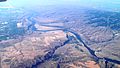
 Channeled Scablands and Palouse Hills.jpg 4 056 × 3 040; 5,97 MB
-
 Channeled Scablands.jpg 4 056 × 3 040; 4,96 MB
-
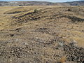
 Clastic dike at cecil swc.jpg 4 463 × 2 832; 4,98 MB
-
 Cluster-of-erratics-on-Red-Mountain.JPG 923 × 1 155; 448 KB
-
 Columbia River and West Bar Giant Ripples - Flickr - brewbooks (1).jpg 4 288 × 2 416; 4,86 MB
-
 Columbia River and West Bar Giant Ripples - Flickr - brewbooks.jpg 4 288 × 2 416; 6,41 MB
-
 Corfu-Slide-in-saddle-mountains-Looking-Easterly-.JPG 2 529 × 1 825; 1,08 MB
-
 Debry dune at Frenchman Cataract.jpg 4 056 × 3 040; 6,03 MB
-
 Drumheller Channels National Natural Landmark.jpg 3 541 × 2 041; 1,09 MB
-
 Dry Falls1.JPG 1 280 × 960; 181 KB
-
 Flickr - brewbooks - Basalt rock segments - Giant Ripples, West Bar of Columbia (1).jpg 3 264 × 2 448; 5,22 MB
-
 Flickr - brewbooks - Basalt rock segments - Giant Ripples, West Bar of Columbia.jpg 3 264 × 2 448; 5,66 MB
-
 Flickr - brewbooks - Solitary sagebrush - Giant Ripples, West Bar of Columbia River.jpg 3 264 × 2 448; 4,61 MB
-
 Frenchman Cataract.jpg 4 056 × 3 040; 5,57 MB
-
 Giant ripple marks.jpg 450 × 324; 16 KB
-
 Giant Ripples, West Bar of Columbia River, looking west at sunrise.jpg 3 264 × 2 448; 3,49 MB
-
 Grand Coulee and Steamboat Rock.jpg 4 056 × 3 040; 5,04 MB
-
 Lake Lenore, Washington (2221854065).jpg 3 072 × 2 304; 1,48 MB
-
 Lake Lewis Basin.jpg 720 × 540; 85 KB
-
 Map missoula floods.gif 668 × 481; 24 KB
-
 Palouse from Steptoe Butte.jpg 1 163 × 576; 230 KB
-
 Pothole - 1.jpg 4 056 × 3 040; 8,95 MB
-
 Scablands in Eastern Washington.jpg 3 088 × 2 048; 2,44 MB
-
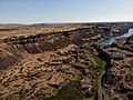
 Sentinel Gap, Washington.jpg 4 056 × 3 040; 5,14 MB
-
 Steamboat Rock - 1.jpg 4 056 × 3 040; 5,96 MB
-
 Touchet-formation-St-Helens-ash.JPG 866 × 813; 244 KB
-
 Wallula-Gap-the-sisters.JPG 1 339 × 1 786; 716 KB
-
 Wpdms nasa topo missoula floods.jpg 464 × 384; 49 KB


.jpg)


.jpg)


.jpg)


