Category:Mixco
Zur Navigation springen
Zur Suche springen
Stadt in Guatemala  .png)   | |||||
| Medium hochladen | |||||
| Ist ein(e) | |||||
|---|---|---|---|---|---|
| Patron | |||||
| Ort | Departamento Guatemala, Guatemala | ||||
| Datum der Gründung, Erstellung, Entstehung, Erbauung |
| ||||
| Einwohnerzahl |
| ||||
| Fläche |
| ||||
| Höhe über dem Meeresspiegel |
| ||||
| offizielle Website | |||||
 | |||||
Unterkategorien
Es werden 3 von insgesamt 3 Unterkategorien in dieser Kategorie angezeigt:
In Klammern die Anzahl der enthaltenen Kategorien (K), Seiten (S), Dateien (D)
Medien in der Kategorie „Mixco“
Folgende 43 Dateien sind in dieser Kategorie, von 43 insgesamt.
-
 A glimpse of Guatemala 20 - A Mixco Washerwoman.png 731 × 1.111; 266 KB
-
 Aguilar batres.JPG 3.072 × 2.304; 2,35 MB
-
 Bosque Las Victorias (100973153).jpeg 1.365 × 2.048; 1,91 MB
-
 Bosques de San Nicolás - Mixco - 51908798441.jpg 4.000 × 3.000; 12,46 MB
-
 Bosques de San Nicolás - Mixco - 51908890433.jpg 4.000 × 3.000; 10,66 MB
-
 Bosques de San Nicolás - Mixco.jpg 4.000 × 3.000; 10,9 MB
-
 Bosques del Encinal - panoramio.jpg 600 × 800; 257 KB
-
 Calzada Roosevelt - Guatemala.jpg 4.000 × 3.000; 3,24 MB
-
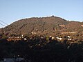 Cerroalux2009.jpg 1.600 × 1.200; 264 KB
-
 Claret1.JPG 2.304 × 3.072; 2,91 MB
-
 Claret2.JPG 2.304 × 3.072; 3,2 MB
-
 Claret3.JPG 2.304 × 3.072; 3,07 MB
-
 Condado Naranjo - Mixco, Guatemala.jpg 4.000 × 2.039; 7,7 MB
-
 Ernesto bran.jpg 4.512 × 3.008; 5,34 MB
-
 Escudo De Mixco.png 500 × 500; 182 KB
-
 Guatemala - Mixco.png 572 × 650; 197 KB
-
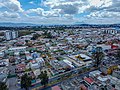
 Guatemala City Metropolitan Area.jpg 6.000 × 4.000; 14,03 MB
-
 Image - 2023-07-10T102403.815.png 150 × 150; 22 KB
-
 Miraflores02.jpg 2.304 × 3.072; 3,09 MB
-
 Miraflores1.JPG 3.072 × 2.304; 3,02 MB
-
 Mixco1910.jpg 649 × 404; 91 KB
-
 Naranjo Mall - Mixco - 51908797641.jpg 4.000 × 3.000; 10,64 MB
-
 Naranjo Mall - Mixco.jpg 4.000 × 3.000; 11,09 MB
-
 Neto bran.jpg 718 × 958; 258 KB
-
 Panorámica Condado Naranjo - Mixco.jpg 5.579 × 1.956; 10,2 MB
-
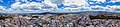 Panorámica Mixco.jpg 9.367 × 2.087; 18,68 MB
-
 Parque de la industria.JPG 3.072 × 2.304; 2,65 MB
-
 Parque de la industria01.JPG 3.072 × 2.304; 2,92 MB
-
 Parque001.JPG 3.072 × 2.304; 3,01 MB
-
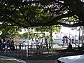 Parque03.JPG 3.072 × 2.304; 3,18 MB
-
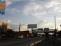
 Paso a Desnivel Ruta Interamericana CA-1.jpg 4.000 × 2.250; 4,9 MB
-
 PilaMixco1910.jpg 480 × 261; 58 KB
-
 Población del Área Metropolitana de Guatemala.png 3.507 × 2.480; 429 KB
-
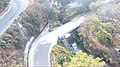 Puente La Comunidad Majaditas.jpg 4.000 × 2.250; 3,81 MB
-
 Ruedadechicago.JPG 2.304 × 3.072; 3,08 MB
-
 Ruta Express de Mixco, Guatemala.jpg 1.200 × 800; 133 KB
-
 Rutas Express, Guatemala City-Mixco.jpg 1.200 × 900; 512 KB
-
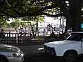
 Trafico05.JPG 2.304 × 3.072; 2,07 MB
-
 Trafico06.JPG 2.304 × 3.072; 3,09 MB
-
 Trafico07.JPG 3.072 × 2.304; 2,99 MB
-
 Zona 8 de Mixco, Guatemala - panoramio.jpg 2.560 × 1.920; 2,55 MB
-
 Área Metropolitana de Guatemala (AMG).jpg 3.032 × 2.064; 1,33 MB
-
 Área Metropolitana de Guatemala, Guatemala.png 3.530 × 3.653; 8,59 MB


.jpeg)


.jpg)
