Category:Moggerhanger
Vai alla navigazione
Vai alla ricerca
village and civil parish in Bedfordshire, UK  | |||||
| Carica un file multimediale | |||||
| Istanza di | |||||
|---|---|---|---|---|---|
| Luogo | Central Bedfordshire, Bedfordshire, Est dell'Inghilterra, Inghilterra | ||||
 | |||||
English: Moggerhanger is a village in the English county of Bedfordshire. It is west of Sandy on the road to Bedford. In the twentieth century the village name was spelled variously as: Moggerhanger, Mogerhanger, Muggerhanger and Morehanger. Local pronunciation of the name is as Morhanger.
Sottocategorie
Questa categoria contiene le 2 sottocategorie indicate di seguito, su un totale di 2.
M
File nella categoria "Moggerhanger"
Questa categoria contiene 98 file, indicati di seguito, su un totale di 98.
-
 A gate and field near Moggerhanger - geograph.org.uk - 426169.jpg 640 × 480; 108 KB
-
 A603 - geograph.org.uk - 4988050.jpg 640 × 371; 58 KB
-
 A603 towards Bedford - geograph.org.uk - 4620960.jpg 640 × 480; 58 KB
-
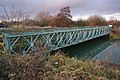 Bailey Bridge, Blunham - geograph.org.uk - 2815157.jpg 3 872 × 2 592; 2,86 MB
-
 Barford Old Mill Lock - geograph.org.uk - 2952298.jpg 1 200 × 1 600; 2,48 MB
-
 Blunham Road - geograph.org.uk - 4617157.jpg 640 × 480; 59 KB
-
 Blunham Road - geograph.org.uk - 5599099.jpg 640 × 428; 139 KB
-
 Blunham South Mills Weir - geograph.org.uk - 2815142.jpg 3 872 × 2 592; 2,91 MB
-
 Bridge Farm Shop, Bedford Road - geograph.org.uk - 1965353.jpg 640 × 480; 93 KB
-
 Bridleway by Sheerhatch Wood - geograph.org.uk - 5096031.jpg 1 600 × 1 066; 394 KB
-
 Bridleway towards Hill Farm - geograph.org.uk - 426099.jpg 640 × 480; 83 KB
-
 Bungalow near South Mills - geograph.org.uk - 4617151.jpg 640 × 480; 76 KB
-
 Citroen 2CV 3 wheeler Kelly Trike.jpg 3 149 × 2 445; 1,57 MB
-
 Cycle route 51 and tunnel at South Mills - geograph.org.uk - 3788300.jpg 4 320 × 3 240; 6,43 MB
-
 Cycle route 51 towards Sandy - geograph.org.uk - 5067099.jpg 1 066 × 1 600; 508 KB
-
 Entering Blunham - geograph.org.uk - 4697785.jpg 640 × 480; 47 KB
-
 Entrance to Moggerhanger Park - geograph.org.uk - 5066932.jpg 1 600 × 1 066; 425 KB
-

-
 Farm shop, Girtford Bridge - geograph.org.uk - 4620951.jpg 640 × 480; 44 KB
-
 Farmland off The Ridgeway - geograph.org.uk - 4617146.jpg 640 × 480; 56 KB
-
 Field beside Lady Wood - geograph.org.uk - 4617136.jpg 640 × 480; 76 KB
-
 Field entrance near South Mills - geograph.org.uk - 4620970.jpg 640 × 480; 86 KB
-
 Footpath crossing NCN51 - geograph.org.uk - 2742644.jpg 1 600 × 1 200; 647 KB
-
 Footpath into Chalton - geograph.org.uk - 5067093.jpg 1 600 × 1 066; 506 KB
-
 Footpath to Beeston Leasoes Farm - geograph.org.uk - 5096036.jpg 1 600 × 1 066; 458 KB
-
 Footpath to Blunham - geograph.org.uk - 5067100.jpg 1 600 × 1 066; 439 KB
-
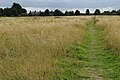
 Footpath to Moggerhanger - geograph.org.uk - 5066943.jpg 1 600 × 1 066; 582 KB
-
 Footpath to the Bedford Road - geograph.org.uk - 5066941.jpg 1 600 × 1 066; 665 KB
-
 Footpath to the Bedford Road - geograph.org.uk - 5066951.jpg 1 600 × 1 066; 461 KB
-
 Footpath towards Chalton - geograph.org.uk - 5067096.jpg 1 600 × 1 066; 505 KB
-
 Footpath towards Great Barford - geograph.org.uk - 5067094.jpg 1 066 × 1 600; 406 KB
-
 Gated entrance on Blunham Road - geograph.org.uk - 4697781.jpg 640 × 480; 71 KB
-
 Girtford Bridge - geograph.org.uk - 2815164.jpg 3 872 × 2 592; 3,34 MB
-
 Grazing, Bridge Farm - geograph.org.uk - 4617125.jpg 640 × 480; 82 KB
-
 Heading north near South Mills - geograph.org.uk - 4620966.jpg 640 × 480; 78 KB
-
 Houses on St John's Road - geograph.org.uk - 5066948.jpg 1 600 × 1 066; 304 KB
-

-
 Junction on the A603 - geograph.org.uk - 4620954.jpg 640 × 480; 59 KB
-
 Lady Wood - geograph.org.uk - 4617139.jpg 478 × 640; 101 KB
-
 Lady Wood - geograph.org.uk - 4620957.jpg 480 × 640; 109 KB
-
 Long shot of St James and St Edmund, Blunham - geograph.org.uk - 3788312.jpg 4 320 × 3 240; 4,59 MB
-
 Lost lifebelt - geograph.org.uk - 2815146.jpg 3 872 × 2 592; 3,72 MB
-
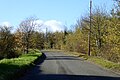
 Minor road towards Blunham - geograph.org.uk - 4620963.jpg 640 × 480; 64 KB
-
 Moggerhanger from across the fields - geograph.org.uk - 4619403.jpg 4 298 × 3 210; 4,89 MB
-
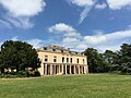 Moggerhanger House - geograph.org.uk - 5988606.jpg 3 264 × 2 448; 1,6 MB
-
 Moggerhanger Lower School - geograph.org.uk - 2206363.jpg 640 × 480; 129 KB
-
 National Cycle Network 51 - geograph.org.uk - 4602696.jpg 1 600 × 1 066; 555 KB
-

-

-

-
 Park Close, Moggerhanger - geograph.org.uk - 2235066.jpg 640 × 480; 66 KB
-
 Park Lane, Moggerhanger - geograph.org.uk - 426083.jpg 640 × 480; 127 KB
-

-
 Park Road, Moggerhanger - geograph.org.uk - 2235060.jpg 640 × 480; 74 KB
-
 Park Road, Moggerhanger - geograph.org.uk - 2235063.jpg 640 × 480; 60 KB
-
 Path into Moggerhanger - geograph.org.uk - 5066949.jpg 1 600 × 1 066; 638 KB
-
 Pond on Park Road - geograph.org.uk - 5066936.jpg 1 600 × 1 066; 460 KB
-
 Poppies by the stubble field - geograph.org.uk - 4602695.jpg 1 600 × 1 066; 547 KB
-
 Private car park, Bridge Farm Shop - geograph.org.uk - 5599027.jpg 640 × 428; 135 KB
-
 Public footpath towards Chalton - geograph.org.uk - 5067089.jpg 1 600 × 1 066; 539 KB
-
 Road junction near South Mills - geograph.org.uk - 2206381.jpg 640 × 480; 126 KB
-
 Road junction with a view - geograph.org.uk - 5599012.jpg 640 × 480; 92 KB
-

-
 St John the Evangelist - geograph.org.uk - 5066950.jpg 1 600 × 1 066; 373 KB
-
 St John the Evangelist, Moggerhanger - geograph.org.uk - 3788289.jpg 4 260 × 3 158; 5,74 MB
-
 Station Rd - geograph.org.uk - 4988079.jpg 640 × 381; 48 KB
-
 Stubble field and hedgerow - geograph.org.uk - 4697784.jpg 640 × 480; 56 KB
-
 Stubble field off the A603 - geograph.org.uk - 4617143.jpg 640 × 480; 53 KB
-
 Stubble field with bales - geograph.org.uk - 4617153.jpg 640 × 480; 66 KB
-
 Thatched cottage on Blunham Road - geograph.org.uk - 4620972.jpg 640 × 480; 46 KB
-
 The Crescent, Moggerhanger - geograph.org.uk - 2206352.jpg 640 × 480; 112 KB
-
 The Guinea - geograph.org.uk - 3492773.jpg 1 024 × 680; 181 KB
-
 The Guinea pub, Moggerhanger - geograph.org.uk - 3788286.jpg 3 349 × 2 421; 2,99 MB
-
 The Guinea, Moggerhanger - geograph.org.uk - 2235068.jpg 640 × 466; 54 KB
-
 The Ice House, Moggerhanger Park - geograph.org.uk - 2206327.jpg 640 × 480; 116 KB
-
 The Old Post Office - geograph.org.uk - 82047.jpg 640 × 520; 115 KB
-
 The Ridgeway - geograph.org.uk - 4617149.jpg 640 × 480; 61 KB
-
 The Ridgeway - geograph.org.uk - 4988064.jpg 640 × 275; 31 KB
-
 The Ridgeway - geograph.org.uk - 5599089.jpg 640 × 428; 83 KB
-
 Track into Moggerhanger - geograph.org.uk - 5066944.jpg 1 600 × 1 066; 536 KB
-
 Track to Willow Farm - geograph.org.uk - 4617127.jpg 640 × 480; 65 KB
-
 Track towards Chalton - geograph.org.uk - 5066946.jpg 1 600 × 1 066; 440 KB
-
 Track towards the Great Ouse - geograph.org.uk - 5066945.jpg 1 600 × 1 066; 445 KB
-

-
 Welcome to Abbey Corrugated - geograph.org.uk - 2815132.jpg 3 872 × 2 592; 3,45 MB
-
 Wild flowers on the field boundary - geograph.org.uk - 5066947.jpg 1 600 × 1 066; 597 KB
-
 Winter time-the River Ivel near Blunham - geograph.org.uk - 3788306.jpg 4 320 × 3 240; 4,11 MB
-

-

-
 Another digger and a field - geograph.org.uk - 426249.jpg 640 × 480; 95 KB
-
 Gravel Pit Entrance - geograph.org.uk - 181108.jpg 640 × 480; 67 KB
-
 Hill Farm - geograph.org.uk - 426107.jpg 640 × 480; 117 KB
-

-
 Housing in Moggerhanger - geograph.org.uk - 426075.jpg 640 × 480; 72 KB
-

-
 Track to Beeston Leasoes Farm - geograph.org.uk - 426202.jpg 640 × 480; 97 KB
-
 Willowhill Cottages - geograph.org.uk - 426093.jpg 640 × 480; 98 KB
-
 Wood Lane. - geograph.org.uk - 426111.jpg 640 × 480; 103 KB


