Category:Mohawk River (New York)
Zur Navigation springen
Zur Suche springen
Nebenfluss des Hudson River   | |||||
| Medium hochladen | |||||
| Ist ein(e) | |||||
|---|---|---|---|---|---|
| Ort | New York | ||||
| Länge |
| ||||
| Mündet in | |||||
| Nebenfluss |
| ||||
 | |||||
Unterkategorien
Es werden 16 von insgesamt 16 Unterkategorien in dieser Kategorie angezeigt:
In Klammern die Anzahl der enthaltenen Kategorien (K), Seiten (S), Dateien (D)
B
C
- Crescent Dam (Mohawk River) (15 D)
F
H
L
- Lock E11, Amsterdam (33 D)
- Lock E12, Tribes Hill (11 D)
- Lock E17, Little Falls (4 D)
- Lock E2, Waterford (11 D)
- Lock E3, Waterford (4 D)
- Lock E7, Vischer Ferry (39 D)
- Lock E9, Rotterdam (5 D)
M
P
- Peebles Island State Park (10 D)
T
- Thaddeus Kosciusko Bridge (16 D)
Medien in der Kategorie „Mohawk River (New York)“
Folgende 62 Dateien sind in dieser Kategorie, von 62 insgesamt.
-
 20180523 - 11 - Canajoharie, NY - "On the Sunny Side of the Street".jpg 1.858 × 1.394; 277 KB
-

-
 2020 Lock E11 from the Mohawk Valley Gateway Overlook.jpg 2.121 × 1.220; 464 KB
-
 2020 Mohawk River north from Mohawk Valley Gateway Overlook.jpg 5.117 × 3.420; 2,73 MB
-
 2020 Mohawk River power canal building above Cohoes Falls.jpg 4.362 × 2.230; 2,3 MB
-
 20220508 - 18 - Halfmoon, New York - From the Muddy Banks of the Mohawk.jpg 4.025 × 2.415; 4,07 MB
-
 A Town on the Mohawk River in Central New York State (?) MET 128565.jpg 3.807 × 2.369; 3,12 MB
-
 A Town on the Mohawk River in Central New York State (?) MET ap42.95.46.jpg 2.215 × 1.380; 826 KB
-
 A view on the Mohawk River (NYPL NYPG94-F42-419815).jpg 3.292 × 2.504; 2,78 MB
-
 Albany International Airport aerial.jpg 2.354 × 1.403; 871 KB
-
 Annual report (1903) (17808964263).jpg 3.344 × 2.128; 1,53 MB
-
 Annual report of the Regents (1894) (17812737563).jpg 3.632 × 2.108; 2,05 MB
-
 Annual report of the Regents (1894) (18245679750).jpg 3.600 × 2.100; 1,51 MB
-
 Annual report of the Regents - New York State Museum. (1902) (19178643620).jpg 4.080 × 2.728; 2,3 MB
-
-
 Aqueduct at Rexford, New York.jpg 548 × 684; 171 KB
-
 Cross-section of the Helderberg Ridge, NY.png 585 × 237; 34 KB
-
 DurhamBoat-MohawkR.jpg 812 × 560; 198 KB
-
 Eastern Mowhawk River area NY 8792 (4853774919).jpg 2.816 × 2.112; 2,3 MB
-
 Eastern Mowhawk River area NY 8793 (4853777631).jpg 2.816 × 2.112; 2,34 MB
-
 Firstbranch.jpg 640 × 480; 55 KB
-

-
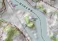
 Halsey Old NY Frontier Patent Map small.png 2.326 × 2.110; 653 KB
-
 Herkimer House north porch view 2.jpg 3.072 × 2.304; 3,32 MB
-
 Herkimer House north porch view 3.jpg 3.072 × 2.304; 2,21 MB
-
 Herkimer House north porch view 4.jpg 3.072 × 2.304; 2,62 MB
-
 Herkimer House north porch view.jpg 3.072 × 2.304; 2,81 MB
-
 Herkimer House north view.jpg 3.072 × 2.304; 2,59 MB
-

-
 Hudsonmap.png 1.000 × 1.005; 416 KB
-
 Lock 8 on the Mohawk River - panoramio.jpg 2.400 × 1.800; 657 KB
-
 Lock E12 Mohawk River looking upstream.jpg 5.095 × 3.037; 2,48 MB
-
 Martyrs' Shrine at Auriesville.jpg 619 × 485; 216 KB
-
 Mohawk River - Albany Landing (33296877585).jpg 2.400 × 1.600; 2,08 MB
-
 Mohawk River aerial.jpg 1.378 × 2.451; 667 KB
-

-
 Mohawk Towpath Byway - Peebles Island - NARA - 7720472.jpg 2.160 × 1.440; 1,16 MB
-
 Mohawk Valley flood relief 130704-Z-ZZ999-004.jpg 2.448 × 3.264; 1,59 MB
-
 Mohawk Valley flood relief 130704-Z-ZZ999-008.jpg 2.448 × 3.264; 1,36 MB
-
 Mohawk Valley flood relief 130704-Z-ZZ999-102.jpg 2.448 × 3.264; 2,56 MB
-
 Mowhawk and Hudson River Confluence Eastern Mowhawk River area NY 8772 (4853787873).jpg 2.816 × 2.112; 2,31 MB
-
 Mowhawk and Hudson River Confluence Eastern Mowhawk River area NY 8773 (4853790545).jpg 2.816 × 2.112; 2,18 MB
-
 Mowhawk and Hudson River Confluence Eastern Mowhawk River area NY 8774 (4854411782).jpg 2.816 × 2.112; 2,23 MB
-
 New York State Route 103 crossing the Erie Canal and Mohawk River.jpg 1.024 × 768; 299 KB
-
 NiskaIsleNY.jpeg 420 × 300; 25 KB
-
 NorthbranchMohawkRiver.jpg 640 × 480; 47 KB
-
 NY 146 East at Mohawk River.jpg 1.024 × 768; 158 KB
-
 NY 5S westbound between NY 28 and NY 922B.jpg 2.048 × 1.536; 830 KB
-
 NYmohawk-PeeblesIsland.JPG 2.160 × 1.440; 2,4 MB
-
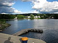
 NYmohawk-WaterfordHarbor.JPG 2.288 × 1.712; 735 KB
-
 Old State Highway sign on Saratoga CR 91.jpg 768 × 1.024; 162 KB
-
 On the Mohawk LCCN2004666898.jpg 10.485 × 7.802; 9,08 MB
-
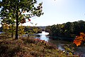
 Riverlink Park view.jpg 1.000 × 669; 572 KB
-
 Schenectady - Mohawk River I-890 (33168723571).jpg 1.600 × 2.400; 2,49 MB
-
 Shrine at Auriesville.jpg 1.451 × 989; 234 KB
-
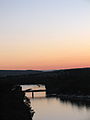 Sunset on the Eastern Mohawk River area NY 8811 (4853861153).jpg 2.112 × 2.816; 2,5 MB
-
 Tribal nations in NW New York Province.jpg 1.477 × 1.037; 215 KB
-
 Two Kayakers on the Mohawk (33296878285).jpg 2.400 × 1.600; 2,35 MB
-

-

-

-


_MET_128565.jpg)
_MET_ap42.95.46.jpg)
.jpg)

_(17808964263).jpg)
_(17812737563).jpg)
_(18245679750).jpg)
_(19178643620).jpg)
_(14781620701).jpg)


.jpg)
.jpg)

_(14762832974).jpg)


_-_Google_Art_Project.jpg)


.jpg)


.jpg)
.jpg)
.jpg)


.jpg)

.jpg)

.jpg)


