Category:Moreton cum Alcumlow
Vai alla navigazione
Vai alla ricerca
English: Moreton-cum-Alcumlow is a small civil parish in the unitary authority of Cheshire East and the ceremonial county of Cheshire, England. In the census of 2001 it was recorded as having a population of 150. The civil parish holds a parish council meeting under a grouping scheme with the adjacent
civil parish in Cheshire East, England  | |||||
| Carica un file multimediale | |||||
| Istanza di | |||||
|---|---|---|---|---|---|
| Luogo | Cheshire East, Cheshire, Nord Ovest dell'Inghilterra, Inghilterra | ||||
 | |||||
Sottocategorie
Questa categoria contiene le 3 sottocategorie indicate di seguito, su un totale di 3.
File nella categoria "Moreton cum Alcumlow"
Questa categoria contiene 33 file, indicati di seguito, su un totale di 33.
-
 A34 at Brownlow Heath, Cheshire - geograph.org.uk - 2619617.jpg 1 600 × 1 200; 503 KB
-
 Alcumlow Hall Farm - geograph.org.uk - 235026.jpg 601 × 451; 30 KB
-
 Alcumlow Hall Farm rear entrance - geograph.org.uk - 2910595.jpg 5 184 × 3 456; 3,3 MB
-
 Astbury Parish Council noticeboard - geograph.org.uk - 3781956.jpg 1 024 × 768; 192 KB
-
 Astbury St. Mary's and Jodrell Bank - geograph.org.uk - 1531372.jpg 640 × 512; 55 KB
-
 Beginning of Brook Lane, Brownlow Heath - geograph.org.uk - 2619615.jpg 1 600 × 1 200; 596 KB
-
 Brook Lane - geograph.org.uk - 2910279.jpg 5 184 × 3 456; 4,98 MB
-
 Brook Lane, Brownlow Heath - geograph.org.uk - 3781713.jpg 1 024 × 768; 134 KB
-
 Brownlow Heath Lane-Brook Lane junction - geograph.org.uk - 2910273.jpg 5 184 × 3 456; 4,19 MB
-
 Cheshire Farmland - geograph.org.uk - 4836591.jpg 640 × 348; 38 KB
-

-
 Countryside south of Congleton - geograph.org.uk - 2205465.jpg 640 × 430; 122 KB
-
 Entrance to Alcumlow Hall Farm's courtyard barns - geograph.org.uk - 3781686.jpg 1 024 × 768; 131 KB
-
 Field at Daisy Bank Farm - geograph.org.uk - 6080399.jpg 1 024 × 768; 187 KB
-
 Footpath to Brook Lane, Noahs Ark Farm - geograph.org.uk - 2910587.jpg 5 184 × 3 456; 4,85 MB
-
 Former quarry access behind Daisy Bank Farm - geograph.org.uk - 6080408.jpg 1 024 × 768; 266 KB
-
 Former quarry behind Daisy Bank Farm - geograph.org.uk - 6080406.jpg 1 024 × 768; 141 KB
-
 Junction of Chance Hall Lane and Brook Lane - geograph.org.uk - 3781677.jpg 1 024 × 768; 130 KB
-

-
 Moreton Fisheries - geograph.org.uk - 2261080.jpg 1 200 × 803; 987 KB
-
 Moss Motors - Second Hand Car Dealers - geograph.org.uk - 6157502.jpg 4 200 × 2 130; 2,68 MB
-
 Mow Cop transmitter - geograph.org.uk - 6080377.jpg 1 024 × 768; 77 KB
-
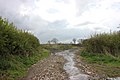
 Muddy entrance to a stubble field - geograph.org.uk - 3781701.jpg 1 024 × 615; 168 KB
-
 Sheep grazing - geograph.org.uk - 4745148.jpg 640 × 426; 37 KB
-
 Sheep grazing a crop field - geograph.org.uk - 6080394.jpg 1 024 × 768; 138 KB
-
 The Gritstone Trail at Mow Cop - geograph.org.uk - 6080391.jpg 1 024 × 768; 213 KB
-
 The Lodge at Great Moreton Hall - geograph.org.uk - 201565.jpg 640 × 480; 55 KB
-
 Trail through the woods at Roe Park - geograph.org.uk - 6080410.jpg 1 024 × 768; 303 KB
-
 View from the South Cheshire Way - geograph.org.uk - 5098675.jpg 4 184 × 2 789; 2,67 MB
-
 West Lodge Entrance - geograph.org.uk - 235573.jpg 640 × 480; 50 KB
-
 Wharf Lane - geograph.org.uk - 4660030.jpg 2 184 × 1 456; 1,64 MB
-
 Woodland on the east side of the Congleton Road - geograph.org.uk - 3781695.jpg 1 024 × 768; 157 KB
-
 Woods at Roe Park - geograph.org.uk - 6080409.jpg 1 024 × 768; 360 KB


