Category:Mountains of Tasmania
Zur Navigation springen
Zur Suche springen
Bundesstaaten von Australien: Neusüdwales · Queensland · Südaustralien · Tasmanien · Victoria · Westaustralien
Innere Gebiete Australiens: Australian Capital Territory · Northern Territory
Außengebiete Australiens:
Innere Gebiete Australiens: Australian Capital Territory · Northern Territory
Außengebiete Australiens:
Wikimedia-Kategorie | |||||
| Medium hochladen | |||||
| Ist ein(e) | |||||
|---|---|---|---|---|---|
| Kategorie enthält | |||||
| |||||
English: Mountains of Tasmania
Unterkategorien
Es werden 23 von insgesamt 23 Unterkategorien in dieser Kategorie angezeigt:
In Klammern die Anzahl der enthaltenen Kategorien (K), Seiten (S), Dateien (D)
A
- Mount Arthur (Tasmania) (7 D)
B
C
- Cathedral Mountain (Tasmania) (21 D)
F
- Federation Peak (4 D)
- Frankland Range (1 D)
- Frenchmans Cap, Tasmania (7 D)
H
- Hartz Mountains (9 D)
J
M
O
P
- Mount Pelion East (11 D)
- Mount Pelion West (16 D)
R
- Mount Ragoona (6 D)
- Mount Roland (15 D)
S
- Stacks Bluff (1 D)
W
Medien in der Kategorie „Mountains of Tasmania“
Folgende 72 Dateien sind in dieser Kategorie, von 72 insgesamt.
-
 20100209 Wineglass Bay and The Hazards from Mt Amos peak.JPG 4.288 × 2.848; 5,14 MB
-
 68-507a Roger & Jill near Kitchen Hut, Xmas , Tasmania, Australia 1968 (51215837260).jpg 1.850 × 1.313; 698 KB
-
 Australia tasmania relief location map Arthur.png 921 × 1.130; 800 KB
-
 Australia tasmania relief location map BenLomond.png 921 × 1.130; 801 KB
-
 Australia tasmania relief location map Pelion.png 921 × 1.130; 799 KB
-
 Ben Lomond Dolarmite -41513807 147661180.jpg 1.200 × 1.600; 969 KB
-
 Ben Lomond Peak-41513807 147661180.jpg 1.200 × 1.600; 1,12 MB
-
 Colin Pitt cairn 20171121-022.jpg 4.008 × 3.008; 3,43 MB
-
 Collin's Cap From Tom Thumb.jpg 2.136 × 1.424; 3,12 MB
-
 Cradle Mountain from Barn Bluff.jpg 5.184 × 3.456; 5,22 MB
-
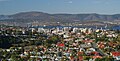
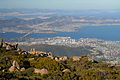 CSIRO ScienceImage 2566 Hobart and the Derwent River Tasmania.jpg 2.657 × 1.771; 2,87 MB
-
 CSIRO ScienceImage 2567 Hobart City and the Tasman Bridge Tasmania (cropped).jpg 2.657 × 1.356; 2,18 MB
-
 CSIRO ScienceImage 2567 Hobart City and the Tasman Bridge Tasmania.jpg 2.657 × 1.771; 2,6 MB
-
 CSIRO ScienceImage 3067 Mt Dromedary Mt Faulkner and surrounding ranges Tasmania.jpg 2.657 × 1.771; 1,96 MB
-
 CSIRO ScienceImage 3068 Hobart and the Derwent River Tasmania.jpg 2.657 × 1.771; 2,97 MB
-
 CSIRO ScienceImage 3408 Hobart City and the Tasman Bridge Tasmania.jpg 2.657 × 1.771; 2,6 MB
-
 CSIRO ScienceImage 3609 Lowlying clouds in valleys near Cambridge Tasmania.jpg 2.657 × 1.771; 2,22 MB
-
 CSIRO ScienceImage 71 Bolster Moor Mt Field National Park.jpg 2.657 × 1.789; 5,44 MB
-
 CSIRO ScienceImage 73 Tarn Shelf Mt Field National Park.jpg 1.805 × 2.657; 4,53 MB
-
 CSIRO ScienceImage 74 Tarn Shelf Mountain Lake.jpg 2.657 × 1.789; 4,36 MB
-
 Dazzler Range, Tasmania (28296796141).jpg 3.456 × 5.184; 9,32 MB
-
 Du Cane Range.JPG 4.000 × 3.000; 3,38 MB
-
 Ducane Range, Tasmania (49936383938).jpg 2.592 × 3.048; 5,79 MB
-
 East Risdon State Reserve 20171120-048.jpg 4.008 × 3.008; 2,13 MB
-
 East-West-Divide-peaks-20171121-014.jpg 4.008 × 3.008; 3,66 MB
-
 Enchanted Forest - Cradle Mountain, Tasmania.jpg 1.920 × 1.272; 3,92 MB
-
 Frenchmans Cap, March 2016.jpg 3.000 × 4.000; 5,58 MB
-
 Freycinet National Park, Tasmania - looking south east over Great Oyster Bay 04.jpg 4.128 × 2.322; 1,93 MB
-
 Gowrie-Park-20070422-010.jpg 2.006 × 3.031; 1,7 MB
-
 Gowrie-Park-Rodeo-20070422-011.jpg 3.031 × 2.006; 1,63 MB
-
 Heimdall Crag.jpg 3.840 × 2.160; 4,29 MB
-
 High-Moor-from-Mount-Columba.jpg 2.048 × 1.536; 1,57 MB
-
 Horsetail Falls Track 20171121-029.jpg 4.008 × 3.008; 3,85 MB
-
 Huon river, Tahune Airwalk.jpg 2.539 × 3.808; 3,29 MB
-
 King Davids Peak.JPG 4.000 × 3.000; 3,63 MB
-
 King William Saddle landscape 20171121-018.jpg 4.008 × 3.008; 3,39 MB
-
 Lake Windermere, Tasmania.jpg 6.296 × 2.096; 8,15 MB
-
 Looking down on Pelion Gap.jpg 600 × 800; 676 KB
-
 Mount Mawson.jpg 450 × 600; 45 KB
-
 Milligans Peak 20171121-017.jpg 4.008 × 3.008; 3,2 MB
-
 Mole Creek Road.jpg 3.000 × 1.000; 4,88 MB
-
 Mount Direction Hobart 20171120-076.jpg 4.008 × 1.799; 1,34 MB
-
 Mount Doris and Mount Ossa - Flickr - brewbooks.jpg 3.888 × 2.592; 4 MB
-
 Mount Doris Summit - Flickr - brewbooks (1).jpg 3.888 × 2.592; 4,47 MB
-
 Mount Geryon.JPG 4.882 × 3.200; 11,66 MB
-
 Mount Gould and The Minotaur.JPG 4.949 × 3.320; 12,19 MB
-
 Mount King William I 20171121-015.jpg 4.008 × 3.008; 3,17 MB
-
 Mount Murchison Tasmania.jpg 3.264 × 1.836; 1,47 MB
-
 Mount Pitt 20171121-016.jpg 4.008 × 3.008; 3,44 MB
-
 Mount-Roland-Reserve-20070422-016.jpg 2.006 × 3.031; 1,59 MB
-
 Mount-Roland-Reserve-20070422-017.jpg 3.031 × 2.006; 1,98 MB
-
 Mount-Roland-Reserve-20070422-018.jpg 3.031 × 2.006; 1,94 MB
-
 Mt Amos.jpg 600 × 800; 72 KB
-
 Mt Darwin.JPG 4.000 × 3.000; 3,62 MB
-
 Mt Oakleigh.jpg 4.541 × 3.027; 2,52 MB
-
 Mt Olympus and Castle Crag from Cathedral.jpg 800 × 600; 217 KB
-
 Mt Sorell.JPG 4.000 × 3.000; 3,86 MB
-
 Mt Victoria.jpg 4.000 × 3.000; 3,4 MB
-
 Mt Wellington.jpg 4.032 × 3.024; 2,99 MB
-
 Ossa from Pelion West.jpg 800 × 600; 412 KB
-
 Ossa winter.jpg 800 × 600; 494 KB
-
 Overlooking Cloudy Bay, South Bruny - panoramio.jpg 2.592 × 1.936; 1,8 MB
-
 Pillinger from Cathedral.jpg 800 × 600; 208 KB
-
 Round-Mountain-lookout-20070422-022.jpg 2.704 × 1.456; 1,39 MB
-
 Round-Mountain-lookout-20070422-023.jpg 3.455 × 1.376; 1,41 MB
-
 SW National Park, Tasmania.jpg 2.000 × 1.138; 2,05 MB
-
 Tasmania-gdfb26d11d 1920.jpg 1.920 × 1.440; 816 KB
-
 Thamnic rainforest at Creekton Falls.JPG 800 × 602; 338 KB
-
 The Acropolis & Mt Geryon.jpg 800 × 600; 365 KB
-
 The Acropolis (Mountain).JPG 4.489 × 3.076; 10,89 MB
-
 Top of Mount Amos.jpg 7.168 × 3.584; 7,26 MB
-
 Walls of Jerusalem.jpg 800 × 600; 393 KB

.jpg)


.jpg)


.jpg)

.jpg)


.jpg)


.JPG)

