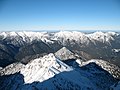
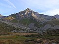
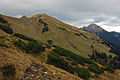
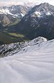
Category:Mountains of Tyrol (state)
Vai alla navigazione
Vai alla ricerca
States of Austria: Burgenland · Carinthia · Lower Austria · Salzburg · Styria · Tyrol · Upper Austria · Vienna · Vorarlberg

categoria di un progetto Wikimedia | |||||
| Carica un file multimediale | |||||
| Istanza di | |||||
|---|---|---|---|---|---|
| Argomenti della categoria | |||||
| Categoria contiene | |||||
| |||||
Sottocategorie
Questa categoria contiene le 200 sottocategorie indicate di seguito, su un totale di 210.
(pagina precedente) (pagina successiva)'
*
.
A
- Astholz (3 F)
G
- Gorner (5 F)
I
- In der Weiße (1 F)
K
- Kegelstein (1 F)
P
- Pfriemeswand (3 F)
R
- Ramolkogel (28 F)
- Raneburgkogel (4 F)
- Rappenspitze (8 F)
- Rauchkofel (Zillertal Alps) (9 F)
- Rauer Kopf (Silvretta) (6 F)
- Rauhkopf (21 F)
- Realspitze (7 F)
- Regalmspitze (14 F)
- Reggentörlturm (5 F)
- Reichenberger Spitze (11 F)
- Reichenspitze (37 F)
- Riegelkopf (15 F)
- Riegelturm (11 F)
- Riepenspitze (7 F)
- Riepenwand (7 F)
- Rietzer Grieskogel (10 F)
- Rinnenspitze (5 F)
- Rofanspitze (11 F)
- Roggspitze (13 F)
- Rosenspitze (14 F)
- Rosshorn (1 P, 8 F)
- Rosskopf (Carnic alps) (3 F)
- Rosskopf (Villgratner Berge) (6 F)
- Roßkopf (Rofan) (9 F)
- Rotbachlspitze (15 F)
- Rote Säule (Wallhornkamm) (21 F)
- Rote Wand (Pinswang) (2 F)
- Rotegg (4 F)
- Rotenkogel (13 F)
- Roter Knopf (21 F)
- Roter Kogel (7 F)
- Rotmooskogel (1 F)
- Rotwandlspitze (4 F)
- Ruitelspitze (10 F)
- Rumer Spitze (37 F)
- Rumesoikopf (1 F)
S
- Sagwandspitze (7 F)
- Sagzahn (12 F)
- Salzkogel (6 F)
- Sattelköpfe (10 F)
- Säule (Lasörlinggruppe) (4 F)
- Saykogel (17 F)
- Schafgrübler (4 F)
- Schafsiedel (8 F)
- Scharnitzspitze (5 F)
- Scheiberkogel (4 F)
- Schinder (20 F)
- Schlüsselspitze (18 F)
- Schmittenberg (22 F)
- Schnappen (2 F)
- Schneekarspitze (1 F)
- Schneekopf (Karwendel) (1 F)
- Schneespitze (1 P, 9 F)
- Schober (Lasörlinggruppe) (5 F)
- Schöntalspitze (5 F)
- Schrammacher (39 F)
- Schrandele (10 F)
- Schwarzachschneid (1 F)
- Schwarze Ader (5 F)
- Schwarze Wand (52 F)
- Schwarzhorn (Stubaier Alpen) (5 F)
- Schüsselkarspitze (5 F)
- Seekarköpfe (2 F)
- Seekarlspitze (5 F)
- Seekopf (Venediger Group) (7 F)
- Seiche (5 F)
- Sennkogel (10 F)
- Silberspitze (15 F)
- Sillingkopf (11 F)
- Sonnjoch (23 F)
- Sonntagsspitze (6 F)
- Speckkarspitze (17 F)
- Speikboden (Lasörling Group) (3 F)
- Spitzer Seichenkopf (8 F)
- Spitzkogel (5 F)
- Spitzmandl (2 F)
- Stampfleskopf (12 F)
- Stanskogel (2 F)
- Stanzling (4 F)
- Stein am Ferner (11 F)
- Steinbergstein (6 F)
- Steingrubenhöhe (6 F)
- Steingrubenkogel (15 F)
- Steingrubenkopf (2 F)
- Steinkarspitze (Karwendel) (4 F)
- Stempeljochspitzen (15 F)
- Strahlkogel (6 F)
- Südlicher Happ (4 F)
- Südliches Höllhorn (4 F)
- Sulzkogel (Sulztalkamm) (8 F)
- Säulkopf (39 F)
- Säulspitze (6 F)
T
- Tajaspitze (4 F)
- Talleitspitze (25 F)
- Tauernkogel (Venedigergruppe) (16 F)
- Taufkarkogel (4 F)
- Teufelshorn (27 F)
- Teufelskamp (65 F)
- Teufelspitze (11 F)
- Timmelsjochberg (4 F)
- Toinigspitze (5 F)
- Torhelm (Kitzbüheler Alpen) (6 F)
- Torhelm (Zillertaler Alpen) (10 F)
- Torkogel (6 F)
- Törlspitzen (Wetterstein) (5 F)
- Totenkarspitze (23 F)
- Totenkirchl (Wilder Kaiser) (18 F)
- Trainsjoch (12 F)
- Trelebitschkopf (4 F)
- Tscharnakt (4 F)
- Türml (9 F)
- Turnerkamp (1 P, 25 F)
- Tuxeck (18 F)
U
- Umbalköpfl (28 F)
- Urkundkolm (7 F)
V
- Vallüla (10 F)
- Valschavielkopf (2 F)
- Vesulspitze (6 F)
- Voldöppberg (9 F)
- Vordere Hintereisspitze (4 F)
- Vorderer Kesselkopf (7 F)
- Vorderer Seekopf (26 F)
- Vorderer Tajakopf (12 F)
- Vorderseespitze (2 F)
- Vorderskopf (4 F)
W
- Wandspitze (10 F)
- Wankspitze (4 F)
- Wannenkogel (9 F)
- Wannig (12 F)
- Warenkarseitenspitze (20 F)
- Weißkugel (1 P, 122 F)
- Weitstrahl (18 F)
- Weißenwandspitze (7 F)
- Weißer Zahn (3 F)
- Wellachköpfe (12 F)
- Westliche Seespitze (3 F)
- Wilde Leck (16 F)
- Wilder Freiger (1 P, 23 F)
- Wildkopf (4 F)
- Winnebachspitzen (13 F)
- Wolfendorn (16 F)
- Wunwand (10 F)
Z
- Zeller Berg (4 F)
- Zilinkopf (8 F)
- Zillerspitze (3 F)
- Zinggetz (14 F)
- Zinizachspitze (7 F)
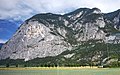
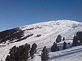
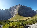
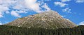
File nella categoria "Mountains of Tyrol (state)"
Questa categoria contiene 200 file, indicati di seguito, su un totale di 411.
(pagina precedente) (pagina successiva)-
 05101-Kerschbuchhof-1904-Blick in die Tiroler Berge-Brück & Sohn Kunstverlag.jpg 1 486 × 1 000; 497 KB
-
 20050529-Vorderkaiserfelden MQ.jpg 2 592 × 1 944; 1,03 MB
-
 AchenseeWinter11.JPG 2 696 × 1 867; 878 KB
-
 AchenseeWinter14.JPG 3 008 × 2 000; 2,4 MB
-
 AchenseeWinter15.JPG 2 000 × 3 008; 2,23 MB
-
 Alpen von der Zugspitze...).jpg 3 874 × 2 578; 3,03 MB
-
 Alps in Austria and Germany.jpg 4 052 × 3 355; 1,74 MB
-
 Arvental Hörnle Schwarzachtal.jpg 7 100 × 3 188; 4,88 MB
-
 Aussichtspunkt mit Blick auf Seefeld 2023-10-10.jpg 5 472 × 3 648; 9,72 MB
-
 Aussichtspunkt mit Blick auf Seefeld Panorama 1 2023-10-10.jpg 6 464 × 2 560; 8,94 MB
-
 Aussichtspunkt mit Blick auf Seefeld Panorama 2 2023-10-10.jpg 7 136 × 3 840; 11,16 MB
-

-
 Berg bei Kirchdorf in Tirol 20220906 101415.jpg 4 000 × 3 000; 2,13 MB
-
 Bergansicht in Tirol 20220904 090945.jpg 4 000 × 3 000; 2,25 MB
-
 Bergstation Tiefenbachbahn - panoramio.jpg 4 494 × 3 298; 6,74 MB
-
 Biberwier 6.jpg 5 470 × 2 823; 3,44 MB
-
 Blick Richtung Hocheder Seefeld Bild 1 2023-10-10.jpg 5 472 × 3 648; 10,73 MB
-
 Blick Richtung Hocheder Seefeld Bild 2 2023-10-10.jpg 5 472 × 3 648; 10,02 MB
-
 Blick vom Scheibler3.jpg 640 × 480; 60 KB
-
 Blick von Dreitorspitze MQ.jpg 2 592 × 1 944; 451 KB
-
 Blick von Munde nach Westen HQ.jpg 1 280 × 960; 308 KB
-
 Brenner-Grenzkamm.JPG 2 612 × 1 380; 2,5 MB
-
 Bsuchalm-N.jpg 3 072 × 2 048; 2,03 MB
-
 Bsuchalm-S.jpg 6 000 × 3 375; 4,66 MB
-
 Cable lift.jpg 3 960 × 2 910; 1,51 MB
-
 Coburger Huette 1.jpg 2 048 × 1 536; 801 KB
-
 Cows on Ehrwalder Alm panorama.jpg 8 132 × 2 457; 3,05 MB
-
 Cows on Ehrwalder Alm.jpg 3 744 × 2 712; 1,53 MB
-
 Cows on field.jpg 11 277 × 4 068; 6,99 MB
-
 D-1-73-135-166 Demmel-Alm s.JPG 1 600 × 1 200; 700 KB
-
 Daniel-Upsspitze Gipfelgrat Blick nach Norden.JPG 3 264 × 2 448; 4 MB
-
 Diasalpe-See.jpg 2 472 × 1 390; 1,05 MB
-
 Diemer Hinterbärenbad um 1900.jpg 340 × 445; 39 KB
-
 Diemer Hinterbärenbad.jpg 333 × 485; 34 KB
-
 Donnerstein.JPG 1 200 × 1 600; 281 KB
-
 DreieckerFromSW.JPG 4 000 × 3 000; 4,59 MB
-
 Ehrwald - playground.jpg 3 144 × 2 568; 2,65 MB
-
 Ehrwalder Alm 2.jpg 4 032 × 2 696; 1,59 MB
-
 Ehrwalder Alm panorama.jpg 5 445 × 2 581; 1,85 MB
-
 FalbesonerOchsenalm.jpg 4 240 × 2 832; 6,05 MB
-
 Falkensteinkamm03.JPG 3 264 × 2 448; 3,22 MB
-
 Fasulferner über dem Schottensee.jpg 3 264 × 2 448; 2,62 MB
-
 Feilkopf Achensee (Pertisau, Tirol, Österreich).jpg 4 608 × 3 456; 6,64 MB
-
 Field and mountain.jpg 4 032 × 3 024; 2,62 MB
-
 Fog on mountain 4.jpg 6 530 × 2 425; 1,6 MB
-
 Frauenwand 3.jpg 5 456 × 2 536; 2,43 MB
-
 Friedrichshafener Weg Muttenjoch.jpg 3 264 × 2 448; 3,63 MB
-
 GaensekragenFromNE.JPG 2 848 × 2 136; 1,61 MB
-
 Galtjoch.jpg 1 280 × 851; 413 KB
-
 Galtür - Gemeindehaus - Treppe 01.jpg 3 423 × 4 559; 8,44 MB
-
 Gamsjoch310507phr.jpg 396 × 607; 52 KB
-
 Gamskarspitze - Gschützspitze.jpg 1 551 × 748; 170 KB
-
 Gaugg-Turm SW.JPG 3 564 × 2 328; 3,51 MB
-
 Geierskragen N.JPG 3 514 × 2 430; 5,45 MB
-
 Geigerwald.jpg 1 536 × 2 048; 1,15 MB
-
 Gemeinde Ischgl, Austria - panoramio - sanja mm.jpg 2 592 × 1 944; 2,22 MB
-

-

-
 Gepatschfer with Wildspitze.JPG 1 944 × 2 592; 893 KB
-
 Gepatschferner.JPG 2 592 × 1 944; 2,48 MB
-
 Getschnerspitzen.JPG 3 094 × 1 926; 4,5 MB
-
 Gleirscher Roßkogel O.JPG 2 626 × 1 416; 2,5 MB
-
 Glockturm 3.jpg 2 592 × 1 699; 716 KB
-
 GloedisFromS.jpg 1 460 × 1 911; 673 KB
-
 Glödis from SW.JPG 2 048 × 1 536; 604 KB
-
 Goldbichl von Südwesten.JPG 3 060 × 1 600; 343 KB
-
 Graen.jpg 1 536 × 1 024; 493 KB
-
 Grafmartspitze.jpg 4 469 × 3 083; 8,33 MB
-
 Gramaijoch.jpg 4 032 × 2 197; 1,53 MB
-
 Grasbergkamm Ahornboden.jpg 1 024 × 768; 717 KB
-
 Grieskogel SE.JPG 3 872 × 2 592; 4,67 MB
-
 Griestaler Spitze Gipfel.jpg 4 000 × 3 000; 4,76 MB
-
 Grist.JPG 3 008 × 2 000; 3,25 MB
-
 Große Riedlkarspitze E.JPG 3 556 × 2 408; 6,38 MB
-
 Grubenkopf N.JPG 3 250 × 1 926; 3,68 MB
-
 Grubenwand NE.JPG 2 363 × 1 434; 2,07 MB
-
 Grubenwand NO.JPG 1 144 × 560; 458 KB
-
 Grubigstein-S.jpg 6 000 × 3 376; 4,2 MB
-
 Grubigstein.jpg 744 × 220; 53 KB
-
 Grän02-2008a.JPG 2 048 × 1 536; 770 KB
-
 Grän02-2008j.JPG 2 048 × 1 536; 670 KB
-
 Gubachspitzen from east.jpg 1 024 × 768; 264 KB
-
 Gueserkopf.JPG 1 840 × 1 232; 344 KB
-
 GurglerFerner1 Hochwildehaus.jpg 2 048 × 1 536; 830 KB
-
 GurglerFerner1.jpg 2 048 × 1 536; 2,18 MB
-
 Guslarspitze 360°.jpg 21 973 × 1 500; 16,65 MB
-
 Haagspitze und Rauher Kopf von Westen.jpg 4 000 × 3 000; 6,82 MB
-
 Habichen, de Ötztaler Ache IMG 0906 2019-07-31 17.35.jpg 3 424 × 5 166; 8,56 MB
-
 Hairlacher Seekopf S.JPG 2 206 × 1 434; 1,58 MB
-
 Handschuhspitzen.jpg 2 592 × 1 944; 1,76 MB
-
 Hauerkogel, Ötztal Alps.jpg 4 903 × 2 992; 6,49 MB
-
 HeiterwandNord.jpg 1 667 × 800; 779 KB
-
 Heiterwanger e See.jpg 4 224 × 3 168; 5,5 MB
-
 Hemerkogel.jpg 3 707 × 1 405; 2,51 MB
-
 Hennekogel.JPG 3 022 × 2 112; 3,8 MB
-
 Hennespitze.JPG 3 872 × 2 592; 4,2 MB
-
 Herrengasse.jpg 4 240 × 2 832; 2,93 MB
-
 Hinterbaerenbad 1900.jpg 3 528 × 2 515; 3,72 MB
-
 Hinterbärenbadhütte-(1894).jpg 1 077 × 732; 468 KB
-
 Hinterer Daunkopf NE.JPG 3 420 × 2 120; 4,77 MB
-
 Hintertux - panoramio.jpg 5 061 × 901; 977 KB
-
 Hippoldspitze NE.JPG 3 872 × 2 592; 3,19 MB
-
 Hochalmkreuz.jpg 2 000 × 1 330; 1,44 MB
-
 Hochalplkopf and Ronberg.jpg 4 032 × 3 024; 3,69 MB
-
 Hochalplkopf.jpg 3 000 × 2 250; 2,48 MB
-
 Hochebenkamm (12813238833).jpg 5 184 × 3 456; 10,9 MB
-
 Hochgeneiner joch--.jpg 4 032 × 2 268; 6,09 MB
-
 Hochplatte SE.JPG 2 520 × 1 624; 2,14 MB
-
 Hochplattig N.JPG 3 800 × 2 440; 5,58 MB
-
 Hochvernagtspitze N.JPG 3 872 × 2 592; 4,23 MB
-
 Hochwandkopf.jpg 2 121 × 1 325; 856 KB
-
 Hochzeiger.JPG 2 048 × 1 536; 659 KB
-
 HoheSalve Nordhang.jpg 3 053 × 2 185; 1,38 MB
-
 HoheWasserfalleFromESE.jpg 3 033 × 2 275; 1,65 MB
-
 Hohljoch.jpg 4 000 × 3 000; 7,07 MB
-
 Hornischegg.jpg 3 264 × 2 448; 3,99 MB
-
 Häselgehrberg from Northnortheast.JPG 3 680 × 2 070; 2,12 MB
-
 Höllenstein.jpg 2 121 × 903; 338 KB
-
 Hölltalspitze - Östliche Schwarzenbergspitze.JPG 3 392 × 1 748; 3,41 MB
-
 Ilfenspitze from East.JPG 1 262 × 710; 483 KB
-
 Ilmspitze NW.JPG 3 724 × 2 514; 6,51 MB
-
 IlmspitzenS.JPG 3 872 × 2 592; 7,86 MB
-
 Im Hinteren Eis Panorama.jpg 16 880 × 2 048; 6,58 MB
-
 Innere Schwarze Schneid.jpg 5 256 × 3 328; 2,68 MB
-
 Innervillgraten - Kalkstein - Ausblick auf den Grumauerberg und das Rote Ginggele.jpg 5 758 × 3 839; 15,53 MB
-
 Innsbruck, panorama vanaf de Kranebitter Allee IMG 0677 2019-07-30 10.47.jpg 4 641 × 2 800; 7,04 MB
-
 Irzwände Hochalter Kühtai.JPG 2 576 × 1 952; 1,44 MB
-
 Jagdhausalm vom Moränenwall.JPG 3 000 × 4 000; 4,29 MB
-
 Jagdhausalm05.JPG 4 000 × 3 000; 4,94 MB
-
 Jagdhausalm06.JPG 4 000 × 3 000; 4,83 MB
-
 Jamtalferner 14082013.JPG 2 816 × 1 880; 1,74 MB
-
 Joelspitze SW.JPG 3 872 × 2 592; 4,59 MB
-
 Judenbichl (Pinswang).jpg 1 440 × 1 080; 318 KB
-
 Kafell SE.JPG 2 084 × 1 168; 1,19 MB
-
 Kalkkoegel-Senderstal 1.jpg 1 400 × 400; 73 KB
-
 Kalkkögel E.JPG 2 048 × 1 536; 966 KB
-
 Kalkwand (Tuxer) S.JPG 2 264 × 1 524; 2,28 MB
-
 Kalkwand mountain.jpg 4 224 × 2 368; 1,54 MB
-
 Kaltenberg (Arlberg).JPG 2 592 × 1 944; 1,84 MB
-
 Kaltenberg, Pflunspitze, Satteinser Spitze N.JPG 4 320 × 3 240; 5,37 MB
-
 Karretschrofen02.JPG 3 264 × 2 448; 4,03 MB
-
 Karspitze.jpg 3 264 × 1 836; 861 KB
-
 Karwendel Alps, Austria.jpg 1 050 × 1 418; 558 KB
-
 Kaserjoch - panoramio.jpg 1 600 × 1 200; 678 KB
-
 Katzenkopf SE.JPG 3 604 × 2 328; 5,26 MB
-
 Kaunergrat-Weisskamm.jpg 2 430 × 634; 1,26 MB
-
 Kaunertal-Nord.JPG 1 280 × 960; 430 KB
-
 KeeskopfFromSE.jpg 2 136 × 2 848; 1,48 MB
-
 Kellerjoch view from Vomp (postcard sent 1905).jpg 1 415 × 971; 212 KB
-
 Kesselschneid.jpg 2 592 × 1 944; 2,02 MB
-
 Kienberg Blessenberg SW.JPG 3 196 × 1 712; 4,1 MB
-
 Kirchspitze NW.JPG 3 549 × 2 364; 3,66 MB
-
 Kleine Ochsenwand SW.JPG 2 884 × 2 364; 5,4 MB
-
 Kleine Seekarspitze S.JPG 3 872 × 2 592; 4,57 MB
-
 Kleine Seekarspitze, Ödkarspitzen W.JPG 3 687 × 1 608; 3,36 MB
-
 Kleiner Ahornboden HQ.jpg 1 200 × 900; 311 KB
-
 Kleiner Gilfert NW.JPG 3 872 × 2 592; 3,53 MB
-
 Klobenjoch Achenseestrasse.JPG 1 844 × 1 229; 1,02 MB
-
 Knappenkopf Kugelhorn Rauhhorn Gaishorn.JPG 3 264 × 2 448; 3,57 MB
-
 Kogel mit Kogelsee.jpg 2 816 × 2 112; 1,95 MB
-
 Kogelsee cropped.JPG 2 737 × 1 540; 2,43 MB
-
 Kogelsee.JPG 3 264 × 2 448; 2,3 MB
-
 Kopftörlgrat von norden.jpg 2 697 × 2 258; 3,69 MB
-
 Kopftörlgrat.jpg 2 813 × 2 201; 2,86 MB
-
 Krachelspitze mit Lechquellengebirge.jpg 3 920 × 2 204; 415 KB
-
 Kreuzjochkogel SE.JPG 2 332 × 1 608; 2,35 MB
-
 Kreuzjöchl N.JPG 3 336 × 2 008; 4,46 MB
-
 Kreuzkarspitze from North.JPG 4 000 × 3 000; 3,16 MB
-
 Kreuzspitze vom Saykogel.jpg 2 000 × 1 500; 1,64 MB
-
 Kreuzspitze von Süden.JPG 2 544 × 2 368; 723 KB
-
 Kreuzspitze, Östliche Knotenspitze SE.JPG 3 016 × 2 068; 3,1 MB
-
 Krumpgampental tirol.jpg 2 048 × 1 536; 2,81 MB
-
 Lackenkarspitze, Kuhkopf SW.JPG 2 860 × 1 436; 2,58 MB
-
 Lake in the Alps.jpg 4 078 × 2 719; 3,97 MB
-
 Lalidersalm, Hochleger.jpg 4 032 × 3 024; 2,97 MB
-
 Langental.jpg 2 048 × 3 072; 2,06 MB
-
 Langtauferer Spitze 2008.jpg 2 592 × 1 944; 763 KB
-
 Larchberg.jpg 4 032 × 3 024; 1,26 MB
-
 Larchköpfl.jpg 4 032 × 2 074; 387 KB
-
 Largoz.jpg 3 456 × 2 304; 4,08 MB
-
 Larstigspitze SW.JPG 3 416 × 2 472; 5,52 MB
-
 Lechtal.Febr.März.2006 049.jpg 1 024 × 768; 587 KB
-
 Lechtaler Alpen.jpg 2 048 × 1 536; 1,11 MB
-
 Leiteralm.jpg 773 × 511; 105 KB
-
 Lermoos 4.jpg 4 032 × 3 024; 5,89 MB
-
 Lermoos 8.JPG 4 412 × 2 667; 2,56 MB
-
 Liebenerspitze, Hochfirst E.JPG 3 404 × 1 308; 3,57 MB
-
 Lochgehrenkopf.JPG 1 358 × 1 019; 1,02 MB
-
 Loreahuette HQ.jpg 926 × 598; 110 KB
-
 Lovely sunshine at the mountainridge West of Galtur - panoramio.jpg 4 288 × 2 848; 5,14 MB
-
 Luibiskogel S.JPG 3 806 × 2 364; 5,37 MB
-
 LuibiskogelFromSW.jpg 1 637 × 2 183; 1,11 MB
-
 Lämpersberg W.JPG 3 368 × 1 936; 2,66 MB
-
 Madlener Spitze.JPG 3 016 × 1 902; 4,25 MB
-
 Madseitberg.jpg 7 000 × 2 054; 2,04 MB
-
 Malgrubenspitze NE.JPG 2 784 × 2 076; 3,13 MB
-
 Malgrubenspitze S.JPG 3 568 × 2 216; 4,09 MB
-
 Malhamspitzen NE.JPG 3 872 × 2 190; 5,42 MB
-
 Marchkopf Blick Nordost.JPG 1 844 × 1 229; 746 KB
-
 Medrigalm.jpg 6 016 × 3 384; 2,79 MB


.jpg)


.jpg)


_-_Vomp_-_Stans_-_Jenbach_-_Schwaz_-_Kellerjoch_map_from_Atlas_Tirolensis_1774.gif)


.jpg)


.jpg)


.jpg)


_S.JPG)

.JPG)


.jpg)


&uselang=it&filefrom=Memminger+H%C3%BCtte.JPG#mw-category-media)